| Home | City Bus | Maps | Villages | Cities | Rail | Tourist Places | School | College | Pin Codes | Corona Cases Count |
| Distance Calculator Bus Services IFSC Codes Trace Mobile Number Weather Search Place Trace IP Available Cash ATM/Banks Locate Polling Booth Report an Error contact People |
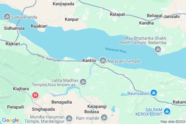
Kantilo
Kantilo Map
EDIT Map
Add Your House
 ..
..
Current Corona Virus Infected Patients Count in Nayagarh District
| City Name | District Name | Total Covid cases |
|---|
Locality Name :
Kantilo
( କଣ୍ଟିଲୋ )
Tehsil Name : Khandapara
District : Nayagarh
State : Odisha
Language : Oriya and Hindi
Current Time 04:26 AM
Date: Saturday , Apr 26,2025 (IST)
Time zone: IST (UTC+5:30)
Elevation / Altitude: 20 meters. Above Seal level
Telephone Code / Std Code: 06756
Assembly constituency : Khandapada assembly constituency
Assembly MLA : anubhav patnaik
Lok Sabha constituency : Cuttack parliamentary constituency
Parliament MP : BHARTRUHARI MAHTAB
Serpanch Name :
Pin Code : 752078
Post Office Name : Kantilo
Commodities Prices : Hindol Market / Mandi
Kantilo Live Weather
Temperature: 27.1 °C
clear sky
Humidity: 70%
Wind : 1.1 mt/sec towards S
StationName : "Kantilo"
observed on 0 Mins Back
Temperature: 27.1 °C
clear sky
Humidity: 70%
Wind : 1.1 mt/sec towards S
StationName : "Kantilo"
observed on 0 Mins Back
Kantilo Weather Forecast for Next 5 days
27-04-2025
26.4°C to 42.9°C
clear sky, broken clouds, scattered clouds
26.4°C to 42.9°C
clear sky, broken clouds, scattered clouds
28-04-2025
27.4°C to 40.3°C
scattered clouds, broken clouds, overcast clouds, light rain
27.4°C to 40.3°C
scattered clouds, broken clouds, overcast clouds, light rain
29-04-2025
26.3°C to 42.5°C
broken clouds, scattered clouds, light rain, few clouds
26.3°C to 42.5°C
broken clouds, scattered clouds, light rain, few clouds
30-04-2025
21.8°C to 39.7°C
few clouds, clear sky, moderate rain, light rain, broken clouds, scattered clouds
21.8°C to 39.7°C
few clouds, clear sky, moderate rain, light rain, broken clouds, scattered clouds
National Highways Reachable To Kantilo
Nationa High Way :NH57
Nationa High Way :NH57
Rivers Near Kantilo
Rana
Mainshia
Rana
Mainshia
About Kantilo
Correct below Info and add more info about KantiloKantilo is a Village in Khandapara Tehsil in Nayagarh District of Odisha State, India. It is located 34 KM towards North from District head quarters Nayagarh. 8 KM from Khandapara. 79 KM from State capital Bhubaneswar
Kantilo Pin code is 752078 and postal head office is Kantilo .
Bada Banapur ( 2 KM ) , Dhanchangada ( 3 KM ) , Benagadia ( 6 KM ) , Bodasa ( 6 KM ) , Ranichheli ( 8 KM ) are the nearby Villages to Kantilo. Kantilo is surrounded by Bhapur Tehsil towards East , Narasinghpur Tehsil towards North , Badamba Tehsil towards East , Gania Tehsil towards west .
Khordha , Dhenkanal , Anugul , Jatani are the near by Cities to Kantilo.
This Place is in the border of the Nayagarh District and Cuttack District. Cuttack District Narasinghpur is North towards this place .
Demographics of Kantilo
Oriya is the Local Language here.Politics in Kantilo
BJD , is the major political party in this area.Polling Stations /Booths near Kantilo
1)Nilakantha Prasad Pry. School2)Kandhapathara Pry. School
3)Ladukeswar Nodal U.p.m.e Kuahara
4)Laxmiprasad Pry. School
5)32-kantilo-6
HOW TO REACH Kantilo
By Rail
There is no railway station near to Kantilo in less than 10 km.Colleges near Kantilo
P.s. Collage
Address :
Pathani Samanta College,khandapara
Address :
Schools in Kantilo
K.b.girls Hs
Address : kantilo , khandapada , nayagarh , Sikkim . PIN- 752078 , Post - Kantilo
Nilamadhaba Bidyapitha
Address : kantilo , khandapada , nayagarh , Sikkim . PIN- 752078 , Post - Kantilo
Panusahupatna Mes
Address : kantilo , khandapada , nayagarh , Sikkim . PIN- 752078 , Post - Kantilo
Kantilo Boys Ps
Address : kantilo , khandapada , nayagarh , Sikkim . PIN- 752078 , Post - Kantilo
Ranipada Govt. U.g.m.e.s.
Address : kantilo , khandapada , nayagarh , Sikkim . PIN- 752078 , Post - Kantilo
Govt Health Centers near Kantilo
1) Sampur , Sampur SubCentre , Sampur , Sampur2) Kalanga , Kalanga SubCentre , Kalanga , Kalanga
3) Kumuti Sahi , Kumutisah SubCentre , Kumutisahi , Kumutisahi
Hospitals in Kantilo,Khandapara
Nilamadhaba kantilo; MEDICAL /UCOBANK /POLICE STATION ROAD
Gania - Kantilo Road; Kantilo; Odisha 752078; India
0.5 KM distance Detail
more ..
Petrol Bunks in Kantilo,Khandapara
Ms Maa Mahakali Filling Centre Indian Oil Petrol Pump
Gopalpur; Cuttack; SH-65; Krushnasyampur Narsinghpur Road; Cuttack; Cuttack; Odisha 754031; India
8.3 KM distance Detail
more ..
Super Markets in Kantilo,Khandapara
Somya Market Complex
At- Krushna Chandra Pur; Po- Gopa Pur; Ps- Badamba; Dist- Pin-754031; Odisha; SH 65; Krishnachanrapur; Odisha 754031; India
11.6 KM distance Detail
About Kantilo &
History
How to reach Kantilo
Tourist Places Near By Kantilo
Schools in Kantilo
Colleges in Kantilo
Temperature & weather of Kantilo
places in Kantilo
Kantilo photos
More Information
How to reach Kantilo
Tourist Places Near By Kantilo
Schools in Kantilo
Colleges in Kantilo
Temperature & weather of Kantilo
places in Kantilo
Kantilo photos
More Information
Village Talk
Post News or Events about this Village
Near Cities
Khordha 53 KM near
Dhenkanal 60 KM near
Anugul 60 KM near
Jatani 63 KM near
Khordha 53 KM near
Dhenkanal 60 KM near
Anugul 60 KM near
Jatani 63 KM near
Near By Taluks
Khandapara 7 KM near
Bhapur 13 KM near
Narasinghpur 17 KM near
Badamba 20 KM near
Khandapara 7 KM near
Bhapur 13 KM near
Narasinghpur 17 KM near
Badamba 20 KM near
Near By Air Ports
Bhubaneswar Airport 73 KM near
Ranchi Airport 368 KM near
Vishakhapatnam Airport 401 KM near
Raipur Airport 415 KM near
Bhubaneswar Airport 73 KM near
Ranchi Airport 368 KM near
Vishakhapatnam Airport 401 KM near
Raipur Airport 415 KM near
Near By Tourist Places
Chilika 69 KM near
Nandan Kanan National Park 71 KM near
Bhubaneswar 73 KM near
Cuttack 80 KM near
Puri 100 KM near
Chilika 69 KM near
Nandan Kanan National Park 71 KM near
Bhubaneswar 73 KM near
Cuttack 80 KM near
Puri 100 KM near
Near By Districts
Nayagarh 33 KM near
Dhenkanal 58 KM near
Anugul 62 KM near
Khordha 72 KM near
Nayagarh 33 KM near
Dhenkanal 58 KM near
Anugul 62 KM near
Khordha 72 KM near
Near By RailWay Station
Nirakarpur Rail Way Station 60 KM near
Dhenkanal Rail Way Station 60 KM near
Nirakarpur Rail Way Station 60 KM near
Dhenkanal Rail Way Station 60 KM near