| Home | City Bus | Maps | Villages | Cities | Rail | Tourist Places | School | College | Pin Codes | Corona Cases Count |
| Distance Calculator Bus Services IFSC Codes Trace Mobile Number Weather Search Place Trace IP Available Cash ATM/Banks Locate Polling Booth Report an Error contact People |
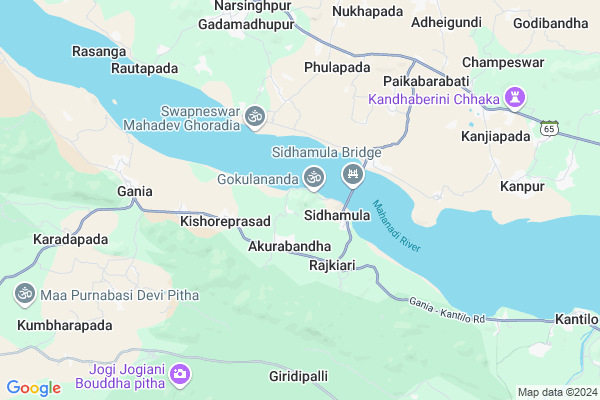
Paturia Map
EDIT Map
Add Your House
 ..
..
Current Corona Virus Infected Patients Count in Nayagarh District
| City Name | District Name | Total Covid cases |
|---|
Locality Name :
Paturia
( ପତୁରିଆ )
Tehsil Name : Gania
District : Nayagarh
State : Odisha
Language : Oriya and Hindi
Current Time 02:13 PM
Date: Wednesday , Feb 05,2025 (IST)
Time zone: IST (UTC+5:30)
Elevation / Altitude: 164 meters. Above Seal level
Telephone Code / Std Code: 06721
Assembly constituency : Khandapada assembly constituency
Assembly MLA : anubhav patnaik
Lok Sabha constituency : Cuttack parliamentary constituency
Parliament MP : BHARTRUHARI MAHTAB
Serpanch Name :
Commodities Prices : Hindol Market / Mandi
Rivers Near Paturia
Burtanga
Mahanadi River :تهر مهاندي :دریائے مہاندی :مهاندي
Burtanga
Mahanadi River :تهر مهاندي :دریائے مہاندی :مهاندي
About Paturia
Correct below Info and add more info about PaturiaPaturia is a small Village/hamlet in Gania Tehsil in Nayagarh District of Odisha State, India. It is located 36 KM towards North from District head quarters Nayagarh. 9 KM from Gania. 92 KM from State capital Bhubaneswar
Gania ( 6 KM ) , Belapadapatna ( 7 KM ) , Rayati Dholamara ( 7 KM ) , Kiajhara ( 8 KM ) , Karadapada ( 9 KM ) are the nearby Villages to Paturia. Paturia is surrounded by Narasinghpur Tehsil towards North , Khandapara Tehsil towards South , Bhapur Tehsil towards East , Badamba Tehsil towards East .
Anugul , Khordha , Dhenkanal , Talcher are the near by Cities to Paturia.
This Place is in the border of the Nayagarh District and Cuttack District. Cuttack District Narasinghpur is North towards this place .
Paturia 2011 Census Details
Paturia Local Language is Oriya. Paturia Village Total population is 864 and number of houses are 189. Female Population is 48.0%. Village literacy rate is 54.3% and the Female Literacy rate is 21.9%.
Population
| Census Parameter | Census Data |
| Total Population | 864 |
| Total No of Houses | 189 |
| Female Population % | 48.0 % ( 415) |
| Total Literacy rate % | 54.3 % ( 469) |
| Female Literacy rate | 21.9 % ( 189) |
| Scheduled Tribes Population % | 0.0 % ( 0) |
| Scheduled Caste Population % | 11.5 % ( 99) |
| Working Population % | 30.2 % |
| Child(0 -6) Population by 2011 | 102 |
| Girl Child(0 -6) Population % by 2011 | 51.0 % ( 52) |
Paturia Census More Deatils.
Politics in Paturia
BJD , is the major political party in this area.Polling Stations /Booths near Paturia
1)Krushnachandrapur Girls Pry School2)Sarbeswar Nodal School Purusottam Prasad
3)Sidhamula Nodal U.p.m.e. School (e)
4)Raghunathpur (a) Proj.u.p. School
5)Barakoli Pry. School
HOW TO REACH Paturia
By Rail
There is no railway station near to Paturia in less than 10 km.Pincodes near Paturia
754037 ( Kanpur ) , 752078 ( Kantilo ) , 754032 ( Narasinghpur )Colleges near Paturia
Model Degree College
Address : At-lathipada
S.l.a.college, Godipada
Address :
P.s. Collage
Address :
Pathani Samanta College,khandapara
Address :
Mohan Mahila Mahavidyayala
Address :
Schools in Paturia
Paturia P.u.p.s.
Address : paturia , gania , nayagarh , Sikkim . PIN- 752085 , Post - Gania
Govt Health Centers near Paturia
1) Kalanga SC , Kalanga , , Near water Tank2) HINDOL , HINDOL , HINDOL , HINDOL HIGH SCHOOL
3) Kumuti Sahi , Kumutisah SubCentre , Kumutisahi , Kumutisahi
Hospitals in Paturia,Gania
Narasinghpur Medical
Medical Road; State Highway 65; Narasinghpur; Odisha 754032; India
8.4 KM distance Detail
more ..
Petrol Bunks in Paturia,Gania
Indian Oil; Shakti Kishan Seva Kendra
Kendupalli;; Narasinghpur; Odisha 754032; India
7.7 KM distance Detail
more ..
Colleges in Paturia,Gania
Shree Shree Raghunath Jew (Degree) Mahavidyalaya; Gania
Gania; Odisha 752085; India
7.4 KM distance Detail
more ..
Electronic Shops in Paturia,Gania
Mahaveer Electrical.
Narasinghpur - Sidhamula Rd; Gania; Odisha 752085; India
7.1 KM distance Detail
Police Stations near Paturia,Gania
Police Station
Narasinghpur Thana Chhaka; State Highway 65; Narasinghpur; Odisha 754032; India
8.4 KM distance Detail
About Paturia &
History
How to reach Paturia
Tourist Places Near By Paturia
Schools in Paturia
Colleges in Paturia
Temperature & weather of Paturia
places in Paturia
Paturia photos
More Information
How to reach Paturia
Tourist Places Near By Paturia
Schools in Paturia
Colleges in Paturia
Temperature & weather of Paturia
places in Paturia
Paturia photos
More Information
Village Talk
Post News or Events about this Village
Near Cities
Anugul 54 KM near
Khordha 66 KM near
Dhenkanal 67 KM near
Talcher 71 KM near
Anugul 54 KM near
Khordha 66 KM near
Dhenkanal 67 KM near
Talcher 71 KM near
Near By Taluks
Gania 9 KM near
Narasinghpur 9 KM near
Khandapara 14 KM near
Bhapur 25 KM near
Gania 9 KM near
Narasinghpur 9 KM near
Khandapara 14 KM near
Bhapur 25 KM near
Near By Air Ports
Bhubaneswar Airport 85 KM near
Ranchi Airport 364 KM near
Vishakhapatnam Airport 399 KM near
Raipur Airport 403 KM near
Bhubaneswar Airport 85 KM near
Ranchi Airport 364 KM near
Vishakhapatnam Airport 399 KM near
Raipur Airport 403 KM near
Near By Tourist Places
Chilika 76 KM near
Nandan Kanan National Park 83 KM near
Bhubaneswar 85 KM near
Cuttack 91 KM near
Phulbani 101 KM near
Chilika 76 KM near
Nandan Kanan National Park 83 KM near
Bhubaneswar 85 KM near
Cuttack 91 KM near
Phulbani 101 KM near
Near By Districts
Nayagarh 35 KM near
Anugul 55 KM near
Dhenkanal 65 KM near
Khordha 84 KM near
Nayagarh 35 KM near
Anugul 55 KM near
Dhenkanal 65 KM near
Khordha 84 KM near
Near By RailWay Station
Angul Rail Way Station 57 KM near
Talcher Road Rail Way Station 61 KM near
Angul Rail Way Station 57 KM near
Talcher Road Rail Way Station 61 KM near