| Home | City Bus | Maps | Villages | Cities | Rail | Tourist Places | School | College | Pin Codes | Corona Cases Count |
| Distance Calculator Bus Services IFSC Codes Trace Mobile Number Weather Search Place Trace IP Available Cash ATM/Banks Locate Polling Booth Report an Error contact People |
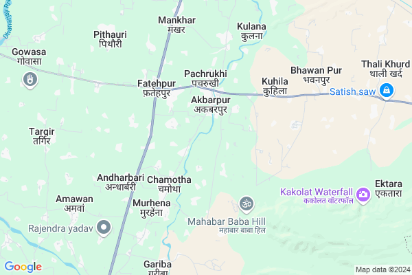
Paharpur Map
EDIT Map
Add Your House
 ..
..
Current Corona Virus Infected Patients Count in Nawada District
| City Name | District Name | Total Covid cases |
|---|---|---|
| Nawada District | Nawada | 3 |
Locality Name :
Paharpur
( पहाड़पुर )
Block Name : Akbarpur
District : Nawada
State : Bihar
Division : Magadh
Language : Maithili and Hindi, Urdu
Current Time 03:18 PM
Date: Tuesday , Apr 29,2025 (IST)
Time zone: IST (UTC+5:30)
Elevation / Altitude: 98 meters. Above Seal level
Telephone Code / Std Code: 06336
Assembly constituency : Hisua assembly constituency
Assembly MLA : Nitu Kumari
Lok Sabha constituency : Nawada parliamentary constituency
Parliament MP : Chandan Singh
Serpanch Name :
Pin Code : 805126
Post Office Name : Rajhat
Main Village Name : PAHARPUR
Edit below overview about Paharpur
Edit below overview about Paharpur
OverView of Paharpur
Paharur is totally a land of bhumihar warriors,but there is many more caste like,yadav, Barber, pandit ,,there is only one king he is shubhashish kumar Manish kumar singh, mahesh prasad sharma, best ngo Help age india foundationwhich was always stay for his village to improve a d developing his. Village from a rough way to a great way,,and the another kings are all people of paharur,,they all are also known as paharur kam ,,there have no any castism and nor any argent with them allEdit below overview about Paharpur
National Highways Reachable To Paharpur
Nationa High Way :NH22
Nationa High Way :NH120
Nationa High Way :NH22
Nationa High Way :NH120
Rivers Near Paharpur
Sakri
Panchane River
Sakri
Panchane River
About Paharpur
Paharpur is a small Village/hamlet in Akbarpur Block in Nawada District of Bihar State, India. It comes under PAHARPUR Panchayath. It belongs to Magadh Division . It is located 20 KM towards South from District head quarters Nawada. 4 KM from Akbarpur. 125 KM from State capital Patna
Paharpur Pin code is 805126 and postal head office is Rajhat .
Panti ( 2 KM ) , Baliya Buzurg ( 3 KM ) , Pachrukhi ( 3 KM ) , Budhuwa ( 4 KM ) , Fatehpur ( 4 KM ) are the nearby Villages to Paharpur. Paharpur is surrounded by Rajauli Block towards South , Gobindpur Block towards East , Narhat Block towards west , Sirdala Block towards west .
Nawada , Hisua , Warisaliganj , Jhumri Tilaiya are the near by Cities to Paharpur.
Paharpur 2011 Census Details
Paharpur Local Language is Maithili. Paharpur Village Total population is 2635 and number of houses are 335. Female Population is 49.9%. Village literacy rate is 64.9% and the Female Literacy rate is 29.5%.
Population
| Census Parameter | Census Data |
| Total Population | 2635 |
| Total No of Houses | 335 |
| Female Population % | 49.9 % ( 1315) |
| Total Literacy rate % | 64.9 % ( 1709) |
| Female Literacy rate | 29.5 % ( 777) |
| Scheduled Tribes Population % | 0.0 % ( 0) |
| Scheduled Caste Population % | 23.3 % ( 613) |
| Working Population % | 36.3 % |
| Child(0 -6) Population by 2011 | 432 |
| Girl Child(0 -6) Population % by 2011 | 49.8 % ( 215) |
Paharpur Census More Deatils.
Politics in Paharpur
JD(U) , LJP , BJP , Lok Jan Shakti Party , RJD are the major political parties in this area.Polling Stations /Booths near Paharpur
1)Aanganwari Kendra Dhagriya2)Utkrmait Madhya Vidyalay Devara
3)Utkramit Uccha Vidyalay Derama
4)Panchayat Bhavan Babhanaur
5)Panchya Bhawan Fatehpur Dakshni Bhag
HOW TO REACH Paharpur
By Rail
There is no railway station near to Paharpur in less than 10 km. Nawadah Rail Way Station (near to Nawada) are the Rail way stations reachable from near by towns.By Road
Nawada are the nearby by towns to Paharpur having road connectivity to PaharpurColleges near Paharpur
Saptarshi Degree Collage Rajauli
Address :
Brahmdev Singh Sumitra Mahavidylya (bali)
Address :
T S Collage Hisua
Address :
J.l.n.college Chandinawan Kashichak
Address :
Kanhaya Lal Shahu College Nawada
Address :
Schools near Paharpur
P.s. Hanuman Garh
Address : kuhila , akbarpur , nawada , Bihar . PIN- 805125 , Post - Rajauli
P.s. Balampur
Address : mahanandpur , akbarpur , nawada , Bihar . PIN- 805110 , Post - Nawadha
P.s. Sanokhara
Address : sanokhara , akbarpur , nawada , Bihar . PIN- 805126 , Post - Rajhat
P.s. Raja Dewar
Address : mastanganj , akbarpur , nawada , Bihar . PIN- 805110 , Post - Nawadha
Govt Health Centers near Paharpur
1) Goga , , ,2) Arie Keshopur , , ,
3) Pale , , ,
Petrol Bunks in Paharpur,Akbarpur
HP PETROL PUMP - KRIPAL AUTO SERVICE
Vill Chapra PO Rajauli DT Bihar; Patna; Bihar 805125; India
10.8 KM distance Detail
more ..
Schools in Paharpur,Akbarpur
Project Girl's High School;Akbarpur
Akbarpur - Bilaspur Rd; Akbarpur; Bihar 805126; India
1.9 KM distance Detail
Super Markets in Paharpur,Akbarpur
Ashok Kirana Store; Akbarpur Panti
Akbarpur Gobindpur Rd; Panti; Bihar 805125; India
2.8 KM distance Detail
Governement Offices near Paharpur,Akbarpur
MKCL Centre Akbarpur
Akbarpur Block Office; Akbarpur Gobindpur Rd; Akbarpur; Bihar 805125; India
2.6 KM distance Detail
About Paharpur &
History
How to reach Paharpur
Tourist Places Near By Paharpur
Schools in Paharpur
Colleges in Paharpur
Temperature & weather of Paharpur
places in Paharpur
Paharpur photos
More Information
How to reach Paharpur
Tourist Places Near By Paharpur
Schools in Paharpur
Colleges in Paharpur
Temperature & weather of Paharpur
places in Paharpur
Paharpur photos
More Information
Village Talk
Post News or Events about this Village
Near Cities
Nawada 19 KM near
Hisua 19 KM near
Warisaliganj 37 KM near
Jhumri Tilaiya 37 KM near
Nawada 19 KM near
Hisua 19 KM near
Warisaliganj 37 KM near
Jhumri Tilaiya 37 KM near
Near By Taluks
Akbarpur 4 KM near
Gobindpur 8 KM near
Rajauli 8 KM near
Narhat 15 KM near
Akbarpur 4 KM near
Gobindpur 8 KM near
Rajauli 8 KM near
Narhat 15 KM near
Near By Air Ports
Gaya Airport 68 KM near
Patna Airport 119 KM near
Ranchi Airport 177 KM near
Varanasi Airport 317 KM near
Gaya Airport 68 KM near
Patna Airport 119 KM near
Ranchi Airport 177 KM near
Varanasi Airport 317 KM near
Near By Tourist Places
Kakolat 18 KM near
Koderma 37 KM near
Jhumri telaiya 37 KM near
Bihar Sharif 58 KM near
Nalanda 59 KM near
Kakolat 18 KM near
Koderma 37 KM near
Jhumri telaiya 37 KM near
Bihar Sharif 58 KM near
Nalanda 59 KM near
Near By Districts
Nawada 18 KM near
Koderma 32 KM near
Nalanda 59 KM near
Sheikhpura 60 KM near
Nawada 18 KM near
Koderma 32 KM near
Nalanda 59 KM near
Sheikhpura 60 KM near
Near By RailWay Station
Nawadah Rail Way Station 19 KM near
Koderma Junction Rail Way Station 36 KM near
Nawadah Rail Way Station 19 KM near
Koderma Junction Rail Way Station 36 KM near