| Home | City Bus | Maps | Villages | Cities | Rail | Tourist Places | School | College | Pin Codes | Corona Cases Count |
| Distance Calculator Bus Services IFSC Codes Trace Mobile Number Weather Search Place Trace IP Available Cash ATM/Banks Locate Polling Booth Report an Error contact People |
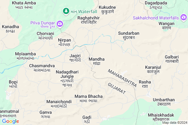
Mandha
Mandha Map
EDIT Map
Add Your House
 ..
..
Current Corona Virus Infected Patients Count in Nashik District
| City Name | District Name | Total Covid cases |
|---|---|---|
| Malegaon | Nashik | 46 |
| Nashik District | Nashik | 15 |
| Nashik | Nashik | 4 |
| Nashik Rural | Nashik | 3 |
Locality Name :
Mandha
( मंद )
Taluka Name : Surgana
District : Nashik
State : Maharashtra
Region : Khandesh and Northern Maharashtra
Division : Nashik
Language : Marathi and Hindi, Ahirani And Bhili
Current Time 12:30 PM
Date: Tuesday , Apr 29,2025 (IST)
Time zone: IST (UTC+5:30)
Elevation / Altitude: 127 meters. Above Seal level
Telephone Code / Std Code: 02593
Assembly constituency : Kalwan assembly constituency
Assembly MLA : Nitin Arjun AT Pawar
Lok Sabha constituency : Dindori parliamentary constituency
Parliament MP : Dr. Bharati Pravin Pawar
Serpanch Name :
Pin Code : 422211
Post Office Name : Surgana
Commodities Prices : Ahwa-Dang Market / Mandi
National Highways Reachable To Mandha
Nationa High Way :NH360;NH953
Nationa High Way :NH360;NH953
Rivers Near Mandha
Ambika
Par River
Ambika
Par River
About Mandha
Correct below Info and add more info about MandhaMandha is a Village in Surgana Taluka in Nashik District of Maharashtra State, India. It belongs to Khandesh and Northern Maharashtra region . It belongs to Nashik Division . It is located 92 KM towards North from District head quarters Nashik. 20 KM from Surgana. 219 KM from State capital Mumbai
Mandha Pin code is 422211 and postal head office is Surgana .
Kukudne ( 7 KM ) , Rasha ( 7 KM ) , Mhaiskhadak ( 11 KM ) , Khuntvihir ( 13 KM ) , Kathipada ( 14 KM ) are the nearby Villages to Mandha. Mandha is surrounded by Dharampur Taluka towards west , Vansda Taluka towards North , Chikhali Taluka towards west , Ahwa Taluka towards East .
Dharampur, India , Pardi , Valsad , Amli are the near by Cities to Mandha.
Mandha 2011 Census Details
Mandha Local Language is Marathi. Mandha Village Total population is 1431 and number of houses are 346. Female Population is 51.6%. Village literacy rate is 42.7% and the Female Literacy rate is 17.8%.
Population
| Census Parameter | Census Data |
| Total Population | 1431 |
| Total No of Houses | 346 |
| Female Population % | 51.6 % ( 738) |
| Total Literacy rate % | 42.7 % ( 611) |
| Female Literacy rate | 17.8 % ( 255) |
| Scheduled Tribes Population % | 99.9 % ( 1429) |
| Scheduled Caste Population % | 0.0 % ( 0) |
| Working Population % | 62.8 % |
| Child(0 -6) Population by 2011 | 243 |
| Girl Child(0 -6) Population % by 2011 | 52.3 % ( 127) |
Mandha Census More Deatils.
Politics in Mandha
CPM , Bharatiya Janata Party , BJP , NCP are the major political parties in this area.Polling Stations /Booths near Mandha
1)Z.p.primary School Khuntvihir Room No.12)Z.p.primary School
3)Z.p.primary School Guhi (ja) South Side Room No.1
4)Z.p.primary School Gopalnagar Room No.1
5)Z.p.primary School
HOW TO REACH Mandha
By Rail
There is no railway station near to Mandha in less than 10 km. Nasik Road Rail Way Station (near to Nashik) are the Rail way stations reachable from near by towns.By Road
Bansda(Gujrat) , Nashik are the nearby by towns to Mandha having road connectivity to MandhaColleges near Mandha
Arts,science And Commerce College Surgana
Address : At/post-surgana Tal-surgana
Schools in Mandha
Z.p.school Naikpada
Address : mandha , surgana , nashik , Maharashtra . PIN- 422211 , Post - Surgana
Z.p.school Pawarpada
Address : mandha , surgana , nashik , Maharashtra . PIN- 422211 , Post - Surgana
Z.p.school Mandha
Address : mandha , surgana , nashik , Maharashtra . PIN- 422211 , Post - Surgana
Govt Health Centers near Mandha
1) Rakshasbhuvan , sub Centre Rakshasbhuvan , ,2) Raitel , 2 , main road , near bus stand
3) Jad , Sub Center , In Village , Near Asharam School
Sub Villages in Mandha
Schools in Mandha,Surgana
Zilla Parishad Upper Primary School Ambatha
Surgana;Nashik; Ambatha; Maharashtra 422211; India
16.3 KM distance Detail
Zilla Parishad Upper Primary
Kathipada; Nashik; Surgana; Maharashtra 422211; India
18.9 KM distance Detail
Super Markets in Mandha,Surgana
Local Parks in Mandha,Surgana
Police Stations near Mandha,Surgana
About Mandha &
History
How to reach Mandha
Tourist Places Near By Mandha
Schools in Mandha
Colleges in Mandha
Temperature & weather of Mandha
places in Mandha
Mandha photos
More Information
How to reach Mandha
Tourist Places Near By Mandha
Schools in Mandha
Colleges in Mandha
Temperature & weather of Mandha
places in Mandha
Mandha photos
More Information
Village Talk
Post News or Events about this Village
Near Cities
Dharampur, India 30 KM near
Pardi 56 KM near
Valsad 57 KM near
Amli 63 KM near
Dharampur, India 30 KM near
Pardi 56 KM near
Valsad 57 KM near
Amli 63 KM near
Near By Taluks
Surgana 19 KM near
Dharampur 21 KM near
Vansda 21 KM near
Chikhali 38 KM near
Surgana 19 KM near
Dharampur 21 KM near
Vansda 21 KM near
Chikhali 38 KM near
Near By Air Ports
Gandhinagar Airport 91 KM near
Chhatrapati Shivaji International Airport 199 KM near
Bhavnagar Airport 203 KM near
Vadodara Airport 215 KM near
Gandhinagar Airport 91 KM near
Chhatrapati Shivaji International Airport 199 KM near
Bhavnagar Airport 203 KM near
Vadodara Airport 215 KM near
Near By Tourist Places
Saputara 35 KM near
Valsad 58 KM near
Tithal 61 KM near
Dadra 63 KM near
Udvada 67 KM near
Saputara 35 KM near
Valsad 58 KM near
Tithal 61 KM near
Dadra 63 KM near
Udvada 67 KM near
Near By Districts
Dang 36 KM near
Valsad 58 KM near
Dadra And Nagar Haveli 64 KM near
Navsari 72 KM near
Dang 36 KM near
Valsad 58 KM near
Dadra And Nagar Haveli 64 KM near
Navsari 72 KM near
Near By RailWay Station
Bilimora Junction Rail Way Station 56 KM near
Valsad Rail Way Station 57 KM near
Bilimora Junction Rail Way Station 56 KM near
Valsad Rail Way Station 57 KM near