| Home | City Bus | Maps | Villages | Cities | Rail | Tourist Places | School | College | Pin Codes | Corona Cases Count |
| Distance Calculator Bus Services IFSC Codes Trace Mobile Number Weather Search Place Trace IP Available Cash ATM/Banks Locate Polling Booth Report an Error contact People |
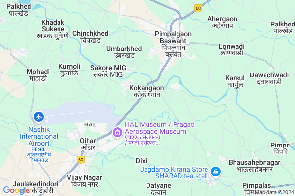
Kokangaon
Kokangaon Map
EDIT Map
Add Your House
 ..
..
Current Corona Virus Infected Patients Count in Nashik District
| City Name | District Name | Total Covid cases |
|---|---|---|
| Malegaon | Nashik | 46 |
| Nashik District | Nashik | 15 |
| Nashik | Nashik | 4 |
| Nashik Rural | Nashik | 3 |
Locality Name :
Kokangaon
( कोकणगाव )
Taluka Name : Niphad
District : Nashik
State : Maharashtra
Region : Khandesh and Northern Maharashtra
Division : Nashik
Language : Marathi and Hindi, Ahirani And Bhili
Current Time 12:50 PM
Date: Sunday , Apr 27,2025 (IST)
Time zone: IST (UTC+5:30)
Elevation / Altitude: 550 meters. Above Seal level
Telephone Code / Std Code: 02550
Assembly constituency : Niphad assembly constituency
Assembly MLA : Bankar Diliprao Shankarrao
Lok Sabha constituency : Dindori parliamentary constituency
Parliament MP : Dr. Bharati Pravin Pawar
Serpanch Name :
Pin Code : 422209
Post Office Name : Pimpalgaon Baswant
Commodities Prices : Pimpalgaon Market / Mandi
Kokangaon Live Weather
Temperature: 35.6 °C
clear sky
Humidity: 16%
Wind : 4.65 mt/sec towards NW
StationName : "Ozar"
observed on 2 Hours Back
Temperature: 35.6 °C
clear sky
Humidity: 16%
Wind : 4.65 mt/sec towards NW
StationName : "Ozar"
observed on 2 Hours Back
Kokangaon Weather Forecast for Next 5 days
28-04-2025
27.2°C to 38.8°C
clear sky
27.2°C to 38.8°C
clear sky
29-04-2025
25.2°C to 40.1°C
clear sky, scattered clouds, few clouds
25.2°C to 40.1°C
clear sky, scattered clouds, few clouds
30-04-2025
24.6°C to 39.7°C
clear sky
24.6°C to 39.7°C
clear sky
01-05-2025
23.8°C to 38.6°C
clear sky
23.8°C to 38.6°C
clear sky
02-05-2025
24.2°C to 39.4°C
clear sky
24.2°C to 39.4°C
clear sky
National Highways Reachable To Kokangaon
Nationa High Way :NH848
Nationa High Way :NH60;NH160
Nationa High Way :NH848
Nationa High Way :NH60;NH160
Rivers Near Kokangaon
Alandi
Alandi
Alandi
Alandi
About Kokangaon
Correct below Info and add more info about KokangaonKokangaon is a Village in Niphad Taluka in Nashik District of Maharashtra State, India. It belongs to Khandesh and Northern Maharashtra region . It belongs to Nashik Division . It is located 29 KM towards East from District head quarters Nashik. 16 KM from Niphad. 199 KM from State capital Mumbai
Kokangaon Pin code is 422209 and postal head office is Pimpalgaon Baswant .
Dixi ( 5 KM ) , Kurnoli ( 6 KM ) , Ojhar ( 7 KM ) , Pimpalgaon B ( 7 KM ) , Thergaon ( 7 KM ) are the nearby Villages to Kokangaon. Kokangaon is surrounded by Dindori Taluka towards west , Nashik Taluka towards west , Chandwad Taluka towards East , Sinnar Taluka towards South .
Ozar , Nashik , Sinnar , Manmad are the near by Cities to Kokangaon.
Kokangaon 2011 Census Details
Kokangaon Local Language is Marathi. Kokangaon Village Total population is 4283 and number of houses are 783. Female Population is 49.5%. Village literacy rate is 74.0% and the Female Literacy rate is 34.1%.
Population
| Census Parameter | Census Data |
| Total Population | 4283 |
| Total No of Houses | 783 |
| Female Population % | 49.5 % ( 2119) |
| Total Literacy rate % | 74.0 % ( 3171) |
| Female Literacy rate | 34.1 % ( 1459) |
| Scheduled Tribes Population % | 30.6 % ( 1310) |
| Scheduled Caste Population % | 11.8 % ( 505) |
| Working Population % | 54.0 % |
| Child(0 -6) Population by 2011 | 587 |
| Girl Child(0 -6) Population % by 2011 | 45.8 % ( 269) |
Kokangaon Census More Deatils.
Politics in Kokangaon
Bharatiya Janata Party , BJP , NCP , SHS are the major political parties in this area.Polling Stations /Booths near Kokangaon
1)Zilla Parishad Primary School Room No.4 From South Shivadi2)Zilla Parishad Primary School Bhegar Wasti East Side North South Kasbe Sukene
3)Zilla Parishad Primary School Agra Road Mule No.2 North Side Building Room No.4 From East Side
4)Zilla Parishad Primary School Devicha Matha West Side Building Room No. 2 From West Pimpalgaon (
5)Zilla Parishad Primary School West Side Building Room No.3 Chitegaon
HOW TO REACH Kokangaon
By Rail
Kasbe Sukene Rail Way Station , Khervadi Rail Way Station are the very nearby railway stations to Kokangaon. Yeola Rail Way Station (near to Yevla) , Nagarsol Rail Way Station (near to Yevla) , Nasik Road Rail Way Station (near to Nashik) are the Rail way stations reachable from near by towns.By Road
Nashik , Yevla are the nearby by towns to Kokangaon having road connectivity to KokangaonColleges near Kokangaon
Nutan.vidyalala.lasalgon.niphad.nasik
Address :
Karmveer Kakasaheb Wagh Junior & Senior College
Address :
Schools in Kokangaon
Cha.shivaji Vid.kokangaon
Address : kokangaon , niphad , nashik , Maharashtra . PIN- 422206 , Post - Ojhar
Z.p.school Kokangaon
Address : kokangaon , niphad , nashik , Maharashtra . PIN- 422206 , Post - Ojhar
Govt Health Centers near Kokangaon
1) Kokangaon , Kokangaon , 1 , Near zp school2) Sakore mig , SC SAKORE MIG , MOHADI RAOD , MOHADI ROAD
3) Muje Sukhene , AT POST MUJE SUKHENE , MUJE SUKHENE , DATTA MANDIR
Petrol Bunks in Kokangaon,Niphad
Namrata Petroleum
Nashik; NH-3; Ozar Road; Nashik; Nashik; Maharashtra 422206; India
0.6 KM distance Detail
Reliance Petroleum
THAKKAR PETROLEUM PLOT NO 447/1;NEAR KALYANI WEIGHBRIDGE; Pimpalgaon Baswant; Maharashtra 422209; India
2.7 KM distance Detail
HP PETROL PUMP - DESHMANE PETROLEUM
S.NO.449/6; Pimpalgaon (baswant); Mumbai Agra Road; TQ. Niphad;; NH 3; Vashi; Maharashtra 422209; India
3.2 KM distance Detail
more ..
Colleges in Kokangaon,Niphad
Gokhale Education Society's College Of Science
HAL; Ojhar; Maharashtra 422302; India
4.0 KM distance Detail
more ..
Schools in Kokangaon,Niphad
Z.P.SCHOOL ; Haiwaybaradwasti (Kok)
Tal. Niphad; Nashik District; Kokangaon; Maharashtra 422210; India
0.6 KM distance Detail
ZP Primary School Kokangaon
Kokangaon ; Niphad; Nashik; Maharashtra 422303; India
0.7 KM distance Detail
Electronic Shops in Kokangaon,Niphad
MK Electronics
Stadium Shopping Complex; HAL; Ojhar; Maharashtra 422302; India
4.0 KM distance Detail
Local Parks in Kokangaon,Niphad
public Garden
Punam Saras Nagar; Pimpalgaon Baswant; Maharashtra 422209; India
5.1 KM distance Detail
Police Stations near Kokangaon,Niphad
Ozar Police Station
Gate No.2; Inside HAL Township; HAL Township Gate Number 3 Rd; HAL; Ojhar; Maharashtra 422207; India
4.3 KM distance Detail
About Kokangaon &
History
How to reach Kokangaon
Tourist Places Near By Kokangaon
Schools in Kokangaon
Colleges in Kokangaon
Temperature & weather of Kokangaon
places in Kokangaon
Kokangaon photos
More Information
How to reach Kokangaon
Tourist Places Near By Kokangaon
Schools in Kokangaon
Colleges in Kokangaon
Temperature & weather of Kokangaon
places in Kokangaon
Kokangaon photos
More Information
Village Talk
Post News or Events about this Village
Near Cities
Ozar 6 KM near
Nashik 26 KM near
Sinnar 35 KM near
Manmad 56 KM near
Ozar 6 KM near
Nashik 26 KM near
Sinnar 35 KM near
Manmad 56 KM near
Near By Taluks
Niphad 15 KM near
Dindori 25 KM near
Nashik 29 KM near
Chandwad 33 KM near
Niphad 15 KM near
Dindori 25 KM near
Nashik 29 KM near
Chandwad 33 KM near
Near By Air Ports
Gandhinagar Airport 27 KM near
Chikkalthana Airport 170 KM near
Chhatrapati Shivaji International Airport 181 KM near
Lohegaon Airport 192 KM near
Gandhinagar Airport 27 KM near
Chikkalthana Airport 170 KM near
Chhatrapati Shivaji International Airport 181 KM near
Lohegaon Airport 192 KM near
Near By Tourist Places
Nasik 26 KM near
Trimbakeshwar 57 KM near
Igatpuri 72 KM near
Shirdi 72 KM near
Khodala 79 KM near
Nasik 26 KM near
Trimbakeshwar 57 KM near
Igatpuri 72 KM near
Shirdi 72 KM near
Khodala 79 KM near
Near By Districts
Nashik 27 KM near
Dang 85 KM near
Dadra And Nagar Haveli 113 KM near
Dhule 134 KM near
Nashik 27 KM near
Dang 85 KM near
Dadra And Nagar Haveli 113 KM near
Dhule 134 KM near
Near By RailWay Station
Niphad Rail Way Station 13 KM near
Nasik Road Rail Way Station 27 KM near
Niphad Rail Way Station 13 KM near
Nasik Road Rail Way Station 27 KM near