| Home | City Bus | Maps | Villages | Cities | Rail | Tourist Places | School | College | Pin Codes | Corona Cases Count |
| Distance Calculator Bus Services IFSC Codes Trace Mobile Number Weather Search Place Trace IP Available Cash ATM/Banks Locate Polling Booth Report an Error contact People |
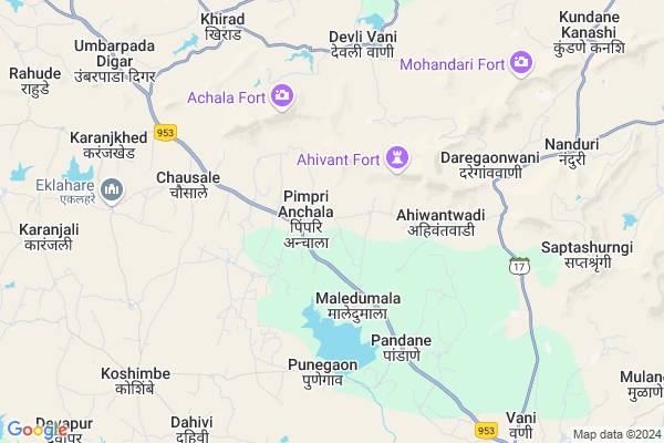
Kolher
Kolher Map
EDIT Map
Add Your House
 ..
..
Current Corona Virus Infected Patients Count in Nashik District
| City Name | District Name | Total Covid cases |
|---|---|---|
| Malegaon | Nashik | 46 |
| Nashik District | Nashik | 15 |
| Nashik | Nashik | 4 |
| Nashik Rural | Nashik | 3 |
Locality Name :
Kolher
( कोल्हेर )
Taluka Name : Dindori
District : Nashik
State : Maharashtra
Region : Khandesh and Northern Maharashtra
Division : Nashik
Language : Marathi and Hindi, Ahirani And Bhili
Current Time 12:14 PM
Date: Tuesday , Apr 29,2025 (IST)
Time zone: IST (UTC+5:30)
Elevation / Altitude: 571 meters. Above Seal level
Telephone Code / Std Code: 02557
Assembly constituency : Dindori assembly constituency
Assembly MLA : Sunil Prabhu
Lok Sabha constituency : Dindori parliamentary constituency
Parliament MP : Dr. Bharati Pravin Pawar
Serpanch Name :
Pin Code : 422215
Post Office Name : Vani
Commodities Prices : Dindori Market / Mandi
Kolher Live Weather
Temperature: 31.9 °C
clear sky
Humidity: 26%
Wind : 4.29 mt/sec towards NW
StationName : "SurgÄ\u0081na"
observed on 2 Hours Back
Temperature: 31.9 °C
clear sky
Humidity: 26%
Wind : 4.29 mt/sec towards NW
StationName : "SurgÄ\u0081na"
observed on 2 Hours Back
Kolher Weather Forecast for Next 5 days
30-04-2025
24.3°C to 36.9°C
clear sky, broken clouds, scattered clouds
24.3°C to 36.9°C
clear sky, broken clouds, scattered clouds
01-05-2025
23.3°C to 37.7°C
clear sky
23.3°C to 37.7°C
clear sky
02-05-2025
23.2°C to 37.7°C
clear sky
23.2°C to 37.7°C
clear sky
03-05-2025
23.0°C to 37.9°C
clear sky
23.0°C to 37.9°C
clear sky
04-05-2025
20.6°C to 36.3°C
clear sky, few clouds, light rain
20.6°C to 36.3°C
clear sky, few clouds, light rain
National Highways Reachable To Kolher
Nationa High Way :NH965
Nationa High Way :NH61
Nationa High Way :NH965
Nationa High Way :NH61
Rivers Near Kolher
Mangla
Sukar
Mangla
Sukar
About Kolher
Correct below Info and add more info about KolherKolher is a Village in Dindori Taluka in Nashik District of Maharashtra State, India. It belongs to Khandesh and Northern Maharashtra region . It belongs to Nashik Division . It is located 54 KM towards North from District head quarters Nashik. 19 KM from Dindori. 216 KM from State capital Mumbai
Kolher Pin code is 422215 and postal head office is Vani .
Maledumala ( 3 KM ) , Bilwadi ( 3 KM ) , Ahiwantwadi ( 4 KM ) , Hastedumala ( 4 KM ) , Chausale ( 5 KM ) are the nearby Villages to Kolher. Kolher is surrounded by Dindori Taluka towards South , Surgana Taluka towards west , Peth Taluka towards west , Deola Taluka towards East .
Ozar , Nashik , Satana , Sinnar are the near by Cities to Kolher.
Kolher 2011 Census Details
Kolher Local Language is Marathi. Kolher Village Total population is 1038 and number of houses are 197. Female Population is 51.8%. Village literacy rate is 61.4% and the Female Literacy rate is 28.0%.
Population
| Census Parameter | Census Data |
| Total Population | 1038 |
| Total No of Houses | 197 |
| Female Population % | 51.8 % ( 538) |
| Total Literacy rate % | 61.4 % ( 637) |
| Female Literacy rate | 28.0 % ( 291) |
| Scheduled Tribes Population % | 99.0 % ( 1028) |
| Scheduled Caste Population % | 0.3 % ( 3) |
| Working Population % | 59.2 % |
| Child(0 -6) Population by 2011 | 177 |
| Girl Child(0 -6) Population % by 2011 | 57.6 % ( 102) |
Kolher Census More Deatils.
Politics in Kolher
Bharatiya Janata Party , BJP , NCP , SHS are the major political parties in this area.Polling Stations /Booths near Kolher
1)Kokangaon(kh).new Zila Parishad Primary School Room No.1 North-side2)Gondegaon Zila Parishad Primary School Room East Building
3)Pimpraj Zila Parishad Primary School Room No. 1 Of
4)Dabhadi Zila Parishad Primary School West Side Room No 1
5)Mahaje Zila Parishad Primary School Room No.1 East Side
HOW TO REACH Kolher
By Rail
There is no railway station near to Kolher in less than 10 km. Nasik Road Rail Way Station (near to Nashik) are the Rail way stations reachable from near by towns.By Road
Nashik are the nearby by towns to Kolher having road connectivity to KolherColleges near Kolher
Secondary And Higher Secondary College Chachadgaon
Address :
Schools in Kolher
Z.p.pri School Kolherpada
Address : kolher , dindori , nashik , Maharashtra . PIN- 422215 , Post - Vani
Z.p.pri School Kolher
Address : kolher , dindori , nashik , Maharashtra . PIN- 422215 , Post - Vani
Govt Health Centers near Kolher
1) Bandarpada , SC BANDARPADA , MANUR ROAD , NEAR AASHRAM SCHOOL2) Tatani , Sub Center , Satana Kelzer Road , Near Asharam School
3) Dindori 1 , SC DINDROI 1 , DINDORI NILWANDI ROAD , NEAR TELEPHON EXCHANGE OFFICE
Sub Villages in Kolher
Petrol Bunks in Kolher,Dindori
Sai Petroleum
Nanduri; Nashik; SH-17; Saputara Nasik Road; Nashik; Nashik; Maharashtra 422215; India
8.7 KM distance Detail
Surekha Petroleum
Nanduri; Nashik; SH-17; Saputara Nasik Road; Nashik; Nashik; Maharashtra 422215; India
9.8 KM distance Detail
more ..
Colleges in Kolher,Dindori
Art's College abhona
Abhona Chankapur Road Near; Annapurna Hotel; Abhona; Maharashtra; India
15.3 KM distance Detail
DP Highschool and Junior College
Surat - Nashik National Hwy; Borgaon; Maharashtra 423502; India
16.6 KM distance Detail
more ..
Schools in Kolher,Dindori
Shri R.P.Pawar Pri.& Sec.Ashramshala Pimpri Anchala
Pimpri Anchala; Maharashtra 422215; India
0.9 KM distance Detail
Zilla Parishad Primary School
Dindori ;Nashik; Pimpri Anchala; Maharashtra 422215; India
1.0 KM distance Detail
Asharam School Pimpri Anchala
Dindori;Nashik District; Pimpri Anchala; Maharashtra 422202; India
1.0 KM distance Detail
Super Markets in Kolher,Dindori
Pundalik Laxman Super shop
5; Nanduri Road; kaunteya Heights; Abhona; Abhona; Maharashtra 423502; India
15.2 KM distance Detail
Local Parks in Kolher,Dindori
Strawberry Hills Club & Resorts
Near Anando Hotels; Opp. hathgad fort; Dalwat Link Road; Nashik Road;; Saputara.; Saputara; Maharashtra 423502; India
18.4 KM distance Detail
Police Stations near Kolher,Dindori
RTO CHECK POST; BORGAON
NH23; Surat - Nashik National Hwy Khirad; Maharashtra 423501; Surat - Nashik National Hwy; Khirad; Maharashtra 423501; India
11.8 KM distance Detail
About Kolher &
History
How to reach Kolher
Tourist Places Near By Kolher
Schools in Kolher
Colleges in Kolher
Temperature & weather of Kolher
places in Kolher
Kolher photos
More Information
How to reach Kolher
Tourist Places Near By Kolher
Schools in Kolher
Colleges in Kolher
Temperature & weather of Kolher
places in Kolher
Kolher photos
More Information
Village Talk
Post News or Events about this Village
Near Cities
Ozar 39 KM near
Nashik 49 KM near
Satana 50 KM near
Sinnar 72 KM near
Ozar 39 KM near
Nashik 49 KM near
Satana 50 KM near
Sinnar 72 KM near
Near By Taluks
Kalwan 18 KM near
Dindori 18 KM near
Surgana 33 KM near
Peth 39 KM near
Kalwan 18 KM near
Dindori 18 KM near
Surgana 33 KM near
Peth 39 KM near
Near By Air Ports
Gandhinagar Airport 53 KM near
Chikkalthana Airport 194 KM near
Chhatrapati Shivaji International Airport 197 KM near
Lohegaon Airport 226 KM near
Gandhinagar Airport 53 KM near
Chikkalthana Airport 194 KM near
Chhatrapati Shivaji International Airport 197 KM near
Lohegaon Airport 226 KM near
Near By Tourist Places
Saputara 47 KM near
Nasik 50 KM near
Trimbakeshwar 68 KM near
Khodala 91 KM near
Vikramgad 92 KM near
Saputara 47 KM near
Nasik 50 KM near
Trimbakeshwar 68 KM near
Khodala 91 KM near
Vikramgad 92 KM near
Near By Districts
Dang 47 KM near
Nashik 51 KM near
Dadra And Nagar Haveli 97 KM near
Valsad 108 KM near
Dang 47 KM near
Nashik 51 KM near
Dadra And Nagar Haveli 97 KM near
Valsad 108 KM near
Near By RailWay Station
Niphad Rail Way Station 47 KM near
Lasalgaon Rail Way Station 55 KM near
Niphad Rail Way Station 47 KM near
Lasalgaon Rail Way Station 55 KM near