| Home | City Bus | Maps | Villages | Cities | Rail | Tourist Places | School | College | Pin Codes | Corona Cases Count |
| Distance Calculator Bus Services IFSC Codes Trace Mobile Number Weather Search Place Trace IP Available Cash ATM/Banks Locate Polling Booth Report an Error contact People |
Rahud
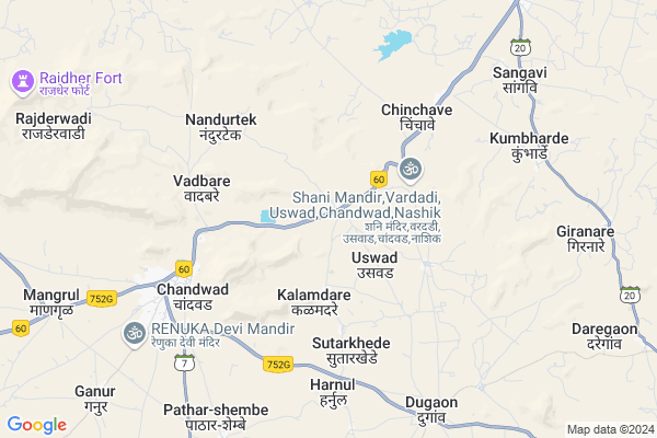
Rahud Map
EDIT Map
Add Your House
 ..
..
Current Corona Virus Infected Patients Count in Nashik District
| City Name | District Name | Total Covid cases |
|---|---|---|
| Malegaon | Nashik | 46 |
| Nashik District | Nashik | 15 |
| Nashik | Nashik | 4 |
| Nashik Rural | Nashik | 3 |
Locality Name :
Rahud
( राहुड )
Taluka Name : Chandwad
District : Nashik
State : Maharashtra
Region : Khandesh and Northern Maharashtra
Division : Nashik
Language : Marathi and Hindi, Ahirani And Bhili
Current Time 10:43 AM
Date: Monday , Apr 28,2025 (IST)
Time zone: IST (UTC+5:30)
Elevation / Altitude: 632 meters. Above Seal level
Telephone Code / Std Code: 02556
Assembly constituency : Chandwad assembly constituency
Assembly MLA : Aher Rahul Daulatrao
Lok Sabha constituency : Dindori parliamentary constituency
Parliament MP : Dr. Bharati Pravin Pawar
Serpanch Name :
Pin Code : 423101
Post Office Name : Chandwad
Alternate Village Name : Rahod
Commodities Prices : Chandvad Market / Mandi
Rahud Live Weather
Temperature: 31.6 °C
clear sky
Humidity: 21%
Wind : 3.26 mt/sec towards W
StationName : "ChÄ\u0081ndor"
observed on 2 Hours Back
Temperature: 31.6 °C
clear sky
Humidity: 21%
Wind : 3.26 mt/sec towards W
StationName : "ChÄ\u0081ndor"
observed on 2 Hours Back
Rahud Weather Forecast for Next 5 days
29-04-2025
29.4°C to 39.7°C
clear sky
29.4°C to 39.7°C
clear sky
30-04-2025
27.1°C to 40.8°C
clear sky, scattered clouds, few clouds
27.1°C to 40.8°C
clear sky, scattered clouds, few clouds
01-05-2025
26.6°C to 40.0°C
clear sky, scattered clouds, few clouds
26.6°C to 40.0°C
clear sky, scattered clouds, few clouds
02-05-2025
27.0°C to 40.8°C
clear sky, scattered clouds, broken clouds
27.0°C to 40.8°C
clear sky, scattered clouds, broken clouds
03-05-2025
26.5°C to 40.4°C
clear sky, scattered clouds
26.5°C to 40.4°C
clear sky, scattered clouds
National Highways Reachable To Rahud
Nationa High Way :NH60
Nationa High Way :NH360
Nationa High Way :NH60
Nationa High Way :NH360
Rivers Near Rahud
Dhavli Nadi
Gul
Dhavli Nadi
Gul
About Rahud
Correct below Info and add more info about RahudRahud is a Village in Chandwad Taluka in Nashik District of Maharashtra State, India. It belongs to Khandesh and Northern Maharashtra region . It belongs to Nashik Division . It is located 77 KM towards East from District head quarters Nashik. 14 KM from Chandwad. 247 KM from State capital Mumbai
Rahud Pin code is 423101 and postal head office is Chandwad .
Kalamdare ( 4 KM ) , Chinchave ( 4 KM ) , Dongargaon ( 4 KM ) , Vadbare ( 5 KM ) , Chandwad ( 6 KM ) are the nearby Villages to Rahud. Rahud is surrounded by Deola Taluka towards North , Niphad Taluka towards South , Malegaon Taluka towards East , Yeola Taluka towards South .
Manmad , Satana , Malegaon , Yevla are the near by Cities to Rahud.
Rahod 2011 Census Details
Rahud Local Language is Marathi. Rahod Village Total population is 2677 and number of houses are 555. Female Population is 48.0%. Village literacy rate is 68.9% and the Female Literacy rate is 30.3%.
Population
| Census Parameter | Census Data |
| Total Population | 2677 |
| Total No of Houses | 555 |
| Female Population % | 48.0 % ( 1284) |
| Total Literacy rate % | 68.9 % ( 1844) |
| Female Literacy rate | 30.3 % ( 811) |
| Scheduled Tribes Population % | 15.7 % ( 420) |
| Scheduled Caste Population % | 16.2 % ( 433) |
| Working Population % | 52.4 % |
| Child(0 -6) Population by 2011 | 374 |
| Girl Child(0 -6) Population % by 2011 | 46.8 % ( 175) |
Rahod Census More Deatils.
Politics in Rahud
Bharatiya Janata Party , BJP , NCP , INC are the major political parties in this area.Polling Stations /Booths near Rahud
1)Z.p.primary School East West Building Room No. 2 From Western Side2)Z.p.primary School East West Building Room No. 3 From Western Side
3)Z.p.primary School East West Building Room No. 2 From Western Side
4)Z.p.primary School North South Building Room No. 1 From Northern Side
5)Z.p.primary School North South Building From Southern Side
HOW TO REACH Rahud
By Rail
There is no railway station near to Rahud in less than 10 km. Manmad Junction Rail Way Station (near to Manmad) , Panevadi Rail Way Station (near to Manmad) , Nasik Road Rail Way Station (near to Nashik) are the Rail way stations reachable from near by towns.By Road
Manmad , Satana , Nashik are the nearby by towns to Rahud having road connectivity to RahudColleges near Rahud
Arts & Com Collage Vadner Bhairao
Address :
Snjb
Address :
Schools in Rahud
Madyamik Vid Rahud
Address : rahud , chandwad , nashik , Maharashtra . PIN- 423104 , Post - Manmad Shiwaji Chouk
Z.p.pri School Rahud
Address : rahud , chandwad , nashik , Maharashtra . PIN- 423104 , Post - Manmad Shiwaji Chouk
Govt Health Centers near Rahud
1) General Hospital Malegaon , g h malegaon , rahul angar kalli kutti malegaon , near by mosum nadi2) Ajang , SUB CENTER AJANG , IN FRONT OF GRANPANCHAYAT , VADEL ROAD
3) Hatane , SUBCENTER HATANE , NEAR Z P SCOOL , TOKDA, ZODGA ROAD
Sub Villages in Rahud
Hospitals in Rahud,Chandwad
Sai Amrut Hospital & Multispeciality Unit
Chandwad; Maharashtra 423101; India
7.4 KM distance Detail
more ..
Petrol Bunks in Rahud,Chandwad
HP PETROL PUMP - R G GUNJAL & ENGINEERS CHANDWAD
Agra Road Chandwad; Vashi; Maharashtra 423101; India
7.2 KM distance Detail
Shivshankar Petroleum Indian Oil
Plot No-1389; Manmad Hwy; Near Dugaon Bus Stand; Dugaon; Maharashtra 423104; India
8.5 KM distance Detail
more ..
Colleges in Rahud,Chandwad
Shree Swami Samarth Krushi Vidyalay Saundane
3; Solapur - Dhule National Hwy; Saundana; Maharashtra; India
17.3 KM distance Detail
Ahilyadevi Holkar Arts And Commarce Collage
Sogras; Maharashtra 423101; India
18.6 KM distance Detail
more ..
Schools in Rahud,Chandwad
Zilla Parishad Primary School
Baglan; Nashik; Rahud; Maharashtra 423204; India
0.6 KM distance Detail
Zilla Parishad Primary School
Tal. Chandvad; Nashik; Kalamdare; Maharashtra 423104; India
3.7 KM distance Detail
Zilla Parishad School Nagar Vasti Dhongar
Niphad; Nashik; Dongargaon; Maharashtra 422305; India
4.6 KM distance Detail
Super Markets in Rahud,Chandwad
Sai Kirana ( Retail Store)
Mahatama Phule Chowk; Dugaon; Tal. Chandwad; Dist. Nashik; Nashik; Maharashtra 423104; India
8.1 KM distance Detail
Local Parks in Rahud,Chandwad
Zalte Wasti Phata; Wagdardi
Lasalgaon-Manmad Rd; Mesankhede Kh; Maharashtra 423104; India
16.9 KM distance Detail
Police Stations near Rahud,Chandwad
Vadner Bhairav Police Station
Manmad - Deola Rd; Bhavade; Maharashtra 423117; India
18.0 KM distance Detail
About Rahud &
History
How to reach Rahud
Tourist Places Near By Rahud
Schools in Rahud
Colleges in Rahud
Temperature & weather of Rahud
places in Rahud
Rahud photos
More Information
How to reach Rahud
Tourist Places Near By Rahud
Schools in Rahud
Colleges in Rahud
Temperature & weather of Rahud
places in Rahud
Rahud photos
More Information
Village Talk
Post News or Events about this Village
Near Cities
Manmad 21 KM near
Satana 29 KM near
Malegaon 39 KM near
Yevla 44 KM near
Manmad 21 KM near
Satana 29 KM near
Malegaon 39 KM near
Yevla 44 KM near
Near By Taluks
Chandwad 13 KM near
Deola 15 KM near
Niphad 39 KM near
Yeola 41 KM near
Chandwad 13 KM near
Deola 15 KM near
Niphad 39 KM near
Yeola 41 KM near
Near By Air Ports
Gandhinagar Airport 73 KM near
Chikkalthana Airport 142 KM near
Lohegaon Airport 224 KM near
Chhatrapati Shivaji International Airport 227 KM near
Gandhinagar Airport 73 KM near
Chikkalthana Airport 142 KM near
Lohegaon Airport 224 KM near
Chhatrapati Shivaji International Airport 227 KM near
Near By Tourist Places
Nasik 72 KM near
Shirdi 73 KM near
Saputara 86 KM near
Dhule 88 KM near
Trimbakeshwar 103 KM near
Nasik 72 KM near
Shirdi 73 KM near
Saputara 86 KM near
Dhule 88 KM near
Trimbakeshwar 103 KM near
Near By Districts
Nashik 73 KM near
Dang 86 KM near
Dhule 89 KM near
Nandurbar 126 KM near
Nashik 73 KM near
Dang 86 KM near
Dhule 89 KM near
Nandurbar 126 KM near
Near By RailWay Station
Manmad Junction Rail Way Station 21 KM near
Lasalgaon Rail Way Station 25 KM near
Manmad Junction Rail Way Station 21 KM near
Lasalgaon Rail Way Station 25 KM near