| Home | City Bus | Maps | Villages | Cities | Rail | Tourist Places | School | College | Pin Codes | Corona Cases Count |
| Distance Calculator Bus Services IFSC Codes Trace Mobile Number Weather Search Place Trace IP Available Cash ATM/Banks Locate Polling Booth Report an Error contact People |
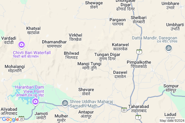
Mangitungi
Mangitungi Map
EDIT Map
Add Your House
 ..
..
Current Corona Virus Infected Patients Count in Nashik District
| City Name | District Name | Total Covid cases |
|---|---|---|
| Malegaon | Nashik | 46 |
| Nashik District | Nashik | 15 |
| Nashik | Nashik | 4 |
| Nashik Rural | Nashik | 3 |
Locality Name :
Mangitungi
( मांगीतुंगी )
Taluka Name : Baglan
District : Nashik
State : Maharashtra
Region : Khandesh and Northern Maharashtra
Division : Nashik
Language : Marathi and Hindi, Ahirani And Bhili
Current Time 04:11 AM
Date: Saturday , Apr 26,2025 (IST)
Time zone: IST (UTC+5:30)
Elevation / Altitude: 632 meters. Above Seal level
Telephone Code / Std Code: 02592
Assembly constituency : Baglan assembly constituency
Assembly MLA : Dilip Manglu Borse
Lok Sabha constituency : Dhule parliamentary constituency
Parliament MP : Bhamre Subhash Ramrao
Serpanch Name :
Pin Code : 423302
Post Office Name : Taharabad
Main Village Name : Bhilwad
Commodities Prices : Nampur Market / Mandi
Mangitungi Live Weather
Temperature: 26.3 °C
clear sky
Humidity: 27%
Wind : 3.15 mt/sec towards W
StationName : "SatÄ\u0081nÄ\u0081"
observed on 2 Hours Back
Temperature: 26.3 °C
clear sky
Humidity: 27%
Wind : 3.15 mt/sec towards W
StationName : "SatÄ\u0081nÄ\u0081"
observed on 2 Hours Back
Mangitungi Weather Forecast for Next 5 days
26-04-2025
25.3°C to 25.3°C
clear sky
25.3°C to 25.3°C
clear sky
27-04-2025
23.8°C to 35.2°C
clear sky, scattered clouds, broken clouds
23.8°C to 35.2°C
clear sky, scattered clouds, broken clouds
28-04-2025
24.2°C to 37.0°C
clear sky, few clouds
24.2°C to 37.0°C
clear sky, few clouds
29-04-2025
23.9°C to 37.3°C
clear sky
23.9°C to 37.3°C
clear sky
30-04-2025
24.2°C to 37.8°C
clear sky
24.2°C to 37.8°C
clear sky
National Highways Reachable To Mangitungi
Nationa High Way :NH53
Nationa High Way :NH60
Nationa High Way :NH53
Nationa High Way :NH60
Rivers Near Mangitungi
Parsul Nadi
Girna River
Parsul Nadi
Girna River
About Mangitungi
Correct below Info and add more info about MangitungiMangitungi is a small Village/hamlet in Baglan Taluka in Nashik District of Maharashtra State, India. It comes under Bhilwad Panchayath. It belongs to Khandesh and Northern Maharashtra region . It belongs to Nashik Division . It is located 115 KM towards North from District head quarters Nashik. 18 KM from Baglan. 279 KM from State capital Mumbai
Mangitungi Pin code is 423302 and postal head office is Taharabad .
Daswel ( 4 KM ) , Antapur ( 6 KM ) , Pimpalkothe ( 6 KM ) , Mulher ( 8 KM ) , Taharabad ( 8 KM ) are the nearby Villages to Mangitungi. Mangitungi is surrounded by Sakri Taluka towards North , Kalwan Taluka towards South , Dang Taluka towards west , Ahwa Taluka towards west .
Satana , Malegaon , Nandurbar , Songadh are the near by Cities to Mangitungi.
Demographics of Mangitungi
Marathi is the Local Language here.Politics in Mangitungi
Bharatiya Janata Party , BJP , NCP , INC are the major political parties in this area.Polling Stations /Booths near Mangitungi
1)Zp Primary School Classroom (east) Borhate2)Z.p.primary School Malgaon Pisore
3)Z.p.primary School South-north Building Room No. 1 Rahud
4)Z.p.primary School West Side Building South North Side Room No. 3 Antapur
5)Z.p.primary School West Side Building North Side Room No. 1 Antapur
HOW TO REACH Mangitungi
By Rail
There is no railway station near to Mangitungi in less than 10 km. are the Rail way stations reachable from near by towns.By Road
Satana are the nearby by towns to Mangitungi having road connectivity to MangitungiColleges near Mangitungi
Janta Vidayalay Sarade
Address :
Yashodhan Education & Social Sansathan
Address : At Post Khamtane Tal Baglan Dist Nashik
Shri Saptshrungi Arts & Commerce College, Dangsoundane
Address :
Schools in Mangitungi
Sec School Bhilwad
Address : bhilwad , baglan , nashik , Maharashtra . PIN- 423302 , Post - Taharabad
Ashram School Bhilwaad
Address : bhilwad , baglan , nashik , Maharashtra . PIN- 423302 , Post - Taharabad
Govt Health Centers near Mangitungi
1) sukapur , 24 , main road , 122) Shevage , 12 , 12 , sevage
3) Sukapur 2 , main road , sukapur , sukapur tal sakri dist dhule.
Hospitals in Mangitungi,Baglan
Siddhi Hospital Taharabad
Siddhi hospital ; near dena bank ;new plot ; taharabad; India
8.7 KM distance Detail
more ..
Petrol Bunks in Mangitungi,Baglan
HP PETROL PUMP - JAI DURGA PETROLEUM
Taharabad Pimpalner Road GAT NO: 494/6; Taharabad Baglan Taluka; Vashi; Maharashtra 423302; India
7.4 KM distance Detail
more ..
Colleges in Mangitungi,Baglan
SHANTAI EDUCATION TRUST INSTITUTE OF PHARMACY
Dhule; Maharashtra 424306; India
14.7 KM distance Detail
more ..
Schools in Mangitungi,Baglan
Zilla Parishad Primary School
Baglan; Tungan Digar; Maharashtra 423201; India
1.7 KM distance Detail
Zilla Parishad Primary School Pandhari Shevare
Baglan Nashik; Shevare; Maharashtra 423302; India
4.2 KM distance Detail
Police Stations near Mangitungi,Baglan
Police Station; Pimpalner
SH 13; Pimpalner; Dhule; Maharashtra 424306; India
17.1 KM distance Detail
About Mangitungi &
History
How to reach Mangitungi
Tourist Places Near By Mangitungi
Schools in Mangitungi
Colleges in Mangitungi
Temperature & weather of Mangitungi
places in Mangitungi
Mangitungi photos
More Information
How to reach Mangitungi
Tourist Places Near By Mangitungi
Schools in Mangitungi
Colleges in Mangitungi
Temperature & weather of Mangitungi
places in Mangitungi
Mangitungi photos
More Information
Village Talk
Post News or Events about this Village
Near Cities
Satana 34 KM near
Malegaon 63 KM near
Nandurbar 70 KM near
Songadh 73 KM near
Satana 34 KM near
Malegaon 63 KM near
Nandurbar 70 KM near
Songadh 73 KM near
Near By Taluks
Baglan 18 KM near
Sakri 26 KM near
Kalwan 43 KM near
Dang 43 KM near
Baglan 18 KM near
Sakri 26 KM near
Kalwan 43 KM near
Dang 43 KM near
Near By Air Ports
Gandhinagar Airport 112 KM near
Chikkalthana Airport 194 KM near
Vadodara Airport 212 KM near
Bhavnagar Airport 249 KM near
Gandhinagar Airport 112 KM near
Chikkalthana Airport 194 KM near
Vadodara Airport 212 KM near
Bhavnagar Airport 249 KM near
Near By Tourist Places
Saputara 47 KM near
Dhule 79 KM near
Nasik 109 KM near
Trimbakeshwar 129 KM near
Navsari 135 KM near
Saputara 47 KM near
Dhule 79 KM near
Nasik 109 KM near
Trimbakeshwar 129 KM near
Navsari 135 KM near
Near By Districts
Dang 46 KM near
Nandurbar 69 KM near
Dhule 80 KM near
Nashik 110 KM near
Dang 46 KM near
Nandurbar 69 KM near
Dhule 80 KM near
Nashik 110 KM near
Near By RailWay Station
Nandurbar Rail Way Station 70 KM near
Manmad Junction Rail Way Station 82 KM near
Nandurbar Rail Way Station 70 KM near
Manmad Junction Rail Way Station 82 KM near