| Home | City Bus | Maps | Villages | Cities | Rail | Tourist Places | School | College | Pin Codes | Corona Cases Count |
| Distance Calculator Bus Services IFSC Codes Trace Mobile Number Weather Search Place Trace IP Available Cash ATM/Banks Locate Polling Booth Report an Error contact People |
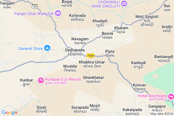
Bhutbeda
Bhutbeda Map
EDIT Map
Add Your House
 ..
..
Current Corona Virus Infected Patients Count in Narmada District
| City Name | District Name | Total Covid cases |
|---|---|---|
| Narmada District | Narmada | 12 |
Locality Name :
Bhutbeda
( ભૂતબેદ )
Taluka Name : Dediyapada
District : Narmada
State : Gujarat
Language : Gujarati and Hindi
Current Time 02:23 PM
Date: Thursday , Apr 24,2025 (IST)
Time zone: IST (UTC+5:30)
Elevation / Altitude: 241 meters. Above Seal level
Telephone Code / Std Code: 02649
Assembly constituency : Dediapada assembly constituency
Assembly MLA : Chaitarbhai Damjibhai Vasava
Lok Sabha constituency : Bharuch parliamentary constituency
Parliament MP : Mansukhbhai Dhanjibhai Vasava
Serpanch Name :
Pin Code : 393130
Post Office Name : Netrang
Main Village Name : Bhutbeda
Commodities Prices : Rajpipla Market / Mandi
Bhutbeda Live Weather
Temperature: 39.1 °C
clear sky
Humidity: 14%
Wind : 4.44 mt/sec towards W
StationName : "RÄ\u0081jpÄ«pla"
observed on 2 Hours Back
Temperature: 39.1 °C
clear sky
Humidity: 14%
Wind : 4.44 mt/sec towards W
StationName : "RÄ\u0081jpÄ«pla"
observed on 2 Hours Back
Bhutbeda Weather Forecast for Next 5 days
25-04-2025
27.0°C to 40.8°C
clear sky
27.0°C to 40.8°C
clear sky
26-04-2025
25.4°C to 40.6°C
clear sky
25.4°C to 40.6°C
clear sky
27-04-2025
24.7°C to 41.0°C
clear sky
24.7°C to 41.0°C
clear sky
28-04-2025
24.4°C to 41.9°C
clear sky
24.4°C to 41.9°C
clear sky
29-04-2025
24.6°C to 41.4°C
clear sky
24.6°C to 41.4°C
clear sky
National Highways Reachable To Bhutbeda
Nationa High Way :NH48
Nationa High Way :NH64
Nationa High Way :NH48
Nationa High Way :NH64
Rivers Near Bhutbeda
Mangla
Dhamani Khadi
Mangla
Dhamani Khadi
About Bhutbeda
Correct below Info and add more info about BhutbedaBhutbeda is a small Village/hamlet in Dediyapada Taluka in Narmada District of Gujarat State, India. It comes under Bhutbeda Panchayath. It is located 35 KM towards South from District head quarters Rajpipla. 239 KM from State capital Gandhinagar
Bhutbeda Pin code is 393130 and postal head office is Netrang .
Bhutbeda is surrounded by Umarpada Taluka towards South , Sagbara Taluka towards East , Nandod Taluka towards North , Rajpipla Taluka towards North .
Rajpipla , Songadh , Vyara , Ankleshwar are the near by Cities to Bhutbeda.
Demographics of Bhutbeda
Gujarati is the Local Language here.Politics in Bhutbeda
JD(U) , Bharatiya Janata Party , BJP , INC are the major political parties in this area.Polling Stations /Booths near Bhutbeda
1)Gaysavar2)Khodaamba
3)Ninghat
4)Datvada
5)Bebar
HOW TO REACH Bhutbeda
By Rail
There is no railway station near to Bhutbeda in less than 10 km.Colleges near Bhutbeda
Shri M. R. Arts And Science College Rajpipla
Address :
M.r.college
Address : M.r.college.rajpipla
Shree Swaminarayan Pharmacy College
Address : Shree Swaminarayan Pharmacy College, Shree Sw Amin
Government Arts College
Address : Dediyapada,dist.: Narmada
Schools in Bhutbeda
Bhutbeda Primary School
Address : bhutbeda , dediyapada , narmada , Gujarat . PIN- 393130 , Post - Netrang
Govt Health Centers near Bhutbeda
1) Khuta-Amba , Khuta-Amba , main road , Dediyapada road2) Sagbara , , near taluka Panchayat office , Panchayat office
3) Patlamau , main road patlamau , ,
Hospitals in Bhutbeda,Dediyapada
Chaha Mogi General Hospital
Narmada; SH-13; Bharuch Road; Netrang; Netrang; Gujarat 393130; India
1.3 KM distance Detail
more ..
Colleges in Bhutbeda,Dediyapada
Government Arts College Dediapada; Di.-Narmada
Besna; Dediapada; Dist. Narmada; Gujarat 393040; India
2.1 KM distance Detail
College of Agricultural Engineering
Parsi Tekra; Dediapada; Gujarat 393040; India
2.3 KM distance Detail
more ..
Schools in Bhutbeda,Dediyapada
Model School Dediapada
Near Muslim cabristaan; A.B Nagar; Unnao; Uttar Pradesh 209801; India
0.7 KM distance Detail
Industrial Training Institute Dediyapada
State Highway 13; Gujarat 393040; India
0.9 KM distance Detail
Electronic Shops in Bhutbeda,Dediyapada
Sreeya Electricals
Thana Faliya; Narmada District; Dediapada; Gujarat 393040; India
1.5 KM distance Detail
Super Markets in Bhutbeda,Dediyapada
Maa Maheswari Tredars& Shree Ram Agro Seeds
har bazar char rasta mozdha road nr fish market; Dediapada; Gujarat; India
1.9 KM distance Detail
Local Parks in Bhutbeda,Dediyapada
Vishal Khadi Eco Campsite
Rajpipla-Netrang road; Khunta Amba; Gujarat 393140; India
20.5 KM distance Detail
Governement Offices near Bhutbeda,Dediyapada
About Bhutbeda &
History
How to reach Bhutbeda
Tourist Places Near By Bhutbeda
Schools in Bhutbeda
Colleges in Bhutbeda
Temperature & weather of Bhutbeda
places in Bhutbeda
Bhutbeda photos
More Information
How to reach Bhutbeda
Tourist Places Near By Bhutbeda
Schools in Bhutbeda
Colleges in Bhutbeda
Temperature & weather of Bhutbeda
places in Bhutbeda
Bhutbeda photos
More Information
Village Talk
Post News or Events about this Village
Near Cities
Rajpipla 33 KM near
Songadh 58 KM near
Vyara 66 KM near
Ankleshwar 69 KM near
Rajpipla 33 KM near
Songadh 58 KM near
Vyara 66 KM near
Ankleshwar 69 KM near
Near By Taluks
Dediyapada 0 KM near
Umarpada 23 KM near
Sagbara 26 KM near
Nandod 32 KM near
Dediyapada 0 KM near
Umarpada 23 KM near
Sagbara 26 KM near
Nandod 32 KM near
Near By Air Ports
Vadodara Airport 98 KM near
Bhavnagar Airport 164 KM near
Gandhinagar Airport 207 KM near
Ahmedabad Airport 212 KM near
Vadodara Airport 98 KM near
Bhavnagar Airport 164 KM near
Gandhinagar Airport 207 KM near
Ahmedabad Airport 212 KM near
Near By Tourist Places
Kevadia Narmada 33 KM near
Ankleshwar 69 KM near
Bharuch 73 KM near
Baroda 98 KM near
Toranmal 105 KM near
Kevadia Narmada 33 KM near
Ankleshwar 69 KM near
Bharuch 73 KM near
Baroda 98 KM near
Toranmal 105 KM near
Near By Districts
Narmada 33 KM near
Bharuch 72 KM near
Nandurbar 80 KM near
Vadodara 98 KM near
Narmada 33 KM near
Bharuch 72 KM near
Nandurbar 80 KM near
Vadodara 98 KM near
Near By RailWay Station
Vyara Rail Way Station 67 KM near
Ankleshwar Junction Rail Way Station 69 KM near
Vyara Rail Way Station 67 KM near
Ankleshwar Junction Rail Way Station 69 KM near