| Home | City Bus | Maps | Villages | Cities | Rail | Tourist Places | School | College | Pin Codes | Corona Cases Count |
| Distance Calculator Bus Services IFSC Codes Trace Mobile Number Weather Search Place Trace IP Available Cash ATM/Banks Locate Polling Booth Report an Error contact People |
Kondakoti
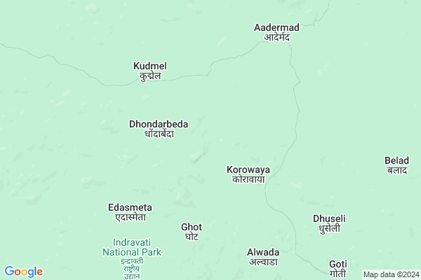
Kondakoti Map
EDIT Map
Add Your House
 ..
..
Current Corona Virus Infected Patients Count in Narayanpur District
| City Name | District Name | Total Covid cases |
|---|
Locality Name :
Kondakoti
( कोंडाकोटि )
Tehsil Name : Orchha(abhujmad)
District : Narayanpur
State : Chattisgarh
Language : Chhattisgarhi and Hindi
Current Time 12:34 PM
Date: Wednesday , Apr 30,2025 (IST)
Time zone: IST (UTC+5:30)
Elevation / Altitude: 408 meters. Above Seal level
Telephone Code / Std Code: 07783
Assembly constituency : Narayanpur assembly constituency
Assembly MLA : Kedar Kashyap
Lok Sabha constituency : Bastar parliamentary constituency
Parliament MP : DEEPAK BAIJ
Serpanch Name :
Pin Code : 494661
Post Office Name : Narayanpur (Narayanpur)
Main Village Name : Kondakoti
Commodities Prices : Bharamgarh Market / Mandi
Rivers Near Kondakoti
Komra
Narangi
Komra
Narangi
About Kondakoti
Correct below Info and add more info about KondakotiKondakoti is a small Village/hamlet in Orchha(abhujmad) Tehsil in Narayanpur District of Chattisgarh State, India. It comes under Kondakoti Panchayath. It is located 64 KM towards South from District head quarters Narayanpur. 20 KM from Orchha. 267 KM from State capital Raipur
Kondakoti Pin code is 494661 and postal head office is Narayanpur (Narayanpur).
Kondakoti is surrounded by Bhairamgarh Tehsil towards South , Geedam Tehsil towards East , Narayanpur Tehsil towards North , Bijapur Tehsil towards South .
Bade Bacheli , Kondagaon , Jagdalpur , Kanker are the near by Cities to Kondakoti.
Demographics of Kondakoti
Chhattisgarhi is the Local Language here.Politics in Kondakoti
Indian National Congress , BJP , INC are the major political parties in this area.Polling Stations /Booths near Kondakoti
1)Aalwahi2)Kurusnar
3)Golawand
4)Gotabenoor
5)Kodiliyar
HOW TO REACH Kondakoti
By Rail
There is no railway station near to Kondakoti in less than 10 km.Schools near Kondakoti
Govt Health Centers near Kondakoti
1) SHC Kalhaza , Shc Kalhaza , Khas para , Main Road2) SHC Ader , shc ader , ,
3) SHC Jatloor , shc Jatlur , Aashrm para ,
Sub Villages in Kondakoti
Schools in Kondakoti,Orchha(abhujmad)
Govt. Higher Secondary School Orchha
Nadipara Road; Orchha; Narayanpur; Chhattisgarh 404661; India
18.6 KM distance Detail
Dav Mukhyamantri Public School
Orchha; Village/Block/Ps Orchha; Distt Narayanpur; Chhattisgarh; Narayanpur; Chhattisgarh; India
19.0 KM distance Detail
Electronic Shops in Kondakoti,Orchha(abhujmad)
Local Parks in Kondakoti,Orchha(abhujmad)
Governement Offices near Kondakoti,Orchha(abhujmad)
About Kondakoti &
History
How to reach Kondakoti
Tourist Places Near By Kondakoti
Schools in Kondakoti
Colleges in Kondakoti
Temperature & weather of Kondakoti
places in Kondakoti
Kondakoti photos
More Information
How to reach Kondakoti
Tourist Places Near By Kondakoti
Schools in Kondakoti
Colleges in Kondakoti
Temperature & weather of Kondakoti
places in Kondakoti
Kondakoti photos
More Information
Village Talk
Post News or Events about this Village
Near Cities
Bade Bacheli 72 KM near
Kondagaon 83 KM near
Jagdalpur 115 KM near
Kanker 135 KM near
Bade Bacheli 72 KM near
Kondagaon 83 KM near
Jagdalpur 115 KM near
Kanker 135 KM near
Near By Taluks
Orchha(Abhujmad) 19 KM near
Bhairamgarh 29 KM near
Geedam 42 KM near
Bijapur 58 KM near
Orchha(Abhujmad) 19 KM near
Bhairamgarh 29 KM near
Geedam 42 KM near
Bijapur 58 KM near
Near By Air Ports
Raipur Airport 252 KM near
Rajahmundry Airport 282 KM near
Vishakhapatnam Airport 318 KM near
Sonegaon Airport 327 KM near
Raipur Airport 252 KM near
Rajahmundry Airport 282 KM near
Vishakhapatnam Airport 318 KM near
Sonegaon Airport 327 KM near
Near By Tourist Places
Dantewada 56 KM near
Bhamragarh Wildlife Sanctuary 59 KM near
Bastar 107 KM near
Jagdalpur 114 KM near
Kanker 135 KM near
Dantewada 56 KM near
Bhamragarh Wildlife Sanctuary 59 KM near
Bastar 107 KM near
Jagdalpur 114 KM near
Kanker 135 KM near
Near By Districts
Dantewada 60 KM near
Narayanpur 61 KM near
Bijapur 64 KM near
Bastar 101 KM near
Dantewada 60 KM near
Narayanpur 61 KM near
Bijapur 64 KM near
Bastar 101 KM near
Near By RailWay Station
Sirpur Kaghaznagar Rail Way Station 186 KM near
Bellampalli Rail Way Station 188 KM near
Sirpur Kaghaznagar Rail Way Station 186 KM near
Bellampalli Rail Way Station 188 KM near