| Home | City Bus | Maps | Villages | Cities | Rail | Tourist Places | School | College | Pin Codes | Corona Cases Count |
| Distance Calculator Bus Services IFSC Codes Trace Mobile Number Weather Search Place Trace IP Available Cash ATM/Banks Locate Polling Booth Report an Error contact People |
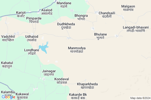
Manmodya
Manmodya Map
EDIT Map
Add Your House
 ..
..
Current Corona Virus Infected Patients Count in Nandurbar District
| City Name | District Name | Total Covid cases |
|---|---|---|
| Nandurbar District | Nandurbar | 6 |
Locality Name :
Manmodya
( मनमोड्या )
Taluka Name : Shahada
District : Nandurbar
State : Maharashtra
Region : Khandesh and Northern Maharashtra
Division : Nashik
Language : Marathi and Hindi, Bhili, Gujrathi And Kokani
Current Time 01:29 PM
Date: Tuesday , Apr 29,2025 (IST)
Time zone: IST (UTC+5:30)
Elevation / Altitude: 161 meters. Above Seal level
Telephone Code / Std Code: 02565
Assembly constituency : Shahada assembly constituency
Assembly MLA : Rajesh Udesing Padvi
Lok Sabha constituency : Nandurbar parliamentary constituency
Parliament MP : Dr. Heena Vijaykumar Gavit
Serpanch Name :
Commodities Prices : Khetia Market / Mandi
Rivers Near Manmodya
Mangla
Shivnad
Mangla
Shivnad
About Manmodya
Correct below Info and add more info about ManmodyaManmodya is a Village in Shahada Taluka in Nandurbar District of Maharashtra State, India. It belongs to Khandesh and Northern Maharashtra region . It belongs to Nashik Division . It is located 53 KM towards East from District head quarters Nandurbar. 17 KM from Shahada. 393 KM from State capital Mumbai
Chirkhan ( 5 KM ) , Khaparkheda ( 6 KM ) , Londhare ( 7 KM ) , Kakarde Kh ( 7 KM ) , Mandane ( 8 KM ) are the nearby Villages to Manmodya. Manmodya is surrounded by Pansemal Taluka towards North , Shirpur Taluka towards East , Shindkhede Taluka towards South , Newali Taluka towards East .
Shahade , Shirpur-Warwade , Nandurbar , Sendhwa are the near by Cities to Manmodya.
Manmodya 2011 Census Details
Manmodya Local Language is Marathi. Manmodya Village Total population is 1507 and number of houses are 297. Female Population is 48.6%. Village literacy rate is 46.3% and the Female Literacy rate is 19.1%.
Population
| Census Parameter | Census Data |
| Total Population | 1507 |
| Total No of Houses | 297 |
| Female Population % | 48.6 % ( 733) |
| Total Literacy rate % | 46.3 % ( 698) |
| Female Literacy rate | 19.1 % ( 288) |
| Scheduled Tribes Population % | 99.1 % ( 1494) |
| Scheduled Caste Population % | 0.5 % ( 7) |
| Working Population % | 47.4 % |
| Child(0 -6) Population by 2011 | 287 |
| Girl Child(0 -6) Population % by 2011 | 46.0 % ( 132) |
Manmodya Census More Deatils.
Politics in Manmodya
Bharatiya Janata Party , BJP , SP , INC , SHS are the major political parties in this area.Polling Stations /Booths near Manmodya
1)Tembhali(aasus)2)Tikhora
3)Tuki
4)Pratppur
5)Purushottam Nagar (lonkheda)
HOW TO REACH Manmodya
By Rail
There is no railway station near to Manmodya in less than 10 km. are the Rail way stations reachable from near by towns.By Road
Shahade are the nearby by towns to Manmodya having road connectivity to ManmodyaPincodes near Manmodya
425423 ( Vadali (Nandurbar) ) , 425444 ( Mandana ) , 425424 ( Purushottam Nagar )Colleges near Manmodya
Shri.chakradhar Madhyamik Vidalaya
Address :
Kai Am Di Sonwane Aadivasi Audani Ashrm School Taradi Ta Shahda
Address : At Taradi Ta Shahda
Schools near Manmodya
Pri. School
Address : kheddigar , shahada , nandurbar , Maharashtra . PIN- 425409 , Post - Shahada Town
Nishat High School Kukdel
Address : nagar palika , shahada , nandurbar , Maharashtra . PIN- 425409 , Post - Shahada Town
Shri Chakradhar High School
Address : jainagar , shahada , nandurbar , Maharashtra . PIN- 425423 , Post - Vadali (Nandurbar)
P.p. S. Godavari Mata High Sch
Address : mhasavad , shahada , nandurbar , Maharashtra . PIN- 425432 , Post - Mhasawad (Nandurbar)
Govt Health Centers near Manmodya
1) Wagharde , PHC Wagharde , ,2) Gogapur , Sub Centre Gogapur , ,
3) RH Sindkheda , RH Shindkheda , Shirpur Road , Near Shivaji Chaufuli
Hospitals in Manmodya,Shahada
Primary Health Centre
Shahada; Nandurbar; SH-1; Shahada Sangvi Khamkheda Lasur Amalner Road; Nandurbar; Nandurbar; Maharashtra 425409; India
8.8 KM distance Detail
more ..
Petrol Bunks in Manmodya,Shahada
Indian Oil Petrol Pump
Shahada; Nandurbar; SH-1; Shahada Sangvi Khamkheda Lasur Amalner Road; Nandurbar; Nandurbar; Maharashtra 425409; India
9.0 KM distance Detail
HP PETROL PUMP - SHRI SAI BALAJI PETROLEUM
Pansemal Pansemal Khetia Pansemal Road; Indore; Madhya Pradesh 451770; India
17.6 KM distance Detail
more ..
Colleges in Manmodya,Shahada
blue chip computer pansemal
MP SH 36; Chouhan Colony; Pansemal; Madhya Pradesh 451770; India
17.6 KM distance Detail
more ..
Schools in Manmodya,Shahada
Yashwant Hansraj Agricultural School
Shahada; Nandurbar; SH-1; Shahada Sangvi Khamkheda Lasur Amalner Road; Nandurbar; Nandurbar; Maharashtra 425409; India
8.6 KM distance Detail
Raje Chhatrapati Pre Primary and Utkarsh English Medium School
Shahada; Nandurbar; SH-1; Shahada Sangvi Khamkheda Lasur Amalner Road; Nandurbar; Nandurbar; Maharashtra 425409; India
8.8 KM distance Detail
Governement Offices near Manmodya,Shahada
Nandurbar Forest Office
Shahane; Nandurbar; SH-1; Shahada Sangvi Khamkheda Lasur Amalner Road; Nandurbar; Nandurbar; Maharashtra 425409; India
15.8 KM distance Detail
About Manmodya &
History
How to reach Manmodya
Tourist Places Near By Manmodya
Schools in Manmodya
Colleges in Manmodya
Temperature & weather of Manmodya
places in Manmodya
Manmodya photos
More Information
How to reach Manmodya
Tourist Places Near By Manmodya
Schools in Manmodya
Colleges in Manmodya
Temperature & weather of Manmodya
places in Manmodya
Manmodya photos
More Information
Village Talk
Post News or Events about this Village
Near Cities
Shahade 20 KM near
Shirpur-Warwade 35 KM near
Nandurbar 50 KM near
Sendhwa 55 KM near
Shahade 20 KM near
Shirpur-Warwade 35 KM near
Nandurbar 50 KM near
Sendhwa 55 KM near
Near By Taluks
Shahada 17 KM near
Pansemal 20 KM near
Shirpur 34 KM near
Shindkhede 38 KM near
Shahada 17 KM near
Pansemal 20 KM near
Shirpur 34 KM near
Shindkhede 38 KM near
Near By Air Ports
Vadodara Airport 193 KM near
Indore Airport 200 KM near
Gandhinagar Airport 217 KM near
Chikkalthana Airport 224 KM near
Vadodara Airport 193 KM near
Indore Airport 200 KM near
Gandhinagar Airport 217 KM near
Chikkalthana Airport 224 KM near
Near By Tourist Places
Toranmal 48 KM near
Dhule 79 KM near
Kevadia Narmada 118 KM near
Maheshwar 134 KM near
Saputara 147 KM near
Toranmal 48 KM near
Dhule 79 KM near
Kevadia Narmada 118 KM near
Maheshwar 134 KM near
Saputara 147 KM near
Near By Districts
Nandurbar 51 KM near
Barwani 70 KM near
Dhule 79 KM near
Alirajpur 102 KM near
Nandurbar 51 KM near
Barwani 70 KM near
Dhule 79 KM near
Alirajpur 102 KM near
Near By RailWay Station
Dondaicha Rail Way Station 26 KM near
Nandurbar Rail Way Station 50 KM near
Dondaicha Rail Way Station 26 KM near
Nandurbar Rail Way Station 50 KM near