| Home | City Bus | Maps | Villages | Cities | Rail | Tourist Places | School | College | Pin Codes | Corona Cases Count |
| Distance Calculator Bus Services IFSC Codes Trace Mobile Number Weather Search Place Trace IP Available Cash ATM/Banks Locate Polling Booth Report an Error contact People |
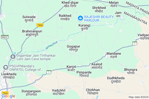
Gogapur
Gogapur Map
EDIT Map
Add Your House
 ..
..
Current Corona Virus Infected Patients Count in Nandurbar District
| City Name | District Name | Total Covid cases |
|---|---|---|
| Nandurbar District | Nandurbar | 6 |
Locality Name :
Gogapur
( गोगापूर )
Taluka Name : Shahada
District : Nandurbar
State : Maharashtra
Region : Khandesh and Northern Maharashtra
Division : Nashik
Language : Marathi and Hindi, Bhili, Gujrathi And Kokani
Current Time 12:41 PM
Date: Tuesday , Apr 29,2025 (IST)
Time zone: IST (UTC+5:30)
Elevation / Altitude: 161 meters. Above Seal level
Telephone Code / Std Code: 02565
Assembly constituency : Shahada assembly constituency
Assembly MLA : Rajesh Udesing Padvi
Lok Sabha constituency : Nandurbar parliamentary constituency
Parliament MP : Dr. Heena Vijaykumar Gavit
Serpanch Name :
Pin Code : 425424
Post Office Name : Purushottam Nagar
Commodities Prices : Khetia Market / Mandi
Gogapur Live Weather
Temperature: 40.8 °C
clear sky
Humidity: 10%
Wind : 5.5 mt/sec towards NW
StationName : "Khetia"
observed on 1 Hours Back
Temperature: 40.8 °C
clear sky
Humidity: 10%
Wind : 5.5 mt/sec towards NW
StationName : "Khetia"
observed on 1 Hours Back
Gogapur Weather Forecast for Next 5 days
30-04-2025
29.0°C to 43.0°C
clear sky, few clouds
29.0°C to 43.0°C
clear sky, few clouds
01-05-2025
28.3°C to 43.3°C
clear sky
28.3°C to 43.3°C
clear sky
02-05-2025
27.8°C to 43.4°C
clear sky
27.8°C to 43.4°C
clear sky
03-05-2025
28.5°C to 43.6°C
clear sky
28.5°C to 43.6°C
clear sky
04-05-2025
26.6°C to 42.2°C
clear sky
26.6°C to 42.2°C
clear sky
Edit below overview about Gogapur
Edit below overview about Gogapur
OverView of Gogapur
Gogapur is very beutiful place. Tha primary language use in gogapur is Gujar. Gomai river have in gogapur.Edit below overview about Gogapur
Rivers Near Gogapur
Mangla
Shivnad
Mangla
Shivnad
About Gogapur
Gogapur is a Village in Shahada Taluka in Nandurbar District of Maharashtra State, India. It belongs to Khandesh and Northern Maharashtra region . It belongs to Nashik Division . It is located 50 KM towards East from District head quarters Nandurbar. 8 KM from Shahada. 396 KM from State capital Mumbai
Gogapur Pin code is 425424 and postal head office is Purushottam Nagar .
Tuki ( 2 KM ) , Bhagapur ( 3 KM ) , Kurangi ( 4 KM ) , Pimparde ( 4 KM ) , Bhortek ( 5 KM ) are the nearby Villages to Gogapur. Gogapur is surrounded by Pansemal Taluka towards East , Taloda Taluka towards west , Pati Taluka towards North , Shirpur Taluka towards East .
Shahade , Shirpur-Warwade , Nandurbar , Sendhwa are the near by Cities to Gogapur.
Gogapur 2011 Census Details
Gogapur Local Language is Marathi. Gogapur Village Total population is 2604 and number of houses are 511. Female Population is 50.2%. Village literacy rate is 44.9% and the Female Literacy rate is 19.4%.
Population
| Census Parameter | Census Data |
| Total Population | 2604 |
| Total No of Houses | 511 |
| Female Population % | 50.2 % ( 1306) |
| Total Literacy rate % | 44.9 % ( 1169) |
| Female Literacy rate | 19.4 % ( 505) |
| Scheduled Tribes Population % | 65.2 % ( 1697) |
| Scheduled Caste Population % | 2.3 % ( 60) |
| Working Population % | 49.0 % |
| Child(0 -6) Population by 2011 | 395 |
| Girl Child(0 -6) Population % by 2011 | 50.6 % ( 200) |
Gogapur Census More Deatils.
Politics in Gogapur
Bharatiya Janata Party , BJP , SP , INC , SHS are the major political parties in this area.Polling Stations /Booths near Gogapur
1)Tembhali(aasus)2)Tikhora
3)Tuki
4)Pratppur
5)Purushottam Nagar (lonkheda)
HOW TO REACH Gogapur
By Rail
There is no railway station near to Gogapur in less than 10 km. are the Rail way stations reachable from near by towns.By Road
Shahade are the nearby by towns to Gogapur having road connectivity to GogapurColleges near Gogapur
Shri.chakradhar Madhyamik Vidalaya
Address :
Kai Am Di Sonwane Aadivasi Audani Ashrm School Taradi Ta Shahda
Address : At Taradi Ta Shahda
Schools in Gogapur
High School
Address : gogapur , shahada , nandurbar , Maharashtra . PIN- 425424 , Post - Purushottam Nagar
Govt Health Centers near Gogapur
1) Gogapur , Sub Centre Gogapur , ,2) Bhagapur , Sub Centre Bhagapur , ,
3) Raikhed , Sub Centre Raikhed , ,
Hospitals in Gogapur,Shahada
Primary Health Centre
Karjot; Shahada; Nandurbar; SH-1; Shahada Sangvi Khamkheda Lasur Amalner Road; Nandurbar; Nandurbar; Maharashtra 425409; India
3.2 KM distance Detail
Primary Health Centre
Shahada; Nandurbar; SH-1; Shahada Sangvi Khamkheda Lasur Amalner Road; Nandurbar; Nandurbar; Maharashtra 425409; India
3.6 KM distance Detail
more ..
Petrol Bunks in Gogapur,Shahada
Indian Oil Petrol Pump
Shahada; Nandurbar; SH-1; Shahada Sangvi Khamkheda Lasur Amalner Road; Nandurbar; Nandurbar; Maharashtra 425409; India
5.2 KM distance Detail
HP PETROL PUMP - SAI AUTO SERVICE
Gram Nisarpur Khetia Tehsil-pansemal; Indore; Madhya Pradesh 451881; India
9.0 KM distance Detail
more ..
Colleges in Gogapur,Shahada
blue chip computer pansemal
MP SH 36; Chouhan Colony; Pansemal; Madhya Pradesh 451770; India
15.8 KM distance Detail
more ..
Schools in Gogapur,Shahada
Government Primary School
Shahada; Nandurbar; SH-1; Shahada Sangvi Khamkheda Lasur Amalner Road; Nandurbar; Nandurbar; Maharashtra 425409; India
3.0 KM distance Detail
Government Primary School
Karjot; Shahada; Nandurbar; SH-1; Shahada Sangvi Khamkheda Lasur Amalner Road; Nandurbar; Nandurbar; Maharashtra 425409; India
3.2 KM distance Detail
Governement Offices near Gogapur,Shahada
Nandurbar Forest Office
Shahane; Nandurbar; SH-1; Shahada Sangvi Khamkheda Lasur Amalner Road; Nandurbar; Nandurbar; Maharashtra 425409; India
20.4 KM distance Detail
About Gogapur &
History
How to reach Gogapur
Tourist Places Near By Gogapur
Schools in Gogapur
Colleges in Gogapur
Temperature & weather of Gogapur
places in Gogapur
Gogapur photos
More Information
How to reach Gogapur
Tourist Places Near By Gogapur
Schools in Gogapur
Colleges in Gogapur
Temperature & weather of Gogapur
places in Gogapur
Gogapur photos
More Information
Village Talk
Post News or Events about this Village
Near Cities
Shahade 14 KM near
Shirpur-Warwade 46 KM near
Nandurbar 47 KM near
Sendhwa 61 KM near
Shahade 14 KM near
Shirpur-Warwade 46 KM near
Nandurbar 47 KM near
Sendhwa 61 KM near
Near By Taluks
Shahada 8 KM near
Pansemal 17 KM near
Taloda 43 KM near
Pati 44 KM near
Shahada 8 KM near
Pansemal 17 KM near
Taloda 43 KM near
Pati 44 KM near
Near By Air Ports
Vadodara Airport 181 KM near
Indore Airport 199 KM near
Gandhinagar Airport 222 KM near
Chikkalthana Airport 235 KM near
Vadodara Airport 181 KM near
Indore Airport 199 KM near
Gandhinagar Airport 222 KM near
Chikkalthana Airport 235 KM near
Near By Tourist Places
Toranmal 37 KM near
Dhule 89 KM near
Kevadia Narmada 108 KM near
Maheshwar 136 KM near
Saputara 147 KM near
Toranmal 37 KM near
Dhule 89 KM near
Kevadia Narmada 108 KM near
Maheshwar 136 KM near
Saputara 147 KM near
Near By Districts
Nandurbar 48 KM near
Barwani 66 KM near
Dhule 89 KM near
Alirajpur 91 KM near
Nandurbar 48 KM near
Barwani 66 KM near
Dhule 89 KM near
Alirajpur 91 KM near
Near By RailWay Station
Dondaicha Rail Way Station 33 KM near
Nandurbar Rail Way Station 47 KM near
Dondaicha Rail Way Station 33 KM near
Nandurbar Rail Way Station 47 KM near