| Home | City Bus | Maps | Villages | Cities | Rail | Tourist Places | School | College | Pin Codes | Corona Cases Count |
| Distance Calculator Bus Services IFSC Codes Trace Mobile Number Weather Search Place Trace IP Available Cash ATM/Banks Locate Polling Booth Report an Error contact People |
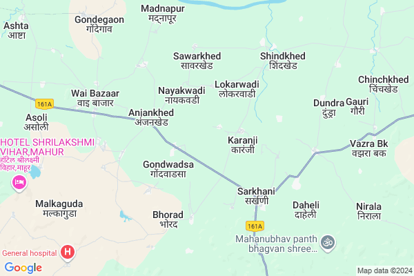
Selu
Selu Map
EDIT Map
Add Your House
 ..
..
Current Corona Virus Infected Patients Count in Nanded District
| City Name | District Name | Total Covid cases |
|---|---|---|
| Nanded District | Nanded | 1 |
Locality Name :
Selu
( सेलू )
Taluka Name : Mahur
District : Nanded
State : Maharashtra
Region : Marathwada
Division : Aurangabad
Language : Andh and Indo-aryan,marathi,punjabi,urdu
Current Time 12:20 PM
Date: Tuesday , Apr 29,2025 (IST)
Time zone: IST (UTC+5:30)
Elevation / Altitude: 329 meters. Above Seal level
Telephone Code / Std Code: 07236
Assembly constituency : Kinwat assembly constituency
Assembly MLA : Bhimrao Ramji Keram
Lok Sabha constituency : Hingoli parliamentary constituency
Parliament MP : Hemant Patil
Serpanch Name :
Pin Code : 431805
Post Office Name : Mandvi (Nanded)
Commodities Prices : Kinwat Market / Mandi
Rivers Near Selu
Penganga :ペーンガンガー :ಪೇನಗಂಗ :पैनगंगा
Waghari
Penganga :ペーンガンガー :ಪೇನಗಂಗ :पैनगंगा
Waghari
About Selu
Correct below Info and add more info about SeluSelu is a Village in Mahur Taluka in Nanded District of Maharashtra State, India. It belongs to Marathwada region . It belongs to Aurangabad Division . It is located 129 KM towards East from District head quarters Nanded. 13 KM from Mahur. 650 KM from State capital Mumbai
Selu Pin code is 431805 and postal head office is Mandvi (Nanded).
Goundwadsa ( 2 KM ) , Anjankhed ( 3 KM ) , Lokarwadi ( 3 KM ) , Sarkhani ( 4 KM ) , Salaiguda ( 4 KM ) are the nearby Villages to Selu. Selu is surrounded by Kinwat Taluka towards South , Arni Taluka towards North , Mahagaon Taluka towards west , Tamsi Taluka towards East .
Ghatanji , Umarkhed , Pandharkaoda , Adilabad are the near by Cities to Selu.
This Place is in the border of the Nanded District and Yavatmal District. Yavatmal District Mahagaon is west towards this place .
Selu 2011 Census Details
Selu Local Language is Andh. Selu Village Total population is 1001 and number of houses are 220. Female Population is 49.1%. Village literacy rate is 74.7% and the Female Literacy rate is 33.7%.
Population
| Census Parameter | Census Data |
| Total Population | 1001 |
| Total No of Houses | 220 |
| Female Population % | 49.1 % ( 491) |
| Total Literacy rate % | 74.7 % ( 748) |
| Female Literacy rate | 33.7 % ( 337) |
| Scheduled Tribes Population % | 5.9 % ( 59) |
| Scheduled Caste Population % | 15.1 % ( 151) |
| Working Population % | 36.9 % |
| Child(0 -6) Population by 2011 | 93 |
| Girl Child(0 -6) Population % by 2011 | 49.5 % ( 46) |
Selu Census More Deatils.
Politics in Selu
BJP , NCP , Shivsena , INC , SHS are the major political parties in this area.Polling Stations /Booths near Selu
1)Savarkhed2)Karmji
3)Kankwadi
4)Gondjewali
5)Gondvadsa
HOW TO REACH Selu
By Rail
There is no railway station near to Selu in less than 10 km. Kinwat Rail Way Station (near to Kinwat) , Ambari Rail Way Station (near to Kinwat) are the Rail way stations reachable from near by towns.By Road
Kinwat are the nearby by towns to Selu having road connectivity to SeluColleges near Selu
Shree Renuka Devi Collage,mahur
Address :
S.n.rai Engg. & Tech.,mahur
Address :
Schools in Selu
Zpps
Address : selu , mahoor , nanded , Maharashtra . PIN- 431805 , Post - Mandvi (Nanded)
Govt Health Centers near Selu
1) Karanji , Sub Centre Karanji , Karanji , Karanji2) Selu , Sub Centre Selu , Selu , Selu
3) Gondwalasa , Sub Centre Gondwadsa , Gondwadsa , Gondwadsa
Electronic Shops in Selu,Mahur
Super Markets in Selu,Mahur
Local Parks in Selu,Mahur
Police Stations near Selu,Mahur
Governement Offices near Selu,Mahur
About Selu &
History
How to reach Selu
Tourist Places Near By Selu
Schools in Selu
Colleges in Selu
Temperature & weather of Selu
places in Selu
Selu photos
More Information
How to reach Selu
Tourist Places Near By Selu
Schools in Selu
Colleges in Selu
Temperature & weather of Selu
places in Selu
Selu photos
More Information
Village Talk
Post News or Events about this Village
Near Cities
Ghatanji 46 KM near
Umarkhed 53 KM near
Pandharkaoda 56 KM near
Adilabad 56 KM near
Ghatanji 46 KM near
Umarkhed 53 KM near
Pandharkaoda 56 KM near
Adilabad 56 KM near
Near By Taluks
Mahur 12 KM near
Kinwat 26 KM near
Arni 30 KM near
Mahagaon 38 KM near
Mahur 12 KM near
Kinwat 26 KM near
Arni 30 KM near
Mahagaon 38 KM near
Near By Air Ports
Nanded Airport 121 KM near
Sonegaon Airport 193 KM near
Latur Airport 260 KM near
Chikkalthana Airport 315 KM near
Nanded Airport 121 KM near
Sonegaon Airport 193 KM near
Latur Airport 260 KM near
Chikkalthana Airport 315 KM near
Near By Tourist Places
Hingoli 111 KM near
Washim 116 KM near
Sevagram 127 KM near
Amravati 141 KM near
Chandrapur 142 KM near
Hingoli 111 KM near
Washim 116 KM near
Sevagram 127 KM near
Amravati 141 KM near
Chandrapur 142 KM near
Near By Districts
Adilabad 56 KM near
Yavatmal 70 KM near
Hingoli 110 KM near
Washim 116 KM near
Adilabad 56 KM near
Yavatmal 70 KM near
Hingoli 110 KM near
Washim 116 KM near
Near By RailWay Station
Kinwat Rail Way Station 29 KM near
Adilabad Rail Way Station 55 KM near
Kinwat Rail Way Station 29 KM near
Adilabad Rail Way Station 55 KM near