| Home | City Bus | Maps | Villages | Cities | Rail | Tourist Places | School | College | Pin Codes | Corona Cases Count |
| Distance Calculator Bus Services IFSC Codes Trace Mobile Number Weather Search Place Trace IP Available Cash ATM/Banks Locate Polling Booth Report an Error contact People |
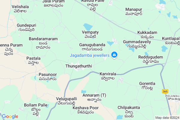
Kunta Palle
Kunta Palle Map
EDIT Map
Add Your House
 ..
..
Current Corona Virus Infected Patients Count in Nalgonda District
| City Name | District Name | Total Covid cases |
|---|---|---|
| Suryapet District | Suryapet | 72 |
| Nalgonda District | Nalgonda | 15 |
Locality Name :
Kunta Palle
( కుంట పల్లె )
Mandal Name : Thungathurthi
District : Nalgonda
State : Telangana
Region : Telangana
Language : Telugu and Urdu
Current Time 06:05 PM
Date: Sunday , Apr 27,2025 (IST)
Time zone: IST (UTC+5:30)
Elevation / Altitude: 223 meters. Above Seal level
Telephone Code / Std Code: 08684
Assembly constituency : Thungathurthy assembly constituency
Assembly MLA : Mandula Samel
Lok Sabha constituency : Bhongir parliamentary constituency
Parliament MP : Komati Reddy Venkat Reddy
Serpanch Name :
Pin Code : 508280
Post Office Name : Thungathurthi
Main Village Name : Kunta palle
Commodities Prices : Suryapeta Market / Mandi
Kunta Palle Live Weather
Temperature: 39.2 °C
broken clouds
Humidity: 20%
Wind : 3.57 mt/sec towards S
StationName : "SuriÄ\u0081pet"
observed on 19 Mins Back
Temperature: 39.2 °C
broken clouds
Humidity: 20%
Wind : 3.57 mt/sec towards S
StationName : "SuriÄ\u0081pet"
observed on 19 Mins Back
Kunta Palle Weather Forecast for Next 5 days
28-04-2025
27.5°C to 36.1°C
light rain, scattered clouds
27.5°C to 36.1°C
light rain, scattered clouds
29-04-2025
27.1°C to 39.5°C
broken clouds, clear sky, scattered clouds, few clouds
27.1°C to 39.5°C
broken clouds, clear sky, scattered clouds, few clouds
30-04-2025
26.8°C to 42.1°C
scattered clouds, clear sky, light rain, few clouds
26.8°C to 42.1°C
scattered clouds, clear sky, light rain, few clouds
01-05-2025
26.8°C to 43.0°C
scattered clouds, few clouds, broken clouds
26.8°C to 43.0°C
scattered clouds, few clouds, broken clouds
02-05-2025
27.8°C to 43.0°C
clear sky, scattered clouds, few clouds
27.8°C to 43.0°C
clear sky, scattered clouds, few clouds
National Highways Reachable To Kunta Palle
Nationa High Way :NH365BB
Nationa High Way :NH365BB
Rivers Near Kunta Palle
Musi River
Munneru River
Musi River
Munneru River
About Kunta Palle
Correct below Info and add more info about Kunta PalleKunta Palle is a small Village/hamlet in Thungathurthi Mandal in Nalgonda District of Telangana State, India. It comes under Kunta palle Panchayath. It belongs to Telangana region . As part Telangana Districts re-organisation , Kunta Palle Village Thungathurthi Mandal re organised from Nalgonda District to Suryapet district. It is located 64 KM towards North from District head quarters Nalgonda.
Kunta Palle Pin code is 508280 and postal head office is Thungathurthi .
Kunta Palle is surrounded by Thirumalagiri Mandal towards west , Aravapally Mandal towards South , Jaji Reddi Gudem (Arvapally) Mandal towards South , Nuthankal Mandal towards East .
Suryapet , Jangaon , Kodad , Khammam are the near by Cities to Kunta Palle.
This Place is in the border of the Nalgonda District and Warangal District. Warangal District Kodakandla is North towards this place .
Kunta Palle 2011 Census Details
Kunta Palle Local Language is Telugu. Kunta Palle Village Total population is 527 and number of houses are 134. Female Population is 49.5%. Village literacy rate is 52.2% and the Female Literacy rate is 22.2%.
Population
| Census Parameter | Census Data |
| Total Population | 527 |
| Total No of Houses | 134 |
| Female Population % | 49.5 % ( 261) |
| Total Literacy rate % | 52.2 % ( 275) |
| Female Literacy rate | 22.2 % ( 117) |
| Scheduled Tribes Population % | 0.9 % ( 5) |
| Scheduled Caste Population % | 9.9 % ( 52) |
| Working Population % | 56.4 % |
| Child(0 -6) Population by 2011 | 42 |
| Girl Child(0 -6) Population % by 2011 | 38.1 % ( 16) |
Kunta Palle Census More Deatils.
Politics in Kunta Palle
TDP , TRS , INC are the major political parties in this area.Polling Stations /Booths near Kunta Palle
1)Thudimidi2)Thungathurthi
3)Thungaturthi
4)Tirumalagiri
5)Etoor
HOW TO REACH Kunta Palle
By Road
Suryapet is the Nearest Town to Kunta Palle. Suryapet is 60 km from Kunta Palle. Road connectivity is there from Suryapet to Kunta Palle.By Rail
There is no railway station near to Kunta Palle in less than 10 km.Colleges near Kunta Palle
Mathrusri Junior College, Suryapet
Address :
Padala Degree College
Address :
Tswrdcw,cherlapally
Address : Tswrdcw,
cherlapally,nalgonda
pon:508001
Vikas Junior College
Address :
Sphoorthy College
Address : Narkatpally
Schools in Kunta Palle
Mpps Kuntapally
Address : kunta palle , thungathurthi , nalgonda , Andhra Pradesh . PIN- 508280 , Post - Thungathurthi
Govt Health Centers near Kunta Palle
1) Primary Health Centre, Thungathurthy , 801 , Main road , Beside Bustand2) SubCentre, Thungathurthi , 801 , Main road , GP
3) SubCentre, Vempati , , Main road , Near GP
Sub Villages in Kunta Palle
Petrol Bunks in Kunta Palle,Thungathurthi
M/S and Son's Filling Station Bharat Petroleum
Jajjireddygudem; Nalgonda; SH-16; Jangaon Suryapet Road; Arvapalli; Arvapalli; Telangana 508224; India
15.6 KM distance Detail
more ..
Electronic Shops in Kunta Palle,Thungathurthi
AMRUTHA ELECTRICALS SARGAM MALLAIAH YADAV
Ambedkar Nagar; Tungaturthi; Telangana 508280; India
1.3 KM distance Detail
Hanuman cable net-Thungathurthy
Vempati Rd; Tungaturthi; Telangana 508280; India
1.8 KM distance Detail
Super Markets in Kunta Palle,Thungathurthi
New Vasavi Kirana&General Store.
Nemmikal - Warangal Road; Nuthankal; Telangana 508221; India
16.6 KM distance Detail
Governement Offices near Kunta Palle,Thungathurthi
MeeSeva Center
Matrixmeeseva;Thunga Thurthi(M); Tungaturthi; Telangana 508280; India
1.7 KM distance Detail
About Kunta Palle &
History
How to reach Kunta Palle
Tourist Places Near By Kunta Palle
Schools in Kunta Palle
Colleges in Kunta Palle
Temperature & weather of Kunta Palle
places in Kunta Palle
Kunta Palle photos
More Information
How to reach Kunta Palle
Tourist Places Near By Kunta Palle
Schools in Kunta Palle
Colleges in Kunta Palle
Temperature & weather of Kunta Palle
places in Kunta Palle
Kunta Palle photos
More Information
Village Talk
Post News or Events about this Village
Near Cities
Suryapet 35 KM near
Jangaon 63 KM near
Kodad 67 KM near
Khammam 68 KM near
Suryapet 35 KM near
Jangaon 63 KM near
Kodad 67 KM near
Khammam 68 KM near
Near By Taluks
Thungathurthi 0 KM near
Thirumalagiri 12 KM near
Aravapally 14 KM near
Jaji Reddi Gudem (Arvapally) 15 KM near
Thungathurthi 0 KM near
Thirumalagiri 12 KM near
Aravapally 14 KM near
Jaji Reddi Gudem (Arvapally) 15 KM near
Near By Air Ports
Rajiv Gandhi International Airport 141 KM near
Vijayawada Airport 180 KM near
Rajahmundry Airport 266 KM near
Nanded Airport 347 KM near
Rajiv Gandhi International Airport 141 KM near
Vijayawada Airport 180 KM near
Rajahmundry Airport 266 KM near
Nanded Airport 347 KM near
Near By Tourist Places
Khammam 68 KM near
Warangal 71 KM near
Nagarjunakonda 92 KM near
Nagarjunsagar 110 KM near
Hyderabad 132 KM near
Khammam 68 KM near
Warangal 71 KM near
Nagarjunakonda 92 KM near
Nagarjunsagar 110 KM near
Hyderabad 132 KM near
Near By Districts
Nalgonda 61 KM near
Khammam 68 KM near
Warangal 70 KM near
Hyderabad 134 KM near
Nalgonda 61 KM near
Khammam 68 KM near
Warangal 70 KM near
Hyderabad 134 KM near
Near By RailWay Station
Kesamudram Rail Way Station 48 KM near
Mahbubabad Rail Way Station 52 KM near
Kesamudram Rail Way Station 48 KM near
Mahbubabad Rail Way Station 52 KM near