| Home | City Bus | Maps | Villages | Cities | Rail | Tourist Places | School | College | Pin Codes | Corona Cases Count |
| Distance Calculator Bus Services IFSC Codes Trace Mobile Number Weather Search Place Trace IP Available Cash ATM/Banks Locate Polling Booth Report an Error contact People |
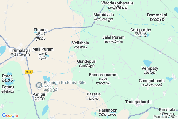
Jatothuthanda
Jatothuthanda Map
EDIT Map
Add Your House
 ..
..
Current Corona Virus Infected Patients Count in Nalgonda District
| City Name | District Name | Total Covid cases |
|---|---|---|
| Suryapet District | Suryapet | 72 |
| Nalgonda District | Nalgonda | 15 |
Locality Name :
Jatothuthanda
( జాటోతుతండా )
Mandal Name : Thirumalagiri
District : Nalgonda
State : Telangana
Region : Telangana
Language : Telugu and Urdu
Current Time 09:25 PM
Date: Wednesday , Feb 05,2025 (IST)
Time zone: IST (UTC+5:30)
Elevation / Altitude: 357 meters. Above Seal level
Telephone Code / Std Code: 08711
Assembly constituency : Thungathurthy assembly constituency
Assembly MLA : Mandula Samel
Lok Sabha constituency : Bhongir parliamentary constituency
Parliament MP : Komati Reddy Venkat Reddy
Serpanch Name :
Pin Code : 508223
Post Office Name : Tirumalgiri
Main Village Name : Gundepuri
Commodities Prices : Nakrekal Market / Mandi
Jatothuthanda Live Weather
Temperature: 27.3 °C
clear sky
Humidity: 32%
Wind : 1.52 mt/sec towards S
StationName : "SuriÄ\u0081pet"
observed on 2 Hours Back
Temperature: 27.3 °C
clear sky
Humidity: 32%
Wind : 1.52 mt/sec towards S
StationName : "SuriÄ\u0081pet"
observed on 2 Hours Back
Jatothuthanda Weather Forecast for Next 5 days
06-02-2025
20.7°C to 27.1°C
clear sky, scattered clouds
20.7°C to 27.1°C
clear sky, scattered clouds
07-02-2025
19.8°C to 32.8°C
scattered clouds, clear sky
19.8°C to 32.8°C
scattered clouds, clear sky
08-02-2025
20.6°C to 33.4°C
clear sky, few clouds
20.6°C to 33.4°C
clear sky, few clouds
09-02-2025
20.6°C to 33.9°C
clear sky
20.6°C to 33.9°C
clear sky
10-02-2025
20.0°C to 33.8°C
clear sky
20.0°C to 33.8°C
clear sky
National Highways Reachable To Jatothuthanda
Nationa High Way :NH161AA
Nationa High Way :Old NH202
Nationa High Way :NH161AA
Nationa High Way :Old NH202
Rivers Near Jatothuthanda
Bukleru River
Mustanapalli Vagu
Bukleru River
Mustanapalli Vagu
About Jatothuthanda
Correct below Info and add more info about JatothuthandaJatothuthanda is a small Village/hamlet in Thirumalagiri Mandal in Nalgonda District of Telangana State, India. It comes under Gundepuri Panchayath. It belongs to Telangana region . As part Telangana Districts re-organisation , Jatothuthanda Village Thirumalagiri Mandal re organised from Nalgonda District to Nalgonda,Suryapet district. It is located 62 KM towards North from District head quarters Nalgonda. 3 KM from Tirmalagiri.
Jatothuthanda Pin code is 508223 and postal head office is Tirumalgiri .
Jatothuthanda is surrounded by Thungathurthi Mandal towards East , Kodakandla Mandal towards North , Jaji Reddi Gudem (Arvapally) Mandal towards South , Aravapally Mandal towards South .
Suryapet , Jangaon , Warangal , Miryalaguda are the near by Cities to Jatothuthanda.
This Place is in the border of the Nalgonda District and Warangal District. Warangal District Kodakandla is North towards this place .
Demographics of Jatothuthanda
Telugu is the Local Language here. Total population of Jatothuthanda is 2078 .Males are 1037 and Females are 1,041 living in 452 Houses. Total area of Jatothuthanda is 700 hectares.Politics in Jatothuthanda
TDP , TRS , INC are the major political parties in this area.Polling Stations /Booths near Jatothuthanda
1)Gummadavelli2)Gundepuri
3)Shaligouraram
4)Banda Rama Ram
5)Veldevi
HOW TO REACH Jatothuthanda
By Road
Suryapet is the Nearest Town to Jatothuthanda. Suryapet is 53 km from Jatothuthanda. Road connectivity is there from Suryapet to Jatothuthanda.By Rail
There is no railway station near to Jatothuthanda in less than 10 km.Colleges near Jatothuthanda
Model School Govt Junior College
Address :
Ragavendra.jr College
Address :
Schools in Jatothuthanda
Zphs Gundepuri
Address : gundepuri , thirumalagiri , nalgonda , Andhra Pradesh . PIN- 508223 , Post - Tirumalgiri
Govt Health Centers near Jatothuthanda
1) SubCentre, Gundepuri , 1--68 , GP road , Near GP2) SubCentre Velishala , 2-65 B/1 , S.c colony , S.c colony
3) Primay Health Centre Velishala , , , Mainroad
Petrol Bunks in Jatothuthanda,Thirumalagiri
Ravi Teja Auto Service Indian Oil Petrol Pump
Malipuram; Nalgonda; SH-16; Jangaon Suryapet Road; Thirumalagiri; Thirumalagiri; Telangana 508223; India
8.8 KM distance Detail
HP PETROL PUMP - SRI RAMA RETAIL OUTLET
HPC Dealers Malipuram (village) Tirumalagiri (mandal); Warangal; 508223; India
9.0 KM distance Detail
more ..
Colleges in Jatothuthanda,Thirumalagiri
Sairam Degree College
Tungathurthy; Near Indian Oil Petrol Pump; NH 365; Nalgonda; Telangana 508001; India
8.3 KM distance Detail
Government Polytechnic College; Thirumalagiri
Near Malipuram; Behind Fathima School; Jangaon - Tirumalagiri - Suryapet Road; Mali Puram; Telangana 508223; India
8.5 KM distance Detail
more ..
Super Markets in Jatothuthanda,Thirumalagiri
Uppalaih Mechanic & Kiranam
Thorrur - Thirumalagiri Rd; Mali Puram; Telangana 508223; India
9.7 KM distance Detail
Police Stations near Jatothuthanda,Thirumalagiri
Thirumalagiri Police Station
8-21; Jangaon - Tirumalagiri - Suryapet Rd; Mali Puram; Telangana 508223; India
10.7 KM distance Detail
Governement Offices near Jatothuthanda,Thirumalagiri
Meeseva
THONDA(VI);THIRUMALAGIRI(;Thirumalagiri;Nalgonda; Thorrur - Thirumalagiri Rd; Thonda; Telangana 508223; India
7.9 KM distance Detail
About Jatothuthanda &
History
How to reach Jatothuthanda
Tourist Places Near By Jatothuthanda
Schools in Jatothuthanda
Colleges in Jatothuthanda
Temperature & weather of Jatothuthanda
places in Jatothuthanda
Jatothuthanda photos
More Information
How to reach Jatothuthanda
Tourist Places Near By Jatothuthanda
Schools in Jatothuthanda
Colleges in Jatothuthanda
Temperature & weather of Jatothuthanda
places in Jatothuthanda
Jatothuthanda photos
More Information
Village Talk
Post News or Events about this Village
Near Cities
Suryapet 41 KM near
Jangaon 53 KM near
Warangal 68 KM near
Miryalaguda 74 KM near
Suryapet 41 KM near
Jangaon 53 KM near
Warangal 68 KM near
Miryalaguda 74 KM near
Near By Taluks
Thirumalagiri 3 KM near
Thungathurthi 9 KM near
Kodakandla 10 KM near
Jaji Reddi Gudem (Arvapally) 16 KM near
Thirumalagiri 3 KM near
Thungathurthi 9 KM near
Kodakandla 10 KM near
Jaji Reddi Gudem (Arvapally) 16 KM near
Near By Air Ports
Rajiv Gandhi International Airport 133 KM near
Vijayawada Airport 190 KM near
Rajahmundry Airport 275 KM near
Nanded Airport 338 KM near
Rajiv Gandhi International Airport 133 KM near
Vijayawada Airport 190 KM near
Rajahmundry Airport 275 KM near
Nanded Airport 338 KM near
Near By Tourist Places
Warangal 67 KM near
Khammam 78 KM near
Nagarjunakonda 100 KM near
Nagarjunsagar 113 KM near
Hyderabad 124 KM near
Warangal 67 KM near
Khammam 78 KM near
Nagarjunakonda 100 KM near
Nagarjunsagar 113 KM near
Hyderabad 124 KM near
Near By Districts
Nalgonda 60 KM near
Warangal 65 KM near
Khammam 78 KM near
Hyderabad 125 KM near
Nalgonda 60 KM near
Warangal 65 KM near
Khammam 78 KM near
Hyderabad 125 KM near
Near By RailWay Station
Kesamudram Rail Way Station 51 KM near
Ghanpur Rail Way Station 51 KM near
Kesamudram Rail Way Station 51 KM near
Ghanpur Rail Way Station 51 KM near