| Home | City Bus | Maps | Villages | Cities | Rail | Tourist Places | School | College | Pin Codes | Corona Cases Count |
| Distance Calculator Bus Services IFSC Codes Trace Mobile Number Weather Search Place Trace IP Available Cash ATM/Banks Locate Polling Booth Report an Error contact People |
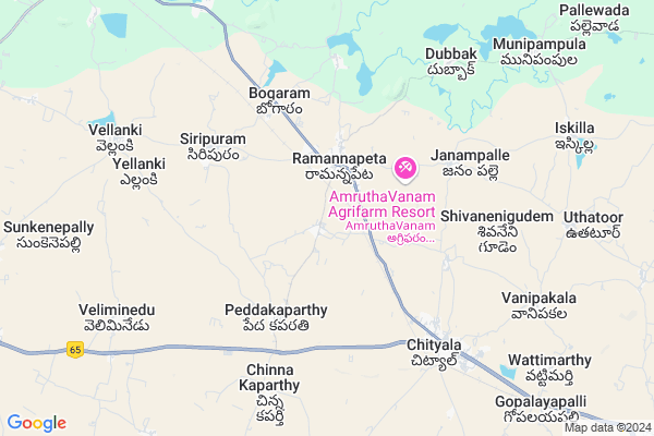
Ramannapet
Ramannapet Map
EDIT Map
Add Your House
 ..
..
Current Corona Virus Infected Patients Count in Nalgonda District
| City Name | District Name | Total Covid cases |
|---|---|---|
| Suryapet District | Suryapet | 72 |
| Nalgonda District | Nalgonda | 15 |
Locality Name :
Ramannapet
( రామన్నపేట )
Mandal Name : Ramannapeta
District : Nalgonda
State : Telangana
Region : Telangana
Language : Telugu and Urdu
Current Time 07:15 AM
Date: Saturday , Apr 26,2025 (IST)
Time zone: IST (UTC+5:30)
Elevation / Altitude: 322 meters. Above Seal level
Telephone Code / Std Code: 08682
Assembly constituency : Nakrekal assembly constituency
Assembly MLA : Vemula Veeresham
Lok Sabha constituency : Bhongir parliamentary constituency
Parliament MP : Komati Reddy Venkat Reddy
Serpanch Name :
Pin Code : 508113
Post Office Name : Ramannnapeta
Commodities Prices : Ramannapet Market / Mandi
Ramannapet Live Weather
Temperature: 27.6 °C
broken clouds
Humidity: 64%
Wind : 5 mt/sec towards SE
StationName : "Bhongīr"
observed on 38 Mins Back
Temperature: 27.6 °C
broken clouds
Humidity: 64%
Wind : 5 mt/sec towards SE
StationName : "Bhongīr"
observed on 38 Mins Back
Ramannapet Weather Forecast for Next 5 days
27-04-2025
28.7°C to 40.2°C
broken clouds, few clouds, scattered clouds, overcast clouds
28.7°C to 40.2°C
broken clouds, few clouds, scattered clouds, overcast clouds
28-04-2025
26.6°C to 35.8°C
overcast clouds, broken clouds, scattered clouds, clear sky
26.6°C to 35.8°C
overcast clouds, broken clouds, scattered clouds, clear sky
29-04-2025
25.7°C to 39.7°C
few clouds, overcast clouds, broken clouds, clear sky, scattered clouds
25.7°C to 39.7°C
few clouds, overcast clouds, broken clouds, clear sky, scattered clouds
30-04-2025
26.0°C to 40.8°C
few clouds, clear sky, scattered clouds, light rain
26.0°C to 40.8°C
few clouds, clear sky, scattered clouds, light rain
01-05-2025
27.1°C to 40.5°C
scattered clouds, broken clouds, few clouds, light rain
27.1°C to 40.5°C
scattered clouds, broken clouds, few clouds, light rain
Edit below overview about Ramannapet
Ramannapeta has one traditional palace called Alisaheb Hills which is located middle of the village.
Edit below overview about Ramannapet
OverView of Ramannapet
Ramannapeta is located in Nalgonda district, It is near by 75 Km from the capital of Andhrapradesh, Near cities are chityal, choutuppal and valigonda, It is Head quarter of mandal. Shobanadripuram, Indrapal nagar, Kakkireni, munipumpula, uttatoor, Iskilla, sarnenigudem, Nidanpally, Bhogaram, Janampally, Yennaram, Kommaigudemmandal, Palliwada villages are under this mandal.Ramannapeta has one traditional palace called Alisaheb Hills which is located middle of the village.
Ramannapet had his assembly constituency till 2009, its has mixed with nakerakal 95(sc) constituency, its was observed a least development since 2009. The people of Ramannapet are suffering a severe florosis due presence of floride substances in ground water which can be prevented by supply of krishna water the floods occurred in November and October led to vast loss of crops and shelters in a bad way.
Overally Ramannapet city has all basic amenities including each and every government offices including munsif court,its the duty of every citizen of Ramannapet to fight for the reorganization of its older constituency in the formation of telangana separate state'
wake up lets achieve our Ramannapeta assembly consituency.
Edit below overview about Ramannapet
National Highways Reachable To Ramannapet
Nationa High Way :Old NH7
Nationa High Way :NH765
Nationa High Way :Old NH7
Nationa High Way :NH765
Rivers Near Ramannapet
Musi River :మూసి
Musi River :మూసి
About Ramannapet
Ramannapet is a Town in Ramannapeta Mandal in Nalgonda District of Telangana State, India. It belongs to Telangana region . It is located 36 KM towards North from District head quarters Nalgonda. It is a Mandal head quarter.
Ramannapet Pin code is 508113 and postal head office is Ramannnapeta .
Pedakaparthy ( 4 KM ) , Janampally ( 5 KM ) , Shivanenigudem ( 5 KM ) , Siripuram ( 5 KM ) , Nidhanpally ( 6 KM ) are the nearby Villages to Ramannapet. Ramannapet is surrounded by Chityala Mandal towards South , Valigonda Mandal towards North , Narketpally Mandal towards East , Choutuppal Mandal towards west .
Bhongir , Jangaon , Suryapet , Hyderabad are the nearby Cities to Ramannapet.
Demographics of Ramannapet
Telugu is the Local Language here. Total population of Ramannapet is 10537 .Males are 5291 and Females are 5,246 living in 2066 Houses. Total area of Ramannapet is 902 hectares.Politics in Ramannapet
CPM , TDP , TRS , INC are the major political parties in this area.Polling Stations /Booths near Ramannapet
1)Kodapakonigudem Majira Chervugattu2)Ramannapet
3)Ramachandrapuram
4)Ramannapet
5)Ramannapet
HOW TO REACH Ramannapet
By Road
Nalgonda is the Nearest Town to Ramannapet. Nalgonda is 38 km from Ramannapet. Road connectivity is there from Nalgonda to Ramannapet.By Rail
Ramannapet Rail Way Station , Chityala Rail Way Station are the very nearby railway stations to Ramannapet. Also you can consider railway Stations from Near By town Nalgonda. Nalgonda Rail Way Station , Shrirampuram Rail Way Station are the railway stations near to Nalgonda. You can reach from Nalgonda to Ramannapet by road after .Govt Health Centers near Ramannapet
1) SubCentre, Ramannapet , 8-50/4 , Teachers Colony , TDP Kalyanamandapam2) Community Health Centre, Ramannapet , . , Post Office line , Opp Bustand
3) SubCentre, Peddakaparthi , H-No.4-175 , Ramannapeta Road , Near Grama Panchayath
Sub Villages in Ramannapet
Hospitals in Ramannapet,Ramannapeta
Uma Medical And General Stores
Near: Area Hospital; Subash Road; Ramannapet; Telangana 508113; India
2.2 KM distance Detail
more ..
Petrol Bunks in Ramannapet,Ramannapeta
Prasanna Ratankal Filling Station-Indian Oil Petrol Pump
Nalgonda; SH-15; Bhongir Nalgonda Road; Ramannapeta; Ramannapeta; 508113; India
1.8 KM distance Detail
Rohini Filling Station-Bharat Petroleum
Nalgonda; SH-15; Bhongir Nalgonda Road; Chityala; Chityala; Telangana 508114; India
5.8 KM distance Detail
more ..
Colleges in Ramannapet,Ramannapeta
Nalanda Junior College
Nalgonda; SH-15; Bhongir Nalgonda Road; Ramannapeta; Ramannapeta; Telangana 508113; India
1.9 KM distance Detail
Government Junior College and Boys High School
Bhuvanagiri-Nalgonda Rd; Ramannapeta; Telangana 508113; India
2.1 KM distance Detail
more ..
Electronic Shops in Ramannapet,Ramannapeta
Surya Studio
Hospital Complex; Opp: Busstand; Ramannapet; Telangana 508113; India
2.2 KM distance Detail
Sai Chaitanya Electricals
Opp:S.B.I Atm; Subash Nagar; Ramannapet; Telangana 508113; India
2.4 KM distance Detail
Super Markets in Ramannapet,Ramannapeta
Ramalingaeshwara Kiranam Ramannapet
Subash Rd; Ramannapeta; Telangana 508113; India
2.2 KM distance Detail
Ramesh Kirana Shop
Bhuvanagiri-Nalgonda Rd; Chityala; Telangana 508114; India
6.6 KM distance Detail
Governement Offices near Ramannapet,Ramannapeta
Assistant Engineer Office (RandB)
Nalgonda; SH-15; Bhongir Nalgonda Road; Ramannapeta; Ramannapeta; Telangana 508113; India
2.0 KM distance Detail
About Ramannapet &
History
How to reach Ramannapet
Tourist Places Near By Ramannapet
Schools in Ramannapet
Colleges in Ramannapet
Temperature & weather of Ramannapet
places in Ramannapet
Ramannapet photos
More Information
How to reach Ramannapet
Tourist Places Near By Ramannapet
Schools in Ramannapet
Colleges in Ramannapet
Temperature & weather of Ramannapet
places in Ramannapet
Ramannapet photos
More Information
Town Talk
Post News or Events about this Town
Near Cities
Bhongir 37 KM near
Jangaon 55 KM near
Suryapet 64 KM near
Hyderabad 73 KM near
Bhongir 37 KM near
Jangaon 55 KM near
Suryapet 64 KM near
Hyderabad 73 KM near
Near By Taluks
Ramannapeta 4 KM near
Chityala 5 KM near
Valigonda 16 KM near
Narketpally 17 KM near
Ramannapeta 4 KM near
Chityala 5 KM near
Valigonda 16 KM near
Narketpally 17 KM near
Near By Air Ports
Rajiv Gandhi International Airport 78 KM near
Vijayawada Airport 223 KM near
Nanded Airport 317 KM near
Rajahmundry Airport 325 KM near
Rajiv Gandhi International Airport 78 KM near
Vijayawada Airport 223 KM near
Nanded Airport 317 KM near
Rajahmundry Airport 325 KM near
Near By Tourist Places
Hyderabad 73 KM near
Nagarjunsagar 91 KM near
Warangal 109 KM near
Nagarjunakonda 115 KM near
Khammam 126 KM near
Hyderabad 73 KM near
Nagarjunsagar 91 KM near
Warangal 109 KM near
Nagarjunakonda 115 KM near
Khammam 126 KM near
Near By Districts
Nalgonda 34 KM near
Hyderabad 76 KM near
Warangal 106 KM near
Rangareddi 117 KM near
Nalgonda 34 KM near
Hyderabad 76 KM near
Warangal 106 KM near
Rangareddi 117 KM near
Near By RailWay Station
Ramannapet Rail Way Station 1.7 KM near
Chityala Rail Way Station 7.4 KM near
Nalgonda Rail Way Station 34 KM near
Bhongir Rail Way Station 38 KM near
Ramannapet Rail Way Station 1.7 KM near
Chityala Rail Way Station 7.4 KM near
Nalgonda Rail Way Station 34 KM near
Bhongir Rail Way Station 38 KM near