| Home | City Bus | Maps | Villages | Cities | Rail | Tourist Places | School | College | Pin Codes | Corona Cases Count |
| Distance Calculator Bus Services IFSC Codes Trace Mobile Number Weather Search Place Trace IP Available Cash ATM/Banks Locate Polling Booth Report an Error contact People |
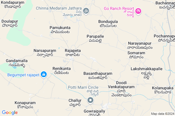
Kuraram Map
EDIT Map
Add Your House
 ..
..
Current Corona Virus Infected Patients Count in Nalgonda District
| City Name | District Name | Total Covid cases |
|---|---|---|
| Suryapet District | Suryapet | 72 |
| Nalgonda District | Nalgonda | 15 |
Locality Name :
Kuraram
( కుర్తారం )
Mandal Name : Rajapet
District : Nalgonda
State : Telangana
Region : Telangana
Language : Telugu and Urdu
Current Time 07:22 PM
Date: Wednesday , Feb 05,2025 (IST)
Time zone: IST (UTC+5:30)
Elevation / Altitude: 366 meters. Above Seal level
Telephone Code / Std Code: 08710
Assembly constituency : Alair assembly constituency
Assembly MLA : Ilaiah Beerla
Lok Sabha constituency : Bhongir parliamentary constituency
Parliament MP : Komati Reddy Venkat Reddy
Serpanch Name :
Pin Code : 508105
Post Office Name : Raghunathpur (Nalgonda)
Alternate Village Name : Kurraram
Commodities Prices : Aler Market / Mandi
Kuraram Live Weather
Temperature: 30.5 °C
clear sky
Humidity: 26%
Wind : 3.44 mt/sec towards SE
StationName : "Bhongīr"
observed on 1 Hours Back
Temperature: 30.5 °C
clear sky
Humidity: 26%
Wind : 3.44 mt/sec towards SE
StationName : "Bhongīr"
observed on 1 Hours Back
Kuraram Weather Forecast for Next 5 days
06-02-2025
20.9°C to 28.8°C
clear sky
20.9°C to 28.8°C
clear sky
07-02-2025
19.7°C to 31.9°C
clear sky, scattered clouds
19.7°C to 31.9°C
clear sky, scattered clouds
08-02-2025
21.0°C to 32.7°C
clear sky
21.0°C to 32.7°C
clear sky
09-02-2025
20.5°C to 32.7°C
clear sky
20.5°C to 32.7°C
clear sky
10-02-2025
19.6°C to 32.4°C
clear sky
19.6°C to 32.4°C
clear sky
Edit below overview about Kuraram
Edit below overview about Kuraram
OverView of Kuraram
Pandavula chandraiah borned this village and the great freedom fighter nd he was fight against the nejams nd rajakars that is kurraram ramreddy also borne this village and one of the great oldest temple Basveshwara swmy also here.Edit below overview about Kuraram
National Highways Reachable To Kuraram
Nationa High Way :NH161AA
Nationa High Way :NH44
Nationa High Way :NH161AA
Nationa High Way :NH44
Rivers Near Kuraram
Haldi
Haldi
About Kuraram
Kuraram is a Village in Rajapet Mandal in Nalgonda District of Telangana State, India. It belongs to Telangana region . It is located 97 KM towards North from District head quarters Nalgonda.
Kuraram Pin code is 508105 and postal head office is Raghunathpur (Nalgonda).
Kuraram is surrounded by M.Turka Pally Mandal towards west , Bachannapeta Mandal towards North , Yadagirigutta Mandal towards South , Jagdevpur Mandal towards west .
Jangaon , Bhongir , Siddipet , Hyderabad are the near by Cities to Kuraram.
This Place is in the border of the Nalgonda District and Medak District. Medak District Jagdevpur is west towards this place . Also it is in the Border of other district Warangal .
Kurraram 2011 Census Details
Kuraram Local Language is Telugu. Kurraram Village Total population is 1316 and number of houses are 297. Female Population is 50.4%. Village literacy rate is 55.5% and the Female Literacy rate is 22.0%.
Population
| Census Parameter | Census Data |
| Total Population | 1316 |
| Total No of Houses | 297 |
| Female Population % | 50.4 % ( 663) |
| Total Literacy rate % | 55.5 % ( 731) |
| Female Literacy rate | 22.0 % ( 289) |
| Scheduled Tribes Population % | 0.0 % ( 0) |
| Scheduled Caste Population % | 26.9 % ( 354) |
| Working Population % | 54.7 % |
| Child(0 -6) Population by 2011 | 111 |
| Girl Child(0 -6) Population % by 2011 | 54.1 % ( 60) |
Kurraram Census More Deatils.
Politics in Kuraram
TDP , TRS , TDP , TRS , INC are the major political parties in this area.Polling Stations /Booths near Kuraram
1)Narsapur2)Nemila
3)Raipalli
4)Rajapeta
5)Rajapeta
HOW TO REACH Kuraram
By Road
Bhongir is the Nearest Town to Kuraram. Bhongir is 38 km from Kuraram. Road connectivity is there from Bhongir to Kuraram.By Rail
There is no railway station near to Kuraram in less than 10 km. How ever there are railway Stations from Near By town Bhongir. are the railway Stations near to Bhongir. You can reach from Bhongir to Kuraram by road after .Colleges near Kuraram
Sri Saraswati Jr College Rajapet
Address : Sri Saraswati Jr College Rajapet
Aprsw (boys) Jr College Rajapet
Address : Aprsw (boys) Jr College Rajapet
Sri Saraswathi Degree College
Address : Rajapet, Nalgonda Dist.
Schools in Kuraram
Zphs Kurraram
Address : kurraram , rajapet , nalgonda , Andhra Pradesh . PIN- 508105 , Post - Raghunathpur (Nalgonda)
Govt Health Centers near Kuraram
1) SubCentre, Nemilla , Jun-54 , Rajapet road , Neaer School2) SubCentre, Rajapet , 2-193 , Narsapur road , Behindpolicestation
3) Primary Health Centre, Rajapet , 2-193 , Narsapur road , Behindpolicestation
Sub Villages in Kuraram
Hospitals in Kuraram,Rajapet
Sri Lakshmi Narsimha Medicall And Generals
Raghunathapuram; Telangana 508105; India
7.5 KM distance Detail
PRIMARY HEALTH CENTER HIRAMANDALAM
Hiramandalam- Nautala Rd; Subhalai Colony; Gotta; Andhra Pradesh 532459; India
7.7 KM distance Detail
more ..
Petrol Bunks in Kuraram,Rajapet
sri Mahalaxmi K S K Petrol Station
Yadagirigutta Temple Rd; Telangana 508105; India
6.8 KM distance Detail
Shri Venkata Sai-Bharat Petroleum
Reddigudem; Nalgonda; NH-163; Warangal Hyderabad Road; Aler; Aler; Telangana 508101; India
16.6 KM distance Detail
more ..
Colleges in Kuraram,Rajapet
Government Junior College
Nalgonda; NH-163; Warangal Hyderabad Road; Aler; Aler; Telangana 508101; India
16.8 KM distance Detail
more ..
Schools in Kuraram,Rajapet
ZPHS DOODIVENKATAPUR
Village Main Road; Doodi Venkatapur; Telangana 508105; India
5.0 KM distance Detail
Super Markets in Kuraram,Rajapet
Vamshi pindi girni
Shivalayam street ;Near :V R college; Aler; Telangana 508101; India
17.7 KM distance Detail
Local Parks in Kuraram,Rajapet
ANR Gardens & Function Hall; Aler
Beside Lions Club; Jeedikal Rd; Aler; Telangana 508101; India
18.8 KM distance Detail
Vishnupuri Township of Punyabhoomi Developers
Near Aler Mandal; Patelgudem; Telangana; India
19.2 KM distance Detail
Police Stations near Kuraram,Rajapet
Police Station Yadagirigutta
Dathar Palle; Yadagirigutta; Telangana 508115; India
19.4 KM distance Detail
Governement Offices near Kuraram,Rajapet
Gram Panchayat; Doodivenkatpur
Rajapet mandal; Doodi Venkatapur; Telangana 508105; India
5.2 KM distance Detail
MeeSeva Center
Raghunathupuram(V);Rajapet(M);Nalgonda(D); 1-143; Raghunathapuram; Telangana 508105; India
7.5 KM distance Detail
About Kuraram &
History
How to reach Kuraram
Tourist Places Near By Kuraram
Schools in Kuraram
Colleges in Kuraram
Temperature & weather of Kuraram
places in Kuraram
Kuraram photos
More Information
How to reach Kuraram
Tourist Places Near By Kuraram
Schools in Kuraram
Colleges in Kuraram
Temperature & weather of Kuraram
places in Kuraram
Kuraram photos
More Information
Village Talk
Post News or Events about this Village
Near Cities
Jangaon 26 KM near
Bhongir 28 KM near
Siddipet 48 KM near
Hyderabad 67 KM near
Jangaon 26 KM near
Bhongir 28 KM near
Siddipet 48 KM near
Hyderabad 67 KM near
Near By Taluks
Rajapet 0 KM near
M.Turka Pally 14 KM near
Bachannapeta 14 KM near
Yadagirigutta 17 KM near
Rajapet 0 KM near
M.Turka Pally 14 KM near
Bachannapeta 14 KM near
Yadagirigutta 17 KM near
Near By Air Ports
Rajiv Gandhi International Airport 86 KM near
Nanded Airport 263 KM near
Vijayawada Airport 266 KM near
Latur Airport 304 KM near
Rajiv Gandhi International Airport 86 KM near
Nanded Airport 263 KM near
Vijayawada Airport 266 KM near
Latur Airport 304 KM near
Near By Tourist Places
Hyderabad 68 KM near
Warangal 86 KM near
Medak 89 KM near
Nagarjunsagar 151 KM near
Khammam 155 KM near
Hyderabad 68 KM near
Warangal 86 KM near
Medak 89 KM near
Nagarjunsagar 151 KM near
Khammam 155 KM near
Near By Districts
Hyderabad 66 KM near
Warangal 82 KM near
Karimnagar 90 KM near
Nalgonda 93 KM near
Hyderabad 66 KM near
Warangal 82 KM near
Karimnagar 90 KM near
Nalgonda 93 KM near
Near By RailWay Station
Aler Rail Way Station 16 KM near
Jangaon Rail Way Station 25 KM near
Aler Rail Way Station 16 KM near
Jangaon Rail Way Station 25 KM near