| Home | City Bus | Maps | Villages | Cities | Rail | Tourist Places | School | College | Pin Codes | Corona Cases Count |
| Distance Calculator Bus Services IFSC Codes Trace Mobile Number Weather Search Place Trace IP Available Cash ATM/Banks Locate Polling Booth Report an Error contact People |
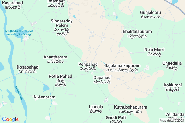
Yellappakuntathanda Map
EDIT Map
Add Your House
 ..
..
Current Corona Virus Infected Patients Count in Nalgonda District
| City Name | District Name | Total Covid cases |
|---|---|---|
| Suryapet District | Suryapet | 72 |
| Nalgonda District | Nalgonda | 15 |
Locality Name :
Yellappakuntathanda
( ఎల్లప్పకుంటతండా )
Mandal Name : Penpahad
District : Nalgonda
State : Telangana
Region : Telangana
Language : Telugu and Urdu
Current Time 12:51 PM
Date: Friday , Mar 14,2025 (IST)
Time zone: IST (UTC+5:30)
Elevation / Altitude: 152 meters. Above Seal level
Telephone Code / Std Code: 08684
Assembly constituency : Suryapet assembly constituency
Assembly MLA : Guntakandla Jagadish Reddy
Lok Sabha constituency : Nalgonda parliamentary constituency
Parliament MP : UTTAM KUMAR REDDY NALAMADA
Serpanch Name :
Main Village Name : Dupahad
Commodities Prices : Suryapeta Market / Mandi
Yellappakuntathanda Live Weather
Temperature: 38.6 °C
clear sky
Humidity: 17%
Wind : 2.69 mt/sec towards S
StationName : "SuriÄ\u0081pet"
observed on 48 Mins Back
Temperature: 38.6 °C
clear sky
Humidity: 17%
Wind : 2.69 mt/sec towards S
StationName : "SuriÄ\u0081pet"
observed on 48 Mins Back
Yellappakuntathanda Weather Forecast for Next 5 days
15-03-2025
24.3°C to 40.5°C
scattered clouds, few clouds, clear sky
24.3°C to 40.5°C
scattered clouds, few clouds, clear sky
16-03-2025
23.6°C to 39.8°C
clear sky, few clouds
23.6°C to 39.8°C
clear sky, few clouds
17-03-2025
22.7°C to 40.5°C
clear sky, overcast clouds, broken clouds, few clouds
22.7°C to 40.5°C
clear sky, overcast clouds, broken clouds, few clouds
18-03-2025
23.0°C to 40.0°C
few clouds, scattered clouds, broken clouds, clear sky
23.0°C to 40.0°C
few clouds, scattered clouds, broken clouds, clear sky
19-03-2025
23.4°C to 40.8°C
few clouds, clear sky, scattered clouds
23.4°C to 40.8°C
few clouds, clear sky, scattered clouds
National Highways Reachable To Yellappakuntathanda
Nationa High Way :NH365BB
Nationa High Way :Old NH9
Nationa High Way :NH365BB
Nationa High Way :Old NH9
Rivers Near Yellappakuntathanda
Musi River
Musi River
About Yellappakuntathanda
Correct below Info and add more info about YellappakuntathandaYellappakuntathanda is a small Village/hamlet in Penpahad Mandal in Nalgonda District of Telangana State, India. It comes under Dupahad Panchayath. It belongs to Telangana region . As part Telangana Districts re-organisation , Yellappakuntathanda Village Penpahad Mandal re organised from Nalgonda District to Suryapet district. It is located 53 KM towards East from District head quarters Nalgonda.
Yellappakuntathanda is surrounded by Chivvemla Mandal towards North , Munagala Mandal towards East , Garide Pally Mandal towards South , Suryapet Mandal towards North .
Suryapet , Miryalaguda , Kodad , Jaggaiahpet are the near by Cities to Yellappakuntathanda.
Demographics of Yellappakuntathanda
Telugu is the Local Language here. Total population of Yellappakuntathanda is 2346 .Males are 1221 and Females are 1,125 living in 565 Houses. Total area of Yellappakuntathanda is 1118 hectares.Politics in Yellappakuntathanda
TDP , TRS , INC are the major political parties in this area.Polling Stations /Booths near Yellappakuntathanda
1)Patharla Pahad2)Penpahad
3)Lingala
4)Macharam
5)Isthalapuram
HOW TO REACH Yellappakuntathanda
By Road
Suryapet is the Nearest Town to Yellappakuntathanda. Suryapet is 25 km from Yellappakuntathanda. Road connectivity is there from Suryapet to Yellappakuntathanda.By Rail
There is no railway station near to Yellappakuntathanda in less than 10 km.Pincodes near Yellappakuntathanda
508213 ( Suryapet ) , 508233 ( Munagala ) , 508218 ( Neredcharla )Colleges near Yellappakuntathanda
R J R Memorial Jr College, Penpahad
Address : Penpahad
Sri Sarada Institute Of Science & Technology
Address : Anantharam, Near Bibinagar, Bhongir (m), Nalgonda
Vathsalya Institute Of Science & Technology
Address : Anantharam, Bhongir (m), Nalgonda - 508 116.
Vathsalya College Of Pharmacy
Address : , Anantharam, Bhongir, Nalgonda Dist.,
Schools in Yellappakuntathanda
Mpps Yellappakunta Thanda
Address : dupahad , penpahad , nalgonda , Andhra Pradesh . PIN- 508201 , Post - Garidepally
Mpps Jalmalakunta Thanda
Address : dupahad , penpahad , nalgonda , Andhra Pradesh . PIN- 508201 , Post - Garidepally
Mpps Dupahad
Address : dupahad , penpahad , nalgonda , Andhra Pradesh . PIN- 508213 , Post - Suryapet
Mpps New Banjara Hills
Address : dupahad , penpahad , nalgonda , Andhra Pradesh . PIN- 508201 , Post - Garidepally
Govt Health Centers near Yellappakuntathanda
1) Primary Health Centre, Penpahad , Public , Main Road , Opp High School2) SubCentre, Penpahad , Public , Main Road , Opp High School
3) SubCentre, Guddimalkapur , 3-8 / , Main Road , Beside GP
Hospitals in Yellappakuntathanda,Penpahad
jyothi multi speciality hospital
telangana talli statue lakshmi vilas bank; Nalgonda; Telangana 508213; India
5.8 KM distance Detail
more ..
Petrol Bunks in Yellappakuntathanda,Penpahad
SHIVA PETROLEUM COMPANY
Lingamanthula Swamy Temple Durajpally; Lingamanthula Swamy Temple Road; Suryapet; Telangana 508213; India
10.8 KM distance Detail
more ..
Colleges in Yellappakuntathanda,Penpahad
Sidhartha Physical Education College
Janareddy Nagar; Telangana 508213; India
7.0 KM distance Detail
K.J.R College Of Pharmacy
Dosapahad Village; Penpahad Mandal; Suryapet; Telangana; India
9.5 KM distance Detail
PRATISHTA INSTITUTE OF PHARMACEUTICAL SCIENCES
Durajpally; Chivemla; Suryapet; Telangana 508214; India
10.2 KM distance Detail
Kamakshi College of Engineering and Technology
Durajpally;Chivvemal; Telangana 508214; India
10.3 KM distance Detail
more ..
Schools in Yellappakuntathanda,Penpahad
Sri. Rangineni Jagannadha Rao Cooperative Junior College
Main Road; Penpahad (Village and Mandal). Nalgonda District; Telangana 508213; India; India
0.9 KM distance Detail
Mandal Praja Parishad High School
Penpahad (Village); Penpahad (Mandal); Nalgonda; Telangana; India
1.0 KM distance Detail
Oruganti Veera Raagavulu Memorial Primary School
Macharam; Telangana 508213; India
1.7 KM distance Detail
Police Stations near Yellappakuntathanda,Penpahad
Police Station Suryapet
Barlapenta Bazaar; Suryapet; Telangana 508213; India
16.8 KM distance Detail
Suryapet Rural Police Station
Thallagadda; Suryapet; Telangana 508213; India
18.3 KM distance Detail
About Yellappakuntathanda &
History
How to reach Yellappakuntathanda
Tourist Places Near By Yellappakuntathanda
Schools in Yellappakuntathanda
Colleges in Yellappakuntathanda
Temperature & weather of Yellappakuntathanda
places in Yellappakuntathanda
Yellappakuntathanda photos
More Information
How to reach Yellappakuntathanda
Tourist Places Near By Yellappakuntathanda
Schools in Yellappakuntathanda
Colleges in Yellappakuntathanda
Temperature & weather of Yellappakuntathanda
places in Yellappakuntathanda
Yellappakuntathanda photos
More Information
Village Talk
Post News or Events about this Village
Near Cities
Suryapet 15 KM near
Miryalaguda 23 KM near
Kodad 32 KM near
Jaggaiahpet 51 KM near
Suryapet 15 KM near
Miryalaguda 23 KM near
Kodad 32 KM near
Jaggaiahpet 51 KM near
Near By Taluks
Penpahad 0 KM near
Chivvemla 11 KM near
Munagala 14 KM near
Garide Pally 15 KM near
Penpahad 0 KM near
Chivvemla 11 KM near
Munagala 14 KM near
Garide Pally 15 KM near
Near By Air Ports
Vijayawada Airport 145 KM near
Rajiv Gandhi International Airport 152 KM near
Rajahmundry Airport 253 KM near
Nanded Airport 388 KM near
Vijayawada Airport 145 KM near
Rajiv Gandhi International Airport 152 KM near
Rajahmundry Airport 253 KM near
Nanded Airport 388 KM near
Near By Tourist Places
Nagarjunakonda 44 KM near
Khammam 61 KM near
Nagarjunsagar 72 KM near
Amaravathi 99 KM near
Warangal 120 KM near
Nagarjunakonda 44 KM near
Khammam 61 KM near
Nagarjunsagar 72 KM near
Amaravathi 99 KM near
Warangal 120 KM near
Near By Districts
Nalgonda 51 KM near
Khammam 61 KM near
Warangal 119 KM near
Guntur 126 KM near
Nalgonda 51 KM near
Khammam 61 KM near
Warangal 119 KM near
Guntur 126 KM near
Near By RailWay Station
Miryalaguda Rail Way Station 28 KM near
Vishnupuram Rail Way Station 40 KM near
Miryalaguda Rail Way Station 28 KM near
Vishnupuram Rail Way Station 40 KM near