| Home | City Bus | Maps | Villages | Cities | Rail | Tourist Places | School | College | Pin Codes | Corona Cases Count |
| Distance Calculator Bus Services IFSC Codes Trace Mobile Number Weather Search Place Trace IP Available Cash ATM/Banks Locate Polling Booth Report an Error contact People |
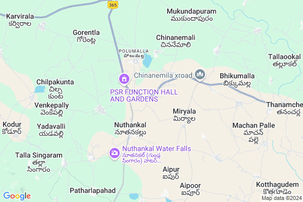
Jalu Thanda Map
EDIT Map
Add Your House
 ..
..
Current Corona Virus Infected Patients Count in Nalgonda District
| City Name | District Name | Total Covid cases |
|---|---|---|
| Suryapet District | Suryapet | 72 |
| Nalgonda District | Nalgonda | 15 |
Locality Name :
Jalu Thanda
( జాలు తండా )
Mandal Name : Nuthankal
District : Nalgonda
State : Telangana
Region : Telangana
Language : Telugu and Urdu
Current Time 06:50 PM
Date: Monday , Apr 28,2025 (IST)
Time zone: IST (UTC+5:30)
Elevation / Altitude: 212 meters. Above Seal level
Telephone Code / Std Code: 08684
Assembly constituency : Thungathurthy assembly constituency
Assembly MLA : Mandula Samel
Lok Sabha constituency : Bhongir parliamentary constituency
Parliament MP : Komati Reddy Venkat Reddy
Serpanch Name :
Pin Code : 508221
Post Office Name : Noothankal
Main Village Name : Somula thanda
Commodities Prices : Suryapeta Market / Mandi
Jalu Thanda Live Weather
Temperature: 37.1 °C
broken clouds
Humidity: 20%
Wind : 2.36 mt/sec towards E
StationName : "SuriÄ\u0081pet"
observed on 15 Mins Back
Temperature: 37.1 °C
broken clouds
Humidity: 20%
Wind : 2.36 mt/sec towards E
StationName : "SuriÄ\u0081pet"
observed on 15 Mins Back
Jalu Thanda Weather Forecast for Next 5 days
29-04-2025
27.5°C to 36.6°C
few clouds, clear sky
27.5°C to 36.6°C
few clouds, clear sky
30-04-2025
26.2°C to 40.2°C
clear sky, few clouds, overcast clouds, scattered clouds
26.2°C to 40.2°C
clear sky, few clouds, overcast clouds, scattered clouds
01-05-2025
26.4°C to 41.1°C
clear sky, scattered clouds, few clouds, light rain, broken clouds
26.4°C to 41.1°C
clear sky, scattered clouds, few clouds, light rain, broken clouds
02-05-2025
27.4°C to 41.5°C
clear sky
27.4°C to 41.5°C
clear sky
03-05-2025
27.5°C to 41.9°C
few clouds, scattered clouds, clear sky, light rain
27.5°C to 41.9°C
few clouds, scattered clouds, clear sky, light rain
National Highways Reachable To Jalu Thanda
Nationa High Way :NH365BB
Nationa High Way :Old NH9
Nationa High Way :NH365BB
Nationa High Way :Old NH9
Rivers Near Jalu Thanda
Munneru River
Munneru River
About Jalu Thanda
Correct below Info and add more info about Jalu ThandaJalu Thanda is a small Village/hamlet in Nuthankal Mandal in Nalgonda District of Telangana State, India. It comes under Somula thanda Panchayath. It belongs to Telangana region . As part Telangana Districts re-organisation , Jalu Thanda Village Nuthankal Mandal re organised from Nalgonda District to Suryapet district. It is located 67 KM towards East from District head quarters Nalgonda.
Jalu Thanda Pin code is 508221 and postal head office is Noothankal .
Jalu Thanda is surrounded by Atmakur(S) Mandal towards South , Aravapally Mandal towards west , Thungathurthi Mandal towards west , Narsimhulapet Mandal towards North .
Suryapet , Kodad , Khammam , Miryalaguda are the near by Cities to Jalu Thanda.
This Place is in the border of the Nalgonda District and Warangal District. Warangal District Narsimhulapet is North towards this place .
Demographics of Jalu Thanda
Telugu is the Local Language here.Politics in Jalu Thanda
TDP , TRS , INC are the major political parties in this area.Polling Stations /Booths near Jalu Thanda
1)Nutanakal2)Nutankal
3)Nutan Kal
4)Nellibanda Tanda
5)Edulaparre Thanda H/o Nandapuram
HOW TO REACH Jalu Thanda
By Rail
There is no railway station near to Jalu Thanda in less than 10 km. are the Rail way stations reachable from near by towns.By Road
Suryapet are the nearby by towns to Jalu Thanda having road connectivity to Jalu ThandaColleges near Jalu Thanda
K L N Jr College, Miryalaguda
Address : Miryalaguda
Sahiti Jr College Miryalaguda
Address : Sahiti Jr College Miryalaguda
Vasavi Junior College Miryalaguda
Address : Vasavi Junior College Miryalaguda
Nagarjuna Jr College Miryalaguda
Address : Nagarjuna Jr College Miryalaguda
J M R (m) Jr College Miryalaguda
Address : J M R (m) Jr College Miryalaguda
Schools near Jalu Thanda
Kgbv
Address : nuthankal , nutankal , nalgonda , Andhra Pradesh . PIN- 508221 , Post - Noothankal
Zphs Lingampally
Address : lingam palle , nutankal , nalgonda , Andhra Pradesh . PIN- 508221 , Post - Noothankal
Prashanthi Vn Hs
Address : dirisana palle , nutankal , nalgonda , Andhra Pradesh . PIN- 508221 , Post - Noothankal
Kbrrm Z P High School
Address : venke palle , nutankal , nalgonda , Andhra Pradesh . PIN- 508221 , Post - Noothankal
Govt Health Centers near Jalu Thanda
1) Primary Health Centre, Nuthankal , 466 , SC Colony , SC Colony2) SubCentre, Nuthankal , 466 , SC Colony , Grampamchaithi
3) SubCentre, Miriyala , 5--54 , BC Colony , Temple
Hospitals in Jalu Thanda,Nuthankal
shiva sai hospital
Suryapet - Warangal Road; Nuthankal; Telangana 508221; India
3.3 KM distance Detail
more ..
Colleges in Jalu Thanda,Nuthankal
Sms Junior College
Nemmikal - Warangal Road; Nuthankal; Telangana 508221; India
2.9 KM distance Detail
more ..
Super Markets in Jalu Thanda,Nuthankal
New Vasavi Kirana&General Store.
Nemmikal - Warangal Road; Nuthankal; Telangana 508221; India
3.1 KM distance Detail
Governement Offices near Jalu Thanda,Nuthankal
MeeSeva Center
7-76; Telagana Bhavan; Main Road; Opp Ambedkar Statue; Nuthankal(V); Nuthankal(M); Nalgonda(D);508221; Nuthankal; Telangana 508221; India
2.9 KM distance Detail
About Jalu Thanda &
History
How to reach Jalu Thanda
Tourist Places Near By Jalu Thanda
Schools in Jalu Thanda
Colleges in Jalu Thanda
Temperature & weather of Jalu Thanda
places in Jalu Thanda
Jalu Thanda photos
More Information
How to reach Jalu Thanda
Tourist Places Near By Jalu Thanda
Schools in Jalu Thanda
Colleges in Jalu Thanda
Temperature & weather of Jalu Thanda
places in Jalu Thanda
Jalu Thanda photos
More Information
Village Talk
Post News or Events about this Village
Near Cities
Suryapet 28 KM near
Kodad 52 KM near
Khammam 54 KM near
Miryalaguda 62 KM near
Suryapet 28 KM near
Kodad 52 KM near
Khammam 54 KM near
Miryalaguda 62 KM near
Near By Taluks
Nuthankal 0 KM near
Atmakur(S) 11 KM near
Thungathurthi 15 KM near
Aravapally 16 KM near
Nuthankal 0 KM near
Atmakur(S) 11 KM near
Thungathurthi 15 KM near
Aravapally 16 KM near
Near By Air Ports
Rajiv Gandhi International Airport 153 KM near
Vijayawada Airport 164 KM near
Rajahmundry Airport 252 KM near
Nanded Airport 363 KM near
Rajiv Gandhi International Airport 153 KM near
Vijayawada Airport 164 KM near
Rajahmundry Airport 252 KM near
Nanded Airport 363 KM near
Near By Tourist Places
Khammam 54 KM near
Nagarjunakonda 80 KM near
Warangal 81 KM near
Nagarjunsagar 107 KM near
Amaravathi 125 KM near
Khammam 54 KM near
Nagarjunakonda 80 KM near
Warangal 81 KM near
Nagarjunsagar 107 KM near
Amaravathi 125 KM near
Near By Districts
Khammam 54 KM near
Nalgonda 65 KM near
Warangal 80 KM near
Hyderabad 147 KM near
Khammam 54 KM near
Nalgonda 65 KM near
Warangal 80 KM near
Hyderabad 147 KM near
Near By RailWay Station
Mahbubabad Rail Way Station 46 KM near
Kesamudram Rail Way Station 47 KM near
Mahbubabad Rail Way Station 46 KM near
Kesamudram Rail Way Station 47 KM near