| Home | City Bus | Maps | Villages | Cities | Rail | Tourist Places | School | College | Pin Codes | Corona Cases Count |
| Distance Calculator Bus Services IFSC Codes Trace Mobile Number Weather Search Place Trace IP Available Cash ATM/Banks Locate Polling Booth Report an Error contact People |
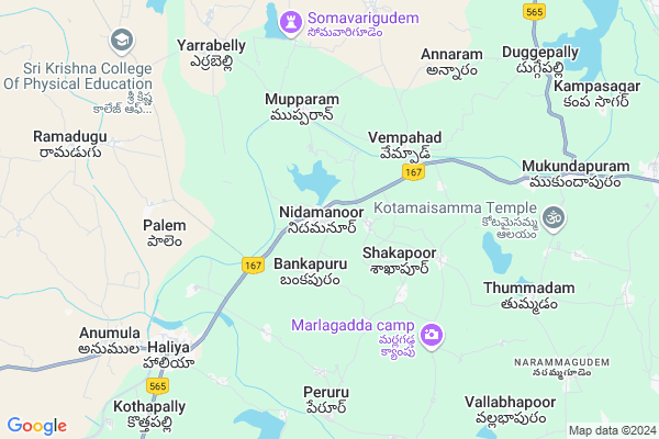
Nidamanur
Nidamanur Map
EDIT Map
Add Your House
 ..
..
Current Corona Virus Infected Patients Count in Nalgonda District
| City Name | District Name | Total Covid cases |
|---|---|---|
| Suryapet District | Suryapet | 72 |
| Nalgonda District | Nalgonda | 15 |
Locality Name :
Nidamanur
( నిడమానూరు )
Mandal Name : Nidamanoor
District : Nalgonda
State : Telangana
Region : Telangana
Language : Telugu and Urdu
Current Time 04:39 AM
Date: Saturday , Apr 26,2025 (IST)
Time zone: IST (UTC+5:30)
Elevation / Altitude: 152 meters. Above Seal level
Telephone Code / Std Code: 08680
Assembly constituency : Nagarjuna Sagar assembly constituency
Assembly MLA : Kunduru Jayaveer
Lok Sabha constituency : Nalgonda parliamentary constituency
Parliament MP : UTTAM KUMAR REDDY NALAMADA
Serpanch Name :
Pin Code : 508278
Post Office Name : Nidmanoor
Alternate Village Name : Nidmanoor
Commodities Prices : Nidamanoor Market / Mandi
Nidamanur Live Weather
Temperature: 28.9 °C
broken clouds
Humidity: 64%
Wind : 4.39 mt/sec towards SE
StationName : "Miryalguda"
observed on Now
Temperature: 28.9 °C
broken clouds
Humidity: 64%
Wind : 4.39 mt/sec towards SE
StationName : "Miryalguda"
observed on Now
Nidamanur Weather Forecast for Next 5 days
27-04-2025
28.5°C to 41.3°C
broken clouds, scattered clouds, few clouds, overcast clouds
28.5°C to 41.3°C
broken clouds, scattered clouds, few clouds, overcast clouds
28-04-2025
27.8°C to 36.2°C
overcast clouds, broken clouds
27.8°C to 36.2°C
overcast clouds, broken clouds
29-04-2025
26.9°C to 40.7°C
broken clouds, scattered clouds, clear sky, few clouds
26.9°C to 40.7°C
broken clouds, scattered clouds, clear sky, few clouds
30-04-2025
27.3°C to 41.7°C
few clouds, clear sky, broken clouds, scattered clouds
27.3°C to 41.7°C
few clouds, clear sky, broken clouds, scattered clouds
Edit below overview about Nidamanur
Edit below overview about Nidamanur
OverView of Nidamanur
NIDAMANOOR is home to numerous courageous individuals who have fought for the betterment of society, such as Ramarao. Additionally, it boasts a renowned kabaddi player and the late police officer, Amaraveer Chenna Keshav, whose legacy is honored with a street named after him, Chenna Keshav Nagar.Edit below overview about Nidamanur
National Highways Reachable To Nidamanur
Nationa High Way :NH167
Nationa High Way :NH167
Rivers Near Nidamanur
Musi River
Krishna :クリシュナ :ಕೃಷ್ಣಾ :कृष्णा :కృష్ణా
Musi River
Krishna :クリシュナ :ಕೃಷ್ಣಾ :कृष्णा :కృష్ణా
About Nidamanur
Nidamanur is a Town in Nidamanoor Mandal in Nalgonda District of Telangana State, India. It belongs to Telangana region . It is located 32 KM towards South from District head quarters Nalgonda. It is a Mandal head quarter.
Nidamanur Pin code is 508278 and postal head office is Nidmanoor .
Bankapuram ( 2 KM ) , Rajannagudem ( 4 KM ) , Venigandla ( 4 KM ) , Vempad ( 4 KM ) , Mupparam ( 5 KM ) are the nearby Villages to Nidamanur. Nidamanur is surrounded by Anumula Mandal towards west , Tripuraram Mandal towards East , Kanagal Mandal towards west , Peddavura Mandal towards west .
Miryalaguda , Macherla , Suryapet , Devarakonda are the nearby Cities to Nidamanur.
Nidamanur 2011 Census Details
Nidamanur Local Language is Telugu. Nidamanur town Total population is 6581 and number of houses are 1595. Female Population is 49.6%. town literacy rate is 66.4% and the Female Literacy rate is 29.0%.
Population
| Census Parameter | Census Data |
| Total Population | 6581 |
| Total No of Houses | 1595 |
| Female Population % | 49.6 % ( 3264) |
| Total Literacy rate % | 66.4 % ( 4370) |
| Female Literacy rate | 29.0 % ( 1906) |
| Scheduled Tribes Population % | 3.3 % ( 217) |
| Scheduled Caste Population % | 15.5 % ( 1022) |
| Working Population % | 42.7 % |
| Child(0 -6) Population by 2011 | 604 |
| Girl Child(0 -6) Population % by 2011 | 48.3 % ( 292) |
Nidamanur Census More Deatils.
Demographics of Nidamanur
Telugu is the Local Language here. Total population of Nidamanur is 6695 .Males are 3461 and Females are 3,234 living in 1409 Houses. Total area of Nidamanur is 958 hectares.Politics in Nidamanur
TDP , TRS , INC are the major political parties in this area.Polling Stations /Booths near Nidamanur
1)Nidamanuru2)Nidamanuru
3)Nidamanuru
4)Nellikal
5)Nidamanur
HOW TO REACH Nidamanur
By Road
Miryalaguda is the Nearest Town to Nidamanur. Miryalaguda is 23 km from Nidamanur. Road connectivity is there from Miryalaguda to Nidamanur.By Rail
There is no railway station near to Nidamanur in less than 10 km. How ever There are railway stations from Near By town Miryalaguda. Miryalaguda Rail Way Station are the railway stations near to Miryalaguda. You can reach from Miryalaguda to Nidamanur by road after .Govt Health Centers near Nidamanur
1) Primary Health Centre, Nidmanoor , 642 Survey No. , Main Road , NSP Camp2) SubCentre, Nidmanoor , 642 Survey No. , Main Road , NSP Camp
3) SubCentre, Venigandla , 2/1/1989 , Main Road , UPS School
Sub Villages in Nidamanur
Hospitals in Nidamanur,Nidamanoor
Sandhya Diagnostic Centre
MAIN ROAD;BESIDE JAGJEEVAN RAO STATUE; Nidamanoor; Telangana 508278; India
0.5 KM distance Detail
more ..
Petrol Bunks in Nidamanur,Nidamanoor
Sri Srinivasa Petro Fuels Hindutan Petroleum
Nidamanoor; Nalgonda; Miryalaguda Nagarjuna Sagar Road; Nidamanoor; Nidamanoor; Telangana 508278; India
0.6 KM distance Detail
Panthulu Kala Pentoji Sai Filling Station Indian Oil Petrol Pump
Shakapuram; Nalgonda; Miryalaguda Nagarjuna Sagar Road; Nidamanoor; Nidamanoor; Telangana 508278; India
1.3 KM distance Detail
more ..
Schools in Nidamanur,Nidamanoor
Kenda Primary School
Nalgonda; SH-2; Miryalaguda Nagarjuna Sagar Road; Nidamanoor; Nidamanoor; Telangana 508278; India
0.4 KM distance Detail
Electronic Shops in Nidamanur,Nidamanoor
Vineela Computer Services
Door No.2-90; Main Road; Nalgonda District; Nidamanoor; Telangana 508278; India
0.5 KM distance Detail
Super Markets in Nidamanur,Nidamanoor
Sai Kirana store
Door No:4-613;Perur Road; Beside Water Tank; Haliya; Telangana 508377; India
7.8 KM distance Detail
About Nidamanur &
History
How to reach Nidamanur
Tourist Places Near By Nidamanur
Schools in Nidamanur
Colleges in Nidamanur
Temperature & weather of Nidamanur
places in Nidamanur
Nidamanur photos
More Information
How to reach Nidamanur
Tourist Places Near By Nidamanur
Schools in Nidamanur
Colleges in Nidamanur
Temperature & weather of Nidamanur
places in Nidamanur
Nidamanur photos
More Information
Town Talk
Post News or Events about this Town
Near Cities
Miryalaguda 27 KM near
Macherla 43 KM near
Suryapet 49 KM near
Devarakonda 56 KM near
Miryalaguda 27 KM near
Macherla 43 KM near
Suryapet 49 KM near
Devarakonda 56 KM near
Near By Taluks
Nidamanoor 2 KM near
Anumula 9 KM near
Tripuraram 12 KM near
Kanagal 23 KM near
Nidamanoor 2 KM near
Anumula 9 KM near
Tripuraram 12 KM near
Kanagal 23 KM near
Near By Air Ports
Rajiv Gandhi International Airport 123 KM near
Vijayawada Airport 174 KM near
Rajahmundry Airport 294 KM near
Nanded Airport 381 KM near
Rajiv Gandhi International Airport 123 KM near
Vijayawada Airport 174 KM near
Rajahmundry Airport 294 KM near
Nanded Airport 381 KM near
Near By Tourist Places
Nagarjunsagar 31 KM near
Nagarjunakonda 60 KM near
Khammam 107 KM near
Srisailam 110 KM near
Amaravathi 123 KM near
Nagarjunsagar 31 KM near
Nagarjunakonda 60 KM near
Khammam 107 KM near
Srisailam 110 KM near
Amaravathi 123 KM near
Near By Districts
Nalgonda 31 KM near
Khammam 107 KM near
Hyderabad 131 KM near
Guntur 142 KM near
Nalgonda 31 KM near
Khammam 107 KM near
Hyderabad 131 KM near
Guntur 142 KM near
Near By RailWay Station
Miryalaguda Rail Way Station 20 KM near
Nalgonda Rail Way Station 31 KM near
Miryalaguda Rail Way Station 20 KM near
Nalgonda Rail Way Station 31 KM near