| Home | City Bus | Maps | Villages | Cities | Rail | Tourist Places | School | College | Pin Codes | Corona Cases Count |
| Distance Calculator Bus Services IFSC Codes Trace Mobile Number Weather Search Place Trace IP Available Cash ATM/Banks Locate Polling Booth Report an Error contact People |
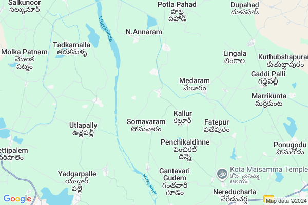
Kallur
Kallur Map
EDIT Map
Add Your House
 ..
..
Current Corona Virus Infected Patients Count in Nalgonda District
| City Name | District Name | Total Covid cases |
|---|---|---|
| Suryapet District | Suryapet | 72 |
| Nalgonda District | Nalgonda | 15 |
Locality Name :
Kallur
( కల్లూరు )
Mandal Name : Nereducherla
District : Nalgonda
State : Telangana
Region : Telangana
Language : Telugu and Urdu
Current Time 01:01 PM
Date: Sunday , Apr 27,2025 (IST)
Time zone: IST (UTC+5:30)
Elevation / Altitude: 91 meters. Above Seal level
Telephone Code / Std Code: 08689
Assembly constituency : Huzurnagar assembly constituency
Assembly MLA : Uttam Kumar Reddy Nalamada
Lok Sabha constituency : Nalgonda parliamentary constituency
Parliament MP : UTTAM KUMAR REDDY NALAMADA
Serpanch Name :
Pin Code : 508218
Post Office Name : Neredcharla
Commodities Prices : Neredcherla Market / Mandi
Kallur Live Weather
Temperature: 36.9 °C
broken clouds
Humidity: 30%
Wind : 4.34 mt/sec towards SE
StationName : "Miryalguda"
observed on 1 Hours Back
Temperature: 36.9 °C
broken clouds
Humidity: 30%
Wind : 4.34 mt/sec towards SE
StationName : "Miryalguda"
observed on 1 Hours Back
Kallur Weather Forecast for Next 5 days
28-04-2025
27.5°C to 39.8°C
broken clouds, light rain
27.5°C to 39.8°C
broken clouds, light rain
29-04-2025
26.9°C to 40.2°C
broken clouds, few clouds, clear sky, scattered clouds
26.9°C to 40.2°C
broken clouds, few clouds, clear sky, scattered clouds
30-04-2025
27.0°C to 43.1°C
few clouds, clear sky, scattered clouds
27.0°C to 43.1°C
few clouds, clear sky, scattered clouds
01-05-2025
28.0°C to 43.6°C
scattered clouds, few clouds, clear sky, light rain, broken clouds
28.0°C to 43.6°C
scattered clouds, few clouds, clear sky, light rain, broken clouds
02-05-2025
28.2°C to 43.1°C
broken clouds, clear sky, scattered clouds, few clouds
28.2°C to 43.1°C
broken clouds, clear sky, scattered clouds, few clouds
Edit below overview about Kallur
Edit below overview about Kallur
OverView of Kallur
This (Kallur) village is very famous for "MOHARRAM" festival celebrations. Because in this village we have only one family of Muslim even though all the people of the village will come together and contribute them selves and celebrate the festival.This festival will take place in like .All the people who are lifting the "Savar". They should follow strict rules like (everyday fasting and don't wear slippers they don't suppose to sleep on coat and didn't even touch broomstic and etc... strict rules should follow till completion of the festival).Normally this festival celebrations will conduct for 9days.Edit below overview about Kallur
National Highways Reachable To Kallur
Nationa High Way :NH167
Nationa High Way :NH167
Rivers Near Kallur
Musi River
Munneru River
Musi River
Munneru River
About Kallur
Kallur is a Village in Nereducherla Mandal in Nalgonda District of Telangana State, India. It belongs to Telangana region . As part Telangana Districts re-organisation , Kallur Village Nereducherla Mandal re organised from Nalgonda District to Suryapet district. It is located 49 KM towards East from District head quarters Nalgonda. 17 KM from Neredcharla.
Kallur Pin code is 508218 and postal head office is Neredcharla .
Medaram ( 5 KM ) , N.annaram ( 6 KM ) , Lingala ( 7 KM ) , Potla Pahad ( 7 KM ) , Kalvapally ( 8 KM ) are the nearby Villages to Kallur. Kallur is surrounded by Garide Pally Mandal towards East , Miryalaguda Mandal towards South , Vemula Pally Mandal towards west , Nereducherla Mandal towards South .
Miryalaguda , Suryapet , Kodad , Jaggaiahpet are the near by Cities to Kallur.
Kallur 2011 Census Details
Kallur Local Language is Telugu. Kallur Village Total population is 3791 and number of houses are 1004. Female Population is 49.8%. Village literacy rate is 56.6% and the Female Literacy rate is 24.6%.
Population
| Census Parameter | Census Data |
| Total Population | 3791 |
| Total No of Houses | 1004 |
| Female Population % | 49.8 % ( 1888) |
| Total Literacy rate % | 56.6 % ( 2144) |
| Female Literacy rate | 24.6 % ( 933) |
| Scheduled Tribes Population % | 0.0 % ( 0) |
| Scheduled Caste Population % | 35.9 % ( 1360) |
| Working Population % | 53.0 % |
| Child(0 -6) Population by 2011 | 373 |
| Girl Child(0 -6) Population % by 2011 | 49.9 % ( 186) |
Kallur Census More Deatils.
Politics in Kallur
CPM , TRS , INC are the major political parties in this area.Polling Stations /Booths near Kallur
1)Kachavari Gudem Majira Kalwapally2)Kalluru
3)Miryalaguda Raod Huzurnagar
4)Yallapuram
5)Shobhanadrigudem
HOW TO REACH Kallur
By Road
Miryalaguda is the Nearest Town to Kallur. Miryalaguda is 21 km from Kallur. Road connectivity is there from Miryalaguda to Kallur.By Rail
There is no railway station near to Kallur in less than 10 km. How ever there are railway Stations from Near By town Miryalaguda. are the railway Stations near to Miryalaguda. You can reach from Miryalaguda to Kallur by road after .Colleges near Kallur
Vikas Junior College
Address :
Schools in Kallur
Mpps Laxmipuram
Address : kallur , nereducherla , nalgonda , Andhra Pradesh . PIN- 508218 , Post - Neredcharla
Mpps Mukundampuram
Address : kallur , nereducherla , nalgonda , Andhra Pradesh . PIN- 508218 , Post - Neredcharla
Mpps Kallur
Address : kallur , nereducherla , nalgonda , Andhra Pradesh . PIN- 508218 , Post - Neredcharla
Govt Health Centers near Kallur
1) SubCentre, Somaram , Feb-41 , Kamma Bazar , Kamma Bazar2) SubCentre, Penchikaldinna , , Kalluru Road , ZPHS High School
3) Primary Health Centre, Penchikaldinna , , Kalluru Road , ZPHS High School
Sub Villages in Kallur
Colleges in Kallur,Nereducherla
sri Ramalingeswara medical and genral stores
9-34/1;gram panchaity road;ponugodu;garidepalli; suryapet; Telangana 508201; India
11.7 KM distance Detail
K.J.R College Of Pharmacy
Dosapahad Village; Penpahad Mandal; Suryapet; Telangana; India
12.1 KM distance Detail
more ..
Schools in Kallur,Nereducherla
Goverment High school
Nereducharla - Suryapeta Rd; Penchikal Dinne; Telangana 508218; India
4.4 KM distance Detail
ZPHS Penchikaldinne
Nereducharla - Suryapeta Rd; Penchikal Dinne; Telangana 508218; India
4.5 KM distance Detail
Police Stations near Kallur,Nereducherla
Police Station; Nereducherla
Miryalaguda road; Nereducherla; State; PIN 508218; Suryapet; Telangana; India
10.8 KM distance Detail
Miryalaguda Rural Police Station
Beat Rd; Miryalaguda; Telangana 508207; India
13.3 KM distance Detail
Adulla Shishupal Reddy
H.No 7-400/A; 508207; Miryalaguda Industrial Area; Miryalaguda; Telangana 508207; India
13.3 KM distance Detail
Governement Offices near Kallur,Nereducherla
MeeSeva Center
OPP-ZPHS School; Madgulapally(V); Thipparthi(M); 2-121; Telangana 508217; India
8.1 KM distance Detail
About Kallur &
History
How to reach Kallur
Tourist Places Near By Kallur
Schools in Kallur
Colleges in Kallur
Temperature & weather of Kallur
places in Kallur
Kallur photos
More Information
How to reach Kallur
Tourist Places Near By Kallur
Schools in Kallur
Colleges in Kallur
Temperature & weather of Kallur
places in Kallur
Kallur photos
More Information
Village Talk
Post News or Events about this Village
Near Cities
Miryalaguda 11 KM near
Suryapet 23 KM near
Kodad 39 KM near
Jaggaiahpet 54 KM near
Miryalaguda 11 KM near
Suryapet 23 KM near
Kodad 39 KM near
Jaggaiahpet 54 KM near
Near By Taluks
Penpahad 11 KM near
Vemula Pally 13 KM near
Miryalaguda 13 KM near
Garide Pally 13 KM near
Penpahad 11 KM near
Vemula Pally 13 KM near
Miryalaguda 13 KM near
Garide Pally 13 KM near
Near By Air Ports
Vijayawada Airport 147 KM near
Rajiv Gandhi International Airport 148 KM near
Rajahmundry Airport 260 KM near
Nanded Airport 391 KM near
Vijayawada Airport 147 KM near
Rajiv Gandhi International Airport 148 KM near
Rajahmundry Airport 260 KM near
Nanded Airport 391 KM near
Near By Tourist Places
Nagarjunakonda 39 KM near
Nagarjunsagar 60 KM near
Khammam 71 KM near
Amaravathi 98 KM near
Guntur 124 KM near
Nagarjunakonda 39 KM near
Nagarjunsagar 60 KM near
Khammam 71 KM near
Amaravathi 98 KM near
Guntur 124 KM near
Near By Districts
Nalgonda 46 KM near
Khammam 71 KM near
Guntur 124 KM near
Warangal 128 KM near
Nalgonda 46 KM near
Khammam 71 KM near
Guntur 124 KM near
Warangal 128 KM near
Near By RailWay Station
Miryalaguda Rail Way Station 16 KM near
Vishnupuram Rail Way Station 30 KM near
Miryalaguda Rail Way Station 16 KM near
Vishnupuram Rail Way Station 30 KM near