| Home | City Bus | Maps | Villages | Cities | Rail | Tourist Places | School | College | Pin Codes | Corona Cases Count |
| Distance Calculator Bus Services IFSC Codes Trace Mobile Number Weather Search Place Trace IP Available Cash ATM/Banks Locate Polling Booth Report an Error contact People |
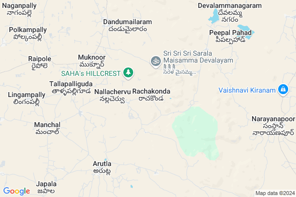
Rachakonda
Rachakonda Map
EDIT Map
Add Your House
 ..
..
Current Corona Virus Infected Patients Count in Nalgonda District
| City Name | District Name | Total Covid cases |
|---|---|---|
| Suryapet District | Suryapet | 72 |
| Nalgonda District | Nalgonda | 15 |
Locality Name :
Rachakonda
( రాచకొండ )
Mandal Name : Narayanapur
District : Nalgonda
State : Telangana
Region : Telangana
Language : Telugu and Urdu
Current Time 11:23 AM
Date: Sunday , Apr 27,2025 (IST)
Time zone: IST (UTC+5:30)
Elevation / Altitude: 322 meters. Above Seal level
Telephone Code / Std Code: 08414
Assembly constituency : Munugode assembly constituency
Assembly MLA : Komatireddy Raj Gopal Reddy
Lok Sabha constituency : Bhongir parliamentary constituency
Parliament MP : Komati Reddy Venkat Reddy
Serpanch Name :
Pin Code : 508253
Post Office Name : Narayanpur (Nalgonda)
Commodities Prices : Ibrahimputnam Market / Mandi
Rachakonda Live Weather
Temperature: 33.5 °C
broken clouds
Humidity: 34%
Wind : 4.09 mt/sec towards SE
StationName : "Ghatkesar"
observed on Now
Temperature: 33.5 °C
broken clouds
Humidity: 34%
Wind : 4.09 mt/sec towards SE
StationName : "Ghatkesar"
observed on Now
Rachakonda Weather Forecast for Next 5 days
28-04-2025
24.7°C to 36.2°C
broken clouds, clear sky
24.7°C to 36.2°C
broken clouds, clear sky
29-04-2025
23.4°C to 37.8°C
few clouds, clear sky, scattered clouds
23.4°C to 37.8°C
few clouds, clear sky, scattered clouds
30-04-2025
26.2°C to 38.3°C
scattered clouds, few clouds, broken clouds, clear sky
26.2°C to 38.3°C
scattered clouds, few clouds, broken clouds, clear sky
01-05-2025
26.9°C to 39.3°C
few clouds, broken clouds, scattered clouds
26.9°C to 39.3°C
few clouds, broken clouds, scattered clouds
02-05-2025
26.0°C to 40.6°C
broken clouds, few clouds, clear sky, scattered clouds
26.0°C to 40.6°C
broken clouds, few clouds, clear sky, scattered clouds
National Highways Reachable To Rachakonda
Nationa High Way :Old NH9
Nationa High Way :Old NH9
About Rachakonda
Correct below Info and add more info about RachakondaRachakonda is a Village in Narayanapur Mandal in Nalgonda District of Telangana State, India. It belongs to Telangana region . It is located 60 KM towards west from District head quarters Nalgonda. 14 KM from Narayanapur.
Rachakonda Pin code is 508253 and postal head office is Narayanpur (Nalgonda).
Malkapur ( 10 KM ) , Narayanapur ( 11 KM ) , Koyalagudem ( 11 KM ) , Chimiryala ( 11 KM ) , Mandollagudem ( 12 KM ) are the nearby Villages to Rachakonda. Rachakonda is surrounded by Narayanapur Mandal towards East , Choutuppal Mandal towards East , Ibrahimpatnam Mandal towards west , Pochampally Mandal towards North .
Bhongir , Hyderabad , Devarakonda , Farooqnagar are the near by Cities to Rachakonda.
This Place is in the border of the Nalgonda District and Rangareddi District. Rangareddi District Manchal is west towards this place .
Rachakonda 2011 Census Details
Rachakonda Local Language is Telugu. Rachakonda Village Total population is 1300 and number of houses are 344. Female Population is 47.5%. Village literacy rate is 31.0% and the Female Literacy rate is 10.7%.
Population
| Census Parameter | Census Data |
| Total Population | 1300 |
| Total No of Houses | 344 |
| Female Population % | 47.5 % ( 618) |
| Total Literacy rate % | 31.0 % ( 403) |
| Female Literacy rate | 10.7 % ( 139) |
| Scheduled Tribes Population % | 90.9 % ( 1182) |
| Scheduled Caste Population % | 5.4 % ( 70) |
| Working Population % | 59.2 % |
| Child(0 -6) Population by 2011 | 249 |
| Girl Child(0 -6) Population % by 2011 | 42.2 % ( 105) |
Rachakonda Census More Deatils.
Politics in Rachakonda
TDP , TRS , CPI , INC are the major political parties in this area.Polling Stations /Booths near Rachakonda
1)Kachilapuram2)Allamdevi Cheruvu
3)Venkepalli
4)Lingojigudem
5)Peddapuram
HOW TO REACH Rachakonda
By Road
Nalgonda is the Nearest Town to Rachakonda. Nalgonda is 65 km from Rachakonda. Road connectivity is there from Nalgonda to Rachakonda.By Rail
There is no railway station near to Rachakonda in less than 10 km. How ever there are railway Stations from Near By town Nalgonda. are the railway Stations near to Nalgonda. You can reach from Nalgonda to Rachakonda by road after .Colleges near Rachakonda
A P Resid (boys) Jr College Sarvail
Address : A P Resid (boys) Jr College Sarvail
Puttapaka [inc] Junior College, Puttapaka
Address : Puttapaka
Schools in Rachakonda
Mpps Indudonala Thanda
Address : rachakonda , narayanapur , nalgonda , Andhra Pradesh . PIN- 508253 , Post - Narayanpur (Nalgonda)
Mpps Thumbavi Thanda
Address : rachakonda , narayanapur , nalgonda , Andhra Pradesh . PIN- 508253 , Post - Narayanpur (Nalgonda)
Mpps Rachakonda
Address : rachakonda , narayanapur , nalgonda , Andhra Pradesh . PIN- 508253 , Post - Narayanpur (Nalgonda)
Mpps Kadilabavi Thanda
Address : rachakonda , narayanapur , nalgonda , Andhra Pradesh . PIN- 508253 , Post - Narayanpur (Nalgonda)
Govt Health Centers near Rachakonda
1) Primary Health Centre Dandumailaram , GOVT , SC COLONY , NEAR ZPHS SCHOOL2) SubCentre Dandumailaram , 3-125 , BC COLONY , BUS STOP
3) SubCentre Arutla , Mar-37 , SC COLONY , NEAR 2ND BUS STOP
Sub Villages in Rachakonda
Hospitals in Rachakonda,Narayanapur
Government Hospital; Samasthan Narayanapur
Samsthan Narayanpur; Telangana 508253; India
12.0 KM distance Detail
more ..
Petrol Bunks in Rachakonda,Narayanapur
Reliance Petroleum
SY.NO.69 (P); 70(P); NH9; VILLAGE & POST MALKAPUR; CHOUTTUPAL MANDAL;; Peddamberpet; Telangana 508252; India
12.4 KM distance Detail
B.S.Filling Station-Bharat Petroleum
Malkapuram; Nalgonda; NH-9; Vijayawada Hyderabad Road; Choutuppal; Choutuppal; Telangana 508252; India
13.0 KM distance Detail
more ..
Colleges in Rachakonda,Narayanapur
Dr.Muscu Madhusudan Reddy College of Physical Education
సంస్థాన్ నారాయణపూర్ - చౌటుప్పల్; Tangallapally; Tangad Palle; Telangana 508252; India
14.7 KM distance Detail
more ..
Schools in Rachakonda,Narayanapur
Telangana Model School; Samasthan Narayanapur
Samsthan Narayanpur - Choutuppal Rd; Samsthan Narayanpur; Telangana 508253; India
10.2 KM distance Detail
Zilla Parishat High School Devalamma Nagaram
Banjara Colony; Koyalagudem; Telangana 508252; India
11.1 KM distance Detail
Electronic Shops in Rachakonda,Narayanapur
33/11kv Koyalagudam Substation
yadadri; Koyalagudem; Choutuppal; Telangana; India
11.1 KM distance Detail
VAMSHI CELL PONT వంశీ సెల్ పాయింట్
संस्थान नारायणपुर - चौटुप्पल; Samsthan Narayanpur; Telangana 508253; India
11.4 KM distance Detail
Super Markets in Rachakonda,Narayanapur
Shareef Chicken Centre Samasthan Narayanpur
సంస్థాన్ నారాయణపూర్ - చౌటుప్పల్; Samsthan Narayanpur; Telangana 508253; India
11.4 KM distance Detail
About Rachakonda &
History
How to reach Rachakonda
Tourist Places Near By Rachakonda
Schools in Rachakonda
Colleges in Rachakonda
Temperature & weather of Rachakonda
places in Rachakonda
Rachakonda photos
More Information
How to reach Rachakonda
Tourist Places Near By Rachakonda
Schools in Rachakonda
Colleges in Rachakonda
Temperature & weather of Rachakonda
places in Rachakonda
Rachakonda photos
More Information
Village Talk
Post News or Events about this Village
Near Cities
Bhongir 42 KM near
Hyderabad 45 KM near
Devarakonda 62 KM near
Farooqnagar 71 KM near
Bhongir 42 KM near
Hyderabad 45 KM near
Devarakonda 62 KM near
Farooqnagar 71 KM near
Near By Taluks
Manchal 10 KM near
Narayanapur 13 KM near
Choutuppal 17 KM near
Ibrahimpatnam 19 KM near
Manchal 10 KM near
Narayanapur 13 KM near
Choutuppal 17 KM near
Ibrahimpatnam 19 KM near
Near By Air Ports
Rajiv Gandhi International Airport 43 KM near
Vijayawada Airport 252 KM near
Nanded Airport 304 KM near
Latur Airport 315 KM near
Rajiv Gandhi International Airport 43 KM near
Vijayawada Airport 252 KM near
Nanded Airport 304 KM near
Latur Airport 315 KM near
Near By Tourist Places
Hyderabad 44 KM near
Nagarjunsagar 98 KM near
Medak 125 KM near
Srisailam 138 KM near
Warangal 140 KM near
Hyderabad 44 KM near
Nagarjunsagar 98 KM near
Medak 125 KM near
Srisailam 138 KM near
Warangal 140 KM near
Near By Districts
Hyderabad 49 KM near
Nalgonda 58 KM near
Rangareddi 82 KM near
Medak 100 KM near
Hyderabad 49 KM near
Nalgonda 58 KM near
Rangareddi 82 KM near
Medak 100 KM near
Near By RailWay Station
Charlapalli Rail Way Station 40 KM near
Moula Ali Rail Way Station 43 KM near
Charlapalli Rail Way Station 40 KM near
Moula Ali Rail Way Station 43 KM near