| Home | City Bus | Maps | Villages | Cities | Rail | Tourist Places | School | College | Pin Codes | Corona Cases Count |
| Distance Calculator Bus Services IFSC Codes Trace Mobile Number Weather Search Place Trace IP Available Cash ATM/Banks Locate Polling Booth Report an Error contact People |
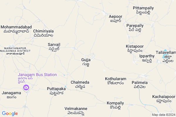
Gujja
Gujja Map
EDIT Map
Add Your House
 ..
..
Current Corona Virus Infected Patients Count in Nalgonda District
| City Name | District Name | Total Covid cases |
|---|---|---|
| Suryapet District | Suryapet | 72 |
| Nalgonda District | Nalgonda | 15 |
Locality Name :
Gujja
( గుజ్జ )
Mandal Name : Narayanapur
District : Nalgonda
State : Telangana
Region : Telangana
Language : Telugu and Urdu
Current Time 11:26 AM
Date: Sunday , Apr 27,2025 (IST)
Time zone: IST (UTC+5:30)
Elevation / Altitude: 322 meters. Above Seal level
Telephone Code / Std Code: 08414
Assembly constituency : Munugode assembly constituency
Assembly MLA : Komatireddy Raj Gopal Reddy
Lok Sabha constituency : Bhongir parliamentary constituency
Parliament MP : Komati Reddy Venkat Reddy
Serpanch Name :
Pin Code : 508253
Post Office Name : Narayanpur (Nalgonda)
Commodities Prices : Chityal Market / Mandi
Gujja Live Weather
Temperature: 32.8 °C
broken clouds
Humidity: 41%
Wind : 4.47 mt/sec towards SE
StationName : "Nalgonda"
observed on 2 Hours Back
Temperature: 32.8 °C
broken clouds
Humidity: 41%
Wind : 4.47 mt/sec towards SE
StationName : "Nalgonda"
observed on 2 Hours Back
Gujja Weather Forecast for Next 5 days
28-04-2025
26.6°C to 38.7°C
broken clouds, scattered clouds, light rain, few clouds
26.6°C to 38.7°C
broken clouds, scattered clouds, light rain, few clouds
29-04-2025
25.3°C to 39.5°C
clear sky, few clouds, scattered clouds
25.3°C to 39.5°C
clear sky, few clouds, scattered clouds
30-04-2025
26.9°C to 41.0°C
scattered clouds, clear sky, few clouds
26.9°C to 41.0°C
scattered clouds, clear sky, few clouds
01-05-2025
28.1°C to 41.2°C
scattered clouds, broken clouds
28.1°C to 41.2°C
scattered clouds, broken clouds
02-05-2025
27.9°C to 42.2°C
broken clouds, scattered clouds, few clouds, clear sky
27.9°C to 42.2°C
broken clouds, scattered clouds, few clouds, clear sky
Edit below overview about Gujja
Edit below overview about Gujja
OverView of Gujja
it is the oldest village in india. so many tourists visit gujja to see the tree at bodamarlagadda. The muthyalammatemple is most famous.
Gujja is the place which is having ancient Temple of Lord Lakshmi Chennakeshava. It is the oldest temple and people will this god very much. The Jathara and Kalyanam will happens Lord. Beautiful statues are identified while digging the well of Lord's cultivation lands and it is very ancient and old temple.
Edit below overview about Gujja
National Highways Reachable To Gujja
Nationa High Way :Old NH9
Nationa High Way :Old NH9
About Gujja
Gujja is a Village in Narayanapur Mandal in Nalgonda District of Telangana State, India. It belongs to Telangana region . It is located 38 KM towards west from District head quarters Nalgonda. 8 KM from Narayanapur.
Gujja Pin code is 508253 and postal head office is Narayanpur (Nalgonda).
Kothularam ( 5 KM ) , Sarvail ( 5 KM ) , Puttapaka ( 5 KM ) , Aipoor ( 6 KM ) , Velmakanne ( 7 KM ) are the nearby Villages to Gujja. Gujja is surrounded by Munugode Mandal towards South , Choutuppal Mandal towards North , Chityala Mandal towards East , Chandur Mandal towards South .
Bhongir , Devarakonda , Hyderabad , Jangaon are the near by Cities to Gujja.
This Place is in the border of the Nalgonda District and Rangareddi District. Rangareddi District Manchal is west towards this place .
Gujja 2011 Census Details
Gujja Local Language is Telugu. Gujja Village Total population is 2413 and number of houses are 635. Female Population is 48.7%. Village literacy rate is 52.9% and the Female Literacy rate is 21.1%.
Population
| Census Parameter | Census Data |
| Total Population | 2413 |
| Total No of Houses | 635 |
| Female Population % | 48.7 % ( 1176) |
| Total Literacy rate % | 52.9 % ( 1277) |
| Female Literacy rate | 21.1 % ( 509) |
| Scheduled Tribes Population % | 0.2 % ( 5) |
| Scheduled Caste Population % | 22.7 % ( 547) |
| Working Population % | 65.1 % |
| Child(0 -6) Population by 2011 | 236 |
| Girl Child(0 -6) Population % by 2011 | 45.8 % ( 108) |
Gujja Census More Deatils.
Politics in Gujja
TDP , TRS , CPI , INC are the major political parties in this area.Polling Stations /Booths near Gujja
1)Guddimalka Puram2)Gujja
3)Gujja
4)Mallapuraju Palli
5)Kotulapuram
HOW TO REACH Gujja
By Road
Nalgonda is the Nearest Town to Gujja. Nalgonda is 53 km from Gujja. Road connectivity is there from Nalgonda to Gujja.By Rail
There is no railway station near to Gujja in less than 10 km. How ever there are railway Stations from Near By town Nalgonda. are the railway Stations near to Nalgonda. You can reach from Nalgonda to Gujja by road after .Colleges near Gujja
A P Resid (boys) Jr College Sarvail
Address : A P Resid (boys) Jr College Sarvail
Puttapaka [inc] Junior College, Puttapaka
Address : Puttapaka
Schools in Gujja
Zphs Gujja
Address : gujja , narayanapur , nalgonda , Andhra Pradesh . PIN- 508253 , Post - Narayanpur (Nalgonda)
Govt Health Centers near Gujja
1) SubCentre, Gujja , 2.-5 , GP AREA , NEAR.BIG WATER TANK2) SubCentre, Survail , 4.-186/1 , BC COLONY , CHOUTUPPAL ROAD
3) SubCentre, Puttapaka , 4.-114/1 , ,
Sub Villages in Gujja
Petrol Bunks in Gujja,Narayanapur
Hindustan Petroleum Bunk
Gundrampalli; Nalgonda; NH-9; Vijayawada Hyderabad Road; Chityala; Telangana 508114; India
10.8 KM distance Detail
more ..
Colleges in Gujja,Narayanapur
TELANGANA RESIDENTIAL JUNIOR COLLEGE;SARVAIL
Sarvail; Telangana 508253; India
5.6 KM distance Detail
sri sai medical hall
Hyderabad - Vijayawada Hwy; Gundrampalli; Telangana 508114; India
11.0 KM distance Detail
more ..
Schools in Gujja,Narayanapur
lingam vari gudem Primary School
Lingamvarigudem Rd; Lingam Vari Gudem; Telangana 508253; India
3.7 KM distance Detail
Saigonibavi Primary School
Narayanapur .YADADRI BHUVANAGIRI.; Telangana 508253; India
4.9 KM distance Detail
TS Recidential School Sarvail
Mallareddygudem - Gujja Rd; Sarvail; Telangana 508253; India
5.0 KM distance Detail
Super Markets in Gujja,Narayanapur
Shareef Chicken Centre Samasthan Narayanpur
సంస్థాన్ నారాయణపూర్ - చౌటుప్పల్; Samsthan Narayanpur; Telangana 508253; India
11.4 KM distance Detail
Governement Offices near Gujja,Narayanapur
MeeSeva Center
5-108;silk sahakara sangam;puttapaka;beside canara bank;puttapaka(V);narayanapur(M);nalgonda(D); Puttapaka; Telangana 508253; India
6.7 KM distance Detail
MeeSeva Center
2-99;sc-colony;near busstop;kompally(V);munugode(M);nalgonda(D); Telangana 508244; India
7.8 KM distance Detail
About Gujja &
History
How to reach Gujja
Tourist Places Near By Gujja
Schools in Gujja
Colleges in Gujja
Temperature & weather of Gujja
places in Gujja
Gujja photos
More Information
How to reach Gujja
Tourist Places Near By Gujja
Schools in Gujja
Colleges in Gujja
Temperature & weather of Gujja
places in Gujja
Gujja photos
More Information
Village Talk
Post News or Events about this Village
Near Cities
Bhongir 45 KM near
Devarakonda 57 KM near
Hyderabad 65 KM near
Jangaon 73 KM near
Bhongir 45 KM near
Devarakonda 57 KM near
Hyderabad 65 KM near
Jangaon 73 KM near
Near By Taluks
Narayanapur 7 KM near
Munugode 9 KM near
Choutuppal 16 KM near
Chityala 17 KM near
Narayanapur 7 KM near
Munugode 9 KM near
Choutuppal 16 KM near
Chityala 17 KM near
Near By Air Ports
Rajiv Gandhi International Airport 65 KM near
Vijayawada Airport 231 KM near
Nanded Airport 319 KM near
Latur Airport 335 KM near
Rajiv Gandhi International Airport 65 KM near
Vijayawada Airport 231 KM near
Nanded Airport 319 KM near
Latur Airport 335 KM near
Near By Tourist Places
Hyderabad 64 KM near
Nagarjunsagar 83 KM near
Nagarjunakonda 119 KM near
Warangal 129 KM near
Srisailam 134 KM near
Hyderabad 64 KM near
Nagarjunsagar 83 KM near
Nagarjunakonda 119 KM near
Warangal 129 KM near
Srisailam 134 KM near
Near By Districts
Nalgonda 36 KM near
Hyderabad 69 KM near
Rangareddi 104 KM near
Medak 120 KM near
Nalgonda 36 KM near
Hyderabad 69 KM near
Rangareddi 104 KM near
Medak 120 KM near
Near By RailWay Station
Nalgonda Rail Way Station 38 KM near
Bhongir Rail Way Station 47 KM near
Nalgonda Rail Way Station 38 KM near
Bhongir Rail Way Station 47 KM near