| Home | City Bus | Maps | Villages | Cities | Rail | Tourist Places | School | College | Pin Codes | Corona Cases Count |
| Distance Calculator Bus Services IFSC Codes Trace Mobile Number Weather Search Place Trace IP Available Cash ATM/Banks Locate Polling Booth Report an Error contact People |
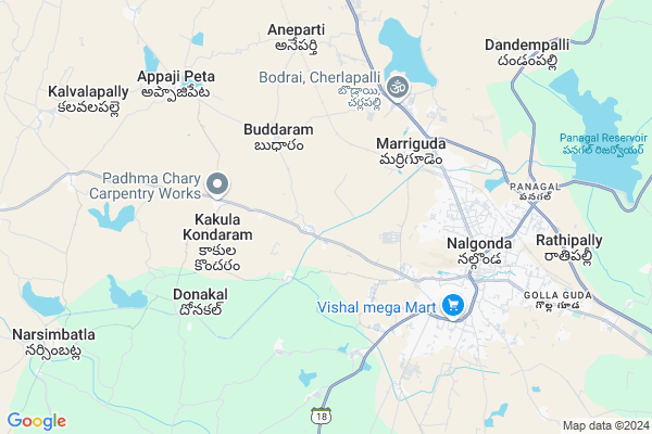
Mamillaguda Map
EDIT Map
Add Your House
 ..
..
Current Corona Virus Infected Patients Count in Nalgonda District
| City Name | District Name | Total Covid cases |
|---|---|---|
| Suryapet District | Suryapet | 72 |
| Nalgonda District | Nalgonda | 15 |
Locality Name :
Mamillaguda
( మామిళ్లగూడ )
Mandal Name : Nalgonda
District : Nalgonda
State : Telangana
Region : Telangana
Language : Telugu and Urdu
Current Time 11:37 PM
Date: Wednesday , Feb 05,2025 (IST)
Time zone: IST (UTC+5:30)
Elevation / Altitude: 224 meters. Above Seal level
Telephone Code / Std Code: 08682
Assembly constituency : Nalgonda assembly constituency
Assembly MLA : Komati Reddy Venkat Reddy
Lok Sabha constituency : Nalgonda parliamentary constituency
Parliament MP : UTTAM KUMAR REDDY NALAMADA
Serpanch Name :
Pin Code : 508001
Post Office Name : Nalgonda
Main Village Name : Kanchanpally
Commodities Prices : Venkateswarnagar Market / Mandi
Mamillaguda Live Weather
Temperature: 22.7 °C
clear sky
Humidity: 56%
Wind : 2.67 mt/sec towards SE
StationName : "Nalgonda"
observed on 5 Mins Back
Temperature: 22.7 °C
clear sky
Humidity: 56%
Wind : 2.67 mt/sec towards SE
StationName : "Nalgonda"
observed on 5 Mins Back
Mamillaguda Weather Forecast for Next 5 days
06-02-2025
21.1°C to 22.2°C
few clouds
21.1°C to 22.2°C
few clouds
07-02-2025
20.1°C to 33.1°C
few clouds, clear sky, scattered clouds
20.1°C to 33.1°C
few clouds, clear sky, scattered clouds
08-02-2025
20.8°C to 33.6°C
clear sky
20.8°C to 33.6°C
clear sky
09-02-2025
20.8°C to 34.2°C
clear sky
20.8°C to 34.2°C
clear sky
10-02-2025
20.3°C to 34.1°C
clear sky
20.3°C to 34.1°C
clear sky
National Highways Reachable To Mamillaguda
Nationa High Way :NH365BB
Nationa High Way :NH365BB
Rivers Near Mamillaguda
Musi River
Musi River
About Mamillaguda
Correct below Info and add more info about MamillagudaMamillaguda is a small Village/hamlet in Nalgonda Mandal in Nalgonda District of Telangana State, India. It comes under Kanchanpally Panchayath. It belongs to Telangana region . It is located 5 KM towards west from District head quarters Nalgonda. 1 KM from Nalgonda.
Mamillaguda Pin code is 508001 and postal head office is Nalgonda .
Mamillaguda is surrounded by Kanagal Mandal towards South , Kattangoor Mandal towards North , Narketpally Mandal towards North , Munugode Mandal towards west .
Suryapet , Miryalaguda , Devarakonda , Bhongir are the near by Cities to Mamillaguda.
Demographics of Mamillaguda
Telugu is the Local Language here. Total population of Mamillaguda is 2413 .Males are 1180 and Females are 1,233 living in 582 Houses. Total area of Mamillaguda is 1198 hectares.Politics in Mamillaguda
CPM , TDP , TRS , INC are the major political parties in this area.Polling Stations /Booths near Mamillaguda
1)Kanagal2)Kanchana Pally
3)Godarigudem H/o Mamidala
4)Darvesh Puram
5)Mamidala
HOW TO REACH Mamillaguda
By Road
Nalgonda is the Nearest Town to Mamillaguda. Nalgonda is 5 km from Mamillaguda. Road connectivity is there from Nalgonda to Mamillaguda.By Rail
Shrirampuram Rail Way Station , Nalgonda Rail Way Station are the very nearby railway stations to Mamillaguda. Also you can consider railway Stations from Near By town Nalgonda. Nalgonda Rail Way Station , Shrirampuram Rail Way Station are the railway Stations near to Nalgonda. You can reach from Nalgonda to Mamillaguda by road after .Colleges near Mamillaguda
Tswrdcw,cherlapally
Address : Tswrdcw,
cherlapally,nalgonda
pon:508001
Popepaul Vi Co-op Jr. Coll, Nalgonda
Address : Nalgonda
Goutami Jr Clg (g),vivekananda Ngr,nalgonda
Address : Vivekananda Ngr,nalgonda
Sapthapadi Jr College, Nalgonda
Address : Nalgonda
Aurobindo Jr College,? Nalgonda
Address : ? Nalgonda
Schools near Mamillaguda
Sri Vaishnavi Concept Hs
Address : nalgonda-2 , nalgonda , nalgonda , Andhra Pradesh . PIN- 508001 , Post - Nalgonda
Prerana Concept Hs
Address : nalgonda-2 , nalgonda , nalgonda , Andhra Pradesh . PIN- 508001 , Post - Nalgonda
Mvr Concept Hs
Address : nalgonda-2 , nalgonda , nalgonda , Andhra Pradesh . PIN- 508001 , Post - Nalgonda
Govt. Mkv Padmanagr
Address : nalgonda-1 , nalgonda , nalgonda , Andhra Pradesh . PIN- 508001 , Post - Nalgonda
Govt Health Centers near Mamillaguda
1) SubCentre, Kanchanpally , H.No 1-22/1 , G P Area , G p Area2) SubCentre, Ramulabanda , H.NO 2-1/1 , PHC , PHC
3) Primary Health Centre, Nalgonda (Rural Area) , H.NO 2-1/1 , , Near Ramalayam
Hospitals in Mamillaguda,Nalgonda
Government Hospital - Ramula Banda
మునుగోడు -- నల్గొండ; Ramulabanda; Telangana 508001; India
4.2 KM distance Detail
more ..
Petrol Bunks in Mamillaguda,Nalgonda
Shiva Rama Krishna Oil Company
Mungode Road; APHB Colony; Madhava Nagar; Nalgonda; Telangana 508004; India
2.7 KM distance Detail
Durga Devi Filling Station Hindustan Petroleum
Marriguda; Nalgonda; SH-2; Guntur Hyderabad Road; Nalgonda; Nalgonda; Telangana 508001; India
5.0 KM distance Detail
more ..
Schools in Mamillaguda,Nalgonda
Govt. Primary School - Ramula Banda
మునుగోడు -- నల్గొండ; Ramulabanda; Telangana 508001; India
4.2 KM distance Detail
Vipasyaa International School
Hyderabad Road; District Nalgonda; Cherlapalli; Telangana 508001; India
4.8 KM distance Detail
Telangana Social Welfare Residential School For Boys
Industrial Area; Nalgonda; Telangana 508001; India
4.9 KM distance Detail
Electronic Shops in Mamillaguda,Nalgonda
స్వాతి ఎలక్ట్రికల్ వర్క్స్
Munugodu Rd; Old City; Nalgonda; Telangana 508001; India
5.1 KM distance Detail
ROBOTICS COMPUTERS Sales & Service
1st Floor; Opp: Hanuman Temple; VT Colony; HYD Road; Nalgonda; VT COLONY; Ravindra Nagar Colony; Ravinder Nagar Colony; Old Venkateshwara Colony; Nalgonda; Telangana 508001; India
5.3 KM distance Detail
Super Markets in Mamillaguda,Nalgonda
Santhosh.kiranam&general Store
APHB Colony; Madhava Nagar; Nalgonda; Telangana 508001; India
3.6 KM distance Detail
Local Parks in Mamillaguda,Nalgonda
Ganesh Youth Park
APHB Colony; Madhava Nagar; Nalgonda; Telangana 508001; India
4.0 KM distance Detail
Police Stations near Mamillaguda,Nalgonda
Government of Telangana Nalgonda Police
Near Clock Tower; Hyderabad Road; Nalgonda; Telangana 508001; India
5.5 KM distance Detail
Police Head Quarters Nalgonda
Nagarjunar Colony; Nalgonda; Telangana 508001; India
5.9 KM distance Detail
Governement Offices near Mamillaguda,Nalgonda
Mee Seva Center
Gramapanchaethi ; Old Bus Stop; Marri Guda; Marriguda; Telangana 508001; India
4.3 KM distance Detail
About Mamillaguda &
History
How to reach Mamillaguda
Tourist Places Near By Mamillaguda
Schools in Mamillaguda
Colleges in Mamillaguda
Temperature & weather of Mamillaguda
places in Mamillaguda
Mamillaguda photos
More Information
How to reach Mamillaguda
Tourist Places Near By Mamillaguda
Schools in Mamillaguda
Colleges in Mamillaguda
Temperature & weather of Mamillaguda
places in Mamillaguda
Mamillaguda photos
More Information
Village Talk
Post News or Events about this Village
Near Cities
Suryapet 48 KM near
Miryalaguda 51 KM near
Devarakonda 59 KM near
Bhongir 66 KM near
Suryapet 48 KM near
Miryalaguda 51 KM near
Devarakonda 59 KM near
Bhongir 66 KM near
Near By Taluks
Nalgonda 2 KM near
Kanagal 15 KM near
Kattangoor 16 KM near
Narketpally 16 KM near
Nalgonda 2 KM near
Kanagal 15 KM near
Kattangoor 16 KM near
Narketpally 16 KM near
Near By Air Ports
Rajiv Gandhi International Airport 96 KM near
Vijayawada Airport 199 KM near
Rajahmundry Airport 309 KM near
Nanded Airport 346 KM near
Rajiv Gandhi International Airport 96 KM near
Vijayawada Airport 199 KM near
Rajahmundry Airport 309 KM near
Nanded Airport 346 KM near
Near By Tourist Places
Nagarjunsagar 63 KM near
Nagarjunakonda 88 KM near
Hyderabad 95 KM near
Khammam 113 KM near
Warangal 124 KM near
Nagarjunsagar 63 KM near
Nagarjunakonda 88 KM near
Hyderabad 95 KM near
Khammam 113 KM near
Warangal 124 KM near
Near By Districts
Nalgonda 5 KM near
Hyderabad 100 KM near
Khammam 113 KM near
Warangal 121 KM near
Nalgonda 5 KM near
Hyderabad 100 KM near
Khammam 113 KM near
Warangal 121 KM near
Near By RailWay Station
Shrirampuram Rail Way Station 6.3 KM near
Nalgonda Rail Way Station 7.9 KM near
Miryalaguda Rail Way Station 45 KM near
Shrirampuram Rail Way Station 6.3 KM near
Nalgonda Rail Way Station 7.9 KM near
Miryalaguda Rail Way Station 45 KM near