| Home | City Bus | Maps | Villages | Cities | Rail | Tourist Places | School | College | Pin Codes | Corona Cases Count |
| Distance Calculator Bus Services IFSC Codes Trace Mobile Number Weather Search Place Trace IP Available Cash ATM/Banks Locate Polling Booth Report an Error contact People |
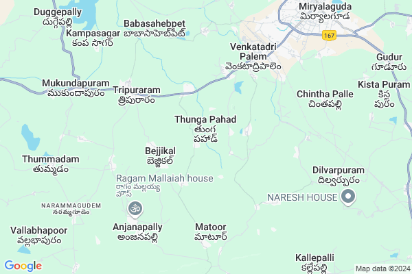
Jagramthanda
Jagramthanda Map
EDIT Map
Add Your House
 ..
..
Current Corona Virus Infected Patients Count in Nalgonda District
| City Name | District Name | Total Covid cases |
|---|---|---|
| Suryapet District | Suryapet | 72 |
| Nalgonda District | Nalgonda | 15 |
Locality Name :
Jagramthanda
( జాగరంతండా )
Mandal Name : Miryalaguda
District : Nalgonda
State : Telangana
Region : Telangana
Language : Telugu and Urdu
Current Time 05:22 PM
Date: Tuesday , Apr 29,2025 (IST)
Time zone: IST (UTC+5:30)
Elevation / Altitude: 152 meters. Above Seal level
Telephone Code / Std Code: 08689
Assembly constituency : Nagarjuna Sagar assembly constituency
Assembly MLA : Kunduru Jayaveer
Lok Sabha constituency : Nalgonda parliamentary constituency
Parliament MP : UTTAM KUMAR REDDY NALAMADA
Serpanch Name :
Pin Code : 508207
Post Office Name : Miryalguda
Main Village Name : Thungapahad
Commodities Prices : Miryalaguda Market / Mandi
Jagramthanda Live Weather
Temperature: 41.0 °C
clear sky
Humidity: 16%
Wind : 0.56 mt/sec towards E
StationName : "Miryalguda"
observed on 27 Mins Back
Temperature: 41.0 °C
clear sky
Humidity: 16%
Wind : 0.56 mt/sec towards E
StationName : "Miryalguda"
observed on 27 Mins Back
Jagramthanda Weather Forecast for Next 5 days
30-04-2025
28.1°C to 40.5°C
clear sky
28.1°C to 40.5°C
clear sky
01-05-2025
27.2°C to 41.6°C
clear sky, scattered clouds, overcast clouds, broken clouds
27.2°C to 41.6°C
clear sky, scattered clouds, overcast clouds, broken clouds
02-05-2025
28.4°C to 42.8°C
scattered clouds, few clouds, clear sky
28.4°C to 42.8°C
scattered clouds, few clouds, clear sky
03-05-2025
28.3°C to 42.8°C
scattered clouds, clear sky, light rain, overcast clouds, broken clouds
28.3°C to 42.8°C
scattered clouds, clear sky, light rain, overcast clouds, broken clouds
04-05-2025
28.2°C to 43.6°C
clear sky, light rain, scattered clouds
28.2°C to 43.6°C
clear sky, light rain, scattered clouds
National Highways Reachable To Jagramthanda
Nationa High Way :NH167
Nationa High Way :NH167
Rivers Near Jagramthanda
Musi River
Krishna :クリシュナ :ಕೃಷ್ಣಾ :कृष्णा :కృష్ణా
Musi River
Krishna :クリシュナ :ಕೃಷ್ಣಾ :कृष्णा :కృష్ణా
About Jagramthanda
Correct below Info and add more info about JagramthandaJagramthanda is a small Village/hamlet in Miryalaguda Mandal in Nalgonda District of Telangana State, India. It comes under Thungapahad Panchayath. It belongs to Telangana region . It is located 43 KM towards East from District head quarters Nalgonda. 9 KM from Miryalaguda.
Jagramthanda Pin code is 508207 and postal head office is Miryalguda .
Jagramthanda is surrounded by Miryalaguda Mandal towards North , Nidamanoor Mandal towards west , Dameracherla Mandal towards South , Nereducherla Mandal towards East .
Miryalaguda , Macherla , Suryapet , Kodad are the near by Cities to Jagramthanda.
Demographics of Jagramthanda
Telugu is the Local Language here. Total population of Jagramthanda is 6134 .Males are 3206 and Females are 2,928 living in 1331 Houses. Total area of Jagramthanda is 2469 hectares.Politics in Jagramthanda
TDP , TRS , INC are the major political parties in this area.Polling Stations /Booths near Jagramthanda
1)Satyampadu Tanda2)Battugudem
3)Bejikallu
4)Chelmareddi Gudem
5)Tripuraram
HOW TO REACH Jagramthanda
By Road
Miryalaguda is the Nearest Town to Jagramthanda. Miryalaguda is 9 km from Jagramthanda. Road connectivity is there from Miryalaguda to Jagramthanda.By Rail
Miryalaguda Rail Way Station is the very nearby railway stations to Jagramthanda. Also you can consider railway Stations from Near By town Miryalaguda. Miryalaguda Rail Way Station are the railway Stations near to Miryalaguda. You can reach from Miryalaguda to Jagramthanda by road after .Colleges near Jagramthanda
Anasuya Devi Institute Of Technology & Sciences
Address : Gudur (v), Bibinagar (m), Nalgonda Dist.
Tudi Ram Reddy Institute Of Technology & Sciences
Address : Gudur (v), Bibinagar (m), Nalgonda Dist.
Tudi Narsimha Reddy Institute Of Technology & Sciences
Address : Gudur (v), Bibinagar (m), Nalgonda Dist.
Schools in Jagramthanda
Zphs Thungapahad
Address : thungapahad , miryalaguda , nalgonda , Andhra Pradesh . PIN- 508207 , Post - Miryalguda
Govt Health Centers near Jagramthanda
1) SubCentre, Thungapadu , Mar-53 , Near High School , Near Anganwadi2) SubCentre, Japtiveerappagudem , 27-Jun , Near Anganwadi , Opp School Lane
3) Primary Health Centre, Thripuraram (M) , 4-171/1 , MAIN ROAD , Near PS
Petrol Bunks in Jagramthanda,Miryalaguda
HP PETROL PUMP - LALITHA FILLING STATION
Venkatadripalem Miryalaguda; Warangal; 508207; India
6.6 KM distance Detail
Sai Pooja Filling Station Bharat Petroleum
Sagar Rd; Thripuraram; Telangana 508207; India
6.8 KM distance Detail
more ..
Colleges in Jagramthanda,Miryalaguda
Nagarjuna Insitute of Technology and Sciences; Miryalaguda
Srinivas Nagar; V.T Palem;; Miryalaguda; Telangana 508207; India
4.6 KM distance Detail
Nagarjuna Institute of Technology and Sciences
Srinivas Nagar; Telangana 508207; India
4.7 KM distance Detail
RIYAN COLLEGE OF EDUCATION
Sy. No. 112; Miryalguda Mandal; Nalgonda District; Venkatadripalem; Telangana 508207; India
6.0 KM distance Detail
more ..
Schools in Jagramthanda,Miryalaguda
Z P P School
Thungapahad; Nalgonda; SH-2; Miryalaguda Nagarjuna Sagar Road; Miryalaguda; Miryalaguda; Telangana 508207; India
2.8 KM distance Detail
Saint Raymonds High School
Srinivasanagar; Nalgonda; Miryalaguda Nagarjuna Sagar Road; Miryalaguda; Miryalaguda; Telangana 508207; India
3.9 KM distance Detail
MJPTBCWR SCHOOL(G); THUMMADAM & DHAMARA CHARLA
Srinivas Nagar; Telangana 508207; India
4.7 KM distance Detail
Electronic Shops in Jagramthanda,Miryalaguda
Murali Chowhan
Nadimi thanda; Thripuraram; Thunga Pahad; Telangana 508207; India
4.4 KM distance Detail
Sitara Dj Sounds
Sagar Rd; Venkatadripalem; Miryalaguda; Telangana 508207; India
5.8 KM distance Detail
Super Markets in Jagramthanda,Miryalaguda
Mahavishnu Rice Industries
Telangana thungapahad road; Donka Thanda; Telangana 508207; India
3.4 KM distance Detail
Devender Kiranam shop
Saibaba Temple Rd; Miryalaguda; Telangana 508207; India
8.9 KM distance Detail
More Supermarket
Sri Raghavendra Swamy Complex; Opp.Miryalaguda Function Hall; Sagar Road; Hanumanpeta; Miryalaguda; Telangana 508207; India
9.2 KM distance Detail
Local Parks in Jagramthanda,Miryalaguda
Gayatri Nagar Colony Garden
Gayatri Nagar Colony; Miryalaguda; Telangana 508207; India
8.6 KM distance Detail
Police Stations near Jagramthanda,Miryalaguda
Miryalaguda Town II police Station
Hanumanpet; Miryalaguda; Telangana 508207; India
9.7 KM distance Detail
About Jagramthanda &
History
How to reach Jagramthanda
Tourist Places Near By Jagramthanda
Schools in Jagramthanda
Colleges in Jagramthanda
Temperature & weather of Jagramthanda
places in Jagramthanda
Jagramthanda photos
More Information
How to reach Jagramthanda
Tourist Places Near By Jagramthanda
Schools in Jagramthanda
Colleges in Jagramthanda
Temperature & weather of Jagramthanda
places in Jagramthanda
Jagramthanda photos
More Information
Village Talk
Post News or Events about this Village
Near Cities
Miryalaguda 12 KM near
Macherla 41 KM near
Suryapet 42 KM near
Kodad 59 KM near
Miryalaguda 12 KM near
Macherla 41 KM near
Suryapet 42 KM near
Kodad 59 KM near
Near By Taluks
Tripuraram 6 KM near
Miryalaguda 9 KM near
Nidamanoor 14 KM near
Dameracherla 15 KM near
Tripuraram 6 KM near
Miryalaguda 9 KM near
Nidamanoor 14 KM near
Dameracherla 15 KM near
Near By Air Ports
Rajiv Gandhi International Airport 139 KM near
Vijayawada Airport 157 KM near
Rajahmundry Airport 277 KM near
Nanded Airport 393 KM near
Rajiv Gandhi International Airport 139 KM near
Vijayawada Airport 157 KM near
Rajahmundry Airport 277 KM near
Nanded Airport 393 KM near
Near By Tourist Places
Nagarjunsagar 37 KM near
Nagarjunakonda 44 KM near
Khammam 94 KM near
Amaravathi 106 KM near
Srisailam 119 KM near
Nagarjunsagar 37 KM near
Nagarjunakonda 44 KM near
Khammam 94 KM near
Amaravathi 106 KM near
Srisailam 119 KM near
Near By Districts
Nalgonda 41 KM near
Khammam 94 KM near
Guntur 126 KM near
Warangal 146 KM near
Nalgonda 41 KM near
Khammam 94 KM near
Guntur 126 KM near
Warangal 146 KM near
Near By RailWay Station
Miryalaguda Rail Way Station 7.1 KM near
Vishnupuram Rail Way Station 20 KM near
Miryalaguda Rail Way Station 7.1 KM near
Vishnupuram Rail Way Station 20 KM near