| Home | City Bus | Maps | Villages | Cities | Rail | Tourist Places | School | College | Pin Codes | Corona Cases Count |
| Distance Calculator Bus Services IFSC Codes Trace Mobile Number Weather Search Place Trace IP Available Cash ATM/Banks Locate Polling Booth Report an Error contact People |
Kappalakuntathanda B
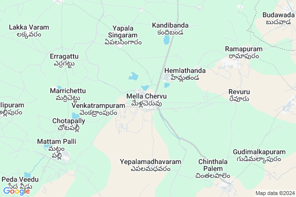
Kappalakuntathanda B Map
EDIT Map
Add Your House
 ..
..
Current Corona Virus Infected Patients Count in Nalgonda District
| City Name | District Name | Total Covid cases |
|---|---|---|
| Suryapet District | Suryapet | 72 |
| Nalgonda District | Nalgonda | 15 |
Locality Name :
Kappalakuntathanda B
( కప్పలకుంటతండా బి )
Mandal Name : Mella Chervu
District : Nalgonda
State : Telangana
Region : Telangana
Language : Telugu and Urdu
Current Time 03:08 PM
Date: Tuesday , Apr 29,2025 (IST)
Time zone: IST (UTC+5:30)
Elevation / Altitude: 103 meters. Above Seal level
Telephone Code / Std Code: 08683
Assembly constituency : Huzurnagar assembly constituency
Assembly MLA : Uttam Kumar Reddy Nalamada
Lok Sabha constituency : Nalgonda parliamentary constituency
Parliament MP : UTTAM KUMAR REDDY NALAMADA
Serpanch Name :
Pin Code : 508246
Post Office Name : Medlacheruvu
Main Village Name : Mellacheruvu
Alternate Village Name : Kappalakuntathanda
Commodities Prices : Huzurnagar Market / Mandi
Kappalakuntathanda B Live Weather
Temperature: 41.7 °C
clear sky
Humidity: 18%
Wind : 1.61 mt/sec towards S
StationName : "KodÄ\u0081r"
observed on 44 Mins Back
Temperature: 41.7 °C
clear sky
Humidity: 18%
Wind : 1.61 mt/sec towards S
StationName : "KodÄ\u0081r"
observed on 44 Mins Back
Kappalakuntathanda B Weather Forecast for Next 5 days
30-04-2025
27.9°C to 41.8°C
clear sky, few clouds, scattered clouds
27.9°C to 41.8°C
clear sky, few clouds, scattered clouds
01-05-2025
27.0°C to 41.6°C
clear sky, few clouds, scattered clouds
27.0°C to 41.6°C
clear sky, few clouds, scattered clouds
02-05-2025
28.0°C to 42.9°C
few clouds, clear sky, scattered clouds
28.0°C to 42.9°C
few clouds, clear sky, scattered clouds
03-05-2025
28.4°C to 42.9°C
few clouds, scattered clouds, clear sky, broken clouds
28.4°C to 42.9°C
few clouds, scattered clouds, clear sky, broken clouds
04-05-2025
28.3°C to 43.5°C
clear sky, scattered clouds, light rain
28.3°C to 43.5°C
clear sky, scattered clouds, light rain
National Highways Reachable To Kappalakuntathanda B
Nationa High Way :NH365BB
Nationa High Way :NH16
Nationa High Way :NH365BB
Nationa High Way :NH16
About Kappalakuntathanda B
Correct below Info and add more info about Kappalakuntathanda BKappalakuntathanda B is a small Village/hamlet in Mella Chervu Mandal in Nalgonda District of Telangana State, India. It comes under Mellacheruvu Panchayath. It belongs to Telangana region . As part Telangana Districts re-organisation , Kappalakuntathanda B Village Mella Chervu Mandal re organised from Nalgonda District to Suryapet district. It is located 88 KM towards East from District head quarters Nalgonda. 6 KM from Mellacheruvu.
Kappalakuntathanda B Pin code is 508246 and postal head office is Medlacheruvu .
Kappalakuntathanda B is surrounded by Mattam Pally Mandal towards west , Huzurnagar Mandal towards west , Chilkur Mandal towards North , Kodad Mandal towards North .
Jaggaiahpet , Kodad , Miryalaguda , Suryapet are the near by Cities to Kappalakuntathanda B.
This Place is in the border of the Nalgonda District and Guntur District. Guntur District Machavaram is South towards this place . It is near to the Andhra Pradesh State Border.
Demographics of Kappalakuntathanda B
Telugu is the Local Language here. Total population of Kappalakuntathanda B is 15555 .Males are 7876 and Females are 7,679 living in 3561 Houses. Total area of Kappalakuntathanda B is 5797 hectares.Politics in Kappalakuntathanda B
CPM , TRS , INC are the major political parties in this area.Polling Stations /Booths near Kappalakuntathanda B
1)Mella Cheruvu2)Mellachervu
3)Mellacheruvu
4)Mellacheruvu
5)Mellacheruvu
HOW TO REACH Kappalakuntathanda B
By Road
Jaggaiahpet is the Nearest Town to Kappalakuntathanda B. Jaggaiahpet is 36 km from Kappalakuntathanda B. Road connectivity is there from Jaggaiahpet to Kappalakuntathanda B.By Rail
There is no railway station near to Kappalakuntathanda B in less than 10 km.Colleges near Kappalakuntathanda B
Manjeera [inc] Junior Coll,mellacheruvu
Address : Mellacheruvu
Schools in Kappalakuntathanda B
Krushi Vm
Address : mella chervu , mellacheruvu , nalgonda , Andhra Pradesh . PIN- 508246 , Post - Medlacheruvu
Kgbv Mellachervu
Address : mella chervu , mellacheruvu , nalgonda , Andhra Pradesh . PIN- 508246 , Post - Medlacheruvu
Shanthi High School
Address : mella chervu , mellacheruvu , nalgonda , Andhra Pradesh . PIN- 508246 , Post - Medlacheruvu
Navabharath Hs
Address : mella chervu , mellacheruvu , nalgonda , Andhra Pradesh . PIN- 508246 , Post - Medlacheruvu
Zphs Mellachervu
Address : mella chervu , mellacheruvu , nalgonda , Andhra Pradesh . PIN- 508246 , Post - Medlacheruvu
Govt Health Centers near Kappalakuntathanda B
1) Primary Health Centre, Meelacheruvu , 789/790 , Main Road , Anjaneya Temple2) SubCentre, Mellacheruvu , 789/790 , Main Road , Anjaneya Temple
3) SubCentre, Vepula Madaram , 2-37/2 , Main Road , Committee Hall
Hospitals in Kappalakuntathanda B,Mella Chervu
Saimanikanta Hospital. Dr. B. Ramakrishna
5-16/1; Mellacheruvu - Huzurnagar Rd; Mellacheruvu; Telangana 508246; India
0.5 KM distance Detail
NEW LIFE HOSPITAL
Mellacheruvu - Huzurnagar Rd; Mellacheruvu; Telangana 508246; India
0.7 KM distance Detail
more ..
Petrol Bunks in Kappalakuntathanda B,Mella Chervu
HP PETROL PUMP - SREE MARUTHI FILLING CENTRE
HPC Petrol Bunk Kodad Road; Mellacheruvu; 508246; India
2.3 KM distance Detail
more ..
Electronic Shops in Kappalakuntathanda B,Mella Chervu
KRANTHI DIGITAL STUDIO
5-16/1; Mellacheruvu - Huzurnagar Rd; Mellacheruvu; Telangana 508216; India
0.5 KM distance Detail
Super Markets in Kappalakuntathanda B,Mella Chervu
Somanadham Kirana&general Stores
5-112; Mellacheruvu - Huzurnagar Rd; Mellacheruvu; Telangana 508216; India
0.5 KM distance Detail
Governement Offices near Kappalakuntathanda B,Mella Chervu
mee seva center
5; Mellacheruvu - Huzurnagar Rd; Mellacheruvu; Telangana 508246; India
0.6 KM distance Detail
About Kappalakuntathanda B &
History
How to reach Kappalakuntathanda B
Tourist Places Near By Kappalakuntathanda B
Schools in Kappalakuntathanda B
Colleges in Kappalakuntathanda B
Temperature & weather of Kappalakuntathanda B
places in Kappalakuntathanda B
Kappalakuntathanda B photos
More Information
How to reach Kappalakuntathanda B
Tourist Places Near By Kappalakuntathanda B
Schools in Kappalakuntathanda B
Colleges in Kappalakuntathanda B
Temperature & weather of Kappalakuntathanda B
places in Kappalakuntathanda B
Kappalakuntathanda B photos
More Information
Village Talk
Post News or Events about this Village
Near Cities
Jaggaiahpet 21 KM near
Kodad 23 KM near
Miryalaguda 40 KM near
Suryapet 54 KM near
Jaggaiahpet 21 KM near
Kodad 23 KM near
Miryalaguda 40 KM near
Suryapet 54 KM near
Near By Taluks
Mella Chervu 5 KM near
Mattam Pally 8 KM near
Huzurnagar 12 KM near
Chilkur 17 KM near
Mella Chervu 5 KM near
Mattam Pally 8 KM near
Huzurnagar 12 KM near
Chilkur 17 KM near
Near By Air Ports
Vijayawada Airport 109 KM near
Rajiv Gandhi International Airport 186 KM near
Rajahmundry Airport 228 KM near
Tirupati Airport 399 KM near
Vijayawada Airport 109 KM near
Rajiv Gandhi International Airport 186 KM near
Rajahmundry Airport 228 KM near
Tirupati Airport 399 KM near
Near By Tourist Places
Nagarjunakonda 14 KM near
Khammam 59 KM near
Amaravathi 60 KM near
Nagarjunsagar 79 KM near
Guntur 87 KM near
Nagarjunakonda 14 KM near
Khammam 59 KM near
Amaravathi 60 KM near
Nagarjunsagar 79 KM near
Guntur 87 KM near
Near By Districts
Khammam 59 KM near
Nalgonda 84 KM near
Guntur 88 KM near
West Godavari 141 KM near
Khammam 59 KM near
Nalgonda 84 KM near
Guntur 88 KM near
West Godavari 141 KM near
Near By RailWay Station
Vishnupuram Rail Way Station 37 KM near
Nadikude Junction Rail Way Station 37 KM near
Vishnupuram Rail Way Station 37 KM near
Nadikude Junction Rail Way Station 37 KM near