| Home | City Bus | Maps | Villages | Cities | Rail | Tourist Places | School | College | Pin Codes | Corona Cases Count |
| Distance Calculator Bus Services IFSC Codes Trace Mobile Number Weather Search Place Trace IP Available Cash ATM/Banks Locate Polling Booth Report an Error contact People |
Adloor
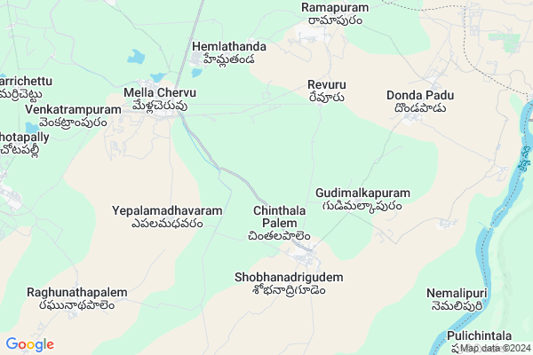
Adloor Map
EDIT Map
Add Your House
 ..
..
Current Corona Virus Infected Patients Count in Nalgonda District
| City Name | District Name | Total Covid cases |
|---|---|---|
| Suryapet District | Suryapet | 72 |
| Nalgonda District | Nalgonda | 15 |
Locality Name :
Adloor
( అడ్లూర్ )
Mandal Name : Mella Chervu
District : Nalgonda
State : Telangana
Region : Telangana
Language : Telugu and Urdu
Current Time 07:02 PM
Date: Tuesday , Apr 29,2025 (IST)
Time zone: IST (UTC+5:30)
Elevation / Altitude: 103 meters. Above Seal level
Telephone Code / Std Code: 08683
Assembly constituency : Huzurnagar assembly constituency
Assembly MLA : Uttam Kumar Reddy Nalamada
Lok Sabha constituency : Nalgonda parliamentary constituency
Parliament MP : UTTAM KUMAR REDDY NALAMADA
Serpanch Name :
Pin Code : 508246
Post Office Name : Medlacheruvu
Commodities Prices : Huzurnagar Market / Mandi
National Highways Reachable To Adloor
Nationa High Way :NH365BB
Nationa High Way :NH16
Nationa High Way :NH365BB
Nationa High Way :NH16
About Adloor
Correct below Info and add more info about AdloorAdloor is a Village in Mella Chervu Mandal in Nalgonda District of Telangana State, India. It belongs to Telangana region . As part Telangana Districts re-organisation , Adloor Village Mella Chervu Mandal re organised from Nalgonda District to Suryapet district. It is located 94 KM towards East from District head quarters Nalgonda.
Adloor Pin code is 508246 and postal head office is Medlacheruvu .
Adloor is surrounded by Mattam Pally Mandal towards west , Huzurnagar Mandal towards west , Chilkur Mandal towards North , Kodad Mandal towards North .
Jaggaiahpet , Kodad , Miryalaguda , Sattenapalle are the near by Cities to Adloor.
This Place is in the border of the Nalgonda District and Guntur District. Guntur District Machavaram is South towards this place . It is near to the Andhra Pradesh State Border.
Adlur 2011 Census Details
Adloor Local Language is Telugu. Adlur Village Total population is 2530 and number of houses are 717. Female Population is 48.9%. Village literacy rate is 50.3% and the Female Literacy rate is 20.7%.
Population
| Census Parameter | Census Data |
| Total Population | 2530 |
| Total No of Houses | 717 |
| Female Population % | 48.9 % ( 1236) |
| Total Literacy rate % | 50.3 % ( 1272) |
| Female Literacy rate | 20.7 % ( 524) |
| Scheduled Tribes Population % | 1.5 % ( 37) |
| Scheduled Caste Population % | 27.0 % ( 684) |
| Working Population % | 66.9 % |
| Child(0 -6) Population by 2011 | 261 |
| Girl Child(0 -6) Population % by 2011 | 44.1 % ( 115) |
Adlur Census More Deatils.
Politics in Adloor
CPM , TRS , INC are the major political parties in this area.Polling Stations /Booths near Adloor
1)Chintakunta Majira Chillepalli2)Chinthalapalem
3)Chinthalapalem
4)Chinthalapalem
5)Venkatrampuram Majira Mellacheruvu
HOW TO REACH Adloor
By Road
Jaggaiahpet is the Nearest Town to Adloor. Jaggaiahpet is 38 km from Adloor. Road connectivity is there from Jaggaiahpet to Adloor.By Rail
There is no railway station near to Adloor in less than 10 km.Colleges near Adloor
Manjeera [inc] Junior Coll,mellacheruvu
Address : Mellacheruvu
Schools near Adloor
Bharathi Vidya Mandir
Address : kandibanda , mellacheruvu , nalgonda , Andhra Pradesh . PIN- 508238 , Post - Gudibanda (Nalgonda)
Krushi Vm
Address : mella chervu , mellacheruvu , nalgonda , Andhra Pradesh . PIN- 508246 , Post - Medlacheruvu
Ravi Hs
Address : chinthala palem , mellacheruvu , nalgonda , Andhra Pradesh . PIN- 508246 , Post - Medlacheruvu
Kgbv Mellachervu
Address : mella chervu , mellacheruvu , nalgonda , Andhra Pradesh . PIN- 508246 , Post - Medlacheruvu
Govt Health Centers near Adloor
1) SubCentre, Mallareddygudem , 3-126 , Bodrai Bazar , Near Private School2) SubCentre, Gudimalkapuram , 2-111 , Main Road , Near UPS School
3) SubCentre, Vepula Madaram , 2-37/2 , Main Road , Committee Hall
Sub Villages in Adloor
Hospitals in Adloor,Mella Chervu
Saimanikanta Hospital. Dr. B. Ramakrishna
5-16/1; Mellacheruvu - Huzurnagar Rd; Mellacheruvu; Telangana 508246; India
5.9 KM distance Detail
NEW LIFE HOSPITAL
Mellacheruvu - Huzurnagar Rd; Mellacheruvu; Telangana 508246; India
6.1 KM distance Detail
more ..
Petrol Bunks in Adloor,Mella Chervu
HP PETROL PUMP - SREE MARUTHI FILLING CENTRE
HPC Petrol Bunk Kodad Road; Mellacheruvu; 508246; India
7.1 KM distance Detail
more ..
Electronic Shops in Adloor,Mella Chervu
Juvenaboina Achyuth Rao జూవ్వెనబోయిన అచ్చుత్ రావు
; Revuru; Telangana 508246; India
5.1 KM distance Detail
RAVI Mobils (Ravi)
1;; 5-16/1; Mellacheruvu - Huzurnagar Rd; Mellacheruvu; Telangana 508216; India
5.9 KM distance Detail
Super Markets in Adloor,Mella Chervu
Somanadham Kirana&general Stores
5-112; Mellacheruvu - Huzurnagar Rd; Mellacheruvu; Telangana 508216; India
5.9 KM distance Detail
Local Parks in Adloor,Mella Chervu
Jaggayyapet Muncipal Park
Y.Y. Colony; Jaggayyapet; Andhra Pradesh 521175; India
20.8 KM distance Detail
Governement Offices near Adloor,Mella Chervu
mee seva center
5; Mellacheruvu - Huzurnagar Rd; Mellacheruvu; Telangana 508246; India
6.1 KM distance Detail
About Adloor &
History
How to reach Adloor
Tourist Places Near By Adloor
Schools in Adloor
Colleges in Adloor
Temperature & weather of Adloor
places in Adloor
Adloor photos
More Information
How to reach Adloor
Tourist Places Near By Adloor
Schools in Adloor
Colleges in Adloor
Temperature & weather of Adloor
places in Adloor
Adloor photos
More Information
Village Talk
Post News or Events about this Village
Near Cities
Jaggaiahpet 19 KM near
Kodad 27 KM near
Miryalaguda 45 KM near
Sattenapalle 53 KM near
Jaggaiahpet 19 KM near
Kodad 27 KM near
Miryalaguda 45 KM near
Sattenapalle 53 KM near
Near By Taluks
Mella Chervu 0 KM near
Mattam Pally 12 KM near
Huzurnagar 18 KM near
Chilkur 22 KM near
Mella Chervu 0 KM near
Mattam Pally 12 KM near
Huzurnagar 18 KM near
Chilkur 22 KM near
Near By Air Ports
Vijayawada Airport 103 KM near
Rajiv Gandhi International Airport 191 KM near
Rajahmundry Airport 224 KM near
Tirupati Airport 396 KM near
Vijayawada Airport 103 KM near
Rajiv Gandhi International Airport 191 KM near
Rajahmundry Airport 224 KM near
Tirupati Airport 396 KM near
Near By Tourist Places
Nagarjunakonda 14 KM near
Amaravathi 54 KM near
Khammam 61 KM near
Guntur 82 KM near
Nagarjunsagar 82 KM near
Nagarjunakonda 14 KM near
Amaravathi 54 KM near
Khammam 61 KM near
Guntur 82 KM near
Nagarjunsagar 82 KM near
Near By Districts
Khammam 61 KM near
Guntur 82 KM near
Nalgonda 90 KM near
West Godavari 136 KM near
Khammam 61 KM near
Guntur 82 KM near
Nalgonda 90 KM near
West Godavari 136 KM near
Near By RailWay Station
Nadikude Junction Rail Way Station 38 KM near
Piduguralla Rail Way Station 40 KM near
Nadikude Junction Rail Way Station 38 KM near
Piduguralla Rail Way Station 40 KM near