| Home | City Bus | Maps | Villages | Cities | Rail | Tourist Places | School | College | Pin Codes | Corona Cases Count |
| Distance Calculator Bus Services IFSC Codes Trace Mobile Number Weather Search Place Trace IP Available Cash ATM/Banks Locate Polling Booth Report an Error contact People |
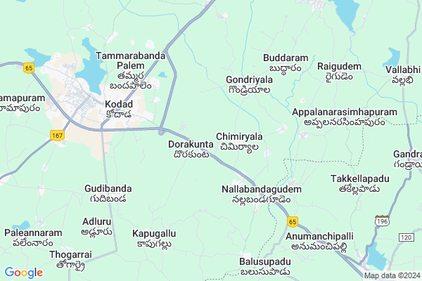
Dorakunta Map
EDIT Map
Add Your House
 ..
..
Current Corona Virus Infected Patients Count in Nalgonda District
| City Name | District Name | Total Covid cases |
|---|---|---|
| Suryapet District | Suryapet | 72 |
| Nalgonda District | Nalgonda | 15 |
Locality Name :
Dorakunta
( దొరకుంట )
Mandal Name : Kodad
District : Nalgonda
State : Telangana
Region : Telangana
Language : Telugu and Urdu
Current Time 05:32 PM
Date: Wednesday , Feb 05,2025 (IST)
Time zone: IST (UTC+5:30)
Elevation / Altitude: 103 meters. Above Seal level
Telephone Code / Std Code: 08683
Assembly constituency : Kodad assembly constituency
Assembly MLA : Nalamada Padmavathi Reddy
Lok Sabha constituency : Nalgonda parliamentary constituency
Parliament MP : UTTAM KUMAR REDDY NALAMADA
Serpanch Name :
Pin Code : 508206
Post Office Name : Kodad
Commodities Prices : Kodad Market / Mandi
Dorakunta Live Weather
Temperature: 35.4 °C
clear sky
Humidity: 22%
Wind : 2.89 mt/sec towards S
StationName : "KodÄ\u0081r"
observed on 2 Hours Back
Temperature: 35.4 °C
clear sky
Humidity: 22%
Wind : 2.89 mt/sec towards S
StationName : "KodÄ\u0081r"
observed on 2 Hours Back
Dorakunta Weather Forecast for Next 5 days
06-02-2025
20.4°C to 34.6°C
clear sky, scattered clouds
20.4°C to 34.6°C
clear sky, scattered clouds
07-02-2025
19.6°C to 34.9°C
scattered clouds, few clouds, clear sky
19.6°C to 34.9°C
scattered clouds, few clouds, clear sky
08-02-2025
20.8°C to 35.9°C
clear sky
20.8°C to 35.9°C
clear sky
09-02-2025
20.9°C to 36.4°C
clear sky
20.9°C to 36.4°C
clear sky
10-02-2025
20.4°C to 35.8°C
clear sky
20.4°C to 35.8°C
clear sky
Edit below overview about Dorakunta
Edit below overview about Dorakunta
OverView of Dorakunta
Nearest Railway station Khammam just 35 KM's only. Dorakunta is very near to Hyderabad and Vijayawada. NH9 main highwayEdit below overview about Dorakunta
National Highways Reachable To Dorakunta
Nationa High Way :NH365A
Nationa High Way :NH365BG
Nationa High Way :NH365A
Nationa High Way :NH365BG
Rivers Near Dorakunta
Krishna :نهر كرشنا :رود کرشنا :クリシュナ :ಕೃಷ್ಣಾ :कृष्णा :కృష్ణా :دریائے کرشنا
Krishna :نهر كرشنا :رود کرشنا :クリシュナ :ಕೃಷ್ಣಾ :कृष्णा :కృష్ణా :دریائے کرشنا
About Dorakunta
Dorakunta is a Village in Kodad Mandal in Nalgonda District of Telangana State, India. It belongs to Telangana region . As part Telangana Districts re-organisation , Dorakunta Village Kodad Mandal re organised from Nalgonda District to Suryapet district. It is located 94 KM towards East from District head quarters Nalgonda. 5 KM from Kodad.
Dorakunta Pin code is 508206 and postal head office is Kodad .
Gondriyala ( 4 KM ) , Srirangapuram ( 4 KM ) , Kodad ( 6 KM ) , Gudibanda ( 6 KM ) , Redlakunta ( 6 KM ) are the nearby Villages to Dorakunta. Dorakunta is surrounded by Chilkur Mandal towards west , Nelakondapally Mandal towards North , Jaggayyapeta Mandal towards East , Huzurnagar Mandal towards west .
Kodad , Jaggaiahpet , Khammam , Suryapet are the near by Cities to Dorakunta.
This Place is in the border of the Nalgonda District and Khammam District. Khammam District Nelakondapally is North towards this place . Also it is in the Border of other district Krishna . It is near to the Andhra Pradesh State Border.
Dorakunta 2011 Census Details
Dorakunta Local Language is Telugu. Dorakunta Village Total population is 3323 and number of houses are 911. Female Population is 51.2%. Village literacy rate is 55.6% and the Female Literacy rate is 24.1%.
Population
| Census Parameter | Census Data |
| Total Population | 3323 |
| Total No of Houses | 911 |
| Female Population % | 51.2 % ( 1701) |
| Total Literacy rate % | 55.6 % ( 1848) |
| Female Literacy rate | 24.1 % ( 801) |
| Scheduled Tribes Population % | 0.5 % ( 15) |
| Scheduled Caste Population % | 10.9 % ( 361) |
| Working Population % | 53.1 % |
| Child(0 -6) Population by 2011 | 396 |
| Girl Child(0 -6) Population % by 2011 | 51.3 % ( 203) |
Dorakunta Census More Deatils.
Politics in Dorakunta
TDP , TRS , INC are the major political parties in this area.Polling Stations /Booths near Dorakunta
1)Chimiryala2)Dorakunta
3)Dorakunta
4)Chilukuru
5)Chimiryala
HOW TO REACH Dorakunta
By Road
Jaggaiahpet is the Nearest Town to Dorakunta. Jaggaiahpet is 20 km from Dorakunta. Road connectivity is there from Jaggaiahpet to Dorakunta.By Rail
There is no railway station near to Dorakunta in less than 10 km.Colleges near Dorakunta
Mrr Jr College, Kodad
Address : Kodad
New Science Jr College Kodad
Address : New Science Jr College Kodad
Govt Junior College Kodad
Address : Govt Junior College Kodad
Sneha Jr College? Kodad
Address : Sneha Jr College? Kodad
Mandal Coop Jr Coll Kodad
Address : Mandal Coop Jr Coll Kodad
Schools in Dorakunta
Zphs Dorakunta
Address : dorakunta , kodad , nalgonda , Andhra Pradesh . PIN- 508206 , Post - Kodad
Govt Health Centers near Dorakunta
1) SubCentre, Dorakunta , 16-Apr , NH-9 Main Road , Near Grampanchayath2) SubCentre, Nallbandagudem , 1-35/1 , Gramapanchayath Road , Near Grampanchayath
3) SubCentre, Gondriyala , , Main Road , Near Grampanchayath
Hospitals in Dorakunta,Kodad
Dr. Shouqhat Ali
Vijayawada - Hyderabad Hwy; Nallabandagudem; Telangana 508206; India
4.6 KM distance Detail
more ..
Petrol Bunks in Dorakunta,Kodad
Ganesh Filling Station-Bharat Petroleum
Dorakunta; Nalgonda; NH-9; Vijayawada Hyderabad Road; Kodada; Kodada; Telangana 508206; India
1.0 KM distance Detail
M/S.GANESH FILLING STATION
DORAKUNTA; KODAD; NALGONDA; Telangana 508206; India
1.0 KM distance Detail
Sri Venkateshwara Swamy Filling Station-Indian Oil
Dorakunta; Nalgonda; NH-9; Vijayawada Hyderabad Road; Kodada; Kodada; Telangana 508206; India
2.1 KM distance Detail
more ..
Schools in Dorakunta,Kodad
Dorakunta School
Hyderabad - Vijayawada Hwy; Dorakunta; Telangana 508206; India
0.7 KM distance Detail
Satyanveshana Mandali
Kodada mandal; district;; Dorakunta; Telangana 508206; India
1.7 KM distance Detail
Mandal Parishad Primary School
Nallabanda Gudem; Nalgonda; NH-9; Vijayawada Hyderabad Road; Kodada; Kodada; Telangana 508206; India
3.0 KM distance Detail
Super Markets in Dorakunta,Kodad
srinivasa supermarket
opp.srinivasatheatre;mainroad; Kodad; Telangana 508206; India
8.2 KM distance Detail
Police Stations near Dorakunta,Kodad
Traffic Police Station Kodada
Khammam X Road; Nalgonda; NH-9; Vijayawada Hyderabad Road; Kodada; Kodada; Telangana 508206; India
6.7 KM distance Detail
Kodad Town Police Station
Old National Highway 9; Suryapet; Kodad; Telangana 508206; India
7.2 KM distance Detail
Governement Offices near Dorakunta,Kodad
MeeSeva Center
Main Road; Near New Grampanchayath; Ananthagiri (V); Kodada (M); nalgonda (Dist); Anantha Giri; 508206; India
6.6 KM distance Detail
About Dorakunta &
History
How to reach Dorakunta
Tourist Places Near By Dorakunta
Schools in Dorakunta
Colleges in Dorakunta
Temperature & weather of Dorakunta
places in Dorakunta
Dorakunta photos
More Information
How to reach Dorakunta
Tourist Places Near By Dorakunta
Schools in Dorakunta
Colleges in Dorakunta
Temperature & weather of Dorakunta
places in Dorakunta
Dorakunta photos
More Information
Village Talk
Post News or Events about this Village
Near Cities
Kodad 7 KM near
Jaggaiahpet 14 KM near
Khammam 37 KM near
Suryapet 51 KM near
Kodad 7 KM near
Jaggaiahpet 14 KM near
Khammam 37 KM near
Suryapet 51 KM near
Near By Taluks
Kodad 5 KM near
Chilkur 12 KM near
Nelakondapally 15 KM near
Jaggayyapeta 16 KM near
Kodad 5 KM near
Chilkur 12 KM near
Nelakondapally 15 KM near
Jaggayyapeta 16 KM near
Near By Air Ports
Vijayawada Airport 108 KM near
Rajiv Gandhi International Airport 192 KM near
Rajahmundry Airport 215 KM near
Vishakhapatnam Airport 392 KM near
Vijayawada Airport 108 KM near
Rajiv Gandhi International Airport 192 KM near
Rajahmundry Airport 215 KM near
Vishakhapatnam Airport 392 KM near
Near By Tourist Places
Nagarjunakonda 36 KM near
Khammam 37 KM near
Amaravathi 66 KM near
Vijayawada 93 KM near
Guntur 97 KM near
Nagarjunakonda 36 KM near
Khammam 37 KM near
Amaravathi 66 KM near
Vijayawada 93 KM near
Guntur 97 KM near
Near By Districts
Khammam 37 KM near
Nalgonda 90 KM near
Guntur 97 KM near
West Godavari 134 KM near
Khammam 37 KM near
Nalgonda 90 KM near
Guntur 97 KM near
West Godavari 134 KM near
Near By RailWay Station
Khammam Rail Way Station 36 KM near
Madhira Rail Way Station 41 KM near
Khammam Rail Way Station 36 KM near
Madhira Rail Way Station 41 KM near