| Home | City Bus | Maps | Villages | Cities | Rail | Tourist Places | School | College | Pin Codes | Corona Cases Count |
| Distance Calculator Bus Services IFSC Codes Trace Mobile Number Weather Search Place Trace IP Available Cash ATM/Banks Locate Polling Booth Report an Error contact People |
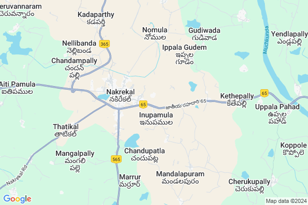
Rayapuram
Rayapuram Map
EDIT Map
Add Your House
 ..
..
Current Corona Virus Infected Patients Count in Nalgonda District
| City Name | District Name | Total Covid cases |
|---|---|---|
| Suryapet District | Suryapet | 72 |
| Nalgonda District | Nalgonda | 15 |
Locality Name :
Rayapuram
( రాయపురం )
Mandal Name : Kethe Pally
District : Nalgonda
State : Telangana
Region : Telangana
Language : Telugu and Urdu
Current Time 05:52 AM
Date: Saturday , Apr 26,2025 (IST)
Time zone: IST (UTC+5:30)
Elevation / Altitude: 185 meters. Above Seal level
Telephone Code / Std Code: 08693
Assembly constituency : Nakrekal assembly constituency
Assembly MLA : Vemula Veeresham
Lok Sabha constituency : Bhongir parliamentary constituency
Parliament MP : Komati Reddy Venkat Reddy
Serpanch Name :
Pin Code : 508211
Post Office Name : Nakrekal
Main Village Name : Inupamula
Commodities Prices : Nakrekal Market / Mandi
Rayapuram Live Weather
Temperature: 28.1 °C
broken clouds
Humidity: 64%
Wind : 5.28 mt/sec towards SE
StationName : "Nalgonda"
observed on 15 Mins Back
Temperature: 28.1 °C
broken clouds
Humidity: 64%
Wind : 5.28 mt/sec towards SE
StationName : "Nalgonda"
observed on 15 Mins Back
Rayapuram Weather Forecast for Next 5 days
27-04-2025
28.3°C to 40.9°C
broken clouds, few clouds, scattered clouds, clear sky, overcast clouds
28.3°C to 40.9°C
broken clouds, few clouds, scattered clouds, clear sky, overcast clouds
28-04-2025
27.6°C to 36.9°C
overcast clouds, broken clouds, scattered clouds, light rain
27.6°C to 36.9°C
overcast clouds, broken clouds, scattered clouds, light rain
29-04-2025
25.8°C to 40.8°C
broken clouds, scattered clouds, clear sky, few clouds
25.8°C to 40.8°C
broken clouds, scattered clouds, clear sky, few clouds
30-04-2025
26.0°C to 41.1°C
clear sky, broken clouds, scattered clouds, few clouds
26.0°C to 41.1°C
clear sky, broken clouds, scattered clouds, few clouds
01-05-2025
26.9°C to 42.1°C
scattered clouds, clear sky, light rain, broken clouds
26.9°C to 42.1°C
scattered clouds, clear sky, light rain, broken clouds
Edit below overview about Rayapuram
Edit below overview about Rayapuram
OverView of Rayapuram
In Rayapuram village one of the biggest church called St. Peter's Church, Parish House, boys hostel, schoolEdit below overview about Rayapuram
National Highways Reachable To Rayapuram
Nationa High Way :NH365A
Nationa High Way :NH365BB
Nationa High Way :NH365A
Nationa High Way :NH365BB
About Rayapuram
Rayapuram is a small Village/hamlet in Kethe Pally Mandal in Nalgonda District of Telangana State, India. It comes under Inupamula Panchayath. It belongs to Telangana region . It is located 28 KM towards East from District head quarters Nalgonda. 7 KM from Kethepally.
Rayapuram Pin code is 508211 and postal head office is Nakrekal .
Nomula ( 5 KM ) , Kondakindigudem ( 6 KM ) , Gudiwada ( 6 KM ) , Chandampalli ( 6 KM ) , Kethepally ( 7 KM ) are the nearby Villages to Rayapuram. Rayapuram is surrounded by Kethe Pally Mandal towards East , Kattangoor Mandal towards west , Thipparthi Mandal towards South , Shali Gouraram Mandal towards North .
Suryapet , Miryalaguda , Kodad , Jangaon are the near by Cities to Rayapuram.
Demographics of Rayapuram
Telugu is the Local Language here. Total population of Rayapuram is 3574 .Males are 1753 and Females are 1,821 living in 847 Houses. Total area of Rayapuram is 1371 hectares.Politics in Rayapuram
CPM , TDP , TRS , INC are the major political parties in this area.Polling Stations /Booths near Rayapuram
1)Gundrampalli2)Inupamula
3)Nakrekal
4)Nakrekal
5)Nakkalapally
HOW TO REACH Rayapuram
By Road
Suryapet is the Nearest Town to Rayapuram. Suryapet is 20 km from Rayapuram. Road connectivity is there from Suryapet to Rayapuram.By Rail
There is no railway station near to Rayapuram in less than 10 km.Colleges near Rayapuram
St. Anne's Jr College
Address :
Manikanta Jr College Kethepally
Address : Manikanta Jr College Kethepally
Schools near Rayapuram
Zphs
Address : Cherkupally
Zphs Bheemaram
Address : Near Busstand
Bheemaram
Z.p.h.s. Gudiwada
Address :
Zph School In Kothapeta
Address :
Govt Health Centers near Rayapuram
1) SubCentre, Inupamula , 002-79 , Kotagurju , Near GPO2) SubCentre, Nakrekal , 11-103 , , Near mirchi powdermill
3) Community Health Center Nakrekal , , ,
Hospitals in Rayapuram,Kethe Pally
Cheraku Sudhakar(Hamsa) Hospital
V.T. Colony;; Nakrekal; Telangana 508211; India
2.7 KM distance Detail
more ..
Petrol Bunks in Rayapuram,Kethe Pally
M. Kotaiah and Son Filling Station-Indian Oil Petrol
Nakrekhal Main Road; Nalgonda; NH-9; Vijayavada Hydrabad Road; Nakirekal; Nakirekal; Telangana 508211; India
2.4 KM distance Detail
DAIDA RONIKASUNDARAIAH F.S
NAKREKAL; ON NALGONDA ROAD; NALGONDA; Telangana 508211; India
3.5 KM distance Detail
more ..
Colleges in Rayapuram,Kethe Pally
Kakathiya Junior College
Shakuntala Function Hall Rd; Nakrekal; Telangana 508211; India
2.3 KM distance Detail
Arunodaya P G College
Laxmi Complex; Nalgonda; NH-9; Vijayavada Hydrabad Road; Nakirekal; Nakirekal; Telangana 508211; India
2.5 KM distance Detail
AVM GROUP OF INSTUTUTIONS
20-95; Reddy Colony; Nakrekal; Telangana 508211; India
3.0 KM distance Detail
more ..
Schools in Rayapuram,Kethe Pally
Nethaji Vidya Niketan High School/Shiva Shivani E.m High School
Sri Vinayakanagar; Nakrekal; Telangana 508211; India
2.4 KM distance Detail
Electronic Shops in Rayapuram,Kethe Pally
Lakshmi Sai Mobiles
Shakuntala Function Hall Rd; Sri Vinayakanagar; Nakrekal; Telangana 508211; India
2.6 KM distance Detail
Sri Sathya Computers
beside axis bank atm; main road;; Nakrekal; Telangana 508211; India
2.7 KM distance Detail
JS COMPUTERS SALES&SERVICES
Sri Vinayakanagar; Nakrekal; Telangana 508211; India
2.7 KM distance Detail
Super Markets in Rayapuram,Kethe Pally
Sridevi kiranam & general stores
9-135; Musi Rd; Nakrekal; Telangana 508211; India
2.9 KM distance Detail
swetha kiranam&GM
thiparthi; Tipparti-Nakirekal Rd; Nakrekal; Telangana 508211; India
2.9 KM distance Detail
Local Parks in Rayapuram,Kethe Pally
shankuntala Gardens
Shakuntala Function Hall Rd; Sri Vinayakanagar; Nakrekal; Telangana 508211; India
2.7 KM distance Detail
Police Stations near Rayapuram,Kethe Pally
Nakrekal Police Station
National Highway 9; Nakrekal; Telangana 508211; India
2.8 KM distance Detail
Kattangur police station
Eduloor - Kattangur Road; kattangur; Telangana 508205; India
17.9 KM distance Detail
Suryapet Rural Police Station
Thallagadda; Suryapet; Telangana 508213; India
19.2 KM distance Detail
Governement Offices near Rayapuram,Kethe Pally
Aitipamula Village Panchayat Offcice
Aitipamula; Nalgonda; NH-9; Vijayavada Hydrabad Road; Kattangur; Kattangur; Telangana 508205; India
11.6 KM distance Detail
About Rayapuram &
History
How to reach Rayapuram
Tourist Places Near By Rayapuram
Schools in Rayapuram
Colleges in Rayapuram
Temperature & weather of Rayapuram
places in Rayapuram
Rayapuram photos
More Information
How to reach Rayapuram
Tourist Places Near By Rayapuram
Schools in Rayapuram
Colleges in Rayapuram
Temperature & weather of Rayapuram
places in Rayapuram
Rayapuram photos
More Information
Village Talk
Post News or Events about this Village
Near Cities
Suryapet 20 KM near
Miryalaguda 40 KM near
Kodad 64 KM near
Jangaon 77 KM near
Suryapet 20 KM near
Miryalaguda 40 KM near
Kodad 64 KM near
Jangaon 77 KM near
Near By Taluks
Nakrekal 6 KM near
Kethe Pally 6 KM near
Kattangoor 17 KM near
Thipparthi 18 KM near
Nakrekal 6 KM near
Kethe Pally 6 KM near
Kattangoor 17 KM near
Thipparthi 18 KM near
Near By Air Ports
Rajiv Gandhi International Airport 121 KM near
Vijayawada Airport 178 KM near
Rajahmundry Airport 282 KM near
Nanded Airport 356 KM near
Rajiv Gandhi International Airport 121 KM near
Vijayawada Airport 178 KM near
Rajahmundry Airport 282 KM near
Nanded Airport 356 KM near
Near By Tourist Places
Nagarjunakonda 74 KM near
Nagarjunsagar 74 KM near
Khammam 84 KM near
Warangal 105 KM near
Hyderabad 117 KM near
Nagarjunakonda 74 KM near
Nagarjunsagar 74 KM near
Khammam 84 KM near
Warangal 105 KM near
Hyderabad 117 KM near
Near By Districts
Nalgonda 26 KM near
Khammam 84 KM near
Warangal 103 KM near
Hyderabad 121 KM near
Nalgonda 26 KM near
Khammam 84 KM near
Warangal 103 KM near
Hyderabad 121 KM near
Near By RailWay Station
Nalgonda Rail Way Station 23 KM near
Miryalaguda Rail Way Station 38 KM near
Nalgonda Rail Way Station 23 KM near
Miryalaguda Rail Way Station 38 KM near