| Home | City Bus | Maps | Villages | Cities | Rail | Tourist Places | School | College | Pin Codes | Corona Cases Count |
| Distance Calculator Bus Services IFSC Codes Trace Mobile Number Weather Search Place Trace IP Available Cash ATM/Banks Locate Polling Booth Report an Error contact People |
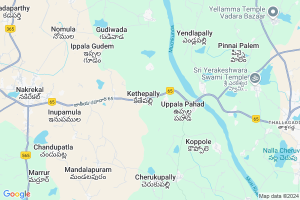
Korlapad
Korlapad Map
EDIT Map
Add Your House
 ..
..
Current Corona Virus Infected Patients Count in Nalgonda District
| City Name | District Name | Total Covid cases |
|---|---|---|
| Suryapet District | Suryapet | 72 |
| Nalgonda District | Nalgonda | 15 |
Locality Name :
Korlapad
( కొర్లపాడ్ )
Mandal Name : Kethe Pally
District : Nalgonda
State : Telangana
Region : Telangana
Language : Telugu and Urdu
Current Time 12:37 PM
Date: Sunday , Apr 27,2025 (IST)
Time zone: IST (UTC+5:30)
Elevation / Altitude: 185 meters. Above Seal level
Telephone Code / Std Code: 08693
Assembly constituency : Nakrekal assembly constituency
Assembly MLA : Vemula Veeresham
Lok Sabha constituency : Bhongir parliamentary constituency
Parliament MP : Komati Reddy Venkat Reddy
Serpanch Name :
Pin Code : 508211
Post Office Name : Nakrekal
Alternate Village Name : Korlapadu
Commodities Prices : Nakrekal Market / Mandi
Korlapad Live Weather
Temperature: 34.9 °C
few clouds
Humidity: 36%
Wind : 4.88 mt/sec towards SE
StationName : "SuriÄ\u0081pet"
observed on 2 Hours Back
Temperature: 34.9 °C
few clouds
Humidity: 36%
Wind : 4.88 mt/sec towards SE
StationName : "SuriÄ\u0081pet"
observed on 2 Hours Back
Korlapad Weather Forecast for Next 5 days
28-04-2025
27.7°C to 39.7°C
scattered clouds, light rain
27.7°C to 39.7°C
scattered clouds, light rain
29-04-2025
26.7°C to 40.1°C
broken clouds, clear sky, few clouds
26.7°C to 40.1°C
broken clouds, clear sky, few clouds
30-04-2025
26.6°C to 42.5°C
clear sky, scattered clouds, broken clouds
26.6°C to 42.5°C
clear sky, scattered clouds, broken clouds
01-05-2025
27.5°C to 42.7°C
scattered clouds, few clouds, broken clouds
27.5°C to 42.7°C
scattered clouds, few clouds, broken clouds
02-05-2025
27.8°C to 42.7°C
scattered clouds, clear sky, few clouds
27.8°C to 42.7°C
scattered clouds, clear sky, few clouds
National Highways Reachable To Korlapad
Nationa High Way :NH365A
Nationa High Way :NH365BB
Nationa High Way :NH365A
Nationa High Way :NH365BB
About Korlapad
Correct below Info and add more info about KorlapadKorlapad is a Village in Kethe Pally Mandal in Nalgonda District of Telangana State, India. It belongs to Telangana region . It is located 34 KM towards East from District head quarters Nalgonda.
Korlapad Pin code is 508211 and postal head office is Nakrekal .
Korlapad is surrounded by Nakrekal Mandal towards west , Suryapet Mandal towards East , Aravapally Mandal towards North , Vemula Pally Mandal towards South .
Suryapet , Miryalaguda , Kodad , Khammam are the near by Cities to Korlapad.
Korla Pahad 2011 Census Details
Korlapad Local Language is Telugu. Korla Pahad Village Total population is 1986 and number of houses are 498. Female Population is 49.8%. Village literacy rate is 56.8% and the Female Literacy rate is 23.7%.
Population
| Census Parameter | Census Data |
| Total Population | 1986 |
| Total No of Houses | 498 |
| Female Population % | 49.8 % ( 990) |
| Total Literacy rate % | 56.8 % ( 1128) |
| Female Literacy rate | 23.7 % ( 470) |
| Scheduled Tribes Population % | 0.0 % ( 0) |
| Scheduled Caste Population % | 34.7 % ( 690) |
| Working Population % | 51.5 % |
| Child(0 -6) Population by 2011 | 209 |
| Girl Child(0 -6) Population % by 2011 | 51.7 % ( 108) |
Korla Pahad Census More Deatils.
Politics in Korlapad
CPM , TDP , TRS , INC are the major political parties in this area.Polling Stations /Booths near Korlapad
1)Kethepally2)Kattangur
3)Kethepally
4)Chandupatla
5)Kothagudam Majiraa B.vellamla
HOW TO REACH Korlapad
By Road
Suryapet is the Nearest Town to Korlapad. Suryapet is 16 km from Korlapad. Road connectivity is there from Suryapet to Korlapad.By Rail
There is no railway station near to Korlapad in less than 10 km.Colleges near Korlapad
St. Anne's Jr College
Address :
Manikanta Jr College Kethepally
Address : Manikanta Jr College Kethepally
Schools near Korlapad
Zphs
Address : Cherkupally
Zphs Bheemaram
Address : Near Busstand
Bheemaram
Z.p.h.s. Gudiwada
Address :
Zph School In Kothapeta
Address :
Govt Health Centers near Korlapad
1) SubCentre, Kethepally , 002-114/1 , , MRO Office2) Primary Health Centre, Kethepally , 002-114 , , MRO Office
3) SubCentre, Tekumatla , 4-122 , BC Colony , Opp Ration shop 1
Sub Villages in Korlapad
Petrol Bunks in Korlapad,Kethe Pally
HP Petrol Station
Vijayawada - Hyderabad Hwy; Uppala Pahad; Telangana 508376; India
1.6 KM distance Detail
HP PETROL BUNK - HIGHWAY FILLING STATION
HPC Dealers NH-9; Vill & Mandal Kethepally Dist; Warangal; 508211; India
1.7 KM distance Detail
High Way Filling Station-Hindustan Petroleum
Nalgonda; NH-9; Vijayavada Hydrabad Road; Kethepalli; Kethepalli; Telangana 508211; India
1.7 KM distance Detail
more ..
Colleges in Korlapad,Kethe Pally
Kakathiya Junior College
Shakuntala Function Hall Rd; Nakrekal; Telangana 508211; India
9.7 KM distance Detail
Arunodaya P G College
Laxmi Complex; Nalgonda; NH-9; Vijayavada Hydrabad Road; Nakirekal; Nakirekal; Telangana 508211; India
10.0 KM distance Detail
AVM GROUP OF INSTUTUTIONS
20-95; Reddy Colony; Nakrekal; Telangana 508211; India
10.3 KM distance Detail
more ..
Electronic Shops in Korlapad,Kethe Pally
Lakshmi Sai Mobiles
Shakuntala Function Hall Rd; Sri Vinayakanagar; Nakrekal; Telangana 508211; India
10.0 KM distance Detail
Sri Sathya Computers
beside axis bank atm; main road;; Nakrekal; Telangana 508211; India
10.1 KM distance Detail
Super Markets in Korlapad,Kethe Pally
Sridevi kiranam & general stores
9-135; Musi Rd; Nakrekal; Telangana 508211; India
10.2 KM distance Detail
swetha kiranam&GM
thiparthi; Tipparti-Nakirekal Rd; Nakrekal; Telangana 508211; India
10.3 KM distance Detail
Local Parks in Korlapad,Kethe Pally
Meena Reddy Garden
Meerpet Main Road; Meerpet; Hyderabad; Telangana 500097; India
6.1 KM distance Detail
Police Stations near Korlapad,Kethe Pally
Nakrekal Police Station
National Highway 9; Nakrekal; Telangana 508211; India
10.2 KM distance Detail
Suryapet Rural Police Station
Thallagadda; Suryapet; Telangana 508213; India
11.8 KM distance Detail
Rural police station
Suryapet; Thallagadda; Suryapet; Telangana 508213; India
11.9 KM distance Detail
Governement Offices near Korlapad,Kethe Pally
MeeSeva Center
Sri Saiinternet&Xerox; Mainroad; Suryapet(M); 1-35; NH65; Rayanigudem; Telangana 508376; India
7.1 KM distance Detail
Motor Vehicle Inspector Department
Nalgonda; SH-16; Jangaon Suryapet Road; Suryapet; Suryapet; Telangana 508213; India
12.0 KM distance Detail
About Korlapad &
History
How to reach Korlapad
Tourist Places Near By Korlapad
Schools in Korlapad
Colleges in Korlapad
Temperature & weather of Korlapad
places in Korlapad
Korlapad photos
More Information
How to reach Korlapad
Tourist Places Near By Korlapad
Schools in Korlapad
Colleges in Korlapad
Temperature & weather of Korlapad
places in Korlapad
Korlapad photos
More Information
Village Talk
Post News or Events about this Village
Near Cities
Suryapet 13 KM near
Miryalaguda 38 KM near
Kodad 57 KM near
Khammam 77 KM near
Suryapet 13 KM near
Miryalaguda 38 KM near
Kodad 57 KM near
Khammam 77 KM near
Near By Taluks
Kethe Pally 0 KM near
Suryapet 12 KM near
Nakrekal 12 KM near
Vemula Pally 19 KM near
Kethe Pally 0 KM near
Suryapet 12 KM near
Nakrekal 12 KM near
Vemula Pally 19 KM near
Near By Air Ports
Rajiv Gandhi International Airport 129 KM near
Vijayawada Airport 172 KM near
Rajahmundry Airport 275 KM near
Nanded Airport 361 KM near
Rajiv Gandhi International Airport 129 KM near
Vijayawada Airport 172 KM near
Rajahmundry Airport 275 KM near
Nanded Airport 361 KM near
Near By Tourist Places
Nagarjunakonda 69 KM near
Nagarjunsagar 76 KM near
Khammam 77 KM near
Warangal 104 KM near
Hyderabad 124 KM near
Nagarjunakonda 69 KM near
Nagarjunsagar 76 KM near
Khammam 77 KM near
Warangal 104 KM near
Hyderabad 124 KM near
Near By Districts
Nalgonda 33 KM near
Khammam 77 KM near
Warangal 102 KM near
Hyderabad 128 KM near
Nalgonda 33 KM near
Khammam 77 KM near
Warangal 102 KM near
Hyderabad 128 KM near
Near By RailWay Station
Nalgonda Rail Way Station 29 KM near
Miryalaguda Rail Way Station 37 KM near
Nalgonda Rail Way Station 29 KM near
Miryalaguda Rail Way Station 37 KM near