| Home | City Bus | Maps | Villages | Cities | Rail | Tourist Places | School | College | Pin Codes | Corona Cases Count |
| Distance Calculator Bus Services IFSC Codes Trace Mobile Number Weather Search Place Trace IP Available Cash ATM/Banks Locate Polling Booth Report an Error contact People |
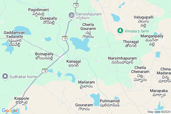
Turkapally Map
EDIT Map
Add Your House
 ..
..
Current Corona Virus Infected Patients Count in Nalgonda District
| City Name | District Name | Total Covid cases |
|---|---|---|
| Suryapet District | Suryapet | 72 |
| Nalgonda District | Nalgonda | 15 |
Locality Name :
Turkapally
( తుర్కపల్లి )
Mandal Name : Kanagal
District : Nalgonda
State : Telangana
Region : Telangana
Language : Telugu and Urdu
Current Time 04:32 AM
Date: Saturday , Apr 26,2025 (IST)
Time zone: IST (UTC+5:30)
Elevation / Altitude: 224 meters. Above Seal level
Telephone Code / Std Code: 08682
Assembly constituency : Nalgonda assembly constituency
Assembly MLA : Komati Reddy Venkat Reddy
Lok Sabha constituency : Nalgonda parliamentary constituency
Parliament MP : UTTAM KUMAR REDDY NALAMADA
Serpanch Name :
Pin Code : 508266
Post Office Name : Pedavoora
Alternate Village Name : Thurkapally
Commodities Prices : Venkateswarnagar Market / Mandi
Turkapally Live Weather
Temperature: 29.2 °C
broken clouds
Humidity: 57%
Wind : 4.74 mt/sec towards SE
StationName : "Nalgonda"
observed on Now
Temperature: 29.2 °C
broken clouds
Humidity: 57%
Wind : 4.74 mt/sec towards SE
StationName : "Nalgonda"
observed on Now
Turkapally Weather Forecast for Next 5 days
27-04-2025
28.2°C to 40.0°C
overcast clouds, broken clouds, scattered clouds
28.2°C to 40.0°C
overcast clouds, broken clouds, scattered clouds
28-04-2025
27.7°C to 36.9°C
overcast clouds, broken clouds
27.7°C to 36.9°C
overcast clouds, broken clouds
29-04-2025
27.0°C to 41.0°C
broken clouds, scattered clouds, clear sky, overcast clouds, few clouds
27.0°C to 41.0°C
broken clouds, scattered clouds, clear sky, overcast clouds, few clouds
30-04-2025
27.2°C to 41.5°C
few clouds, clear sky, broken clouds, scattered clouds
27.2°C to 41.5°C
few clouds, clear sky, broken clouds, scattered clouds
Rivers Near Turkapally
Musi River
Musi River
About Turkapally
Correct below Info and add more info about TurkapallyTurkapally is a Village in Kanagal Mandal in Nalgonda District of Telangana State, India. It belongs to Telangana region . It is located 13 KM towards South from District head quarters Nalgonda.
Turkapally Pin code is 508266 and postal head office is Pedavoora .
Turkapally is surrounded by Nalgonda Mandal towards North , Gurrampode Mandal towards west , Anumula Mandal towards South , Thipparthi Mandal towards East .
Miryalaguda , Devarakonda , Suryapet , Macherla are the near by Cities to Turkapally.
Turka Palle 2011 Census Details
Turkapally Local Language is Telugu. Turka Palle Village Total population is 1052 and number of houses are 266. Female Population is 48.6%. Village literacy rate is 51.1% and the Female Literacy rate is 21.0%.
Population
| Census Parameter | Census Data |
| Total Population | 1052 |
| Total No of Houses | 266 |
| Female Population % | 48.6 % ( 511) |
| Total Literacy rate % | 51.1 % ( 538) |
| Female Literacy rate | 21.0 % ( 221) |
| Scheduled Tribes Population % | 0.0 % ( 0) |
| Scheduled Caste Population % | 31.4 % ( 330) |
| Working Population % | 61.6 % |
| Child(0 -6) Population by 2011 | 125 |
| Girl Child(0 -6) Population % by 2011 | 42.4 % ( 53) |
Turka Palle Census More Deatils.
Politics in Turkapally
CPM , TDP , TRS , INC are the major political parties in this area.Polling Stations /Booths near Turkapally
1)Kanagal2)Kanagal
3)Kakula Kondaram
4)Telakantigudem H/o Kanagal
5)Bachanna Gudem H/o G. Yada Velly
HOW TO REACH Turkapally
By Road
Nalgonda is the Nearest Town to Turkapally. Nalgonda is 25 km from Turkapally. Road connectivity is there from Nalgonda to Turkapally.By Rail
There is no railway station near to Turkapally in less than 10 km. How ever there are railway Stations from Near By town Nalgonda. are the railway Stations near to Nalgonda. You can reach from Nalgonda to Turkapally by road after .Colleges near Turkapally
Sri Bhuvana [inc] Jr College M Turkapally
Address : Sri Bhuvana [inc] Jr College M Turkapally
Schools near Turkapally
Kgbv Kanagal
Address : kangal , kanagal , nalgonda , Andhra Pradesh . PIN- 508255 , Post - Chandur (Nalgonda)
Sri Venkateshwara Hs
Address : kangal , kanagal , nalgonda , Andhra Pradesh . PIN- 508255 , Post - Chandur (Nalgonda)
Zphs Dorepally
Address : dorepalle , kanagal , nalgonda , Andhra Pradesh . PIN- 508004 , Post - Slbc
Zphs Kurampally
Address : regatla , kanagal , nalgonda , Andhra Pradesh . PIN- 508255 , Post - Chandur (Nalgonda)
Govt Health Centers near Turkapally
1) Primary Health Centre, Kangal , , S.C. Colony , PHC2) SubCentre, Kanagal , , S.C. Colony , PHC
3) SubCentre, Parvathagiri , , G.P. Line , Near G.P
Sub Villages in Turkapally
Hospitals in Turkapally,Kanagal
Sujani Sowmya Ploy Clinic
SH 2; Nilagiri Colony; Nalgonda; Telangana 508004; India
12.0 KM distance Detail
Leprosy Health Center
Mella Duppalapally Rd; Sai Nagar; Nalgonda; Telangana 508001; India
12.1 KM distance Detail
more ..
Petrol Bunks in Turkapally,Kanagal
M/s Laxmi Raghava Filling Station-Indian Oil Petrol Pump
S.Lingotam; Nalgonda; NH-565; Nalgonda Sagar Road; Nalgonda; Nalgonda; Telangana 508001; India
5.3 KM distance Detail
more ..
Colleges in Turkapally,Kanagal
Pope Paul VI Junior College
POPE PAUL VI JUNIOR COLLEGE MAMILLAGUDA;OPP SLBC; NALGONDA ; Mamillaguda; Andhra Pradesh; Nagarjuna Sagar Road; Telangana Region; GV Gudem; Telangana 508004; India
10.2 KM distance Detail
Vijetha Junior College
Nilagiri Colony; Nalgonda; NH-565; Nalgonda Sagar Road; Nalgonda; Nalgonda; Telangana 508001; India
12.1 KM distance Detail
more ..
Electronic Shops in Turkapally,Kanagal
Friends Net Zone
GV Gudem Rd; Shasthri Nagar; Chaitanyapuri Colony; Nalgonda; Telangana 508004; India
11.9 KM distance Detail
R.v.enterprses
H.o.Beside Swapna Agencies; GV Gudem Rd; Nalgonda; Telangana 508001; India
12.5 KM distance Detail
Super Markets in Turkapally,Kanagal
Apna super bazar
Abbasia Colony; Sai Nagar; Nalgonda; Telangana 508001; India
12.6 KM distance Detail
Om Sai Kiranam & General Stores
Annadurai Nagar; Nalgonda; Telangana 508001; India
13.3 KM distance Detail
Local Parks in Turkapally,Kanagal
Ganesh Youth Park
APHB Colony; Madhava Nagar; Nalgonda; Telangana 508001; India
13.7 KM distance Detail
Police Stations near Turkapally,Kanagal
1 Town Police station
Indira Rd; Shanthi Nagar; Nalgonda; Telangana 508001; India
14.0 KM distance Detail
Women Police Station
Miryalaguda Rd; Hitech Colony; GollaGuda; Nalgonda; Telangana 508004; India
14.3 KM distance Detail
Governement Offices near Turkapally,Kanagal
Panchayati Raj Engineering Department; Regional Office
Sagar Rd; Nilagiri Colony; Nalgonda; Telangana 508004; India
11.3 KM distance Detail
MeeSeva Center
2-67;main road;ramalayam temple;koppole(V);gurrompode(M);nalgonda(D); Koppole; Telangana 508256; India
11.7 KM distance Detail
About Turkapally &
History
How to reach Turkapally
Tourist Places Near By Turkapally
Schools in Turkapally
Colleges in Turkapally
Temperature & weather of Turkapally
places in Turkapally
Turkapally photos
More Information
How to reach Turkapally
Tourist Places Near By Turkapally
Schools in Turkapally
Colleges in Turkapally
Temperature & weather of Turkapally
places in Turkapally
Turkapally photos
More Information
Village Talk
Post News or Events about this Village
Near Cities
Miryalaguda 44 KM near
Devarakonda 49 KM near
Suryapet 51 KM near
Macherla 63 KM near
Miryalaguda 44 KM near
Devarakonda 49 KM near
Suryapet 51 KM near
Macherla 63 KM near
Near By Taluks
Kanagal 0 KM near
Nalgonda 13 KM near
Gurrampode 18 KM near
Anumula 22 KM near
Kanagal 0 KM near
Nalgonda 13 KM near
Gurrampode 18 KM near
Anumula 22 KM near
Near By Air Ports
Rajiv Gandhi International Airport 102 KM near
Vijayawada Airport 194 KM near
Rajahmundry Airport 309 KM near
Nanded Airport 358 KM near
Rajiv Gandhi International Airport 102 KM near
Vijayawada Airport 194 KM near
Rajahmundry Airport 309 KM near
Nanded Airport 358 KM near
Near By Tourist Places
Nagarjunsagar 48 KM near
Nagarjunakonda 81 KM near
Hyderabad 103 KM near
Khammam 116 KM near
Srisailam 117 KM near
Nagarjunsagar 48 KM near
Nagarjunakonda 81 KM near
Hyderabad 103 KM near
Khammam 116 KM near
Srisailam 117 KM near
Near By Districts
Nalgonda 12 KM near
Hyderabad 108 KM near
Khammam 116 KM near
Warangal 135 KM near
Nalgonda 12 KM near
Hyderabad 108 KM near
Khammam 116 KM near
Warangal 135 KM near
Near By RailWay Station
Nalgonda Rail Way Station 15 KM near
Miryalaguda Rail Way Station 37 KM near
Nalgonda Rail Way Station 15 KM near
Miryalaguda Rail Way Station 37 KM near