| Home | City Bus | Maps | Villages | Cities | Rail | Tourist Places | School | College | Pin Codes | Corona Cases Count |
| Distance Calculator Bus Services IFSC Codes Trace Mobile Number Weather Search Place Trace IP Available Cash ATM/Banks Locate Polling Booth Report an Error contact People |
Babulthanda
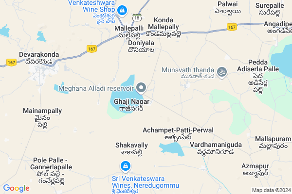
Babulthanda Map
EDIT Map
Add Your House
 ..
..
Current Corona Virus Infected Patients Count in Nalgonda District
| City Name | District Name | Total Covid cases |
|---|---|---|
| Suryapet District | Suryapet | 72 |
| Nalgonda District | Nalgonda | 15 |
Locality Name :
Babulthanda
( బాబులతండా )
Mandal Name : Devarakonda
District : Nalgonda
State : Telangana
Region : Telangana
Language : Telugu and Urdu
Current Time 12:28 PM
Date: Friday , Mar 14,2025 (IST)
Time zone: IST (UTC+5:30)
Elevation / Altitude: 224 meters. Above Seal level
Telephone Code / Std Code: 08691
Assembly constituency : Devarakonda assembly constituency
Assembly MLA : Balu Naik Nenavath
Lok Sabha constituency : Nalgonda parliamentary constituency
Parliament MP : UTTAM KUMAR REDDY NALAMADA
Serpanch Name :
Pin Code : 508243
Post Office Name : Kondamallepalli
Main Village Name : Pendlipakala
Commodities Prices : Devarkonda(Mallepalli) Market / Mandi
Banyathanda Live Weather
Temperature: 37.4 °C
clear sky
Humidity: 17%
Wind : 1.96 mt/sec towards E
StationName : "Devarkonda"
observed on now
Temperature: 37.4 °C
clear sky
Humidity: 17%
Wind : 1.96 mt/sec towards E
StationName : "Devarkonda"
observed on now
Banyathanda Weather Forecast for Next 5 days
15-03-2025
26.8°C to 38.9°C
few clouds, clear sky
26.8°C to 38.9°C
few clouds, clear sky
16-03-2025
24.9°C to 38.5°C
clear sky, few clouds
24.9°C to 38.5°C
clear sky, few clouds
17-03-2025
25.6°C to 39.1°C
clear sky, scattered clouds, broken clouds, overcast clouds
25.6°C to 39.1°C
clear sky, scattered clouds, broken clouds, overcast clouds
18-03-2025
25.2°C to 39.1°C
few clouds, clear sky
25.2°C to 39.1°C
few clouds, clear sky
19-03-2025
24.8°C to 39.6°C
clear sky, scattered clouds, few clouds
24.8°C to 39.6°C
clear sky, scattered clouds, few clouds
National Highways Reachable To Babulthanda
Nationa High Way :NH167
Nationa High Way :NH167
Rivers Near Babulthanda
Krishna :クリシュナ :ಕೃಷ್ಣಾ :कृष्णा :కృష్ణా
Dindi
Krishna :クリシュナ :ಕೃಷ್ಣಾ :कृष्णा :కృష్ణా
Dindi
About Babulthanda
Correct below Info and add more info about BabulthandaBabulthanda is a small Village/hamlet in Devarakonda Mandal in Nalgonda District of Telangana State, India. It comes under Pendlipakala Panchayath. It belongs to Telangana region . It is located 59 KM towards South from District head quarters Nalgonda. 7 KM from Deverkonda.
Babulthanda Pin code is 508243 and postal head office is Kondamallepalli .
Babulthanda is surrounded by Pedda Adiserla Pally Mandal towards East , Chandampet Mandal towards South , Gundlapally (Dindi) Mandal towards west , Nampally Mandal towards North .
Devarakonda , Macherla , Srisailam Project (Right Flank Colony) Township , Miryalaguda are the near by Cities to Babulthanda.
Demographics of Babulthanda
Telugu is the Local Language here. Total population of Babulthanda is 2477 .Males are 1271 and Females are 1,206 living in 511 Houses. Total area of Babulthanda is 1616 hectares.Politics in Babulthanda
INC , TDP , TRS , CPI , INC are the major political parties in this area.Polling Stations /Booths near Babulthanda
1)Peddamunigala2)Pendli Pakala
3)Chintha Kuntla
4)Chintapalli
5)Vadthya Tanda Majira Gaji Nagar
HOW TO REACH Babulthanda
By Road
Nalgonda is the Nearest Town to Babulthanda. Nalgonda is 60 km from Babulthanda. Road connectivity is there from Nalgonda to Babulthanda.By Rail
There is no railway station near to Babulthanda in less than 10 km. How ever there are railway Stations from Near By town Nalgonda. are the railway Stations near to Nalgonda. You can reach from Nalgonda to Babulthanda by road after .Colleges near Babulthanda
Sri Kranthi Junior College
Address :
Sanjeevini Degree College
Address : Konda Mallepally (p&m), Sagar Road, Devarakonda -
Schools near Babulthanda
Briliyant Hs Dvk
Address : devarkonda , devarakonda , nalgonda , Andhra Pradesh . PIN- 508248 , Post - Gandhinagar (Nalgonda)
Sri Krishnaveni Talent Hs
Address : kondamalla palli , devarakonda , nalgonda , Andhra Pradesh . PIN- 508243 , Post - Kondamallepalli
Adharsha Hs
Address : kondamalla palli , devarakonda , nalgonda , Andhra Pradesh . PIN- 580248
Adarsha V Hs
Address : kolmunthal pahad , devarakonda , nalgonda , Andhra Pradesh . PIN- 508248 , Post - Gandhinagar (Nalgonda)
Govt Health Centers near Babulthanda
1) SubCentre, Pendlipakala , 10-Feb , Auto Stand , Near Post Office2) SubCentre, Gazinagar , Feb-72 , Main Road , SC Colony
3) SubCentre, Chinthakuntla , Jan-95 , Chinthakuntla , Near GP
Petrol Bunks in Babulthanda,Devarakonda
Muralichikan Marketing
Nagarjuna Sagar Rd; Mallepalli; Telangana 508243; India
5.5 KM distance Detail
Sri Venkateswara Filling Station Indian Oil Petrol
Konda Malle Palli; Nalgonda; SH-19; Hyderabad Nagarjuna Sagar Road; Devarakonda; Devarakonda; Telangana 508243; India
5.7 KM distance Detail
indian Oil Petrol Station
Kondamallepally To nagarajuna sagar road; Telangana; India
5.7 KM distance Detail
more ..
Colleges in Babulthanda,Devarakonda
Mohammedans College Of Diploma In Engineering And Technology
Vuppu Vagu; Devarakonda; Gazinagar; Telangana 508248; India
1.3 KM distance Detail
more ..
Schools in Babulthanda,Devarakonda
Nagarjuna Grammar Concept School;km Pally;telangana
Mallepalli; Telangana 508243; India
5.4 KM distance Detail
Vijayameri High school
Sharada High School Rd; Mallepalli; Telangana 508243; India
5.6 KM distance Detail
Chaitanya Bharathi High School
Nagarjuna sagar road;Konada mallepalli; Miryalaguda Rd; Kondamallapalle; Telangana 508243; India
5.7 KM distance Detail
Super Markets in Babulthanda,Devarakonda
subramanyeshwara Traders
Nagarjuna Sagar Rd; Mallepalli; Telangana 508243; India
6.0 KM distance Detail
Sri Lakshmi Narsimha Kirana & General Stores
5-91(5-224) X; Mallepalli Bus Stand Road; 508243; India
6.1 KM distance Detail
Governement Offices near Babulthanda,Devarakonda
MeeSeva Center
shop no:4;beside maharshi photo studio;kondamallapally(V);devarakonda(m); Miryalaguda Rd; Mallepalli; Telangana 508243; India
6.3 KM distance Detail
MeeSeva Center
kanishka dtp & xerox center mainroad;chandampet 3-54; Neredugommu; 508248; India
6.8 KM distance Detail
About Babulthanda &
History
How to reach Babulthanda
Tourist Places Near By Babulthanda
Schools in Babulthanda
Colleges in Babulthanda
Temperature & weather of Babulthanda
places in Babulthanda
Babulthanda photos
More Information
How to reach Babulthanda
Tourist Places Near By Babulthanda
Schools in Babulthanda
Colleges in Babulthanda
Temperature & weather of Babulthanda
places in Babulthanda
Babulthanda photos
More Information
Village Talk
Post News or Events about this Village
Near Cities
Devarakonda 8 KM near
Macherla 58 KM near
Srisailam Project (Right Flank Colony) Township 74 KM near
Miryalaguda 76 KM near
Devarakonda 8 KM near
Macherla 58 KM near
Srisailam Project (Right Flank Colony) Township 74 KM near
Miryalaguda 76 KM near
Near By Taluks
Devarakonda 6 KM near
Pedda Adiserla Pally 12 KM near
Chandampet 13 KM near
Gundlapally (Dindi) 23 KM near
Devarakonda 6 KM near
Pedda Adiserla Pally 12 KM near
Chandampet 13 KM near
Gundlapally (Dindi) 23 KM near
Near By Air Ports
Rajiv Gandhi International Airport 97 KM near
Vijayawada Airport 216 KM near
Rajahmundry Airport 341 KM near
Latur Airport 369 KM near
Rajiv Gandhi International Airport 97 KM near
Vijayawada Airport 216 KM near
Rajahmundry Airport 341 KM near
Latur Airport 369 KM near
Near By Tourist Places
Nagarjunsagar 41 KM near
Srisailam 75 KM near
Nagarjunakonda 105 KM near
Hyderabad 107 KM near
Kurnool 154 KM near
Nagarjunsagar 41 KM near
Srisailam 75 KM near
Nagarjunakonda 105 KM near
Hyderabad 107 KM near
Kurnool 154 KM near
Near By Districts
Nalgonda 56 KM near
Hyderabad 113 KM near
Mahbubnagar 119 KM near
Rangareddi 130 KM near
Nalgonda 56 KM near
Hyderabad 113 KM near
Mahbubnagar 119 KM near
Rangareddi 130 KM near
Near By RailWay Station
Nalgonda Rail Way Station 59 KM near
Miryalaguda Rail Way Station 69 KM near
Nalgonda Rail Way Station 59 KM near
Miryalaguda Rail Way Station 69 KM near