| Home | City Bus | Maps | Villages | Cities | Rail | Tourist Places | School | College | Pin Codes | Corona Cases Count |
| Distance Calculator Bus Services IFSC Codes Trace Mobile Number Weather Search Place Trace IP Available Cash ATM/Banks Locate Polling Booth Report an Error contact People |
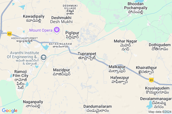
Toopranpet
Toopranpet Map
EDIT Map
Add Your House
 ..
..
Current Corona Virus Infected Patients Count in Nalgonda District
| City Name | District Name | Total Covid cases |
|---|---|---|
| Suryapet District | Suryapet | 72 |
| Nalgonda District | Nalgonda | 15 |
Locality Name :
Toopranpet
( తూప్రాన్గాపేట్ )
Mandal Name : Choutuppal
District : Nalgonda
State : Telangana
Region : Telangana
Language : Telugu and Urdu
Current Time 10:27 AM
Date: Wednesday , Apr 30,2025 (IST)
Time zone: IST (UTC+5:30)
Elevation / Altitude: 317 meters. Above Seal level
Telephone Code / Std Code: 08414
Assembly constituency : Munugode assembly constituency
Assembly MLA : Komatireddy Raj Gopal Reddy
Lok Sabha constituency : Bhongir parliamentary constituency
Parliament MP : Komati Reddy Venkat Reddy
Serpanch Name :
Pin Code : 508252
Post Office Name : Choutupala
Alternate Village Name : Tupranpet
Commodities Prices : Ibrahimputnam Market / Mandi
Toopranpet Live Weather
Temperature: 28.6 °C
few clouds
Humidity: 56%
Wind : 2.05 mt/sec towards E
StationName : "Gūdūr"
observed on 2 Hours Back
Temperature: 28.6 °C
few clouds
Humidity: 56%
Wind : 2.05 mt/sec towards E
StationName : "Gūdūr"
observed on 2 Hours Back
Toopranpet Weather Forecast for Next 5 days
01-05-2025
26.8°C to 39.9°C
scattered clouds, broken clouds, few clouds
26.8°C to 39.9°C
scattered clouds, broken clouds, few clouds
02-05-2025
25.6°C to 40.8°C
few clouds, scattered clouds, clear sky, broken clouds
25.6°C to 40.8°C
few clouds, scattered clouds, clear sky, broken clouds
03-05-2025
26.5°C to 40.6°C
scattered clouds, clear sky, few clouds, light rain, broken clouds
26.5°C to 40.6°C
scattered clouds, clear sky, few clouds, light rain, broken clouds
04-05-2025
25.7°C to 40.6°C
scattered clouds, clear sky, few clouds, broken clouds
25.7°C to 40.6°C
scattered clouds, clear sky, few clouds, broken clouds
05-05-2025
27.9°C to 37.7°C
light rain, few clouds, scattered clouds, overcast clouds, broken clouds, clear sky
27.9°C to 37.7°C
light rain, few clouds, scattered clouds, overcast clouds, broken clouds, clear sky
Edit below overview about Toopranpet
Edit below overview about Toopranpet
OverView of Toopranpet
choutuppal mandal to malkapur village bus root diatance in ashok institute of engineering technologyEdit below overview about Toopranpet
National Highways Reachable To Toopranpet
Nationa High Way :NH765
Nationa High Way :NH65
Nationa High Way :NH765
Nationa High Way :NH65
About Toopranpet
Toopranpet is a Village in Choutuppal Mandal in Nalgonda District of Telangana State, India. It belongs to Telangana region . It is located 69 KM towards west from District head quarters Nalgonda. 18 KM from Choutuppal.
Toopranpet Pin code is 508252 and postal head office is Choutupala .
Malkapur ( 4 KM ) , Meharnagar ( 5 KM ) , Deshmukhi ( 6 KM ) , Jalalpur ( 7 KM ) , Peddaravulapally ( 10 KM ) are the nearby Villages to Toopranpet. Toopranpet is surrounded by Hayathnagar Mandal towards west , Choutuppal Mandal towards East , Ibrahimpatnam Mandal towards west , Manchal Mandal towards South .
Bhongir , Hyderabad , Jangaon , Farooqnagar are the near by Cities to Toopranpet.
Tupranpet 2011 Census Details
Toopranpet Local Language is Telugu. Tupranpet Village Total population is 1501 and number of houses are 360. Female Population is 44.8%. Village literacy rate is 57.4% and the Female Literacy rate is 19.9%.
Population
| Census Parameter | Census Data |
| Total Population | 1501 |
| Total No of Houses | 360 |
| Female Population % | 44.8 % ( 672) |
| Total Literacy rate % | 57.4 % ( 862) |
| Female Literacy rate | 19.9 % ( 299) |
| Scheduled Tribes Population % | 0.2 % ( 3) |
| Scheduled Caste Population % | 13.6 % ( 204) |
| Working Population % | 47.2 % |
| Child(0 -6) Population by 2011 | 175 |
| Girl Child(0 -6) Population % by 2011 | 50.3 % ( 88) |
Tupranpet Census More Deatils.
Politics in Toopranpet
TDP , TRS , CPI , INC are the major political parties in this area.Polling Stations /Booths near Toopranpet
1)Thungapadu2)Mahmmadaabadu
3)Malkapuram
4)Malkapur
5)Kethepalli
HOW TO REACH Toopranpet
By Road
Hyderabad is the Nearest Town to Toopranpet. Hyderabad is 31 km from Toopranpet. Road connectivity is there from Hyderabad to Toopranpet.By Rail
There is no railway station near to Toopranpet in less than 10 km. How ever there are railway Stations from Near By town Hyderabad. are the railway Stations near to Hyderabad. You can reach from Hyderabad to Toopranpet by road after .Colleges near Toopranpet
New Netaji Institute Of Technology
Address : Toopranpet, Near Ramoji Film City, Choutuppal (m)
Schools in Toopranpet
Zphs Tupranpet
Address : tupranpet , choutuppal , nalgonda , Andhra Pradesh . PIN- 508252 , Post - Choutupala
Govt Health Centers near Toopranpet
1) SubCentre Batasingaram , Govt Building , Batasingaram , Beside ZPHS2) SubCentre, Dhandu Malkapur , 03,-44 , CHURCH AREA , Near Church
3) SubCentre, Jalalapur , 02.-83 , Rmananda Theartha area , Back Line of Primary School
Hospitals in Toopranpet,Choutuppal
Ganesh Bone Setting
H.No: 6-4/4; RamNagar; Bhoodan Pochampally; Telangana 508284; India
10.0 KM distance Detail
more ..
Petrol Bunks in Toopranpet,Choutuppal
B.S.Filling Station-Bharat Petroleum
Malkapuram; Nalgonda; NH-9; Vijayawada Hyderabad Road; Choutuppal; Choutuppal; Telangana 508252; India
3.7 KM distance Detail
Reliance Petroleum
SY.NO.69 (P); 70(P); NH9; VILLAGE & POST MALKAPUR; CHOUTTUPAL MANDAL;; Peddamberpet; Telangana 508252; India
5.0 KM distance Detail
more ..
Colleges in Toopranpet,Choutuppal
Dhruva Institute Of Engineering And Technology
Nalgonda; Telangana 508252; India
1.0 KM distance Detail
more ..
Schools in Toopranpet,Choutuppal
Pradhamika Unatha Patashala
National Highway 9; Toopranpet; Telangana 508252; India
0.3 KM distance Detail
Super Markets in Toopranpet,Choutuppal
Panduranga General Stores & Stationery Gifts
Bhoodan Pochampally; Telangana 508284; India
10.7 KM distance Detail
Governement Offices near Toopranpet,Choutuppal
Sri Thirumala Transport
Bhoodan Pochard ally; District -Nalgonda; hyderabad; Telangana 508284; India
8.7 KM distance Detail
MeeSeva Center
laxmi sai online services;markandeya temple;pochampally; 7-7; M. G Rd; Bhoodhan Pochampally; Telangana 508284; India
10.5 KM distance Detail
Sravani Xerox
Padma Nagar Colony; Bhoodan Pochampally; District; Hyderabad; Telangana 508284; India
10.7 KM distance Detail
About Toopranpet &
History
How to reach Toopranpet
Tourist Places Near By Toopranpet
Schools in Toopranpet
Colleges in Toopranpet
Temperature & weather of Toopranpet
places in Toopranpet
Toopranpet photos
More Information
How to reach Toopranpet
Tourist Places Near By Toopranpet
Schools in Toopranpet
Colleges in Toopranpet
Temperature & weather of Toopranpet
places in Toopranpet
Toopranpet photos
More Information
Village Talk
Post News or Events about this Village
Near Cities
Bhongir 31 KM near
Hyderabad 35 KM near
Jangaon 71 KM near
Farooqnagar 71 KM near
Bhongir 31 KM near
Hyderabad 35 KM near
Jangaon 71 KM near
Farooqnagar 71 KM near
Near By Taluks
Pochampally 12 KM near
Hayathnagar 12 KM near
Choutuppal 17 KM near
Ibrahimpatnam 19 KM near
Pochampally 12 KM near
Hayathnagar 12 KM near
Choutuppal 17 KM near
Ibrahimpatnam 19 KM near
Near By Air Ports
Rajiv Gandhi International Airport 39 KM near
Vijayawada Airport 260 KM near
Nanded Airport 291 KM near
Latur Airport 305 KM near
Rajiv Gandhi International Airport 39 KM near
Vijayawada Airport 260 KM near
Nanded Airport 291 KM near
Latur Airport 305 KM near
Near By Tourist Places
Hyderabad 34 KM near
Nagarjunsagar 111 KM near
Medak 111 KM near
Warangal 133 KM near
Nagarjunakonda 150 KM near
Hyderabad 34 KM near
Nagarjunsagar 111 KM near
Medak 111 KM near
Warangal 133 KM near
Nagarjunakonda 150 KM near
Near By Districts
Hyderabad 39 KM near
Nalgonda 66 KM near
Rangareddi 78 KM near
Medak 90 KM near
Hyderabad 39 KM near
Nalgonda 66 KM near
Rangareddi 78 KM near
Medak 90 KM near
Near By RailWay Station
Charlapalli Rail Way Station 27 KM near
Moula Ali Rail Way Station 31 KM near
Charlapalli Rail Way Station 27 KM near
Moula Ali Rail Way Station 31 KM near