| Home | City Bus | Maps | Villages | Cities | Rail | Tourist Places | School | College | Pin Codes | Corona Cases Count |
| Distance Calculator Bus Services IFSC Codes Trace Mobile Number Weather Search Place Trace IP Available Cash ATM/Banks Locate Polling Booth Report an Error contact People |
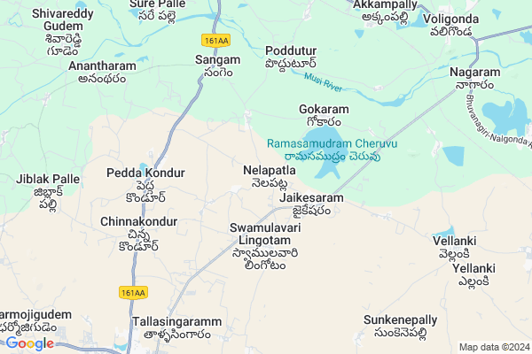
Nelapatla
Nelapatla Map
EDIT Map
Add Your House
 ..
..
Current Corona Virus Infected Patients Count in Nalgonda District
| City Name | District Name | Total Covid cases |
|---|---|---|
| Suryapet District | Suryapet | 72 |
| Nalgonda District | Nalgonda | 15 |
Locality Name :
Nelapatla
( నేలపట్ల )
Mandal Name : Choutuppal
District : Nalgonda
State : Telangana
Region : Telangana
Language : Telugu and Urdu
Current Time 04:45 AM
Date: Saturday , Apr 19,2025 (IST)
Time zone: IST (UTC+5:30)
Elevation / Altitude: 317 meters. Above Seal level
Telephone Code / Std Code: 08414
Assembly constituency : Munugode assembly constituency
Assembly MLA : Komatireddy Raj Gopal Reddy
Lok Sabha constituency : Bhongir parliamentary constituency
Parliament MP : Komati Reddy Venkat Reddy
Serpanch Name :
Pin Code : 508252
Post Office Name : Choutupala
Commodities Prices : Voligonda Market / Mandi
Nelapatla Live Weather
Temperature: 27.6 °C
scattered clouds
Humidity: 62%
Wind : 2.81 mt/sec towards S
StationName : "Bhongīr"
observed on Now
Temperature: 27.6 °C
scattered clouds
Humidity: 62%
Wind : 2.81 mt/sec towards S
StationName : "Bhongīr"
observed on Now
Nelapatla Weather Forecast for Next 5 days
20-04-2025
27.6°C to 39.5°C
scattered clouds, broken clouds, few clouds, light rain
27.6°C to 39.5°C
scattered clouds, broken clouds, few clouds, light rain
21-04-2025
29.2°C to 41.3°C
broken clouds, scattered clouds, clear sky, light rain, overcast clouds
29.2°C to 41.3°C
broken clouds, scattered clouds, clear sky, light rain, overcast clouds
22-04-2025
29.4°C to 41.5°C
broken clouds, scattered clouds, few clouds, clear sky
29.4°C to 41.5°C
broken clouds, scattered clouds, few clouds, clear sky
23-04-2025
28.1°C to 42.7°C
clear sky
28.1°C to 42.7°C
clear sky
National Highways Reachable To Nelapatla
Nationa High Way :NH765
Nationa High Way :NH65
Nationa High Way :NH765
Nationa High Way :NH65
About Nelapatla
Correct below Info and add more info about NelapatlaNelapatla is a Village in Choutuppal Mandal in Nalgonda District of Telangana State, India. It belongs to Telangana region . It is located 52 KM towards west from District head quarters Nalgonda. 8 KM from Choutuppal.
Nelapatla Pin code is 508252 and postal head office is Choutupala .
Jaikesaram ( 2 KM ) , Gokaram ( 3 KM ) , Peddakondur ( 4 KM ) , Sarinenigudem ( 5 KM ) , Sangem ( 6 KM ) are the nearby Villages to Nelapatla. Nelapatla is surrounded by Valigonda Mandal towards East , Pochampally Mandal towards west , Ramannapeta Mandal towards East , Chityala Mandal towards East .
Bhongir , Jangaon , Hyderabad , Devarakonda are the near by Cities to Nelapatla.
Nelapatla 2011 Census Details
Nelapatla Local Language is Telugu. Nelapatla Village Total population is 3052 and number of houses are 747. Female Population is 48.7%. Village literacy rate is 62.3% and the Female Literacy rate is 25.1%.
Population
| Census Parameter | Census Data |
| Total Population | 3052 |
| Total No of Houses | 747 |
| Female Population % | 48.7 % ( 1486) |
| Total Literacy rate % | 62.3 % ( 1901) |
| Female Literacy rate | 25.1 % ( 766) |
| Scheduled Tribes Population % | 1.0 % ( 29) |
| Scheduled Caste Population % | 5.1 % ( 157) |
| Working Population % | 49.2 % |
| Child(0 -6) Population by 2011 | 303 |
| Girl Child(0 -6) Population % by 2011 | 53.5 % ( 162) |
Nelapatla Census More Deatils.
Politics in Nelapatla
TDP , TRS , CPI , INC are the major political parties in this area.Polling Stations /Booths near Nelapatla
1)Navillagudem Majira Pedda Puram2)Koyyala Gudem
3)Ipparthi
4)Jaikesaaram
5)Reddybavi
HOW TO REACH Nelapatla
By Road
Nalgonda is the Nearest Town to Nelapatla. Nalgonda is 58 km from Nelapatla. Road connectivity is there from Nalgonda to Nelapatla.By Rail
Valigonda Rail Way Station is the very nearby railway stations to Nelapatla. Also you can consider railway Stations from Near By town Nalgonda. Nalgonda Rail Way Station , Shrirampuram Rail Way Station are the railway Stations near to Nalgonda. You can reach from Nalgonda to Nelapatla by road after .Colleges near Nelapatla
Arabindo Jr College Choutuppal
Address : Arabindo Jr College Choutuppal
Mathrusri Jr College Choutuppal
Address : Mathrusri Jr College Choutuppal
New Chanukya (g) Jr Coll? Choutuppal
Address : New Chanukya (g) Jr Coll? Choutuppal
Chaitanya Junior College Choutuppal
Address : Chaitanya Junior College Choutuppal
Mathrusree Degree College
Address : Sy.no.211/a, 212/a, Gundhipark, Choutuppal, Nalgo
Schools in Nelapatla
Zphs Kuntlagudem
Address : nelapatla , choutuppal , nalgonda , Andhra Pradesh . PIN- 508252 , Post - Choutupala
Zphs Nelapatla
Address : nelapatla , choutuppal , nalgonda , Andhra Pradesh . PIN- 508252 , Post - Choutupala
Govt Health Centers near Nelapatla
1) SubCentre, Kuntlagudem , 1.-99/3 , GP AREA , Beside G.P Office2) SubCentre, Jaikesaram , 02.-48 , BC COLONY , Beside G.P Office
3) SubCentre, Varkatpally , House. No.2-40 , RAMULAVARIVEEDI , NEAR RAMALAYAM
Sub Villages in Nelapatla
Petrol Bunks in Nelapatla,Choutuppal
UDAYA SAI FILLING STATION
VALIGONDA VILLAGE; NALGONDA; Telangana 508101; India
10.5 KM distance Detail
Indian Oil Petrol Pump
National Highway 9; Choutuppal; Telangana 508252; India
10.8 KM distance Detail
Gaffar Habib Filling Station-Hindustan Petroleum
Nalgonda; NH-9; Vijayawada Hyderabad Road; Choutuppal; Choutuppal; Telangana 508252; India
11.1 KM distance Detail
more ..
Colleges in Nelapatla,Choutuppal
Sri Gayathri Junior College
Plot No: 1/A; Opp to H.P. Gas; Vidhya Nagar; Choutuppal; Telangana 508252; India
10.4 KM distance Detail
Sree Medha Junior College
House No 1;Valigonda X Choutuppal;; Road; Hyderabad; Telangana 508252; India
10.5 KM distance Detail
Mother Thersa Paramedical college (SKLN & KV Memorial)
Plot No: 3-61/A; Near Gandhi Park; Choutuppal; Telangana 508252; India
10.7 KM distance Detail
more ..
Electronic Shops in Nelapatla,Choutuppal
M.N.WATER SOLUTION
Padma Sali Colony; Swamulavari Lingotam; Telangana 508252; India
3.2 KM distance Detail
Super Markets in Nelapatla,Choutuppal
Laxmi Super Market
Chinna Kondur Road; Choutppal; District; Hyderabad; Telangana 508252; India
10.8 KM distance Detail
Governement Offices near Nelapatla,Choutuppal
MeeSeva Center
1-94;main road valigonda;valigonda(V);valigonda(M);nalgonda(D); Valigonda; Telangana 508112; India
11.4 KM distance Detail
About Nelapatla &
History
How to reach Nelapatla
Tourist Places Near By Nelapatla
Schools in Nelapatla
Colleges in Nelapatla
Temperature & weather of Nelapatla
places in Nelapatla
Nelapatla photos
More Information
How to reach Nelapatla
Tourist Places Near By Nelapatla
Schools in Nelapatla
Colleges in Nelapatla
Temperature & weather of Nelapatla
places in Nelapatla
Nelapatla photos
More Information
Village Talk
Post News or Events about this Village
Near Cities
Bhongir 24 KM near
Jangaon 55 KM near
Hyderabad 56 KM near
Devarakonda 78 KM near
Bhongir 24 KM near
Jangaon 55 KM near
Hyderabad 56 KM near
Devarakonda 78 KM near
Near By Taluks
Choutuppal 8 KM near
Valigonda 12 KM near
Pochampally 15 KM near
Ramannapeta 18 KM near
Choutuppal 8 KM near
Valigonda 12 KM near
Pochampally 15 KM near
Ramannapeta 18 KM near
Near By Air Ports
Rajiv Gandhi International Airport 62 KM near
Vijayawada Airport 241 KM near
Nanded Airport 301 KM near
Latur Airport 324 KM near
Rajiv Gandhi International Airport 62 KM near
Vijayawada Airport 241 KM near
Nanded Airport 301 KM near
Latur Airport 324 KM near
Near By Tourist Places
Hyderabad 55 KM near
Nagarjunsagar 102 KM near
Warangal 115 KM near
Medak 122 KM near
Nagarjunakonda 132 KM near
Hyderabad 55 KM near
Nagarjunsagar 102 KM near
Warangal 115 KM near
Medak 122 KM near
Nagarjunakonda 132 KM near
Near By Districts
Nalgonda 50 KM near
Hyderabad 58 KM near
Rangareddi 100 KM near
Medak 109 KM near
Nalgonda 50 KM near
Hyderabad 58 KM near
Rangareddi 100 KM near
Medak 109 KM near
Near By RailWay Station
Bhongir Rail Way Station 26 KM near
Aler Rail Way Station 41 KM near
Bhongir Rail Way Station 26 KM near
Aler Rail Way Station 41 KM near