| Home | City Bus | Maps | Villages | Cities | Rail | Tourist Places | School | College | Pin Codes | Corona Cases Count |
| Distance Calculator Bus Services IFSC Codes Trace Mobile Number Weather Search Place Trace IP Available Cash ATM/Banks Locate Polling Booth Report an Error contact People |
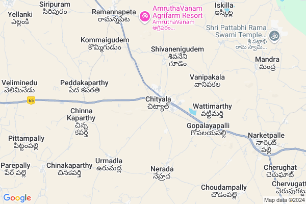
Chityal Map
EDIT Map
Add Your House
 ..
..
Current Corona Virus Infected Patients Count in Nalgonda District
| City Name | District Name | Total Covid cases |
|---|---|---|
| Suryapet District | Suryapet | 72 |
| Nalgonda District | Nalgonda | 15 |
Locality Name :
Chityal
( చిట్యాల )
Mandal Name : Chityala
District : Nalgonda
State : Telangana
Region : Telangana
Language : Telugu and Urdu
Current Time 06:39 AM
Date: Saturday , Apr 26,2025 (IST)
Time zone: IST (UTC+5:30)
Elevation / Altitude: 311 meters. Above Seal level
Telephone Code / Std Code: 08682
Assembly constituency : Nakrekal assembly constituency
Assembly MLA : Vemula Veeresham
Lok Sabha constituency : Bhongir parliamentary constituency
Parliament MP : Komati Reddy Venkat Reddy
Serpanch Name :
Pin Code : 508114
Post Office Name : Chityala
Alternate Village Name : Chityala
Commodities Prices : Chityal Market / Mandi
Chityal Live Weather
Temperature: 27.3 °C
broken clouds
Humidity: 66%
Wind : 4.69 mt/sec towards SE
StationName : "Nalgonda"
observed on Now
Temperature: 27.3 °C
broken clouds
Humidity: 66%
Wind : 4.69 mt/sec towards SE
StationName : "Nalgonda"
observed on Now
Chityal Weather Forecast for Next 5 days
27-04-2025
28.4°C to 40.1°C
broken clouds, few clouds, scattered clouds, overcast clouds
28.4°C to 40.1°C
broken clouds, few clouds, scattered clouds, overcast clouds
28-04-2025
26.5°C to 35.7°C
overcast clouds, broken clouds, scattered clouds, clear sky
26.5°C to 35.7°C
overcast clouds, broken clouds, scattered clouds, clear sky
29-04-2025
25.5°C to 39.6°C
few clouds, overcast clouds, broken clouds, clear sky, scattered clouds
25.5°C to 39.6°C
few clouds, overcast clouds, broken clouds, clear sky, scattered clouds
30-04-2025
25.9°C to 40.7°C
few clouds, clear sky, scattered clouds, light rain
25.9°C to 40.7°C
few clouds, clear sky, scattered clouds, light rain
01-05-2025
27.0°C to 40.5°C
scattered clouds, broken clouds, few clouds, light rain
27.0°C to 40.5°C
scattered clouds, broken clouds, few clouds, light rain
Edit below overview about Chityal
Edit below overview about Chityal
OverView of Chityal
Sarpanches list Emmadi Narsiah Emmadi Krishnamurthy Vellupalli BikshapathiA. MalliahNagesh There are few temples in chityal Shivuni GudiBala Narsimha Temple Kanakadurga GudiSri Shiridi Saibaba Temple Uppalamma Temple.Edit below overview about Chityal
National Highways Reachable To Chityal
Nationa High Way :NH365BB
Nationa High Way :Old NH9
Nationa High Way :NH365BB
Nationa High Way :Old NH9
About Chityal
Chityal is a Town in Chityala Mandal in Nalgonda District of Telangana State, India. It belongs to Telangana region . It is located 29 KM towards North from District head quarters Nalgonda. It is a Mandal head quarter.
Chityal Pin code is 508114 and postal head office is Chityala .
Vanipakala ( 4 KM ) , Vattimarthy ( 4 KM ) , Ramannapet ( 6 KM ) , Urumadla ( 6 KM ) , Janampally ( 6 KM ) are the nearby Villages to Chityal. Chityal is surrounded by Ramannapeta Mandal towards North , Narketpally Mandal towards East , Munugode Mandal towards South , Valigonda Mandal towards North .
Bhongir , Suryapet , Jangaon , Devarakonda are the nearby Cities to Chityal.
Demographics of Chityal
Telugu is the Local Language here. Total population of Chityal is 13296 .Males are 6845 and Females are 6,451 living in 2912 Houses. Total area of Chityal is 1743 hectares.Politics in Chityal
CPM , TDP , TRS , INC are the major political parties in this area.Polling Stations /Booths near Chityal
1)Chityala2)Chippala Pally
3)Chityala
4)Chityala
5)Chityala
HOW TO REACH Chityal
By Road
Nalgonda is the Nearest Town to Chityal. Nalgonda is 28 km from Chityal. Road connectivity is there from Nalgonda to Chityal.By Rail
Chityala Rail Way Station , Ramannapet Rail Way Station are the very nearby railway stations to Chityal. Also you can consider railway Stations from Near By town Nalgonda. Nalgonda Rail Way Station , Shrirampuram Rail Way Station are the railway stations near to Nalgonda. You can reach from Nalgonda to Chityal by road after .Govt Health Centers near Chityal
1) SubCentre, Chityal , 2780 , Chityala Main road , M.Gudem road2) Primary Health Centre, Chityala , 2780 Survey No , Chityala Main road , M.Gudem road
3) SubCentre, Venkatapuram , 10-113 , Venkatapuram , ammavari gudi vedi
Sub Villages in Chityal
Hospitals in Chityal,Chityala
Vishnu Medical And General Stores
Opp: Z. P.H.S; Main Road; Chityala; Telangana 508114; India
0.7 KM distance Detail
Sairam Kiranam/Genaral Store
Nehrada to chityal Rd; Chityala; Telangana 508114; India
0.7 KM distance Detail
Venu Medical General Stores And Xerox
Opp: Highmast Light; Main Road; Chityala; Telangana 508114; India
0.8 KM distance Detail
Bhavani Medical And General Stores
Beside: Nagarjuna Bank; Bhongiri Road; Chityala; Telangana 508114; India
0.8 KM distance Detail
more ..
Petrol Bunks in Chityal,Chityala
Reliance Petroleum
RELIANCE PETROL RETAIL OUTLET;SURVEY NO. 322/A;MILE STONE 81; NH-09;WATTIMARTHI; Chityala; Telangana 508254; India
0.7 KM distance Detail
Rohini Filling Station-Bharat Petroleum
Nalgonda; SH-15; Bhongir Nalgonda Road; Chityala; Chityala; Telangana 508114; India
0.8 KM distance Detail
Mahalaxmi Filling Station-Indian Oil Petrol Pump
Nalgonda; NH-9; Vijayawada Hyderabad Road; Chityala; Chityala; Telangana 508114; India
1.6 KM distance Detail
more ..
Colleges in Chityal,Chityala
Sriram Institute of Technology Solutions Society
Opp : Bus Stand Sai Dwarakapuri Colony; Hyderabad - Vijayawada Hwy; Chityala; Telangana 508114; India
0.6 KM distance Detail
Nalanda Junior College
Nalgonda; SH-15; Bhongir Nalgonda Road; Ramannapeta; Ramannapeta; Telangana 508113; India
7.5 KM distance Detail
more ..
Schools in Chityal,Chityala
Chityala Vanaparthi Dist
Bhuvanagiri-Nalgonda Rd; Chityala; Telangana 508114; India
0.7 KM distance Detail
St.Mary's High School
Bhuvanagiri-Nalgonda Rd; Chityala; Telangana 508114; India
0.9 KM distance Detail
Electronic Shops in Chityal,Chityala
VIJAYALAXMI AUTOMOBAIL
Vijayawada - Hyderabad Hwy; Chityala; Telangana 508114; India
0.6 KM distance Detail
Super Markets in Chityal,Chityala
Ramesh Kirana Shop
Bhuvanagiri-Nalgonda Rd; Chityala; Telangana 508114; India
0.8 KM distance Detail
Governement Offices near Chityal,Chityala
Government Agriculture Committee Office
Nalgonda; NH-9; Vijayawada Hyderabad Road; Chityala; Chityala; Telangana 508114; India
0.6 KM distance Detail
mee seva center
Kankadurga center;chitayala;nalgonda;andhrapradesh; Chityala; Telangana 508114; India
0.8 KM distance Detail
About Chityal &
History
How to reach Chityal
Tourist Places Near By Chityal
Schools in Chityal
Colleges in Chityal
Temperature & weather of Chityal
places in Chityal
Chityal photos
More Information
How to reach Chityal
Tourist Places Near By Chityal
Schools in Chityal
Colleges in Chityal
Temperature & weather of Chityal
places in Chityal
Chityal photos
More Information
Town Talk
Post News or Events about this Town
Near Cities
Bhongir 43 KM near
Suryapet 60 KM near
Jangaon 60 KM near
Devarakonda 71 KM near
Bhongir 43 KM near
Suryapet 60 KM near
Jangaon 60 KM near
Devarakonda 71 KM near
Near By Taluks
Chityala 3 KM near
Ramannapeta 9 KM near
Narketpally 12 KM near
Munugode 20 KM near
Chityala 3 KM near
Ramannapeta 9 KM near
Narketpally 12 KM near
Munugode 20 KM near
Near By Air Ports
Rajiv Gandhi International Airport 82 KM near
Vijayawada Airport 218 KM near
Rajahmundry Airport 321 KM near
Nanded Airport 323 KM near
Rajiv Gandhi International Airport 82 KM near
Vijayawada Airport 218 KM near
Rajahmundry Airport 321 KM near
Nanded Airport 323 KM near
Near By Tourist Places
Hyderabad 77 KM near
Nagarjunsagar 85 KM near
Nagarjunakonda 109 KM near
Warangal 111 KM near
Khammam 122 KM near
Hyderabad 77 KM near
Nagarjunsagar 85 KM near
Nagarjunakonda 109 KM near
Warangal 111 KM near
Khammam 122 KM near
Near By Districts
Nalgonda 28 KM near
Hyderabad 81 KM near
Warangal 108 KM near
Rangareddi 121 KM near
Nalgonda 28 KM near
Hyderabad 81 KM near
Warangal 108 KM near
Rangareddi 121 KM near
Near By RailWay Station
Chityala Rail Way Station 1.1 KM near
Ramannapet Rail Way Station 7.9 KM near
Nalgonda Rail Way Station 28 KM near
Bhongir Rail Way Station 45 KM near
Chityala Rail Way Station 1.1 KM near
Ramannapet Rail Way Station 7.9 KM near
Nalgonda Rail Way Station 28 KM near
Bhongir Rail Way Station 45 KM near