| Home | City Bus | Maps | Villages | Cities | Rail | Tourist Places | School | College | Pin Codes | Corona Cases Count |
| Distance Calculator Bus Services IFSC Codes Trace Mobile Number Weather Search Place Trace IP Available Cash ATM/Banks Locate Polling Booth Report an Error contact People |
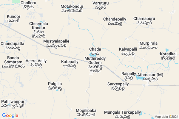
Muthireddygudem
Muthireddygudem Map
EDIT Map
Add Your House
 ..
..
Current Corona Virus Infected Patients Count in Nalgonda District
| City Name | District Name | Total Covid cases |
|---|---|---|
| Suryapet District | Suryapet | 72 |
| Nalgonda District | Nalgonda | 15 |
Locality Name :
Muthireddygudem
( ముత్తిరెడ్డిగూడెం )
Mandal Name : Atmakur(m)
District : Nalgonda
State : Telangana
Region : Telangana
Language : Telugu and Urdu
Current Time 12:03 PM
Date: Monday , Apr 28,2025 (IST)
Time zone: IST (UTC+5:30)
Elevation / Altitude: 317 meters. Above Seal level
Telephone Code / Std Code: 08716
Assembly constituency : Alair assembly constituency
Assembly MLA : Ilaiah Beerla
Lok Sabha constituency : Bhongir parliamentary constituency
Parliament MP : Komati Reddy Venkat Reddy
Serpanch Name :
Pin Code : 508111
Post Office Name : Athmakur
Main Village Name : Chada
Commodities Prices : Voligonda Market / Mandi
Muthireddygudem Live Weather
Temperature: 32.4 °C
clear sky
Humidity: 42%
Wind : 4.52 mt/sec towards S
StationName : "Bhongīr"
observed on 2 Hours Back
Temperature: 32.4 °C
clear sky
Humidity: 42%
Wind : 4.52 mt/sec towards S
StationName : "Bhongīr"
observed on 2 Hours Back
Muthireddygudem Weather Forecast for Next 5 days
29-04-2025
27.2°C to 38.8°C
clear sky, scattered clouds, overcast clouds, broken clouds
27.2°C to 38.8°C
clear sky, scattered clouds, overcast clouds, broken clouds
30-04-2025
26.1°C to 40.9°C
few clouds, clear sky, scattered clouds
26.1°C to 40.9°C
few clouds, clear sky, scattered clouds
01-05-2025
26.9°C to 41.9°C
few clouds, clear sky, scattered clouds, broken clouds
26.9°C to 41.9°C
few clouds, clear sky, scattered clouds, broken clouds
02-05-2025
26.6°C to 42.1°C
scattered clouds, clear sky
26.6°C to 42.1°C
scattered clouds, clear sky
03-05-2025
27.3°C to 41.5°C
broken clouds, scattered clouds, few clouds, clear sky
27.3°C to 41.5°C
broken clouds, scattered clouds, few clouds, clear sky
National Highways Reachable To Muthireddygudem
Nationa High Way :NH163
Nationa High Way :NH161AA
Nationa High Way :NH163
Nationa High Way :NH161AA
About Muthireddygudem
Correct below Info and add more info about MuthireddygudemMuthireddygudem is a small Village/hamlet in Atmakur(m) Mandal in Nalgonda District of Telangana State, India. It comes under Chada Panchayath. It belongs to Telangana region . It is located 61 KM towards North from District head quarters Nalgonda. 8 KM from Atmakur(M).
Muthireddygudem Pin code is 508111 and postal head office is Athmakur .
Sarvepally ( 4 KM ) , Puligilla ( 6 KM ) , Chandepally ( 6 KM ) , Mogilipaka ( 7 KM ) , Veeravelly ( 8 KM ) are the nearby Villages to Muthireddygudem. Muthireddygudem is surrounded by Valigonda Mandal towards South , Bhuvanagiri Mandal towards west , Yadagirigutta Mandal towards North , Alair Mandal towards North .
Bhongir , Jangaon , Hyderabad , Suryapet are the near by Cities to Muthireddygudem.
Demographics of Muthireddygudem
Telugu is the Local Language here. Total population of Muthireddygudem is 7564 .Males are 3827 and Females are 3,737 living in 1733 Houses. Total area of Muthireddygudem is 4697 hectares.Politics in Muthireddygudem
TDP , TRS , TDP , TRS , INC are the major political parties in this area.Polling Stations /Booths near Muthireddygudem
1)Muneerabad2)Nagineni Pally
3)Kapraayipalli
4)Katepalli Majira Chaade
5)Burugu Pally
HOW TO REACH Muthireddygudem
By Road
Bhongir is the Nearest Town to Muthireddygudem. Bhongir is 22 km from Muthireddygudem. Road connectivity is there from Bhongir to Muthireddygudem.By Rail
There is no railway station near to Muthireddygudem in less than 10 km. How ever there are railway Stations from Near By town Bhongir. are the railway Stations near to Bhongir. You can reach from Bhongir to Muthireddygudem by road after .Colleges near Muthireddygudem
Mathrusri Junior College, Suryapet
Address :
Padala Degree College
Address :
Tswrdcw,cherlapally
Address : Tswrdcw,
cherlapally,nalgonda
pon:508001
Vikas Junior College
Address :
Sphoorthy College
Address : Narkatpally
Schools in Muthireddygudem
Zphs Muthireddigudem
Address : chada , atmakur(m) , nalgonda , Andhra Pradesh . PIN- 508111 , Post - Athmakur
Manasa Vidyamandir High S
Address : chada , atmakur(m) , nalgonda , Andhra Pradesh . PIN- 508111 , Post - Athmakur
Zphs Chada
Address : chada , atmakur(m) , nalgonda , Andhra Pradesh . PIN- 508111 , Post - Athmakur
Govt Health Centers near Muthireddygudem
1) SubCentre, Muthireddygudem , 3115 , Near Auto Stand , Near Water Tank2) SubCentre, Chada , 2-2. , Near GP , Grampanchayath
3) SubCentre, Nancharipet , 2-98/1 , Grampanchayath Opposite , AWW centre
Petrol Bunks in Muthireddygudem,Atmakur(m)
Sri Lakshmi Naraslmha Swamy (Nursery)
m); Mothkur - Bhuvanagiri Rd; Atmakur(m); Telangana 508111; India
8.6 KM distance Detail
more ..
Colleges in Muthireddygudem,Atmakur(m)
Swami Vivekananda Institute of Pharmaceutical Sciences
Nalgonda; Telangana 508286; India
15.1 KM distance Detail
Bhagya Laxmi Travels
Valigonda; District; Hyderabad; Telangana 508112; India
15.7 KM distance Detail
more ..
Schools in Muthireddygudem,Atmakur(m)
Manasa Vidya Mandir High School
Hanuman Temple;; Muthireddy Gudem; Telangana 508111; India
0.8 KM distance Detail
Super Markets in Muthireddygudem,Atmakur(m)
Santhoshi maatha kiranam & wholesale(Murali shop)
Atmakur(m); Telangana 508111; India
9.0 KM distance Detail
Local Parks in Muthireddygudem,Atmakur(m)
Kanukuntla Andamma Mango Garden
Siddapuram; (M); Yadadri District; Atmakur(m); Telangana; India
10.6 KM distance Detail
Governement Offices near Muthireddygudem,Atmakur(m)
MeeSeva Center
ram nagar colony;opp:govt hospital;athmakur(V);athmakur(M); 11-28; Atmakur(m); Telangana 508111; India
8.9 KM distance Detail
Meeseva Center
H.no:8-105/2;aroor(V);valigonda(M);Nalgonda(D); Telangana 508112; India
12.6 KM distance Detail
About Muthireddygudem &
History
How to reach Muthireddygudem
Tourist Places Near By Muthireddygudem
Schools in Muthireddygudem
Colleges in Muthireddygudem
Temperature & weather of Muthireddygudem
places in Muthireddygudem
Muthireddygudem photos
More Information
How to reach Muthireddygudem
Tourist Places Near By Muthireddygudem
Schools in Muthireddygudem
Colleges in Muthireddygudem
Temperature & weather of Muthireddygudem
places in Muthireddygudem
Muthireddygudem photos
More Information
Village Talk
Post News or Events about this Village
Near Cities
Bhongir 20 KM near
Jangaon 29 KM near
Hyderabad 70 KM near
Suryapet 78 KM near
Bhongir 20 KM near
Jangaon 29 KM near
Hyderabad 70 KM near
Suryapet 78 KM near
Near By Taluks
Atmakur(M) 8 KM near
Valigonda 13 KM near
Bhuvanagiri 15 KM near
Yadagirigutta 16 KM near
Atmakur(M) 8 KM near
Valigonda 13 KM near
Bhuvanagiri 15 KM near
Yadagirigutta 16 KM near
Near By Air Ports
Rajiv Gandhi International Airport 82 KM near
Vijayawada Airport 237 KM near
Nanded Airport 295 KM near
Latur Airport 329 KM near
Rajiv Gandhi International Airport 82 KM near
Vijayawada Airport 237 KM near
Nanded Airport 295 KM near
Latur Airport 329 KM near
Near By Tourist Places
Hyderabad 70 KM near
Warangal 89 KM near
Nagarjunsagar 118 KM near
Medak 118 KM near
Khammam 132 KM near
Hyderabad 70 KM near
Warangal 89 KM near
Nagarjunsagar 118 KM near
Medak 118 KM near
Khammam 132 KM near
Near By Districts
Nalgonda 59 KM near
Hyderabad 71 KM near
Warangal 86 KM near
Karimnagar 117 KM near
Nalgonda 59 KM near
Hyderabad 71 KM near
Warangal 86 KM near
Karimnagar 117 KM near
Near By RailWay Station
Aler Rail Way Station 19 KM near
Bhongir Rail Way Station 20 KM near
Aler Rail Way Station 19 KM near
Bhongir Rail Way Station 20 KM near