| Home | City Bus | Maps | Villages | Cities | Rail | Tourist Places | School | College | Pin Codes | Corona Cases Count |
| Distance Calculator Bus Services IFSC Codes Trace Mobile Number Weather Search Place Trace IP Available Cash ATM/Banks Locate Polling Booth Report an Error contact People |
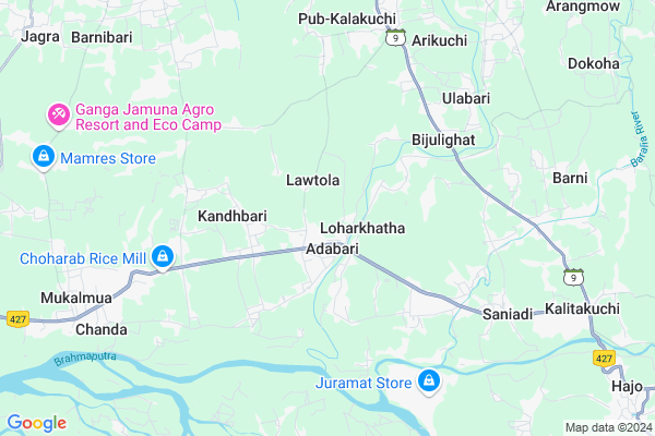
Ghoga Map
EDIT Map
Add Your House
 ..
..
Current Corona Virus Infected Patients Count in Nalbari District
| City Name | District Name | Total Covid cases |
|---|---|---|
| Nalbari District | Nalbari | 3 |
Locality Name :
Ghoga
( होगा )
Tehsil Name : Barkhetri
District : Nalbari
State : Assam
Language : Assamese
Current Time 07:03 AM
Date: Saturday , Apr 26,2025 (IST)
Time zone: IST (UTC+5:30)
Elevation / Altitude: 54 meters. Above Seal level
Telephone Code / Std Code: 03664
Assembly constituency : Barkhetry assembly constituency
Assembly MLA : Diganta Barman
Lok Sabha constituency : Gauhati parliamentary constituency
Parliament MP : QUEEN OJA
Serpanch Name :
Pin Code : 781126
Post Office Name : Mukalmua
Commodities Prices : Mawiong Regulated Market Market / Mandi
Ghoga Live Weather
Temperature: 26.8 °C
clear sky
Humidity: 66%
Wind : 3.31 mt/sec towards NE
StationName : "HÄ\u0081jo"
observed on Now
Temperature: 26.8 °C
clear sky
Humidity: 66%
Wind : 3.31 mt/sec towards NE
StationName : "HÄ\u0081jo"
observed on Now
Ghoga Weather Forecast for Next 5 days
27-04-2025
24.4°C to 36.3°C
light rain, clear sky, few clouds
24.4°C to 36.3°C
light rain, clear sky, few clouds
28-04-2025
21.9°C to 38.0°C
light rain, clear sky, few clouds, moderate rain
21.9°C to 38.0°C
light rain, clear sky, few clouds, moderate rain
29-04-2025
22.9°C to 34.5°C
overcast clouds, broken clouds, light rain
22.9°C to 34.5°C
overcast clouds, broken clouds, light rain
30-04-2025
23.0°C to 33.3°C
light rain, overcast clouds, broken clouds
23.0°C to 33.3°C
light rain, overcast clouds, broken clouds
01-05-2025
22.2°C to 24.6°C
light rain, overcast clouds
22.2°C to 24.6°C
light rain, overcast clouds
National Highways Reachable To Ghoga
Nationa High Way :NH27
Nationa High Way :NH27
Rivers Near Ghoga
Digaru
Brahmaputra :ব্ৰহ্মপুত্ৰ :ব্রহ্মপুত্র :Brahmaputra :Brahmaputra :ब्रह्मपुत्र :ಬ್ರಹ್ಮಪುತ್ರ :பிரம்மபுத்திரா :బ్రహ్మపుత్రా :Брахмапутра :雅鲁藏布江
Digaru
Brahmaputra :ব্ৰহ্মপুত্ৰ :ব্রহ্মপুত্র :Brahmaputra :Brahmaputra :ब्रह्मपुत्र :ಬ್ರಹ್ಮಪುತ್ರ :பிரம்மபுத்திரா :బ్రహ్మపుత్రా :Брахмапутра :雅鲁藏布江
About Ghoga
Correct below Info and add more info about GhogaGhoga is a Village in Barkhetri Tehsil in Nalbari District of Assam State, India. It is located 18 KM towards South from District head quarters Nalbari.. 10 KM from . 40 KM from State capital Dispur
Ghoga Pin code is 781126 and postal head office is Mukalmua .
Loharkata Adabari ( 4 KM ) , Kurihamari Borchulia ( 12 KM ) , Kakaya ( 13 KM ) , Sanekuchi ( 14 KM ) , Belsor ( 14 KM ) are the nearby Villages to Ghoga. Ghoga is surrounded by Borbhag Tehsil towards East , Barkhetri Tehsil towards west , Hajo Tehsil towards East , Bongaon Tehsil towards North .
Nalbari , Rangia , Guwahati , Dispur are the near by Cities to Ghoga.
This Place is in the border of the Nalbari District and Kamrup District. Kamrup District Hajo is East towards this place .
Ghoga 2011 Census Details
Ghoga Local Language is Assamese. Ghoga Village Total population is 5031 and number of houses are 948. Female Population is 48.8%. Village literacy rate is 59.8% and the Female Literacy rate is 26.5%.
Population
| Census Parameter | Census Data |
| Total Population | 5031 |
| Total No of Houses | 948 |
| Female Population % | 48.8 % ( 2453) |
| Total Literacy rate % | 59.8 % ( 3008) |
| Female Literacy rate | 26.5 % ( 1333) |
| Scheduled Tribes Population % | 5.4 % ( 271) |
| Scheduled Caste Population % | 0.1 % ( 5) |
| Working Population % | 36.0 % |
| Child(0 -6) Population by 2011 | 719 |
| Girl Child(0 -6) Population % by 2011 | 48.0 % ( 345) |
Ghoga Census More Deatils.
Politics in Ghoga
Bharatiya Janata Party , BJP , 88.78% , 69375 , INC are the major political parties in this area.Polling Stations /Booths near Ghoga
1)No 3 Bartola L.p. School (r/w)2)Adabari L.p. School (l/w)
3)Pub Barkhetri High School (l/w)
4)Pub Barkhetri High School (m/w)
5)Adabari L.p. School (l/w)
HOW TO REACH Ghoga
By Rail
There is no railway station near to Ghoga in less than 10 km.Colleges near Ghoga
Swahid Sowarani College
Address : Village -bamunbori Po Bamunbori
Schools in Ghoga
Ghoga Badani Akhiya Mem
Address : ghoga , barkhetri , nalbari , Assam . PIN- 781126 , Post - Mukalmua
Govt Health Centers near Ghoga
1) Mahatma Gandhi Model Hospital , Adabari , Mahatma Gandhi Model Hospital , Adabari , Guwahati Barpeta Road ,2) Mahatma Gandhi Model Hospital, Belsor , , Bihampur Belsor Devalaya Road , Near Public Health Engineering Office
3) Kharghuli MPHC , 148/241 , Yuvajyouti Path , Near Jatiya Bidyalaya
Petrol Bunks in Ghoga,Barkhetri
HP Petrol Pump
Bartola Mukalmua Hajo; Barpeta-Hajo-Guwahati Rd; Guwahati; Assam 781138; India
14.2 KM distance Detail
Assam Service Station Indian Oil Petrol Pump
Nalbari College Rd; Nalbari; Assam 781334; India
16.7 KM distance Detail
more ..
Schools in Ghoga,Barkhetri
SHANKER DEV SHISHU VIDDYA NIKETON;ADABARI
Adabari; Guwahati; Assam 781126; India
1.0 KM distance Detail
Super Markets in Ghoga,Barkhetri
Swayambar Marriage Hall And Pancharatna Commercial Complex
Gopal Bazar; Nalbari; Assam 781334; India
17.6 KM distance Detail
Police Stations near Ghoga,Barkhetri
Kayan Police Station
Kayan Police Station Rd; Purna Khumdum; Assam 781350; India
16.7 KM distance Detail
Governement Offices near Ghoga,Barkhetri
Block Mission Management Unit Barkhetri (ASRLM)
Mukalmua; Assam 781126; India
9.3 KM distance Detail
About Ghoga &
History
How to reach Ghoga
Tourist Places Near By Ghoga
Schools in Ghoga
Colleges in Ghoga
Temperature & weather of Ghoga
places in Ghoga
Ghoga photos
More Information
How to reach Ghoga
Tourist Places Near By Ghoga
Schools in Ghoga
Colleges in Ghoga
Temperature & weather of Ghoga
places in Ghoga
Ghoga photos
More Information
Village Talk
Post News or Events about this Village
Near Cities
Nalbari 14 KM near
Rangia 27 KM near
Guwahati 36 KM near
Dispur 41 KM near
Nalbari 14 KM near
Rangia 27 KM near
Guwahati 36 KM near
Dispur 41 KM near
Near By Taluks
Tamulpur 4 KM near
Barkhetri 10 KM near
Borbhag 10 KM near
Hajo 12 KM near
Tamulpur 4 KM near
Barkhetri 10 KM near
Borbhag 10 KM near
Hajo 12 KM near
Near By Air Ports
Borjhar Airport 29 KM near
Shillong Airport 104 KM near
Salonibari Airport 160 KM near
Rupsi Airport 170 KM near
Borjhar Airport 29 KM near
Shillong Airport 104 KM near
Salonibari Airport 160 KM near
Rupsi Airport 170 KM near
Near By Tourist Places
Hajo 12 KM near
Nalbari 17 KM near
Guwahati 39 KM near
Dispur 44 KM near
Barpeta 56 KM near
Hajo 12 KM near
Nalbari 17 KM near
Guwahati 39 KM near
Dispur 44 KM near
Barpeta 56 KM near
Near By Districts
Nalbari 17 KM near
Kamrup Metro 20 KM near
Kamrup 20 KM near
Baksa 31 KM near
Nalbari 17 KM near
Kamrup Metro 20 KM near
Kamrup 20 KM near
Baksa 31 KM near
Near By RailWay Station
Nalbari Rail Way Station 18 KM near
Rangiya Junction Rail Way Station 26 KM near
Nalbari Rail Way Station 18 KM near
Rangiya Junction Rail Way Station 26 KM near