| Home | City Bus | Maps | Villages | Cities | Rail | Tourist Places | School | College | Pin Codes | Corona Cases Count |
| Distance Calculator Bus Services IFSC Codes Trace Mobile Number Weather Search Place Trace IP Available Cash ATM/Banks Locate Polling Booth Report an Error contact People |
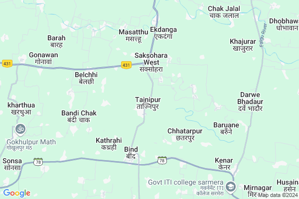
Tajnipur Map
EDIT Map
Add Your House
 ..
..
Current Corona Virus Infected Patients Count in Nalanda District
| City Name | District Name | Total Covid cases |
|---|---|---|
| Bihar Sarif | Nalanda | 18 |
| Nalanda District | Nalanda | 9 |
| Bihar Sharif | Nalanda | 5 |
| Asthwan | Nalanda | 1 |
| Sharif | Nalanda | 1 |
Locality Name :
Tajnipur
( ताजनीपुर )
Block Name : Bind
District : Nalanda
State : Bihar
Division : Patna
Language : Maithili and Hindi, Urdu
Current Time 05:09 PM
Date: Tuesday , Apr 29,2025 (IST)
Time zone: IST (UTC+5:30)
Elevation / Altitude: 47 meters. Above Seal level
Telephone Code / Std Code: 06132
Assembly constituency : assembly constituency
Assembly MLA :
Lok Sabha constituency : parliamentary constituency
Parliament MP :
Serpanch Name :
Pin Code : 803107
Post Office Name : Asthawan
Tajnipur Live Weather
Temperature: 33.7 °C
overcast clouds
Humidity: 25%
Wind : 2.73 mt/sec towards N
StationName : "Bar Bigha"
observed on 1 Hours Back
Temperature: 33.7 °C
overcast clouds
Humidity: 25%
Wind : 2.73 mt/sec towards N
StationName : "Bar Bigha"
observed on 1 Hours Back
Tajnipur Weather Forecast for Next 5 days
30-04-2025
26.1°C to 33.7°C
overcast clouds, scattered clouds, broken clouds
26.1°C to 33.7°C
overcast clouds, scattered clouds, broken clouds
01-05-2025
24.6°C to 38.5°C
scattered clouds, clear sky, light rain
24.6°C to 38.5°C
scattered clouds, clear sky, light rain
02-05-2025
27.1°C to 37.8°C
few clouds, clear sky, broken clouds, light rain, overcast clouds
27.1°C to 37.8°C
few clouds, clear sky, broken clouds, light rain, overcast clouds
03-05-2025
26.1°C to 36.4°C
overcast clouds, broken clouds, clear sky, light rain
26.1°C to 36.4°C
overcast clouds, broken clouds, clear sky, light rain
04-05-2025
29.1°C to 38.8°C
overcast clouds, few clouds, clear sky, light rain
29.1°C to 38.8°C
overcast clouds, few clouds, clear sky, light rain
National Highways Reachable To Tajnipur
Nationa High Way :NH31
Nationa High Way :NH31
Rivers Near Tajnipur
Phalgu :फल्गु
Garkhe
Phalgu :फल्गु
Garkhe
About Tajnipur
Correct below Info and add more info about TajnipurTajnipur is a Village in Bind Block in Nalanda District of Bihar State, India. It belongs to Patna Division . It is located 25 KM towards East from District head quarters Bihar Sharif. 4 KM from Bind. 75 KM from State capital Patna
Tajnipur Pin code is 803107 and postal head office is Asthawan .
Jahana ( 4 KM ) , Kathrahi ( 4 KM ) , Belchhi ( 5 KM ) , Malawan ( 6 KM ) , Kenar ( 7 KM ) are the nearby Villages to Tajnipur. Tajnipur is surrounded by Belchchi Block towards west , Sarmera Block towards East , Pandarak Block towards East , Barh Block towards North .
Barbigha , Barh , Bakhtiarpur , Mokameh are the near by Cities to Tajnipur.
This Place is in the border of the Nalanda District and Patna District. Patna District Belchchi is west towards this place . Also it is in the Border of other district Sheikhpura .
Tajnipur 2011 Census Details
Tajnipur Local Language is Maithili. Tajnipur Village Total population is 1944 and number of houses are 333. Female Population is 47.2%. Village literacy rate is 52.7% and the Female Literacy rate is 19.3%.
Population
| Census Parameter | Census Data |
| Total Population | 1944 |
| Total No of Houses | 333 |
| Female Population % | 47.2 % ( 917) |
| Total Literacy rate % | 52.7 % ( 1025) |
| Female Literacy rate | 19.3 % ( 375) |
| Scheduled Tribes Population % | 0.1 % ( 2) |
| Scheduled Caste Population % | 40.9 % ( 795) |
| Working Population % | 40.1 % |
| Child(0 -6) Population by 2011 | 401 |
| Girl Child(0 -6) Population % by 2011 | 44.4 % ( 178) |
Tajnipur Census More Deatils.
HOW TO REACH Tajnipur
By Rail
There is no railway station near to Tajnipur in less than 10 km. Bihar Sharif Junction Rail Way Station (near to Bihar Sharif) , Tungi Halt Rail Way Station (near to Bihar Sharif) are the Rail way stations reachable from near by towns.By Road
Bihar Sharif are the nearby by towns to Tajnipur having road connectivity to TajnipurColleges near Tajnipur
College Of Engineering & Institute Of It
Address :
K S T College
Address :
Mahabodhi College
Address :
K S T College
Address :
S U Collage
Address :
Schools in Tajnipur
P.s. Saidpur
Address : tajnipur , bind , nalanda , Bihar . PIN- 803213 , Post - Barh (Patna)
M.s. Tajnipur
Address : tajnipur , bind , nalanda , Bihar . PIN- 803213 , Post - Barh (Patna)
Govt Health Centers near Tajnipur
1) BeclhiPHC , , Belchi ,2) Nadwan , Private Building , Nadawan , Near Durga Mandir
3) Poari , , ,
Hospitals in Tajnipur,Bind
Dipu Prathmik Upchar Kendra
803213; Chhatauni Rd; Tulsi Nagar; Kukudakhandi; Odisha 761100; India
7.3 KM distance Detail
more ..
Schools in Tajnipur,Bind
parathmik Vidayalya Nauranga Dr Ravi
Barh - Sak Sohara - Bind Rd; Bind; Bihar 803107; India
1.1 KM distance Detail
About Tajnipur &
History
How to reach Tajnipur
Tourist Places Near By Tajnipur
Schools in Tajnipur
Colleges in Tajnipur
Temperature & weather of Tajnipur
places in Tajnipur
Tajnipur photos
More Information
How to reach Tajnipur
Tourist Places Near By Tajnipur
Schools in Tajnipur
Colleges in Tajnipur
Temperature & weather of Tajnipur
places in Tajnipur
Tajnipur photos
More Information
Village Talk
Post News or Events about this Village
Near Cities
Barbigha 16 KM near
Barh 16 KM near
Bakhtiarpur 24 KM near
Mokameh 25 KM near
Barbigha 16 KM near
Barh 16 KM near
Bakhtiarpur 24 KM near
Mokameh 25 KM near
Near By Taluks
Bind 4 KM near
Belchchi 4 KM near
Sarmera 10 KM near
Pandarak 12 KM near
Bind 4 KM near
Belchchi 4 KM near
Sarmera 10 KM near
Pandarak 12 KM near
Near By Air Ports
Patna Airport 75 KM near
Gaya Airport 112 KM near
Ranchi Airport 255 KM near
Gorakhpur Airport 307 KM near
Patna Airport 75 KM near
Gaya Airport 112 KM near
Ranchi Airport 255 KM near
Gorakhpur Airport 307 KM near
Near By Tourist Places
Nalanda 25 KM near
Bihar Sharif 26 KM near
Kakolat 60 KM near
Samastipur 64 KM near
Agam Kuan 65 KM near
Nalanda 25 KM near
Bihar Sharif 26 KM near
Kakolat 60 KM near
Samastipur 64 KM near
Agam Kuan 65 KM near
Near By Districts
Nalanda 25 KM near
Sheikhpura 30 KM near
Lakhisarai 48 KM near
Begusarai 49 KM near
Nalanda 25 KM near
Sheikhpura 30 KM near
Lakhisarai 48 KM near
Begusarai 49 KM near
Near By RailWay Station
Barh Rail Way Station 15 KM near
Athmal Gola Rail Way Station 18 KM near
Barh Rail Way Station 15 KM near
Athmal Gola Rail Way Station 18 KM near