| Home | City Bus | Maps | Villages | Cities | Rail | Tourist Places | School | College | Pin Codes | Corona Cases Count |
| Distance Calculator Bus Services IFSC Codes Trace Mobile Number Weather Search Place Trace IP Available Cash ATM/Banks Locate Polling Booth Report an Error contact People |
Patkot
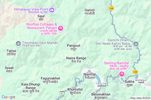
Patkot Map
EDIT Map
Add Your House
 ..
..
Current Corona Virus Infected Patients Count in Nainital District
| City Name | District Name | Total Covid cases |
|---|---|---|
| Nainital District | Nainital | 10 |
Locality Name :
Patkot
( पातकोट )
Block Name : Ramnagar
District : Nainital
State : Uttarakhand
Language : Hindi and Urdu, Garhwali, Kumauni
Current Time 12:05 PM
Date: Wednesday , Apr 30,2025 (IST)
Time zone: IST (UTC+5:30)
Elevation / Altitude: 345 meters. Above Seal level
Telephone Code / Std Code: 05947
Assembly constituency : Nainital assembly constituency
Assembly MLA : Sarita Arya
Lok Sabha constituency : Nainital-Udhamsingh Nagar parliamentary constituency
Parliament MP : Ajay Bhatt
Serpanch Name :
Pin Code : 263002
Post Office Name : Nainital
Commodities Prices : Haldwani Market / Mandi
Patkot Live Weather
Temperature: 27.1 °C
few clouds
Humidity: 31%
Wind : 3.43 mt/sec towards S
StationName : "Nainital"
observed on 59 Mins Back
Temperature: 27.1 °C
few clouds
Humidity: 31%
Wind : 3.43 mt/sec towards S
StationName : "Nainital"
observed on 59 Mins Back
Patkot Weather Forecast for Next 5 days
01-05-2025
14.7°C to 25.6°C
few clouds, scattered clouds, light rain, overcast clouds
14.7°C to 25.6°C
few clouds, scattered clouds, light rain, overcast clouds
02-05-2025
15.0°C to 23.7°C
scattered clouds, broken clouds
15.0°C to 23.7°C
scattered clouds, broken clouds
03-05-2025
14.5°C to 26.5°C
light rain, broken clouds, overcast clouds
14.5°C to 26.5°C
light rain, broken clouds, overcast clouds
04-05-2025
12.9°C to 25.4°C
light rain, overcast clouds
12.9°C to 25.4°C
light rain, overcast clouds
05-05-2025
14.0°C to 26.7°C
overcast clouds, scattered clouds, broken clouds
14.0°C to 26.7°C
overcast clouds, scattered clouds, broken clouds
Edit below overview about Patkot
Edit below overview about Patkot
OverView of Patkot
You Can reach patkot by car or by bus from ramangar.patkot is 25 km from ramangar.between ramangar to patkot you can see tega villege.leti.chopda.amgadi.bhalon and amoi villege.and sitavana temple is 20 km away from ramangar.Edit below overview about Patkot
National Highways Reachable To Patkot
Nationa High Way :NH109
Nationa High Way :NH109E
Nationa High Way :NH109
Nationa High Way :NH109E
Rivers Near Patkot
Ramganga
Phica
Ramganga
Phica
About Patkot
Patkot is a Village in Ramnagar Block in Nainital District of Uttarakhand State, India. It is located 7 KM towards North from District head quarters Nainital. 36 KM from Ramnagar. 196 KM from State capital Dehradun
Patkot Pin code is 263002 and postal head office is Nainital .
Mallital ( 5 KM ) , Garjoli ( 5 KM ) , Ayarpatta ( 5 KM ) , Bajoon ( 6 KM ) , Bargal ( 7 KM ) are the nearby Villages to Patkot. Patkot is surrounded by Kotabag Block towards west , Betalghat Block towards North , Bhimtal Block towards East , Ramgarh Block towards East .
Nainital , Haldwani , Ramnagar , Almora are the near by Cities to Patkot.
Patkot 2011 Census Details
Patkot Local Language is Hindi. Patkot Village Total population is 1725 and number of houses are 350. Female Population is 49.3%. Village literacy rate is 76.6% and the Female Literacy rate is 33.9%.
Population
| Census Parameter | Census Data |
| Total Population | 1725 |
| Total No of Houses | 350 |
| Female Population % | 49.3 % ( 850) |
| Total Literacy rate % | 76.6 % ( 1322) |
| Female Literacy rate | 33.9 % ( 585) |
| Scheduled Tribes Population % | 0.2 % ( 3) |
| Scheduled Caste Population % | 27.5 % ( 475) |
| Working Population % | 30.1 % |
| Child(0 -6) Population by 2011 | 206 |
| Girl Child(0 -6) Population % by 2011 | 48.5 % ( 100) |
Patkot Census More Deatils.
Politics in Patkot
BJP , UKKD , BJP , INC are the major political parties in this area.Polling Stations /Booths near Patkot
1)Ghodiyahalson2)Bresaid Mallital
3)Badhani
4)Maharagaon
5)Boharagaon
HOW TO REACH Patkot
By Rail
There is no railway station near to Patkot in less than 10 km.Colleges near Patkot
Iti Maldhan Chaur No.1
Address :
Schools in Patkot
Kanya J H S Patkot
Address : patkot , ramnagar , nainital , Uttarakhand . PIN- 263159 , Post - Kotabagh
G I C Patkot
Address : patkot , ramnagar , nainital , Uttarakhand . PIN- 263159 , Post - Kotabagh
Govt Health Centers near Patkot
1) B.D.Pandey Male Hospital Nainital , B.D.Pandey Male Hospital , Nainital , Mallital2) B.D.Pandey Female Hospital Nainital , B.D.Pandey Female Hospital , Nainital , Mallital
3) Ratighat , Sub Center , Ratighat , ANM Center
Hospitals in Patkot,Ramnagar
Asha Dental Hospital
new payal hotel; Tallital; Nainital; Uttarakhand 263001; India
3.4 KM distance Detail
Mohan Co. (The famous Medical Shop; Nainital)
Mallital; Nainital; Uttarakhand 263001; India
4.3 KM distance Detail
B.D Pandey Hospital
Bara Bazar;; Mall Rd; Mallital; Nainital; Uttarakhand 263001; India
4.5 KM distance Detail
more ..
Petrol Bunks in Patkot,Ramnagar
Indian Oil Petrol Pump
Nainital - Kaladungi Rd; Ayarpatta; Nainital; Uttarakhand 263002; India
4.0 KM distance Detail
Petrol Station Sukhatal
Nainital - Kaladungi Rd; Sherwani; Nainital; Uttarakhand 263002; India
4.0 KM distance Detail
Petrol Station Tallital
Thandi Rd; Tallital; Nainital; Uttarakhand 263002; India
6.3 KM distance Detail
Indian Oil Petrol Pump
Thandi Rd; Tallital; Nainital; Uttarakhand 263002; India
6.4 KM distance Detail
more ..
Colleges in Patkot,Ramnagar
Rajkiya Polytechnic College
Kilbury Rd; Sherwani; Nainital; Uttarakhand 263002; India
3.7 KM distance Detail
more ..
Schools in Patkot,Ramnagar
BSSV; Nainital
Park (High Court); Sherwani; Nainital; Uttarakhand 263001; India
3.2 KM distance Detail
Mohan Lal Sah Bal Vidya Mandir Senior Secondary Girls School
Mallital; Nainital; Uttarakhand 263002; India
3.7 KM distance Detail
Mohan lal sah bal vidya mandir
Peter's Field Sukhatal; Nainital; Uttarakhand; India
3.7 KM distance Detail
St. Quintins School; Nainital
vimal kunj; Ayarpatta; Nainital; Uttarakhand 263002; India
4.4 KM distance Detail
THE HOLY ANGELS SCHOOL NAINITAL
SNOW DEN COMPOUND BARA PATHAR; Nainital; Uttarakhand 263001; India
4.4 KM distance Detail
Electronic Shops in Patkot,Ramnagar
Solutions
126; 127; Bara Bazar; Mallital; Nainital; Uttarakhand 263001; India
4.1 KM distance Detail
Jio Store
Nainital High Ct Rd; Ayarpatta; Nainital; Uttarakhand 263002; India
4.1 KM distance Detail
Local Parks in Patkot,Ramnagar
Play Ground
7; Maldon Cottage Raod; Mallital; Nainital; Uttarakhand 263001; India
4.3 KM distance Detail
Police Stations near Patkot,Ramnagar
Police Station
Bada-Bazzar Connecting Rd; Mallital; Nainital; Uttarakhand 263001; India
4.6 KM distance Detail
Police Chowki Mallitaal
Mall Rd; Mallital; Nainital; Uttarakhand 263001; India
4.7 KM distance Detail
Governement Offices near Patkot,Ramnagar
Uttarakhand State Legal Services Authority
A.D.R Centre High Court; Nainital; Uttarakhand; India
3.7 KM distance Detail
Passport Seva Kendra; Head Post Office Mallital Nainital
Head post office; Mallital; Nainital; Uttarakhand 263001; India
4.2 KM distance Detail
About Patkot &
History
How to reach Patkot
Tourist Places Near By Patkot
Schools in Patkot
Colleges in Patkot
Temperature & weather of Patkot
places in Patkot
Patkot photos
More Information
How to reach Patkot
Tourist Places Near By Patkot
Schools in Patkot
Colleges in Patkot
Temperature & weather of Patkot
places in Patkot
Patkot photos
More Information
Village Talk
Post News or Events about this Village
Near Cities
Nainital 6 KM near
Haldwani 25 KM near
Ramnagar 33 KM near
Almora 33 KM near
Nainital 6 KM near
Haldwani 25 KM near
Ramnagar 33 KM near
Almora 33 KM near
Near By Taluks
Nainital 5 KM near
Kotabag 12 KM near
Betalghat 14 KM near
Bhimtal 17 KM near
Nainital 5 KM near
Kotabag 12 KM near
Betalghat 14 KM near
Bhimtal 17 KM near
Near By Air Ports
Pantnagar Airport 48 KM near
Dehra Dun Airport 187 KM near
Muzaffarnagar Airport 191 KM near
Indira Gandhi International Airport 275 KM near
Pantnagar Airport 48 KM near
Dehra Dun Airport 187 KM near
Muzaffarnagar Airport 191 KM near
Indira Gandhi International Airport 275 KM near
Near By Tourist Places
Jeolikot 5 KM near
Nainital 6 KM near
Bhowali 10 KM near
Ramgarh 13 KM near
Sattal 13 KM near
Jeolikot 5 KM near
Nainital 6 KM near
Bhowali 10 KM near
Ramgarh 13 KM near
Sattal 13 KM near
Near By Districts
Nainital 6 KM near
Almora 33 KM near
Udam Singh Nagar 55 KM near
Bageshwar 64 KM near
Nainital 6 KM near
Almora 33 KM near
Udam Singh Nagar 55 KM near
Bageshwar 64 KM near
Near By RailWay Station
Kathgodam Rail Way Station 22 KM near
Haldwani Rail Way Station 27 KM near
Kathgodam Rail Way Station 22 KM near
Haldwani Rail Way Station 27 KM near