| Home | City Bus | Maps | Villages | Cities | Rail | Tourist Places | School | College | Pin Codes | Corona Cases Count |
| Distance Calculator Bus Services IFSC Codes Trace Mobile Number Weather Search Place Trace IP Available Cash ATM/Banks Locate Polling Booth Report an Error contact People |
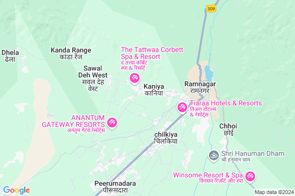
Kaniya
Kaniya Map
EDIT Map
Add Your House
 ..
..
Current Corona Virus Infected Patients Count in Nainital District
| City Name | District Name | Total Covid cases |
|---|---|---|
| Nainital District | Nainital | 10 |
Locality Name :
Kaniya
( कन्या )
Block Name : Ramnagar
District : Nainital
State : Uttarakhand
Language : Hindi and Urdu, Garhwali, Kumauni
Current Time 06:09 AM
Date: Saturday , Apr 26,2025 (IST)
Time zone: IST (UTC+5:30)
Elevation / Altitude: 345 meters. Above Seal level
Telephone Code / Std Code: 05947
Assembly constituency : Ramnagar assembly constituency
Assembly MLA : Diwan Singh Bisht
Lok Sabha constituency : Garhwal parliamentary constituency
Parliament MP : Tirath Singh Rawat
Serpanch Name :
Pin Code : 244715
Post Office Name : Ramnagar (Nainital)
Commodities Prices : Ramnagar Market / Mandi
Kaniya Live Weather
Temperature: 23.3 °C
broken clouds
Humidity: 12%
Wind : 3.37 mt/sec towards NE
StationName : "Ramnagar"
observed on 1 Hours Back
Temperature: 23.3 °C
broken clouds
Humidity: 12%
Wind : 3.37 mt/sec towards NE
StationName : "Ramnagar"
observed on 1 Hours Back
Kaniya Weather Forecast for Next 5 days
27-04-2025
23.0°C to 40.6°C
scattered clouds, broken clouds
23.0°C to 40.6°C
scattered clouds, broken clouds
28-04-2025
24.6°C to 39.7°C
broken clouds, overcast clouds
24.6°C to 39.7°C
broken clouds, overcast clouds
29-04-2025
24.2°C to 40.2°C
broken clouds, scattered clouds, overcast clouds, clear sky
24.2°C to 40.2°C
broken clouds, scattered clouds, overcast clouds, clear sky
30-04-2025
24.7°C to 39.3°C
clear sky, few clouds, scattered clouds, overcast clouds, broken clouds
24.7°C to 39.3°C
clear sky, few clouds, scattered clouds, overcast clouds, broken clouds
Edit below overview about Kaniya
Edit below overview about Kaniya
OverView of Kaniya
Kania is a place where peace of mind and body can be found This place if full of trees due to which there is fresh air. But this place lacks in tours and travels The people living here are quite friendly.Edit below overview about Kaniya
National Highways Reachable To Kaniya
Nationa High Way :NH109
Nationa High Way :NH109E
Nationa High Way :NH109
Nationa High Way :NH109E
Rivers Near Kaniya
Ramganga
Phica
Ramganga
Phica
About Kaniya
Kaniya is a Village in Ramnagar Block in Nainital District of Uttarakhand State, India. It is located 42 KM towards west from District head quarters Nainital. 7 KM from Ramnagar. 169 KM from State capital Dehradun
Kaniya Pin code is 244715 and postal head office is Ramnagar (Nainital).
Karanpur ( 2 KM ) , Chilkiya ( 3 KM ) , Pampapuri ( 4 KM ) , Jogipura ( 4 KM ) , Manglar ( 4 KM ) are the nearby Villages to Kaniya. Kaniya is surrounded by Kotabag Block towards East , Kashipur Block towards South , Bajpur Block towards South , Jaspur Block towards west .
Ramnagar , Kashipur , Bazpur , Jaspur are the near by Cities to Kaniya.
Kaniya 2011 Census Details
Kaniya Local Language is Hindi. Kaniya Village Total population is 2099 and number of houses are 458. Female Population is 49.7%. Village literacy rate is 77.3% and the Female Literacy rate is 35.9%.
Population
| Census Parameter | Census Data |
| Total Population | 2099 |
| Total No of Houses | 458 |
| Female Population % | 49.7 % ( 1044) |
| Total Literacy rate % | 77.3 % ( 1622) |
| Female Literacy rate | 35.9 % ( 754) |
| Scheduled Tribes Population % | 0.2 % ( 5) |
| Scheduled Caste Population % | 19.6 % ( 411) |
| Working Population % | 30.6 % |
| Child(0 -6) Population by 2011 | 250 |
| Girl Child(0 -6) Population % by 2011 | 47.6 % ( 119) |
Kaniya Census More Deatils.
Politics in Kaniya
BJP , INC are the major political parties in this area.Polling Stations /Booths near Kaniya
1)Bhaulon Ramnagar2)G.i.c Gularghatti (room No 3)
3)G.i.c. Gaajani (room N0 1)
4)G.u.m.v.tumadiyadam Maldhachourmaur)
5)Shivpur Bailjuri
HOW TO REACH Kaniya
By Rail
Ramnagar Rail Way Station , Pirumadara Rail Way Station are the very nearby railway stations to Kaniya.Colleges near Kaniya
Iti Maldhan Chaur No.1
Address :
Schools in Kaniya
Jai Mohan Jhs Kaniya
Address : kaniya , ramnagar , nainital , Uttarakhand . PIN- 244715 , Post - Ramnagar (Nainital)
Govt Health Centers near Kaniya
1) Kaaniya , Sub Center , Kanniya , PHC Kanniya2) Kaniya , PHC , Kaniya , Ramnagar Kaniya Road
3) Combined Hospital Ramnagar , Ram Datt Joshi Combined Hospital , Ramnagar , Near Nagar Palika
Hospitals in Kaniya,Ramnagar
Brijesh Hospital
National Highway 121; Pant Colony; Shivlalpur Khazanchi; Uttarakhand 244715; India
3.5 KM distance Detail
Shaikh diagnostic centre
Pant Colony; Shivlalpur Khazanchi; Uttarakhand 244715; India
3.5 KM distance Detail
more ..
Petrol Bunks in Kaniya,Ramnagar
Mahalaxmi Filling Station
Kashipur Road; National Highway 121; Nainital; Ramnagar; Uttarakhand 263001; India
3.3 KM distance Detail
Singhal Indian Oil Petrol Pump
Pant Colony; Shivlalpur Khazanchi; Uttarakhand 244715; India
3.7 KM distance Detail
HP PETROL PUMP MAKHANLAL CHHAJJUMAL
P O Ram Nagar; Dist Nainital; Ramnagar; Uttarakhand 244715; India
4.2 KM distance Detail
Lalta Prasad Indian oil petrol pump
NH309; Ramnagar; Uttarakhand 244715; India
4.3 KM distance Detail
more ..
Colleges in Kaniya,Ramnagar
Uttarakhand Institute of Technical & Professional Education (Polytechnic)
Karanpur; Near Government Inter Colleg; Ramnagar; Uttarakhand 244715; India
1.3 KM distance Detail
Government Inter College Ramnagar
Karanpur; Ramnagar; Uttarakhand 244715; India
3.3 KM distance Detail
Green Field Academy
Vill-Dulaipuri;P.O-Peerumadara; Ramnagar;Nainital; Ramnagar; Uttarakhand 244715; India
3.5 KM distance Detail
more ..
Super Markets in Kaniya,Ramnagar
Yuvraj Traders Dist. - Luminous
Shivlalpur Chungi; National Highway 121; Jassaganja; Shivlalpur Khazanchi; Uttarakhand 244715; India
3.5 KM distance Detail
Local Parks in Kaniya,Ramnagar
khulbe Garden
C-3; Industrial Area; Impcl Mohan;; Ramnagar; Uttarakhand 244715; India
4.2 KM distance Detail
Police Stations near Kaniya,Ramnagar
About Kaniya &
History
How to reach Kaniya
Tourist Places Near By Kaniya
Schools in Kaniya
Colleges in Kaniya
Temperature & weather of Kaniya
places in Kaniya
Kaniya photos
More Information
How to reach Kaniya
Tourist Places Near By Kaniya
Schools in Kaniya
Colleges in Kaniya
Temperature & weather of Kaniya
places in Kaniya
Kaniya photos
More Information
Village Talk
Post News or Events about this Village
Near Cities
Ramnagar 3 KM near
Kashipur 26 KM near
Bazpur 28 KM near
Jaspur 31 KM near
Ramnagar 3 KM near
Kashipur 26 KM near
Bazpur 28 KM near
Jaspur 31 KM near
Near By Taluks
Ramnagar 6 KM near
Kotabag 24 KM near
Kashipur 25 KM near
Bajpur 28 KM near
Ramnagar 6 KM near
Kotabag 24 KM near
Kashipur 25 KM near
Bajpur 28 KM near
Near By Air Ports
Pantnagar Airport 61 KM near
Muzaffarnagar Airport 154 KM near
Dehra Dun Airport 162 KM near
Indira Gandhi International Airport 240 KM near
Pantnagar Airport 61 KM near
Muzaffarnagar Airport 154 KM near
Dehra Dun Airport 162 KM near
Indira Gandhi International Airport 240 KM near
Near By Tourist Places
Ramnagar 3 KM near
Corbett National Park 24 KM near
Kashipur 26 KM near
Nainital 40 KM near
Jeolikot 40 KM near
Ramnagar 3 KM near
Corbett National Park 24 KM near
Kashipur 26 KM near
Nainital 40 KM near
Jeolikot 40 KM near
Near By Districts
Nainital 41 KM near
Udam Singh Nagar 61 KM near
Almora 66 KM near
Rampur 73 KM near
Nainital 41 KM near
Udam Singh Nagar 61 KM near
Almora 66 KM near
Rampur 73 KM near
Near By RailWay Station
Ramnagar Rail Way Station 3.6 KM near
Pirumadara Rail Way Station 6.0 KM near
Kashipur Junction Rail Way Station 26 KM near
Ramnagar Rail Way Station 3.6 KM near
Pirumadara Rail Way Station 6.0 KM near
Kashipur Junction Rail Way Station 26 KM near