| Home | City Bus | Maps | Villages | Cities | Rail | Tourist Places | School | College | Pin Codes | Corona Cases Count |
| Distance Calculator Bus Services IFSC Codes Trace Mobile Number Weather Search Place Trace IP Available Cash ATM/Banks Locate Polling Booth Report an Error contact People |
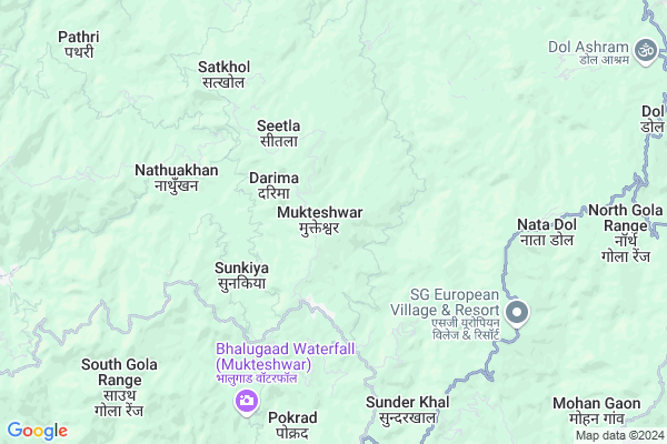
Mukteshwar
Mukteshwar Map
EDIT Map
Add Your House
 ..
..
Current Corona Virus Infected Patients Count in Nainital District
| City Name | District Name | Total Covid cases |
|---|---|---|
| Nainital District | Nainital | 10 |
Locality Name :
Mukteshwar
( मुक्तेश्वर )
Block Name : Ramgarh
District : Nainital
State : Uttarakhand
Language : Hindi and Urdu, Garhwali, Kumauni
Current Time 09:17 AM
Date: Wednesday , Apr 30,2025 (IST)
Time zone: IST (UTC+5:30)
Elevation / Altitude: 520 meters. Above Seal level
Telephone Code / Std Code: 01375
Assembly constituency : Bhimtal assembly constituency
Assembly MLA : Ram Singh Kaira
Lok Sabha constituency : Nainital-Udhamsingh Nagar parliamentary constituency
Parliament MP : Ajay Bhatt
Serpanch Name :
Pin Code : 263138
Post Office Name : Mukteshwar(Kumaon)
Commodities Prices : Haldwani Market / Mandi
Mukteshwar Live Weather
Temperature: 16.1 °C
clear sky
Humidity: 71%
Wind : 0.4 mt/sec towards NE
StationName : "Almora"
observed on 2 Hours Back
Temperature: 16.1 °C
clear sky
Humidity: 71%
Wind : 0.4 mt/sec towards NE
StationName : "Almora"
observed on 2 Hours Back
Mukteshwar Weather Forecast for Next 5 days
01-05-2025
13.0°C to 26.1°C
broken clouds, scattered clouds, few clouds, light rain, overcast clouds
13.0°C to 26.1°C
broken clouds, scattered clouds, few clouds, light rain, overcast clouds
02-05-2025
13.8°C to 23.6°C
few clouds, light rain, broken clouds, scattered clouds
13.8°C to 23.6°C
few clouds, light rain, broken clouds, scattered clouds
03-05-2025
12.9°C to 25.9°C
light rain, overcast clouds
12.9°C to 25.9°C
light rain, overcast clouds
04-05-2025
12.3°C to 24.0°C
light rain, moderate rain, overcast clouds, heavy intensity rain
12.3°C to 24.0°C
light rain, moderate rain, overcast clouds, heavy intensity rain
05-05-2025
13.1°C to 26.5°C
overcast clouds, broken clouds, light rain
13.1°C to 26.5°C
overcast clouds, broken clouds, light rain
National Highways Reachable To Mukteshwar
Nationa High Way :NH309A
Nationa High Way :NH109
Nationa High Way :NH309A
Nationa High Way :NH109
Rivers Near Mukteshwar
Kosi
Ramganga
Kosi
Ramganga
About Mukteshwar
Correct below Info and add more info about MukteshwarMukteshwar is a Village in Ramgarh Block in Nainital District of Uttarakhand State, India. It is located 23 KM towards East from District head quarters Nainital. 8 KM from Ramgarh. 214 KM from State capital Dehradun
Mukteshwar Pin code is 263138 and postal head office is Mukteshwar(Kumaon) .
Sunkiya ( 3 KM ) , Gargaon ( 3 KM ) , Baret ( 4 KM ) , Lodh ( 4 KM ) , Supi ( 4 KM ) are the nearby Villages to Mukteshwar. Mukteshwar is surrounded by Ramgarh Block towards west , Lamgara Block towards East , Almora Block towards North , Bhimtal Block towards South .
Almora , Nainital , Haldwani , Champawat are the near by Cities to Mukteshwar.
This Place is in the border of the Nainital District and Almora District. Almora District Almora is North towards this place .
Mukteshwar 2011 Census Details
Mukteshwar Local Language is Hindi. Mukteshwar Village Total population is 812 and number of houses are 267. Female Population is 44.7%. Village literacy rate is 85.5% and the Female Literacy rate is 35.1%.
Population
| Census Parameter | Census Data |
| Total Population | 812 |
| Total No of Houses | 267 |
| Female Population % | 44.7 % ( 363) |
| Total Literacy rate % | 85.5 % ( 694) |
| Female Literacy rate | 35.1 % ( 285) |
| Scheduled Tribes Population % | 1.2 % ( 10) |
| Scheduled Caste Population % | 44.1 % ( 358) |
| Working Population % | 42.7 % |
| Child(0 -6) Population by 2011 | 67 |
| Girl Child(0 -6) Population % by 2011 | 50.7 % ( 34) |
Mukteshwar Census More Deatils.
Politics in Mukteshwar
BJP , BSP are the major political parties in this area.Polling Stations /Booths near Mukteshwar
1)Matiyal2)Dudali
3)Gahana
4)Bhadrakot
5)Chyurigada
HOW TO REACH Mukteshwar
By Rail
There is no railway station near to Mukteshwar in less than 10 km.Colleges near Mukteshwar
Shri Dhan Singh Negi G.i.c. Peora
Address : Peora
Schools in Mukteshwar
Govt J H S Mukteshwar
Address : mukteshwar , ramgarh , nainital , Uttarakhand . PIN- 263138 , Post - Mukteshwar(Kumaon)
Central School Muktteshwer
Address : mukteshwar , ramgarh , nainital , Uttarakhand . PIN- 263138 , Post - Mukteshwar(Kumaon)
Girls J H S
Address : mukteshwar , ramgarh , nainital , Uttarakhand . PIN- 263138 , Post - Mukteshwar(Kumaon)
Govt Health Centers near Mukteshwar
1) Darim , Sub Center , Darim , ANM Center2) Gahna , Sub Center , Gahna , ANM Center
3) Budibana , Sub Center , Village Budibana , ANM Center
Petrol Bunks in Mukteshwar,Ramgarh
HP PETROL PUMP - KALA FILLING STATION
Shaher Phatak - Haldwani RD. Village - DOL PO- Shaher Phatak; Tehsil- Jainti; Dehradun; 263625; India
10.8 KM distance Detail
Sd Mungoli Indian Oil
Mall Road; Paltan Bazar; Dharanaula; Almora; Uttarakhand 263601; India
18.0 KM distance Detail
more ..
Colleges in Mukteshwar,Ramgarh
Government Inter College
Kaichi - Ramgarh Road; Ramgarh; Uttarakhand 263137; India
11.1 KM distance Detail
Government Inter College
National Highway 109; Lodhiya; Uttarakhand 263601; India
14.1 KM distance Detail
more ..
Schools in Mukteshwar,Ramgarh
Government Primary School
Mukteshwar Mahadev Rd; Mukteshwar; Uttarakhand 263138; India
2.5 KM distance Detail
Government Primary School
Link Road; South Gola Range; Uttarakhand 263132; India
2.5 KM distance Detail
Kendriya Vidyalaya;Mukteshwar
IVRI Campus;Mukteshwar; Nainital; Uttarakhand 263138; India
2.7 KM distance Detail
Electronic Shops in Mukteshwar,Ramgarh
Bhumika Traders And Supplier
Almora - Barechhina Rd; Officers Colony; New Colony; Satyadi Village; Almora; Uttarakhand 263601; India
16.4 KM distance Detail
LG Electronics
BAKSHI KOHLA MAAL ROAD NEAR ICICI BANK; Almora; Uttarakhand 263601; India
16.9 KM distance Detail
Super Markets in Mukteshwar,Ramgarh
SUPER 99
Shop No 09-12/21-24 Ground Floor; Raghunath City Mall Almora; Almora Road; Khatyari; Khagmara Kote; Uttarakhand 263601; India
17.0 KM distance Detail
Local Parks in Mukteshwar,Ramgarh
Camp EcoPath; Somerset Lodge; Sargakhet; Mukteshwar; Nainital; Uttarakhand; India
Sargakhet; Mukteshwar; Uttarakhand 263132; India
0.4 KM distance Detail
Lodge Resort Hotel Retreat Accmodation in Nanital Mukteshwar
Trinetra Orachards; Motia Pathar; Mukhteswar; Paharpani Road; Mukteshwar Nanital (Post Office Motia Pathar ); Uttarakhand 263625; India
0.5 KM distance Detail
Club Taurus Adventure Camp
Village Darima; Mukteshwar; Nathuakhan; 263158; India
3.8 KM distance Detail
Governement Offices near Mukteshwar,Ramgarh
National Informatics Center; Almora
Mall Road; Khazanchi Mohalla; Paltan Bazar; Dharanaula; Almora; Uttarakhand 263601; India
17.9 KM distance Detail
About Mukteshwar &
History
How to reach Mukteshwar
Tourist Places Near By Mukteshwar
Schools in Mukteshwar
Colleges in Mukteshwar
Temperature & weather of Mukteshwar
places in Mukteshwar
Mukteshwar photos
More Information
How to reach Mukteshwar
Tourist Places Near By Mukteshwar
Schools in Mukteshwar
Colleges in Mukteshwar
Temperature & weather of Mukteshwar
places in Mukteshwar
Mukteshwar photos
More Information
Village Talk
Post News or Events about this Village
Near Cities
Almora 17 KM near
Nainital 23 KM near
Haldwani 31 KM near
Champawat 48 KM near
Almora 17 KM near
Nainital 23 KM near
Haldwani 31 KM near
Champawat 48 KM near
Near By Taluks
Dhari 8 KM near
Ramgarh 8 KM near
Lamgara 12 KM near
Almora 17 KM near
Dhari 8 KM near
Ramgarh 8 KM near
Lamgara 12 KM near
Almora 17 KM near
Near By Air Ports
Pantnagar Airport 57 KM near
Dehra Dun Airport 205 KM near
Muzaffarnagar Airport 216 KM near
Indira Gandhi International Airport 300 KM near
Pantnagar Airport 57 KM near
Dehra Dun Airport 205 KM near
Muzaffarnagar Airport 216 KM near
Indira Gandhi International Airport 300 KM near
Near By Tourist Places
Mukteshwar 2 KM near
Naukuchiatal 10 KM near
Ramgarh 11 KM near
Almora 17 KM near
Bhowali 18 KM near
Mukteshwar 2 KM near
Naukuchiatal 10 KM near
Ramgarh 11 KM near
Almora 17 KM near
Bhowali 18 KM near
Near By Districts
Almora 17 KM near
Nainital 23 KM near
Bageshwar 48 KM near
Champawat 50 KM near
Almora 17 KM near
Nainital 23 KM near
Bageshwar 48 KM near
Champawat 50 KM near
Near By RailWay Station
Kathgodam Rail Way Station 27 KM near
Haldwani Rail Way Station 33 KM near
Kathgodam Rail Way Station 27 KM near
Haldwani Rail Way Station 33 KM near