| Home | City Bus | Maps | Villages | Cities | Rail | Tourist Places | School | College | Pin Codes | Corona Cases Count |
| Distance Calculator Bus Services IFSC Codes Trace Mobile Number Weather Search Place Trace IP Available Cash ATM/Banks Locate Polling Booth Report an Error contact People |
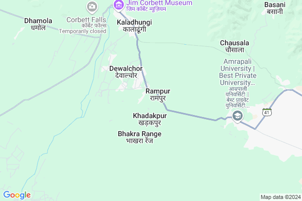
Rampur
Rampur Map
EDIT Map
Add Your House
 ..
..
Current Corona Virus Infected Patients Count in Nainital District
| City Name | District Name | Total Covid cases |
|---|---|---|
| Nainital District | Nainital | 10 |
Locality Name :
Rampur
( रामपुर )
Block Name : Kotabag
District : Nainital
State : Uttarakhand
Language : Hindi and Urdu, Garhwali, Kumauni
Current Time 06:09 AM
Date: Saturday , Apr 26,2025 (IST)
Time zone: IST (UTC+5:30)
Elevation / Altitude: 345 meters. Above Seal level
Telephone Code / Std Code: 05942
Assembly constituency : Kaladhungi assembly constituency
Assembly MLA : Banshidhar Bhagat
Lok Sabha constituency : Nainital-Udhamsingh Nagar parliamentary constituency
Parliament MP : Ajay Bhatt
Serpanch Name :
Commodities Prices : Haldwani Market / Mandi
National Highways Reachable To Rampur
Nationa High Way :NH109
Nationa High Way :NH109
Rivers Near Rampur
Ratela Gad
Dabka River
Ratela Gad
Dabka River
About Rampur
Correct below Info and add more info about RampurRampur is a Village in Kotabag Block in Nainital District of Uttarakhand State, India. It is located 21 KM towards South from District head quarters Nainital. 20 KM from Kotabag. 205 KM from State capital Dehradun
Puranpur ( 2 KM ) , Kaladungi Bandobasti ( 5 KM ) , Lamachaur Khas ( 7 KM ) , Bhimpuri ( 8 KM ) , Kamola ( 9 KM ) are the nearby Villages to Rampur. Rampur is surrounded by Kotabag Block towards North , Nainital Block towards North , Bajpur Block towards west , Bhimtal Block towards East .
Haldwani , Nainital , Bazpur , Ramnagar are the near by Cities to Rampur.
Rampur 2011 Census Details
Rampur Local Language is Hindi. Rampur Village Total population is 1231 and number of houses are 254. Female Population is 49.5%. Village literacy rate is 72.7% and the Female Literacy rate is 32.8%.
Population
| Census Parameter | Census Data |
| Total Population | 1231 |
| Total No of Houses | 254 |
| Female Population % | 49.5 % ( 609) |
| Total Literacy rate % | 72.7 % ( 895) |
| Female Literacy rate | 32.8 % ( 404) |
| Scheduled Tribes Population % | 0.0 % ( 0) |
| Scheduled Caste Population % | 12.7 % ( 156) |
| Working Population % | 39.0 % |
| Child(0 -6) Population by 2011 | 165 |
| Girl Child(0 -6) Population % by 2011 | 44.2 % ( 73) |
Rampur Census More Deatils.
Politics in Rampur
BJP , BJP , INC are the major political parties in this area.Polling Stations /Booths near Rampur
1)Chakluwa2)Chadnaichouk Ghurdoura
3)Prempur Loshgyani
4)Devipura
5)Devalachauda
HOW TO REACH Rampur
By Rail
There is no railway station near to Rampur in less than 10 km.Pincodes near Rampur
263128 ( Patwadanger ) , 263140 ( Kaladhungi ) , 263126 ( Kathgodam )Colleges near Rampur
Iti Maldhan Chaur No.1
Address :
G.i.c Betalghat
Address :
Shri Dhan Singh Negi G.i.c. Peora
Address : Peora
Govt. Inter College Dalkanya
Address :
Schools near Rampur
Rajiv Gandhi Navodaya Vidyalaya
Address : syat , kotabagh , nainital , Uttarakhand . PIN- 263159 , Post - Kotabagh
Univarsal Conv Sec School
Address : kaladhungi , kotabagh , nainital , Uttarakhand . PIN- 263140 , Post - Kaladhungi
Govt G I C Kaladhungi
Address : kaladhungi , kotabagh , nainital , Uttarakhand . PIN- 263140 , Post - Kaladhungi
Govt I C Bajoniyahaldu
Address : bajoniya haldu , kotabagh , nainital , Uttarakhand . PIN- 263159 , Post - Kotabagh
Govt Health Centers near Rampur
1) Pokhri , Sub Center , Pokhri , ANM Center2) Nayisila , Sub Center , Nayisila , ANM Center
3) Mangoli , Sub Center , Mangoli , ANM Center
Petrol Bunks in Rampur,Kotabag
Navdurga Service Station
Kaladhungi Ramnagar Highway Gupta Bagh Kaladhungi Bandobasti Kaladhungi; 263140; India
6.5 KM distance Detail
HP PETROL PUMP - PUNIAN FILLING STATION
Village Nayagaon Ramnagar Road Kaladhungi; Dehradun; 263140; India
6.5 KM distance Detail
Suyal Filling Station
Kaladhungi Road; Lohariya Saal Malla; Nainital; Near katghariya churaha; Haldwani; Uttarakhand 263139; India
13.8 KM distance Detail
more ..
Colleges in Rampur,Kotabag
Rajkiya Kanya Inter College
Ghat Garh; Nainital; SH-41; Haldwani Nainital Road; Nainital; Nainital; Uttarakhand 263140; India
5.9 KM distance Detail
Yura Hotel Management And Training Institute
Kaladhungi Rd; Kathghariya; Ramari Ansingh; Uttarakhand 263139; India
12.3 KM distance Detail
more ..
Schools in Rampur,Kotabag
Rajkiya Uchtar Madhyamik Vidyalaya
Chakluva; Nainital; SH-41; Haldwani Nainital Road; Nainital; Nainital; Uttarakhand 263140; India
1.0 KM distance Detail
Local Parks in Rampur,Kotabag
Kalash Garden
Bhagwanpur Vichla; Kamaluwa Ganja Narsingh; Uttarakhand 263139; India
12.8 KM distance Detail
Governement Offices near Rampur,Kotabag
Karyalaya Up Mandi Sthal
Kaladungi; Nainital; SH-41; Haldwani Nainital Road; Nainital; Nainital; Uttarakhand 263139; India
6.1 KM distance Detail
Collectorate Office Kaladhungi
Kaladungi; Nainital; SH-41; Haldwani Nainital Road; Nainital; Nainital; Uttarakhand 263139; India
7.0 KM distance Detail
About Rampur &
History
How to reach Rampur
Tourist Places Near By Rampur
Schools in Rampur
Colleges in Rampur
Temperature & weather of Rampur
places in Rampur
Rampur photos
More Information
How to reach Rampur
Tourist Places Near By Rampur
Schools in Rampur
Colleges in Rampur
Temperature & weather of Rampur
places in Rampur
Rampur photos
More Information
Village Talk
Post News or Events about this Village
Near Cities
Haldwani 19 KM near
Nainital 20 KM near
Bazpur 23 KM near
Ramnagar 31 KM near
Haldwani 19 KM near
Nainital 20 KM near
Bazpur 23 KM near
Ramnagar 31 KM near
Near By Taluks
Haldwani 18 KM near
Kotabag 19 KM near
Nainital 20 KM near
Bajpur 22 KM near
Haldwani 18 KM near
Kotabag 19 KM near
Nainital 20 KM near
Bajpur 22 KM near
Near By Air Ports
Pantnagar Airport 28 KM near
Muzaffarnagar Airport 185 KM near
Dehra Dun Airport 196 KM near
Indira Gandhi International Airport 260 KM near
Pantnagar Airport 28 KM near
Muzaffarnagar Airport 185 KM near
Dehra Dun Airport 196 KM near
Indira Gandhi International Airport 260 KM near
Near By Tourist Places
Kathgodam 20 KM near
Nainital 20 KM near
Jeolikot 21 KM near
Sattal 22 KM near
Bhowali 24 KM near
Kathgodam 20 KM near
Nainital 20 KM near
Jeolikot 21 KM near
Sattal 22 KM near
Bhowali 24 KM near
Near By Districts
Nainital 20 KM near
Udam Singh Nagar 32 KM near
Almora 55 KM near
Rampur 65 KM near
Nainital 20 KM near
Udam Singh Nagar 32 KM near
Almora 55 KM near
Rampur 65 KM near
Near By RailWay Station
Haldwani Rail Way Station 19 KM near
Kathgodam Rail Way Station 20 KM near
Haldwani Rail Way Station 19 KM near
Kathgodam Rail Way Station 20 KM near