| Home | City Bus | Maps | Villages | Cities | Rail | Tourist Places | School | College | Pin Codes | Corona Cases Count |
| Distance Calculator Bus Services IFSC Codes Trace Mobile Number Weather Search Place Trace IP Available Cash ATM/Banks Locate Polling Booth Report an Error contact People |
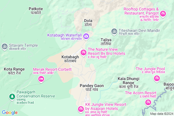
Gauriya Dev
Gauriya Dev Map
EDIT Map
Add Your House
 ..
..
Current Corona Virus Infected Patients Count in Nainital District
| City Name | District Name | Total Covid cases |
|---|---|---|
| Nainital District | Nainital | 10 |
Locality Name :
Gauriya Dev
( गौरिया देव )
Block Name : Kotabag
District : Nainital
State : Uttarakhand
Language : Hindi and Urdu, Garhwali, Kumauni
Current Time 04:16 PM
Date: Monday , Apr 28,2025 (IST)
Time zone: IST (UTC+5:30)
Elevation / Altitude: 345 meters. Above Seal level
Telephone Code / Std Code: 05942
Assembly constituency : Kaladhungi assembly constituency
Assembly MLA : Banshidhar Bhagat
Lok Sabha constituency : Nainital-Udhamsingh Nagar parliamentary constituency
Parliament MP : Ajay Bhatt
Serpanch Name :
Commodities Prices : Ramnagar Market / Mandi
Gauriya Dev Live Weather
Temperature: 35.4 °C
clear sky
Humidity: 15%
Wind : 2.8 mt/sec towards SW
StationName : "Kaladhungi"
observed on 1 Hours Back
Temperature: 35.4 °C
clear sky
Humidity: 15%
Wind : 2.8 mt/sec towards SW
StationName : "Kaladhungi"
observed on 1 Hours Back
Gauriya Dev Weather Forecast for Next 5 days
29-04-2025
19.8°C to 30.4°C
clear sky, few clouds, broken clouds
19.8°C to 30.4°C
clear sky, few clouds, broken clouds
30-04-2025
18.2°C to 30.7°C
overcast clouds, broken clouds
18.2°C to 30.7°C
overcast clouds, broken clouds
01-05-2025
18.7°C to 31.4°C
overcast clouds, few clouds, scattered clouds
18.7°C to 31.4°C
overcast clouds, few clouds, scattered clouds
02-05-2025
17.8°C to 29.7°C
overcast clouds, light rain
17.8°C to 29.7°C
overcast clouds, light rain
03-05-2025
17.0°C to 29.0°C
moderate rain, light rain, overcast clouds, broken clouds
17.0°C to 29.0°C
moderate rain, light rain, overcast clouds, broken clouds
National Highways Reachable To Gauriya Dev
Nationa High Way :NH109
Nationa High Way :NH109
Rivers Near Gauriya Dev
Ratela Gad
Dabka River
Ratela Gad
Dabka River
About Gauriya Dev
Correct below Info and add more info about Gauriya DevGauriya Dev is a Village in Kotabag Block in Nainital District of Uttarakhand State, India. It is located 17 KM towards west from District head quarters Nainital. 188 KM from State capital Dehradun
Gauriya Dev is surrounded by Nainital Block towards East , Betalghat Block towards North , Ramnagar Block towards west , Bhimtal Block towards East .
Nainital , Ramnagar , Haldwani , Bazpur are the near by Cities to Gauriya Dev.
Demographics of Gauriya Dev
Hindi is the Local Language here.Politics in Gauriya Dev
BJP , BJP , INC are the major political parties in this area.Polling Stations /Booths near Gauriya Dev
1)Suriyagaon2)Kotabag
3)Khempur
4)Kotabag
5)Gabuwakash
HOW TO REACH Gauriya Dev
By Rail
There is no railway station near to Gauriya Dev in less than 10 km.Pincodes near Gauriya Dev
263159 ( Kotabagh ) , 263002 ( Nainital ) , 263128 ( Patwadanger )Colleges near Gauriya Dev
Iti Maldhan Chaur No.1
Address :
G.i.c Betalghat
Address :
Shri Dhan Singh Negi G.i.c. Peora
Address : Peora
Govt. Inter College Dalkanya
Address :
Schools near Gauriya Dev
Rajiv Gandhi Navodaya Vidyalaya
Address : syat , kotabagh , nainital , Uttarakhand . PIN- 263159 , Post - Kotabagh
Univarsal Conv Sec School
Address : kaladhungi , kotabagh , nainital , Uttarakhand . PIN- 263140 , Post - Kaladhungi
Govt G I C Kaladhungi
Address : kaladhungi , kotabagh , nainital , Uttarakhand . PIN- 263140 , Post - Kaladhungi
Govt I C Bajoniyahaldu
Address : bajoniya haldu , kotabagh , nainital , Uttarakhand . PIN- 263159 , Post - Kotabagh
Govt Health Centers near Gauriya Dev
1) Thapla , Sub Center , Thapla , ANM Center2) Paatkot , Sub Center , Paatkot , ANM Center
3) Mangoli , Sub Center , Mangoli , ANM Center
Hospitals in Gauriya Dev,Kotabag
मातृ एवं शिशु कल्याण उप केंद्र पतलिया ANM Center
Pipalchora; Uttarakhand 263159; India
4.3 KM distance Detail
I Sight Super Specialty Eye Care Center
Above ICICI Bank; Thandi Sadak; Nainital Road; Haldwani; Haldwani; Uttarakhand 263139; India
13.6 KM distance Detail
Mohan Co. (The famous Medical Shop; Nainital)
Mallital; Nainital; Uttarakhand 263001; India
15.0 KM distance Detail
more ..
Petrol Bunks in Gauriya Dev,Kotabag
Petrol Station Sukhatal
Nainital - Kaladungi Rd; Sherwani; Nainital; Uttarakhand 263002; India
14.3 KM distance Detail
Indian Oil Petrol Pump
Nainital - Kaladungi Rd; Ayarpatta; Nainital; Uttarakhand 263002; India
14.3 KM distance Detail
more ..
Colleges in Gauriya Dev,Kotabag
Govt. Intermediate college Bajauniya haldu
Bajauniya Haldu; Uttarakhand 263159; India
5.8 KM distance Detail
Rajkiya Polytechnic College
Kilbury Rd; Sherwani; Nainital; Uttarakhand 263002; India
13.5 KM distance Detail
more ..
Schools in Gauriya Dev,Kotabag
Rajeev Gandhi Navodaya Vidyalaya Syat Kotabagh Nainital
Chauk Patelia; Uttarakhand 263159; India
1.9 KM distance Detail
Doon Modern Academy
Pataliya; Kotabagh; Po; Kaladhungi; Uttarakhand 263159; India
3.4 KM distance Detail
Government Primary School
Ramnagar Nainital Bypass; Pataliya; Uttarakhand 263159; India
4.1 KM distance Detail
Electronic Shops in Gauriya Dev,Kotabag
Jio Store
Nainital High Ct Rd; Ayarpatta; Nainital; Uttarakhand 263002; India
14.7 KM distance Detail
Solutions
126; 127; Bara Bazar; Mallital; Nainital; Uttarakhand 263001; India
14.8 KM distance Detail
Local Parks in Gauriya Dev,Kotabag
Sitabani Wildlife Reserve
Abhishek Ray; Village Maujli; PO Amgarhi; District Nainital; Ramnagar; Uttarakhand 263159; India
10.9 KM distance Detail
Police Stations near Gauriya Dev,Kotabag
Police Station
Bada-Bazzar Connecting Rd; Mallital; Nainital; Uttarakhand 263001; India
15.2 KM distance Detail
Police Chowki Mallitaal
Mall Rd; Mallital; Nainital; Uttarakhand 263001; India
15.4 KM distance Detail
Governement Offices near Gauriya Dev,Kotabag
Collectorate Office Kaladhungi
Kaladungi; Nainital; SH-41; Haldwani Nainital Road; Nainital; Nainital; Uttarakhand 263139; India
14.4 KM distance Detail
Uttarakhand State Legal Services Authority
A.D.R Centre High Court; Nainital; Uttarakhand; India
14.5 KM distance Detail
About Gauriya Dev &
History
How to reach Gauriya Dev
Tourist Places Near By Gauriya Dev
Schools in Gauriya Dev
Colleges in Gauriya Dev
Temperature & weather of Gauriya Dev
places in Gauriya Dev
Gauriya Dev photos
More Information
How to reach Gauriya Dev
Tourist Places Near By Gauriya Dev
Schools in Gauriya Dev
Colleges in Gauriya Dev
Temperature & weather of Gauriya Dev
places in Gauriya Dev
Gauriya Dev photos
More Information
Village Talk
Post News or Events about this Village
Near Cities
Nainital 16 KM near
Ramnagar 21 KM near
Haldwani 31 KM near
Bazpur 33 KM near
Nainital 16 KM near
Ramnagar 21 KM near
Haldwani 31 KM near
Bazpur 33 KM near
Near By Taluks
Kotabag 0 KM near
Nainital 15 KM near
Betalghat 19 KM near
Ramnagar 23 KM near
Kotabag 0 KM near
Nainital 15 KM near
Betalghat 19 KM near
Ramnagar 23 KM near
Near By Air Ports
Pantnagar Airport 48 KM near
Muzaffarnagar Airport 179 KM near
Dehra Dun Airport 179 KM near
Indira Gandhi International Airport 263 KM near
Pantnagar Airport 48 KM near
Muzaffarnagar Airport 179 KM near
Dehra Dun Airport 179 KM near
Indira Gandhi International Airport 263 KM near
Near By Tourist Places
Nainital 15 KM near
Jeolikot 15 KM near
Ramnagar 21 KM near
Bhowali 21 KM near
Sattal 23 KM near
Nainital 15 KM near
Jeolikot 15 KM near
Ramnagar 21 KM near
Bhowali 21 KM near
Sattal 23 KM near
Near By Districts
Nainital 16 KM near
Almora 44 KM near
Udam Singh Nagar 53 KM near
Bageshwar 73 KM near
Nainital 16 KM near
Almora 44 KM near
Udam Singh Nagar 53 KM near
Bageshwar 73 KM near
Near By RailWay Station
Ramnagar Rail Way Station 21 KM near
Kathgodam Rail Way Station 29 KM near
Ramnagar Rail Way Station 21 KM near
Kathgodam Rail Way Station 29 KM near