| Home | City Bus | Maps | Villages | Cities | Rail | Tourist Places | School | College | Pin Codes | Corona Cases Count |
| Distance Calculator Bus Services IFSC Codes Trace Mobile Number Weather Search Place Trace IP Available Cash ATM/Banks Locate Polling Booth Report an Error contact People |
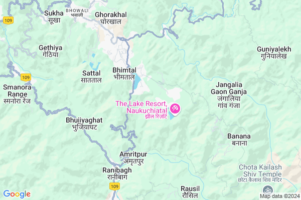
Dungsil
Dungsil Map
EDIT Map
Add Your House
 ..
..
Current Corona Virus Infected Patients Count in Nainital District
| City Name | District Name | Total Covid cases |
|---|---|---|
| Nainital District | Nainital | 10 |
Locality Name :
Dungsil
( डूंगसील )
Block Name : Bhimtal
District : Nainital
State : Uttarakhand
Language : Hindi and Urdu, Garhwali, Kumauni
Current Time 06:07 AM
Date: Saturday , Apr 26,2025 (IST)
Time zone: IST (UTC+5:30)
Elevation / Altitude: 520 meters. Above Seal level
Telephone Code / Std Code: 05942
Assembly constituency : Bhimtal assembly constituency
Assembly MLA : Ram Singh Kaira
Lok Sabha constituency : Nainital-Udhamsingh Nagar parliamentary constituency
Parliament MP : Ajay Bhatt
Serpanch Name :
Pin Code : 263136
Post Office Name : Bhimtal
Commodities Prices : Haldwani Market / Mandi
National Highways Reachable To Dungsil
Nationa High Way :NH109
Nationa High Way :NH109
Rivers Near Dungsil
Kundal Gad
Kosi
Kundal Gad
Kosi
About Dungsil
Correct below Info and add more info about DungsilDungsil is a Village in Bhimtal Block in Nainital District of Uttarakhand State, India. It is located 13 KM towards East from District head quarters Nainital. 2 KM from Bhimtal. 216 KM from State capital Dehradun
Dungsil Pin code is 263136 and postal head office is Bhimtal .
Bhimtal ( 2 KM ) , Jantwal Gaon ( 3 KM ) , Surya Gaon ( 4 KM ) , Amiya ( 5 KM ) , Amritpur ( 5 KM ) are the nearby Villages to Dungsil. Dungsil is surrounded by Dhari Block towards North , Nainital Block towards west , Haldwani Block towards South , Ramgarh Block towards North .
Haldwani , Nainital , Almora , Nagla are the near by Cities to Dungsil.
Demographics of Dungsil
Hindi is the Local Language here.Politics in Dungsil
BJP , BSP are the major political parties in this area.Polling Stations /Booths near Dungsil
1)Paitana2)Bhetidiyarkholi
3)Bhimtal
4)Bhimtal
5)Bhimtal
HOW TO REACH Dungsil
By Rail
Kathgodam Rail Way Station is the very nearby railway stations to Dungsil.Colleges near Dungsil
Iti Maldhan Chaur No.1
Address :
G.i.c Betalghat
Address :
Shri Dhan Singh Negi G.i.c. Peora
Address : Peora
Govt. Inter College Dalkanya
Address :
Schools near Dungsil
Central School
Address : bheemtaal , bheemtal , nainital , Uttarakhand . PIN- 263136 , Post - Bhimtal
Lee Pant I College Bheemtal
Address : bheemtaal , bheemtal , nainital , Uttarakhand . PIN- 263136 , Post - Bhimtal
J H S Bhorsa
Address : bhorsa , bheemtal , nainital , Uttarakhand . PIN- 263126 , Post - Kathgodam
Govt Jhs Ranibagh
Address : ranibagh , bheemtal , nainital , Uttarakhand . PIN- 263126 , Post - Kathgodam
Govt Health Centers near Dungsil
1) Noul , Sub Center , Noul , Naukuchiyataal2) Bhimtal MCH , Sub Center , Bhimtal , CHC Bhimtal
3) Bhimtal CHC , CHC , Bhimtal , Main Road
Hospitals in Dungsil,Bhimtal
Narottam Sharda Ayurvedic Charitable Hospital
Kathgodam; Haldwani; Uttarakhand 263126; India
7.8 KM distance Detail
more ..
Petrol Bunks in Dungsil,Bhimtal
NAINI FILLING STATION
NAINITAL ROAD JEOLIKOT NAINITAL; UTTRAKHAND; Uttarakhand 263126; India
9.6 KM distance Detail
more ..
Colleges in Dungsil,Bhimtal
SOS J.N. KAUL INSTITUTE OF EDUCATION BHIMTAL NAINITAL INDIA
Bhimtal; Uttarakhand 263136; India
1.2 KM distance Detail
LP Government Inter College
Naukuchiatal-Road; Bhimtal; Uttarakhand 263136; India
2.4 KM distance Detail
Department Of Pharmaceutical Sciences; Kumaun University; Bhimtal
Department of Pharmaceutical Sciences;Kumaun University;; Bhimtal; Uttarakhand 263136; India
3.7 KM distance Detail
more ..
Schools in Dungsil,Bhimtal
BOHRAKOON
Bhowali-Bhimtal-Haldwani Rd; Smanora Range; Uttarakhand 263136; India
1.8 KM distance Detail
Electronic Shops in Dungsil,Bhimtal
CAFE (Complete Computer Solution)
1st Floor; Near Central Bank ATM; Main Market; Mallital; Bhowali-Bhimtal-Haldwani Rd; Block Road Area; Bhimtal; Uttarakhand 263136; India
3.4 KM distance Detail
Super Markets in Dungsil,Bhimtal
zishan and kayyum trading company
Daa; Sanguri Gaon; Uttarakhand 263136; India
2.0 KM distance Detail
Sah General Store
Bhowali-Bhimtal-Haldwani Rd; Bhimtal; Uttarakhand 263136; India
3.3 KM distance Detail
Police Stations near Dungsil,Bhimtal
Police Chowki Mullah Kathgodam
NH-87; Kathgodam; Haldwani; Uttarakhand 263126; India
8.1 KM distance Detail
Governement Offices near Dungsil,Bhimtal
IFFCO; Area Office Haldwani
Opposite filter house; Sheeshmahal; Kathgodam; Haldwani; Nainital; Uttarakhand 263126; India
10.7 KM distance Detail
About Dungsil &
History
How to reach Dungsil
Tourist Places Near By Dungsil
Schools in Dungsil
Colleges in Dungsil
Temperature & weather of Dungsil
places in Dungsil
Dungsil photos
More Information
How to reach Dungsil
Tourist Places Near By Dungsil
Schools in Dungsil
Colleges in Dungsil
Temperature & weather of Dungsil
places in Dungsil
Dungsil photos
More Information
Village Talk
Post News or Events about this Village
Near Cities
Haldwani 12 KM near
Nainital 12 KM near
Almora 35 KM near
Nagla 40 KM near
Haldwani 12 KM near
Nainital 12 KM near
Almora 35 KM near
Nagla 40 KM near
Near By Taluks
Bhimtal 1 KM near
Dhari 11 KM near
Nainital 13 KM near
Haldwani 19 KM near
Bhimtal 1 KM near
Dhari 11 KM near
Nainital 13 KM near
Haldwani 19 KM near
Near By Air Ports
Pantnagar Airport 38 KM near
Dehra Dun Airport 206 KM near
Muzaffarnagar Airport 206 KM near
Indira Gandhi International Airport 285 KM near
Pantnagar Airport 38 KM near
Dehra Dun Airport 206 KM near
Muzaffarnagar Airport 206 KM near
Indira Gandhi International Airport 285 KM near
Near By Tourist Places
Bhimtal 1 KM near
Sattal 5 KM near
Kathgodam 7 KM near
Bhowali 8 KM near
Naukuchiatal 10 KM near
Bhimtal 1 KM near
Sattal 5 KM near
Kathgodam 7 KM near
Bhowali 8 KM near
Naukuchiatal 10 KM near
Near By Districts
Nainital 12 KM near
Almora 35 KM near
Udam Singh Nagar 47 KM near
Champawat 57 KM near
Nainital 12 KM near
Almora 35 KM near
Udam Singh Nagar 47 KM near
Champawat 57 KM near
Near By RailWay Station
Kathgodam Rail Way Station 8.8 KM near
Haldwani Rail Way Station 14 KM near
Kathgodam Rail Way Station 8.8 KM near
Haldwani Rail Way Station 14 KM near