| Home | City Bus | Maps | Villages | Cities | Rail | Tourist Places | School | College | Pin Codes | Corona Cases Count |
| Distance Calculator Bus Services IFSC Codes Trace Mobile Number Weather Search Place Trace IP Available Cash ATM/Banks Locate Polling Booth Report an Error contact People |
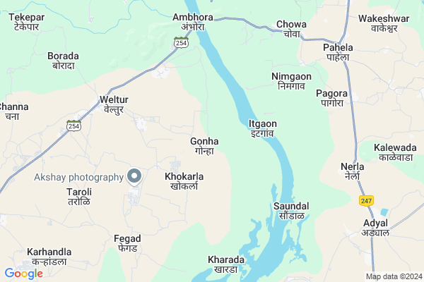
Gonha
Gonha Map
EDIT Map
Add Your House
 ..
..
Current Corona Virus Infected Patients Count in Nagpur District
| City Name | District Name | Total Covid cases |
|---|---|---|
| Nagpur | Nagpur | 51 |
| Nagpur District | Nagpur | 36 |
| Nagpur Rural | Nagpur | 6 |
Locality Name :
Gonha
( गोंह )
Taluka Name : Kuhi
District : Nagpur
State : Maharashtra
Region : Vidarbh
Division : Nagpur
Language : Marathi and Hindi, English
Current Time 03:26 PM
Date: Tuesday , Apr 29,2025 (IST)
Time zone: IST (UTC+5:30)
Elevation / Altitude: 271 meters. Above Seal level
Telephone Code / Std Code: 07100
Assembly constituency : Umred assembly constituency
Assembly MLA : Raju Devnath Parwe
Lok Sabha constituency : Ramtek parliamentary constituency
Parliament MP : Krupal Balaji Tumane
Serpanch Name :
Pin Code : 441210
Post Office Name : Mandhal
Commodities Prices : Mandhal Market / Mandi
Gonha Live Weather
Temperature: 42.4 °C
clear sky
Humidity: 8%
Wind : 3.14 mt/sec towards NW
StationName : "BhandÄ\u0081ra"
observed on 17 Mins Back
Temperature: 42.4 °C
clear sky
Humidity: 8%
Wind : 3.14 mt/sec towards NW
StationName : "BhandÄ\u0081ra"
observed on 17 Mins Back
Gonha Weather Forecast for Next 5 days
30-04-2025
28.6°C to 42.6°C
few clouds, broken clouds
28.6°C to 42.6°C
few clouds, broken clouds
01-05-2025
29.4°C to 43.3°C
broken clouds, clear sky, few clouds, scattered clouds
29.4°C to 43.3°C
broken clouds, clear sky, few clouds, scattered clouds
02-05-2025
29.5°C to 43.2°C
scattered clouds, few clouds, clear sky
29.5°C to 43.2°C
scattered clouds, few clouds, clear sky
03-05-2025
29.2°C to 43.5°C
scattered clouds, few clouds, clear sky, broken clouds
29.2°C to 43.5°C
scattered clouds, few clouds, clear sky, broken clouds
04-05-2025
28.5°C to 43.5°C
broken clouds, clear sky, few clouds, scattered clouds
28.5°C to 43.5°C
broken clouds, clear sky, few clouds, scattered clouds
National Highways Reachable To Gonha
Nationa High Way :NH44
Nationa High Way :NH353I
Nationa High Way :NH44
Nationa High Way :NH353I
Rivers Near Gonha
Kanhan
Nag River :नाग
Kanhan
Nag River :नाग
About Gonha
Correct below Info and add more info about GonhaGonha is a Village in Kuhi Taluka in Nagpur District of Maharashtra State, India. It belongs to Vidarbh region . It belongs to Nagpur Division . It is located 67 KM towards East from District head quarters Nagpur. 22 KM from Kuhi. 864 KM from State capital Mumbai
Gonha Pin code is 441210 and postal head office is Mandhal .
Khokarla ( 2 KM ) , Weltur ( 6 KM ) , Shikarpur ( 6 KM ) , Fegad ( 7 KM ) , Ambhora ( 7 KM ) are the nearby Villages to Gonha. Gonha is surrounded by Pauni Taluka towards South , Bhandara Taluka towards North , Lakhani Taluka towards East , Bhivapur Taluka towards South .
Pauni , Bhandara , Umred , Tumsar are the near by Cities to Gonha.
Gonha 2011 Census Details
Gonha Local Language is Marathi. Gonha Village Total population is 1336 and number of houses are 301. Female Population is 47.8%. Village literacy rate is 66.8% and the Female Literacy rate is 30.2%.
Population
| Census Parameter | Census Data |
| Total Population | 1336 |
| Total No of Houses | 301 |
| Female Population % | 47.8 % ( 638) |
| Total Literacy rate % | 66.8 % ( 893) |
| Female Literacy rate | 30.2 % ( 403) |
| Scheduled Tribes Population % | 0.3 % ( 4) |
| Scheduled Caste Population % | 3.6 % ( 48) |
| Working Population % | 52.8 % |
| Child(0 -6) Population by 2011 | 155 |
| Girl Child(0 -6) Population % by 2011 | 41.9 % ( 65) |
Gonha Census More Deatils.
Politics in Gonha
BJP , Shivsena , BSP , SHS , INC are the major political parties in this area.Polling Stations /Booths near Gonha
1)Gondbori2)Gonha
3)Titur
4)Dhamna
5)Dhanla
HOW TO REACH Gonha
By Rail
There is no railway station near to Gonha in less than 10 km. Umred Rail Way Station (near to Umred) , Bhandara Road Rail Way Station (near to Bhandara) , Nagpur Junction Rail Way Station (near to Nagpur) , Ajni Rail Way Station (near to Nagpur) , Bamhni Rail Way Station (near to Umred) are the Rail way stations reachable from near by towns.By Road
Umred , Bhandara , Nagpur are the nearby by towns to Gonha having road connectivity to GonhaColleges near Gonha
Shri Lemdeo Patil Art And Science Collage, Mandhal
Address : At Post Mandhal Tah Kuhi Dist Nagpur
Mukundrajswami Mahavidyalaya
Address : At-post Pachkhedi(g) Ta-kuhi Dist-nagpur
Schools in Gonha
Chakradhar Smruti Vidyalaya
Address : gonha , kuhi , nagpur , Maharashtra . PIN- 441210 , Post - Mandhal
Z.p.upper Primary School
Address : gonha , kuhi , nagpur , Maharashtra . PIN- 441210 , Post - Mandhal
Govt Health Centers near Gonha
1) Veltur , Primary Health Center Veltur , Veltur , Near Bus Stop2) Veltur , Subcenter Veltur , Veltur , Near Police Station
3) Gothangaon , Mch Subcenter Gothangaon , Gothangaon , Near ZP School
Hospitals in Gonha,Kuhi
श्री दत्त आरोग्य मंदिर (Dr C. H. Titarmare)
Weltur; Maharashtra 441210; India
6.5 KM distance Detail
Primary Health Center; Veltur
veltur; Arakunnam PHC Rd; Arakkunnam; Kerala 682313; India
7.0 KM distance Detail
more ..
Petrol Bunks in Gonha,Kuhi
Adyal Petrol Pump Station (Diesel)
Near Public Health Center; Bhandara Road; Adyar; Maharashtra 441903; India
10.2 KM distance Detail
MA SHARDA PETROLEUM
ADYAL;PAUNI ROAD;BHANDARA; BHANDARA; Maharashtra 441903; India
10.8 KM distance Detail
more ..
Colleges in Gonha,Kuhi
VISHWAVYAPI JUNIOR COLLEGE
TAL-KUHI VIA MANDHAL; DIST- NAGPUR; Weltur; Maharashtra 441210; India
7.0 KM distance Detail
Prakash High School and Junior College
Side by Public Health Care Hospital; Near Teachers Colony; Bhandara Road; Adyal (Adyar); Adyal; Maharashtra 441903; India
10.0 KM distance Detail
Prakash High School And Junior College Adyal
Adyal; Maharashtra 441903; India
10.1 KM distance Detail
Vidarbh Computer Pachkhedi Gangli
Gothangaon - Gohodli Rd; Gohodli; Maharashtra 441210; India
14.0 KM distance Detail
more ..
Schools in Gonha,Kuhi
SAMPURNA SANSKAR COMPUTER CLASSES
AT-POST VELTUR TAH-KUHI DIST-NAGPUR 441210; Weltur; Maharashtra 441210; India
6.2 KM distance Detail
Newtech computer
Main road Taluka kuhi; Distribution; Weltur; Maharashtra 441210; India
6.7 KM distance Detail
sushil Adiwasi Ashrsm School madagi
At madagi post keslwada/wag tah+dist; Maharashtra; India
6.8 KM distance Detail
Local Parks in Gonha,Kuhi
Gothangao Gate Umred Karhandla Wildlife Sanctuary
Nagpur; Maharashtra 441210; India
13.5 KM distance Detail
About Gonha &
History
How to reach Gonha
Tourist Places Near By Gonha
Schools in Gonha
Colleges in Gonha
Temperature & weather of Gonha
places in Gonha
Gonha photos
More Information
How to reach Gonha
Tourist Places Near By Gonha
Schools in Gonha
Colleges in Gonha
Temperature & weather of Gonha
places in Gonha
Gonha photos
More Information
Village Talk
Post News or Events about this Village
Near Cities
Pauni 22 KM near
Bhandara 25 KM near
Umred 35 KM near
Tumsar 53 KM near
Pauni 22 KM near
Bhandara 25 KM near
Umred 35 KM near
Tumsar 53 KM near
Near By Taluks
Kuhi 21 KM near
Pauni 21 KM near
Bhandara 22 KM near
Lakhani 28 KM near
Kuhi 21 KM near
Pauni 21 KM near
Bhandara 22 KM near
Lakhani 28 KM near
Near By Air Ports
Sonegaon Airport 66 KM near
Jabalpur Airport 212 KM near
Raipur Airport 247 KM near
Nanded Airport 350 KM near
Sonegaon Airport 66 KM near
Jabalpur Airport 212 KM near
Raipur Airport 247 KM near
Nanded Airport 350 KM near
Near By Tourist Places
Bhandara 23 KM near
Nagpur 66 KM near
Tadoba 93 KM near
Pench National Park 115 KM near
Sevagram 122 KM near
Bhandara 23 KM near
Nagpur 66 KM near
Tadoba 93 KM near
Pench National Park 115 KM near
Sevagram 122 KM near
Near By Districts
Bhandara 24 KM near
Nagpur 65 KM near
Gondia 89 KM near
Gadchiroli 108 KM near
Bhandara 24 KM near
Nagpur 65 KM near
Gondia 89 KM near
Gadchiroli 108 KM near
Near By RailWay Station
Bhandara Road Rail Way Station 32 KM near
Tumsar Road Junction Rail Way Station 47 KM near
Bhandara Road Rail Way Station 32 KM near
Tumsar Road Junction Rail Way Station 47 KM near