| Home | City Bus | Maps | Villages | Cities | Rail | Tourist Places | School | College | Pin Codes | Corona Cases Count |
| Distance Calculator Bus Services IFSC Codes Trace Mobile Number Weather Search Place Trace IP Available Cash ATM/Banks Locate Polling Booth Report an Error contact People |
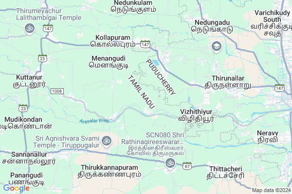
Kottapadi
Kottapadi Map
EDIT Map
Add Your House
 ..
..
Current Corona Virus Infected Patients Count in Nagapattinam District
| City Name | District Name | Total Covid cases |
|---|---|---|
| Nagapattinam District | Nagapattinam | 44 |
Locality Name :
Kottapadi
( கொட்டப்படி )
Block Name : Thirumarugal
District : Nagapattinam
State : Tamil Nadu
Language : Tamil
Current Time 10:32 AM
Date: Monday , Apr 28,2025 (IST)
Time zone: IST (UTC+5:30)
Elevation / Altitude: 11 meters. Above Seal level
Telephone Code / Std Code: 04368
Assembly constituency : Nannilam assembly constituency
Assembly MLA :
Lok Sabha constituency : Nagapattinam parliamentary constituency
Parliament MP :
Serpanch Name :
Pin Code : 609601
Post Office Name : Ambagarathur
Main Village Name : Ervadi
Commodities Prices : Poonthottam Market / Mandi
Kottapadi Live Weather
Temperature: 33.0 °C
broken clouds
Humidity: 50%
Wind : 2.19 mt/sec towards SE
StationName : "Nannilam"
observed on 1 Hours Back
Temperature: 33.0 °C
broken clouds
Humidity: 50%
Wind : 2.19 mt/sec towards SE
StationName : "Nannilam"
observed on 1 Hours Back
Kottapadi Weather Forecast for Next 5 days
29-04-2025
27.6°C to 35.6°C
broken clouds, few clouds, clear sky
27.6°C to 35.6°C
broken clouds, few clouds, clear sky
30-04-2025
27.3°C to 38.4°C
light rain, few clouds, scattered clouds, clear sky, broken clouds
27.3°C to 38.4°C
light rain, few clouds, scattered clouds, clear sky, broken clouds
01-05-2025
28.0°C to 39.2°C
broken clouds, overcast clouds, few clouds
28.0°C to 39.2°C
broken clouds, overcast clouds, few clouds
02-05-2025
28.4°C to 38.7°C
scattered clouds, few clouds, overcast clouds
28.4°C to 38.7°C
scattered clouds, few clouds, overcast clouds
03-05-2025
28.1°C to 38.5°C
overcast clouds, broken clouds
28.1°C to 38.5°C
overcast clouds, broken clouds
National Highways Reachable To Kottapadi
Nationa High Way :NH32
Nationa High Way :NH36
Nationa High Way :NH32
Nationa High Way :NH36
Rivers Near Kottapadi
Vanjiyar River
Vettar
Vanjiyar River
Vettar
About Kottapadi
Correct below Info and add more info about KottapadiKottapadi is a small Village/hamlet in Thirumarugal Block in Nagapattinam District of Tamil Nadu State, India. It comes under Ervadi Panchayath. It is located 23 KM towards North from District head quarters Nagapattinam. 7 KM from Thirumarugal. 285 KM from State capital Chennai
Kottapadi Pin code is 609601 and postal head office is Ambagarathur .
Sheshamoolai ( 4 KM ) , Pandaravadai ( 4 KM ) , Ambal ( 6 KM ) , Alathur ( 7 KM ) , Thirumarugal ( 7 KM ) are the nearby Villages to Kottapadi. Kottapadi is surrounded by Thirumarugal Block towards South , Nadungadu Block towards North , Nannilam Block towards west , Neravy Block towards East .
Karaikal , Tharangambadi , Thiruvarur , Nagapattinam are the near by Cities to Kottapadi.
This Place is in the border of the Nagapattinam District and Karaikal District. Karaikal District Neravy is East towards this place . Also it is in the Border of other district Thiruvarur . It is near to the Pondicherry State Border. It is near to bay of bengal. There is a chance of humidity in the weather.
Kottapadi 2011 Census Details
Kottapadi Local Language is Tamil. Kottapadi Village Total population is 1211 and number of houses are 307. Female Population is 51.5%. Village literacy rate is 76.6% and the Female Literacy rate is 36.4%.
Population
| Census Parameter | Census Data |
| Total Population | 1211 |
| Total No of Houses | 307 |
| Female Population % | 51.5 % ( 624) |
| Total Literacy rate % | 76.6 % ( 928) |
| Female Literacy rate | 36.4 % ( 441) |
| Scheduled Tribes Population % | 0.0 % ( 0) |
| Scheduled Caste Population % | 60.0 % ( 726) |
| Working Population % | 61.7 % |
| Child(0 -6) Population by 2011 | 109 |
| Girl Child(0 -6) Population % by 2011 | 56.9 % ( 62) |
Kottapadi Census More Deatils.
Politics in Kottapadi
DMK , AIADMK , TMC(M) , CPI , ADMK are the major political parties in this area.Polling Stations /Booths near Kottapadi
1)P.u.p. School Moolemangalam 610 1052)P.u.m. School Thirumeeyachur 609405
3)P.u.m.school Terraced Building
4)P.u.m. School Maharajapuram 609503
5)P.u.m. School Menangudi 609 608
HOW TO REACH Kottapadi
By Rail
Punthottam Rail Way Station , Peralam Junction Rail Way Station are the very nearby railway stations to Kottapadi.Colleges near Kottapadi
Dhanalakshmi Srinivasan College Of Nursing
Address : Dhanalakshmi Srinivasan College Of Nursing, 274-c,
Schools in Kottapadi
Pups Vichur
Address : kottapadi , thirumarugal , nagapattinam , Tamil Nadu . PIN- 609601 , Post - Ambagarathur
Pups Kottapadi
Address : kottapadi , thirumarugal , nagapattinam , Tamil Nadu . PIN- 609601 , Post - Ambagarathur
Govt Health Centers near Kottapadi
1) Ganapathipuram , Primary Health Centre , settiyar theru , Kidamangalam2) Sacred Heart Hospital , 1006, , Karaikal Road, Palavanthankattalai, Sakkottai, , Karaikal Road, Palavanthankattalai, Sakkottai,
3) Thiruvilaiyattam , 1/188 , Melathoppu St. , Bus Stand
Petrol Bunks in Kottapadi,Thirumarugal
HP PETROL PUMP - UNITED AUTO SERVICE
Ambagarathur Village Peralam Main Road; Trichy; Puducherry 609601; India
4.5 KM distance Detail
AMBAGARATHUR HP petrol bunk
Kumbakonam - Karaikkal Main Rd; Ambagarathur; Tamil Nadu 609601; India
4.5 KM distance Detail
more ..
Colleges in Kottapadi,Thirumarugal
Don Bosco College Arts and Science
Thamanangudi;; Karaikal; Puducherry; India
4.3 KM distance Detail
Crescent Girls Higher Secondary School
4 Pudhu Manai Street; Ambagarathur;; Karaikal Dist; Puducherry 609601; India
4.7 KM distance Detail
Perunthalaivar Kamarajar Institute of Engineering and Technology
Nedungadu; Opp.PAJANCOA & RI; Karaikal; Puducherry 609603; India
7.2 KM distance Detail
more ..
Schools in Kottapadi,Thirumarugal
Government High School
Karaikal Main Road; Ganapathipuram; Main Rd; Kidamangalam; Tamil Nadu 609601; India
1.7 KM distance Detail
GHSS; Ganapathipuram
609601; Ganapathipuram; Chromepet; Chennai; Tamil Nadu; India
1.7 KM distance Detail
Pandaravadai;Karaikal
Kumbakonam-Karaikal Rd; Sethur; Tamil Nadu 609601; India
2.3 KM distance Detail
Governement Offices near Kottapadi,Thirumarugal
Village Administrative Office
Thirumarukal; Nagapattinam; SH-67; Nagore Nannilam Nachiyar Koil Road; Nagapattinam; Nagapattinam; 609702; India
5.7 KM distance Detail
Village Administrative Office
Thirumarukal; Thiruvarur; SH-67; Nagore Nannilam Nachiyar Koil Road; Thiruvarur; Thiruvarur; 609702; India
6.0 KM distance Detail
About Kottapadi &
History
How to reach Kottapadi
Tourist Places Near By Kottapadi
Schools in Kottapadi
Colleges in Kottapadi
Temperature & weather of Kottapadi
places in Kottapadi
Kottapadi photos
More Information
How to reach Kottapadi
Tourist Places Near By Kottapadi
Schools in Kottapadi
Colleges in Kottapadi
Temperature & weather of Kottapadi
places in Kottapadi
Kottapadi photos
More Information
Village Talk
Post News or Events about this Village
Near Cities
Karaikal 13 KM near
Tharangambadi 19 KM near
Thiruvarur 21 KM near
Nagapattinam 22 KM near
Karaikal 13 KM near
Tharangambadi 19 KM near
Thiruvarur 21 KM near
Nagapattinam 22 KM near
Near By Taluks
Thirunallar 5 KM near
Thirumarugal 6 KM near
Nadungadu 8 KM near
Nannilam 10 KM near
Thirunallar 5 KM near
Thirumarugal 6 KM near
Nadungadu 8 KM near
Nannilam 10 KM near
Near By Air Ports
Civil Airport 126 KM near
Salem Airport 211 KM near
Madurai Airport 241 KM near
Chennai Airport 262 KM near
Civil Airport 126 KM near
Salem Airport 211 KM near
Madurai Airport 241 KM near
Chennai Airport 262 KM near
Near By Tourist Places
Nagore 18 KM near
Thiruvarur 21 KM near
Nagapattinam 22 KM near
Mayiladuthurai 24 KM near
Navagraha Sthalas 26 KM near
Nagore 18 KM near
Thiruvarur 21 KM near
Nagapattinam 22 KM near
Mayiladuthurai 24 KM near
Navagraha Sthalas 26 KM near
Near By Districts
Karaikal 12 KM near
Thiruvarur 21 KM near
Nagapattinam 21 KM near
Thanjavur 73 KM near
Karaikal 12 KM near
Thiruvarur 21 KM near
Nagapattinam 21 KM near
Thanjavur 73 KM near
Near By RailWay Station
Thiruvarur Junction Rail Way Station 22 KM near
Nagappattinam Junction Rail Way Station 24 KM near
Thiruvarur Junction Rail Way Station 22 KM near
Nagappattinam Junction Rail Way Station 24 KM near