| Home | City Bus | Maps | Villages | Cities | Rail | Tourist Places | School | College | Pin Codes | Corona Cases Count |
| Distance Calculator Bus Services IFSC Codes Trace Mobile Number Weather Search Place Trace IP Available Cash ATM/Banks Locate Polling Booth Report an Error contact People |
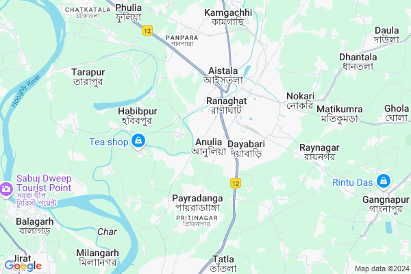
Tarapur
Tarapur Map
EDIT Map
Add Your House
 ..
..
Current Corona Virus Infected Patients Count in Nadia District
| City Name | District Name | Total Covid cases |
|---|---|---|
| Nadia District | Nadia | 5 |
Locality Name :
Tarapur
( তারাপুর )
Block Name : Ranaghat-i
District : Nadia
State : West Bengal
Division : Presidency
Language : Bengali
Current Time 02:06 PM
Date: Monday , Apr 28,2025 (IST)
Time zone: IST (UTC+5:30)
Elevation / Altitude: 16 meters. Above Seal level
Telephone Code / Std Code: 03454
Assembly constituency : Ranaghat Dakshin assembly constituency
Assembly MLA : Mukut Mani Adhikari
Lok Sabha constituency : Ranaghat parliamentary constituency
Parliament MP : JAGANNATH SARKAR
Serpanch Name :
Pin Code : 741402
Post Office Name : Fulia Colony
Commodities Prices : Ranaghat Market / Mandi
Tarapur Live Weather
Temperature: 35.6 °C
few clouds
Humidity: 29%
Wind : 3.01 mt/sec towards SE
StationName : "ShÄ\u0081ntipur"
observed on Now
Temperature: 35.6 °C
few clouds
Humidity: 29%
Wind : 3.01 mt/sec towards SE
StationName : "ShÄ\u0081ntipur"
observed on Now
Tarapur Weather Forecast for Next 5 days
29-04-2025
23.2°C to 35.7°C
few clouds, light rain, scattered clouds
23.2°C to 35.7°C
few clouds, light rain, scattered clouds
30-04-2025
22.4°C to 36.5°C
scattered clouds, clear sky, moderate rain, heavy intensity rain, light rain, overcast clouds
22.4°C to 36.5°C
scattered clouds, clear sky, moderate rain, heavy intensity rain, light rain, overcast clouds
01-05-2025
22.1°C to 31.9°C
few clouds, clear sky, light rain, overcast clouds, moderate rain
22.1°C to 31.9°C
few clouds, clear sky, light rain, overcast clouds, moderate rain
02-05-2025
21.6°C to 33.8°C
light rain, scattered clouds, broken clouds, heavy intensity rain
21.6°C to 33.8°C
light rain, scattered clouds, broken clouds, heavy intensity rain
03-05-2025
23.2°C to 30.6°C
overcast clouds, light rain, few clouds, clear sky, scattered clouds
23.2°C to 30.6°C
overcast clouds, light rain, few clouds, clear sky, scattered clouds
National Highways Reachable To Tarapur
Nationa High Way :NH12
Nationa High Way :NH19
Nationa High Way :NH12
Nationa High Way :NH19
Rivers Near Tarapur
Bhagirathi :Hooghly River
Volluka River
Bhagirathi :Hooghly River
Volluka River
About Tarapur
Correct below Info and add more info about TarapurTarapur is a Village in Ranaghat-i Block in Nadia District of West Bengal State, India. It belongs to Presidency Division . It is located 32 KM towards South from District head quarters Krishnanagar, Nadia. 79 KM from State capital Kolkata
Tarapur Pin code is 741402 and postal head office is Fulia Colony .
Tarapur is surrounded by Ranaghat-Ii Block towards East , Balagarh Block towards west , Chakdah Block towards South , Santipur Block towards west .
Ranaghat , Gopalpur , Santipur , Krishnanagar are the near by Cities to Tarapur.
This Place is in the border of the Nadia District and Bardhaman District. Bardhaman District Kalna-i is west towards this place .
Tarapur 2011 Census Details
Tarapur Local Language is Bengali. Tarapur Village Total population is 3758 and number of houses are 1026. Female Population is 48.1%. Village literacy rate is 76.6% and the Female Literacy rate is 35.6%.
Population
| Census Parameter | Census Data |
| Total Population | 3758 |
| Total No of Houses | 1026 |
| Female Population % | 48.1 % ( 1808) |
| Total Literacy rate % | 76.6 % ( 2877) |
| Female Literacy rate | 35.6 % ( 1339) |
| Scheduled Tribes Population % | 0.0 % ( 0) |
| Scheduled Caste Population % | 0.1 % ( 4) |
| Working Population % | 34.8 % |
| Child(0 -6) Population by 2011 | 302 |
| Girl Child(0 -6) Population % by 2011 | 46.0 % ( 139) |
Tarapur Census More Deatils.
Politics in Tarapur
CPM , Bharatiya Janata Party , AITC are the major political parties in this area.Polling Stations /Booths near Tarapur
1)Anishmali United Primary School Room No.12)"2 No. Ukilnara Primary School "
3)"anulia High School Room No.-1"
4)"anulia High School Room No.-2"
5)Barendra Nagar Pry. School
HOW TO REACH Tarapur
By Rail
Ranaghat Junction Rail Way Station , Payradanga Rail Way Station are the very nearby railway stations to Tarapur.Colleges near Tarapur
Bharati Chatuspathi Sanskrit Mahavidyalaya
Address : 111
bablari
Kaliganj Gov. College
Address : Radhakantapur(debagram)nadia Pin_741137.near Nh_34.
Matiari B.ed College
Address :
Dr. B.r. Ambedkar College
Address :
Srikrishna College
Address :
Schools near Tarapur
Ramnagar Milanbagan Sikshaniketan
Address : ramnagar/i/viii , ranaghat - i , nadia , West Bengal . PIN- 741201 , Post - Ranaghat
Vidyaniketan Shishu Bihar (usha Gra
Address : barasat/xvi , ranaghat - i , nadia , West Bengal . PIN- 741127 , Post - Birnagar
Anjangarh High School
Address : barasat/i , ranaghat - i , nadia , West Bengal . PIN- 741121 , Post - Badkulla
Anandanagar High School
Address : khismal/v , ranaghat - i , nadia , West Bengal . PIN- 241501
Govt Health Centers near Tarapur
1) Milangarh SC , Milangarh Subcentre Building , Milangarh , Near Milangarh High School Play Ground2) Sripur SC , Sripur Balagarh PHC Building , Sripur , Near Sripur Rashtala
3) Debogram SC , VILL+P.O- DEBOGRAM , , POST OFFICE
Petrol Bunks in Tarapur,Ranaghat-i
Bharat Petroleum Petrol Pump
Court Para; Nadia; NH-34; Krishna Nagar Road; Chakda; West Bengal 741402; India
1.9 KM distance Detail
Reliance Petroleum
NH-34; VILLAGE PATULI; PS RANAGHAT; POST OFFICE BEGOPARA; DISTRICT:; Ranaghat; West Bengal 741256; India
2.1 KM distance Detail
more ..
Colleges in Tarapur,Ranaghat-i
JKB PRIVATE ITI
13; Old Berhampore Road; Dakshin Para; District Nadia; Ranaghat; West Bengal 741201; India
2.1 KM distance Detail
Goswami Medical Store
Silver Jubilee Road; Ranaghat; West Bengal 741201; India
2.2 KM distance Detail
more ..
Schools in Tarapur,Ranaghat-i
Majdia Icchahaq Seikh Primary School
Anulia Gram Panchayat; Ranaghat; West Bengal 741232; India
0.4 KM distance Detail
ছাত্র জীবন কম্পিউটার অ্যাকাডেমি
স্তিগাছা; Ranaghat; West Bengal 741232; India
0.9 KM distance Detail
Electronic Shops in Tarapur,Ranaghat-i
LAXMI MOBILE SHOP
Ranaghat; Near ONGC Ground; Shal Bagan; Anulia; West Bengal 741255; India
0.3 KM distance Detail
Super Markets in Tarapur,Ranaghat-i
GODREJ INTERIO EXCLUSIVE SHOWROOM
G N P C Road; Ranaghat; West Bengal 110; India
2.2 KM distance Detail
Local Parks in Tarapur,Ranaghat-i
Pulinnagar Winter Picnic Park
Anulia; Pulinnagar Lane; Ranaghat; West Bengal; India
1.2 KM distance Detail
Pulinnagar Winter Picnic Spot
Anulia; Pulinnagar Lane; Ranaghat; West Bengal; India
1.2 KM distance Detail
Winter Picnic Spot
Anulia - Majdia Ferry Ghat; Ranaghat; West Bengal 741255; India
1.5 KM distance Detail
Police Stations near Tarapur,Ranaghat-i
Ranaghat Urban Police Station
Court Para; Ranaghat; West Bengal 741201; India
2.0 KM distance Detail
About Tarapur &
History
How to reach Tarapur
Tourist Places Near By Tarapur
Schools in Tarapur
Colleges in Tarapur
Temperature & weather of Tarapur
places in Tarapur
Tarapur photos
More Information
How to reach Tarapur
Tourist Places Near By Tarapur
Schools in Tarapur
Colleges in Tarapur
Temperature & weather of Tarapur
places in Tarapur
Tarapur photos
More Information
Village Talk
Post News or Events about this Village
Near Cities
Ranaghat 4 KM near
Gopalpur 4 KM near
Santipur 17 KM near
Krishnanagar 30 KM near
Ranaghat 4 KM near
Gopalpur 4 KM near
Santipur 17 KM near
Krishnanagar 30 KM near
Near By Taluks
Ranaghat-I 0 KM near
Ranaghat-Ii 2 KM near
Balagarh 10 KM near
Chakdah 16 KM near
Ranaghat-I 0 KM near
Ranaghat-Ii 2 KM near
Balagarh 10 KM near
Chakdah 16 KM near
Near By Air Ports
Netaji Subhas Chandra Bose Airport 65 KM near
Singerbhil Airport 320 KM near
Ranchi Airport 369 KM near
Rupsi Airport 403 KM near
Netaji Subhas Chandra Bose Airport 65 KM near
Singerbhil Airport 320 KM near
Ranchi Airport 369 KM near
Rupsi Airport 403 KM near
Near By Tourist Places
Navadvipa 37 KM near
Mayapur 38 KM near
Kolkata 75 KM near
Howrah 77 KM near
Burdwan 79 KM near
Navadvipa 37 KM near
Mayapur 38 KM near
Kolkata 75 KM near
Howrah 77 KM near
Burdwan 79 KM near
Near By Districts
Nadia 30 KM near
Hooghly 37 KM near
24 Paraganas North 55 KM near
Howrah 76 KM near
Nadia 30 KM near
Hooghly 37 KM near
24 Paraganas North 55 KM near
Howrah 76 KM near
Near By RailWay Station
Ranaghat Junction Rail Way Station 2.8 KM near
Payradanga Rail Way Station 4.1 KM near
Naba Raynagar Halt Rail Way Station 6.6 KM near
Ambika Kalna Rail Way Station 23 KM near
Bandel Junction Rail Way Station 35 KM near
Ranaghat Junction Rail Way Station 2.8 KM near
Payradanga Rail Way Station 4.1 KM near
Naba Raynagar Halt Rail Way Station 6.6 KM near
Ambika Kalna Rail Way Station 23 KM near
Bandel Junction Rail Way Station 35 KM near