| Home | City Bus | Maps | Villages | Cities | Rail | Tourist Places | School | College | Pin Codes | Corona Cases Count |
| Distance Calculator Bus Services IFSC Codes Trace Mobile Number Weather Search Place Trace IP Available Cash ATM/Banks Locate Polling Booth Report an Error contact People |
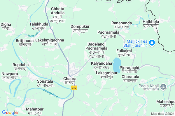
Chapra-i
Chapra-i Map
EDIT Map
Add Your House
 ..
..
Current Corona Virus Infected Patients Count in Nadia District
| City Name | District Name | Total Covid cases |
|---|---|---|
| Nadia District | Nadia | 5 |
Locality Name :
Chapra-i
( Chapra-ই )
Block Name : Chapra
District : Nadia
State : West Bengal
Division : Presidency
Language : Bengali
Current Time 02:30 PM
Date: Friday , Apr 25,2025 (IST)
Time zone: IST (UTC+5:30)
Elevation / Altitude: 17 meters. Above Seal level
Telephone Code / Std Code: 03472
Assembly constituency : Chapra assembly constituency
Assembly MLA : Rukbanur Rahman
Lok Sabha constituency : Krishnanagar parliamentary constituency
Parliament MP : MAHUA MOITRA
Serpanch Name :
Pin Code : 741123
Post Office Name : Bangaljhi
Commodities Prices : Nadia Market / Mandi
Chapra-i Live Weather
Temperature: 41.6 °C
clear sky
Humidity: 16%
Wind : 3.16 mt/sec towards W
StationName : "ChÄ\u0081prÄ\u0081"
observed on 1 Hours Back
Temperature: 41.6 °C
clear sky
Humidity: 16%
Wind : 3.16 mt/sec towards W
StationName : "ChÄ\u0081prÄ\u0081"
observed on 1 Hours Back
Chapra-i Weather Forecast for Next 5 days
26-04-2025
27.5°C to 42.5°C
clear sky
27.5°C to 42.5°C
clear sky
27-04-2025
26.7°C to 41.9°C
clear sky, scattered clouds
26.7°C to 41.9°C
clear sky, scattered clouds
28-04-2025
26.3°C to 40.2°C
scattered clouds, overcast clouds, broken clouds, clear sky, light rain
26.3°C to 40.2°C
scattered clouds, overcast clouds, broken clouds, clear sky, light rain
29-04-2025
23.4°C to 36.8°C
light rain, overcast clouds, moderate rain, broken clouds
23.4°C to 36.8°C
light rain, overcast clouds, moderate rain, broken clouds
30-04-2025
22.2°C to 32.4°C
broken clouds, scattered clouds, light rain, moderate rain, overcast clouds
22.2°C to 32.4°C
broken clouds, scattered clouds, light rain, moderate rain, overcast clouds
Rivers Near Chapra-i
Mathavanga
Jalangi
Mathavanga
Jalangi
About Chapra-i
Correct below Info and add more info about Chapra-iChapra-i is a Village in Chapra Block in Nadia District of West Bengal State, India. It belongs to Presidency Division . It is located 20 KM towards North from District head quarters Krishnanagar, Nadia. 128 KM from State capital Kolkata
Chapra-i Pin code is 741123 and postal head office is Bangaljhi .
Chapra-i is surrounded by Krishnagar-Ii Block towards South , Krishnagar-I Block towards South , Krishnanagar Block towards South , Nakashipara Block towards west .
Krishnanagar , Nabadwip , Santipur , Ranaghat are the near by Cities to Chapra-i.
Demographics of Chapra-i
Bengali is the Local Language here.Politics in Chapra-i
CPM , CPI(M) , AITC , All India Trinamool Congress , INC are the major political parties in this area.Polling Stations /Booths near Chapra-i
1)"bad-elangi Pry. School (room-1)2)Uttar Pukhuria Pry. School (r-2)
3)"bad-elangi Pry. School (room-1)
4)Mrigipota Pry. School
5)Maidanpur Pry. School (r-1)
HOW TO REACH Chapra-i
By Rail
There is no railway station near to Chapra-i in less than 10 km.Colleges near Chapra-i
Bharati Chatuspathi Sanskrit Mahavidyalaya
Address : 111
bablari
Kaliganj Gov. College
Address : Radhakantapur(debagram)nadia Pin_741137.near Nh_34.
Matiari B.ed College
Address :
Dr. B.r. Ambedkar College
Address :
Srikrishna College
Address :
Schools near Chapra-i
Betberia High School
Address : hridaypur/xi , chapra , nadia , West Bengal . PIN- 741123 , Post - Bangaljhi
Hatkhola High Madrasah
Address : hathkhola/viii , chapra , nadia , West Bengal . PIN- 741123 , Post - Bangaljhi
Chhoto Andulia Anchalik Vidyapith
Address : alpha/ix , chapra , nadia , West Bengal . PIN- 741124 , Post - Bara Andulia
Merry Immaculate Girls High School
Address : chapra/ii/v , chapra , nadia , West Bengal . PIN- 741123 , Post - Bangaljhi
Govt Health Centers near Chapra-i
1) Rangiarpota SC , , BSF Road,Chapra , South Side of Rangiarpota JSF Pry School2) Assannagar PHC , , Assannagar Bazar , Near Bazar
3) Muragachha GP HQ SC , Muragacha SC , Post : Muragacha , ,
Colleges in Chapra-i,Chapra
Bhaktabala B.Ed. College
P.S Chapra; District Nadia; Telakpur; West Bengal 741164; India
11.4 KM distance Detail
more ..
Police Stations near Chapra-i,Chapra
Bangladesh Ansar Battalion
Mujibnagar Complex Orphanage; Mujibnagar; Bangladesh
14.5 KM distance Detail
Governement Offices near Chapra-i,Chapra
T.M.C Party Office
Vir Banda Bairagi Marg; Rana Pratap Bagh; New Delhi; West Bengal 741123; India
3.4 KM distance Detail
About Chapra-i &
History
How to reach Chapra-i
Tourist Places Near By Chapra-i
Schools in Chapra-i
Colleges in Chapra-i
Temperature & weather of Chapra-i
places in Chapra-i
Chapra-i photos
More Information
How to reach Chapra-i
Tourist Places Near By Chapra-i
Schools in Chapra-i
Colleges in Chapra-i
Temperature & weather of Chapra-i
places in Chapra-i
Chapra-i photos
More Information
Village Talk
Post News or Events about this Village
Near Cities
Krishnanagar 19 KM near
Nabadwip 30 KM near
Santipur 38 KM near
Ranaghat 44 KM near
Krishnanagar 19 KM near
Nabadwip 30 KM near
Santipur 38 KM near
Ranaghat 44 KM near
Near By Taluks
Chapra 0 KM near
Krishnagar-Ii 17 KM near
Krishnagar-I 17 KM near
Krishnanagar 19 KM near
Chapra 0 KM near
Krishnagar-Ii 17 KM near
Krishnagar-I 17 KM near
Krishnanagar 19 KM near
Near By Air Ports
Netaji Subhas Chandra Bose Airport 112 KM near
Singerbhil Airport 308 KM near
Rupsi Airport 358 KM near
Ranchi Airport 372 KM near
Netaji Subhas Chandra Bose Airport 112 KM near
Singerbhil Airport 308 KM near
Rupsi Airport 358 KM near
Ranchi Airport 372 KM near
Near By Tourist Places
Mayapur 25 KM near
Navadvipa 28 KM near
Murshidabad 85 KM near
Burdwan 89 KM near
Bardhaman 89 KM near
Mayapur 25 KM near
Navadvipa 28 KM near
Murshidabad 85 KM near
Burdwan 89 KM near
Bardhaman 89 KM near
Near By Districts
Nadia 19 KM near
Murshidabad 76 KM near
Hooghly 82 KM near
Bardhaman 90 KM near
Nadia 19 KM near
Murshidabad 76 KM near
Hooghly 82 KM near
Bardhaman 90 KM near
Near By RailWay Station
Nabadwip Dham Rail Way Station 30 KM near
Ambika Kalna Rail Way Station 47 KM near
Nabadwip Dham Rail Way Station 30 KM near
Ambika Kalna Rail Way Station 47 KM near