| Home | City Bus | Maps | Villages | Cities | Rail | Tourist Places | School | College | Pin Codes | Corona Cases Count |
| Distance Calculator Bus Services IFSC Codes Trace Mobile Number Weather Search Place Trace IP Available Cash ATM/Banks Locate Polling Booth Report an Error contact People |
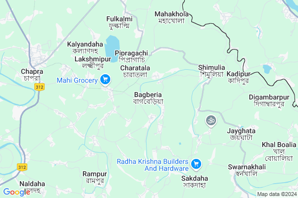
Bagberia
Bagberia Map
EDIT Map
Add Your House
 ..
..
Current Corona Virus Infected Patients Count in Nadia District
| City Name | District Name | Total Covid cases |
|---|---|---|
| Nadia District | Nadia | 5 |
Locality Name :
Bagberia
( বাগবেড়িয়া )
Block Name : Chapra
District : Nadia
State : West Bengal
Division : Presidency
Language : Bengali
Current Time 12:43 PM
Date: Monday , Apr 28,2025 (IST)
Time zone: IST (UTC+5:30)
Elevation / Altitude: 17 meters. Above Seal level
Telephone Code / Std Code: 03472
Assembly constituency : Chapra assembly constituency
Assembly MLA : Rukbanur Rahman
Lok Sabha constituency : Krishnanagar parliamentary constituency
Parliament MP : MAHUA MOITRA
Serpanch Name :
Pin Code : 741123
Post Office Name : Bangaljhi
Commodities Prices : Nadia Market / Mandi
Rivers Near Bagberia
Mathavanga
Jalangi
Mathavanga
Jalangi
About Bagberia
Correct below Info and add more info about BagberiaBagberia is a Village in Chapra Block in Nadia District of West Bengal State, India. It belongs to Presidency Division . It is located 20 KM towards East from District head quarters Krishnanagar, Nadia. 9 KM from Chapra. 124 KM from State capital Kolkata
Bagberia Pin code is 741123 and postal head office is Bangaljhi .
Pipragachhi ( 3 KM ) , Maheshpur ( 5 KM ) , Bhimpur ( 9 KM ) , Poragachha ( 9 KM ) , Chapra ( 9 KM ) are the nearby Villages to Bagberia. Bagberia is surrounded by Krishnaganj Block towards South , Hanskhali Block towards South , Krishnagar-Ii Block towards west , Krishnagar-I Block towards west .
Krishnanagar , Nabadwip , Santipur , Ranaghat are the near by Cities to Bagberia.
Demographics of Bagberia
Bengali is the Local Language here.Politics in Bagberia
CPM , CPI(M) , AITC , All India Trinamool Congress , INC are the major political parties in this area.Polling Stations /Booths near Bagberia
1)Dakshin Brittihuda Pry. School (e)2)Gachha Pry. School (r-2)
3)Rangiarpota Paschimpara. Pry. School
4)Charatala Samajkalyan Pry. School (s)
5)Charuitipi Pry. School (r-1)
HOW TO REACH Bagberia
By Rail
There is no railway station near to Bagberia in less than 10 km.Colleges near Bagberia
Bharati Chatuspathi Sanskrit Mahavidyalaya
Address : 111
bablari
Kaliganj Gov. College
Address : Radhakantapur(debagram)nadia Pin_741137.near Nh_34.
Matiari B.ed College
Address :
Dr. B.r. Ambedkar College
Address :
Srikrishna College
Address :
Schools in Bagberia
Gatra Vidaypith High School
Address : BAGBERIA CHAPRA
Govt Health Centers near Bagberia
1) Rangiarpota SC , , BSF Road,Chapra , South Side of Rangiarpota JSF Pry School2) Assannagar PHC , , Assannagar Bazar , Near Bazar
3) Laxmidanga SC , Laxmidanga SC , Banpur - Majdia Road , Left side of Tungi Bright Club
Petrol Bunks in Bagberia,Chapra
BR Agro Filling Station
PO & Vill Asannagar PS Kotwali; Asannagar; West Bengal 741161; India
9.7 KM distance Detail
more ..
Colleges in Bagberia,Chapra
Asannagar Madan Mohan Tarkalankar College
56;Majhdia Road;Nadia; Asannagar; West Bengal 741161; India
9.0 KM distance Detail
Bhimpur Mohanananda College of Education
Majhdia Rd; Bhimpur; West Bengal 741161; India
9.0 KM distance Detail
more ..
Electronic Shops in Bagberia,Chapra
Tv & Mobile Repairing Centre(Gopal Halder)
Satghata; West Bengal 741506; India
0.8 KM distance Detail
Governement Offices near Bagberia,Chapra
Main Sub-Health Centre
Ichhapur Defence Estate; Ichapur; West Bengal 741164; India
4.1 KM distance Detail
T.M.C Party Office
Vir Banda Bairagi Marg; Rana Pratap Bagh; New Delhi; West Bengal 741123; India
9.8 KM distance Detail
About Bagberia &
History
How to reach Bagberia
Tourist Places Near By Bagberia
Schools in Bagberia
Colleges in Bagberia
Temperature & weather of Bagberia
places in Bagberia
Bagberia photos
More Information
How to reach Bagberia
Tourist Places Near By Bagberia
Schools in Bagberia
Colleges in Bagberia
Temperature & weather of Bagberia
places in Bagberia
Bagberia photos
More Information
Village Talk
Post News or Events about this Village
Near Cities
Krishnanagar 19 KM near
Nabadwip 34 KM near
Santipur 37 KM near
Ranaghat 40 KM near
Krishnanagar 19 KM near
Nabadwip 34 KM near
Santipur 37 KM near
Ranaghat 40 KM near
Near By Taluks
Chapra 8 KM near
Krishnaganj 12 KM near
Hanskhali 17 KM near
Krishnagar-Ii 17 KM near
Chapra 8 KM near
Krishnaganj 12 KM near
Hanskhali 17 KM near
Krishnagar-Ii 17 KM near
Near By Air Ports
Netaji Subhas Chandra Bose Airport 108 KM near
Singerbhil Airport 302 KM near
Rupsi Airport 360 KM near
Ranchi Airport 378 KM near
Netaji Subhas Chandra Bose Airport 108 KM near
Singerbhil Airport 302 KM near
Rupsi Airport 360 KM near
Ranchi Airport 378 KM near
Near By Tourist Places
Mayapur 29 KM near
Navadvipa 31 KM near
Murshidabad 92 KM near
Burdwan 93 KM near
Bardhaman 93 KM near
Mayapur 29 KM near
Navadvipa 31 KM near
Murshidabad 92 KM near
Burdwan 93 KM near
Bardhaman 93 KM near
Near By Districts
Nadia 19 KM near
Hooghly 79 KM near
Murshidabad 84 KM near
Bardhaman 95 KM near
Nadia 19 KM near
Hooghly 79 KM near
Murshidabad 84 KM near
Bardhaman 95 KM near
Near By RailWay Station
Nabadwip Dham Rail Way Station 33 KM near
Ambika Kalna Rail Way Station 47 KM near
Nabadwip Dham Rail Way Station 33 KM near
Ambika Kalna Rail Way Station 47 KM near