| Home | City Bus | Maps | Villages | Cities | Rail | Tourist Places | School | College | Pin Codes | Corona Cases Count |
| Distance Calculator Bus Services IFSC Codes Trace Mobile Number Weather Search Place Trace IP Available Cash ATM/Banks Locate Polling Booth Report an Error contact People |
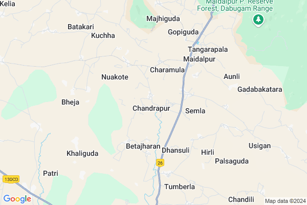
Chandrapur
Chandrapur Map
EDIT Map
Add Your House
 ..
..
Current Corona Virus Infected Patients Count in Nabarangpur District
| City Name | District Name | Total Covid cases |
|---|
Locality Name :
Chandrapur
( ଚନ୍ଦ୍ରପୁର )
Tehsil Name : Papadahandi
District : Nabarangpur
State : Odisha
Language : Oriya and Hindi
Current Time 10:10 AM
Date: Tuesday , Apr 29,2025 (IST)
Time zone: IST (UTC+5:30)
Elevation / Altitude: 592 meters. Above Seal level
Telephone Code / Std Code: 06869
Assembly constituency : Dabugam assembly constituency
Assembly MLA : bhujabal majhi
Lok Sabha constituency : Nabarangpur parliamentary constituency
Parliament MP : RAMESH CHANDRA MAJHI
Serpanch Name :
Pin Code : 764071
Post Office Name : Papadahandi
Commodities Prices : Nawarangpur Market / Mandi
Chandrapur Live Weather
Temperature: 34.8 °C
clear sky
Humidity: 23%
Wind : 3.68 mt/sec towards W
StationName : "KotapÄ\u0081rh"
observed on Now
Temperature: 34.8 °C
clear sky
Humidity: 23%
Wind : 3.68 mt/sec towards W
StationName : "KotapÄ\u0081rh"
observed on Now
Chandrapur Weather Forecast for Next 5 days
30-04-2025
24.1°C to 37.9°C
clear sky, few clouds, scattered clouds, light rain
24.1°C to 37.9°C
clear sky, few clouds, scattered clouds, light rain
01-05-2025
23.7°C to 38.4°C
clear sky, broken clouds, scattered clouds
23.7°C to 38.4°C
clear sky, broken clouds, scattered clouds
02-05-2025
23.7°C to 38.3°C
light rain, few clouds, clear sky, scattered clouds
23.7°C to 38.3°C
light rain, few clouds, clear sky, scattered clouds
03-05-2025
23.0°C to 36.9°C
clear sky, scattered clouds, light rain
23.0°C to 36.9°C
clear sky, scattered clouds, light rain
04-05-2025
23.7°C to 38.9°C
clear sky, few clouds, light rain, broken clouds
23.7°C to 38.9°C
clear sky, few clouds, light rain, broken clouds
Rivers Near Chandrapur
Hatti
San
Hatti
San
About Chandrapur
Correct below Info and add more info about ChandrapurChandrapur is a Village in Papadahandi Tehsil in Nabarangpur District of Odisha State, India. It is located 26 KM towards North from District head quarters Nabarangpur. 5 KM from Papadahandi. 417 KM from State capital Bhubaneswar
Chandrapur Pin code is 764071 and postal head office is Papadahandi .
Maidalpur ( 5 KM ) , Majhiguda ( 8 KM ) , Patri ( 9 KM ) , Jatabal ( 11 KM ) , Manigam ( 13 KM ) are the nearby Villages to Chandrapur. Chandrapur is surrounded by Dabugam Tehsil towards west , Nabarangpur Tehsil towards South , Tentulikhunti Tehsil towards East , Jayapatna Tehsil towards East .
Nabarangapur , Umarkote , Jeypur , Jagdalpur are the near by Cities to Chandrapur.
Chandrapur 2011 Census Details
Chandrapur Local Language is Oriya. Chandrapur Village Total population is 2557 and number of houses are 558. Female Population is 51.3%. Village literacy rate is 42.2% and the Female Literacy rate is 16.4%.
Population
| Census Parameter | Census Data |
| Total Population | 2557 |
| Total No of Houses | 558 |
| Female Population % | 51.3 % ( 1311) |
| Total Literacy rate % | 42.2 % ( 1080) |
| Female Literacy rate | 16.4 % ( 420) |
| Scheduled Tribes Population % | 47.6 % ( 1218) |
| Scheduled Caste Population % | 13.0 % ( 333) |
| Working Population % | 44.2 % |
| Child(0 -6) Population by 2011 | 460 |
| Girl Child(0 -6) Population % by 2011 | 53.0 % ( 244) |
Chandrapur Census More Deatils.
Politics in Chandrapur
BJD , INC are the major political parties in this area.Polling Stations /Booths near Chandrapur
1)Pup School Sirisi2)Tome Maidalpur
3)Pups Ambagan
4)Sevashram Bhatikote
5)Sevashram Chandrapur
HOW TO REACH Chandrapur
By Rail
There is no railway station near to Chandrapur in less than 10 km.Colleges near Chandrapur
Maidal Pur Collage Maidal Pur
Address :
Schools near Chandrapur
Govt Health Centers near Chandrapur
1) SC Santemra , SC Santemra , Santemra , Near High School2) SC Saruguda , SC Saruguda , Saruguda , Beside AWC
3) SC Umergaon , SC Umergaon , Umergaon , School
Hospitals in Chandrapur,Papadahandi
Chandan Pathology Lab
Jeypore-Bhawanipatna Hwy; Pappadahandi; Odisha 764071; India
13.2 KM distance Detail
more ..
Petrol Bunks in Chandrapur,Papadahandi
HP PETROL PUMP - S S FILLING STATION
AT UKT Road Post Papadahandi Papadahandi; Sambalpur; Odisha 764071; India
12.9 KM distance Detail
more ..
Governement Offices near Chandrapur,Papadahandi
Srinivas Marriage Palace
Jharigam-Dabugam Rd; Dabugaon; Odisha 764072; India
17.6 KM distance Detail
About Chandrapur &
History
How to reach Chandrapur
Tourist Places Near By Chandrapur
Schools in Chandrapur
Colleges in Chandrapur
Temperature & weather of Chandrapur
places in Chandrapur
Chandrapur photos
More Information
How to reach Chandrapur
Tourist Places Near By Chandrapur
Schools in Chandrapur
Colleges in Chandrapur
Temperature & weather of Chandrapur
places in Chandrapur
Chandrapur photos
More Information
Village Talk
Post News or Events about this Village
Near Cities
Nabarangapur 26 KM near
Umarkote 48 KM near
Jeypur 71 KM near
Jagdalpur 75 KM near
Nabarangapur 26 KM near
Umarkote 48 KM near
Jeypur 71 KM near
Jagdalpur 75 KM near
Near By Taluks
Papadahandi 5 KM near
Dabugam 22 KM near
Nabarangpur 24 KM near
Tentulikhunti 28 KM near
Papadahandi 5 KM near
Dabugam 22 KM near
Nabarangpur 24 KM near
Tentulikhunti 28 KM near
Near By Air Ports
Vishakhapatnam Airport 227 KM near
Raipur Airport 236 KM near
Rajahmundry Airport 302 KM near
Bhubaneswar Airport 395 KM near
Vishakhapatnam Airport 227 KM near
Raipur Airport 236 KM near
Rajahmundry Airport 302 KM near
Bhubaneswar Airport 395 KM near
Near By Tourist Places
Jeypore 71 KM near
Jagdalpur 75 KM near
Bastar 80 KM near
Kalahandi 88 KM near
Araku Valley 142 KM near
Jeypore 71 KM near
Jagdalpur 75 KM near
Bastar 80 KM near
Kalahandi 88 KM near
Araku Valley 142 KM near
Near By Districts
Nabarangpur 26 KM near
Bastar 78 KM near
Koraput 80 KM near
Kalahandi 91 KM near
Nabarangpur 26 KM near
Bastar 78 KM near
Koraput 80 KM near
Kalahandi 91 KM near
Near By RailWay Station
Koraput Junction Rail Way Station 83 KM near
Therubali Rail Way Station 102 KM near
Koraput Junction Rail Way Station 83 KM near
Therubali Rail Way Station 102 KM near